Leaving behind the Yellow Submarine for now, Marie, Duke and Mike pressed on east and followed Coney Island Creek to its end at Shell Road….
Exploring Coney Island Creek
Coney Island Creek is actually a tidal strait (as is the much bigger Long Island Sound) and originally connected Gravesend and Sheepshead Bays. Coney Island was, of course, originally a small island, and when the Dutch settled it in the 1600s they named it for the rabbits they found there: konijn is Dutch for rabbit. By about 1930, the Sheepshead Bay end was dredged and landfilled, with Coney Island Creek end now terminating at Shell Road.
WAYFARING MAP: CONEY ISLAND CREEK
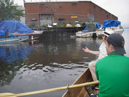
Greeting a fellow boater near Kaiser Playground on the Coney Island side. Nearby, on the north side, was the old White Sands district, much of which was razed to make room for a Home Depot. photo: Marie Lorenz
Nearing the Cropsey Avenue bascule bridge. The 382′ x 155′ bridge opened December 20, 1931. A bascule is a drawbridge with a counterweight that continuously balances the span, or “leaf”, throughout the entire upward swing in providing clearance for boat traffic. ML
East of Cropsey, Coney Island Creek takes a little jog to the northeast and the Belt, originally the Circumferential, Parkway comes into view. The house on the right is built on Hart Place, which runs briefly along the creek. ML
Coney Island Creek makes its closest approach to the Belt just west of Stillwell Avenue. ML
The Stillwell Avenue Bridge is relatively new. It was built (and here your webmaster’s memory is just a little hazy) in the late 1970s or early 1980s. For awhile, the B64 bus was rerouted to Cropsey Avenue because the rapidly deteriorating old bridge couldn’t handle truck or bus traffic, or so I may recall. ML
What an amazing photo. The relatively narrow original Stillwell Avenue swing bridge, built in 1929, easily handled the B31 trolley, which ran from the Bush Terminal area in Sunset Park to the Stillwell Avenue subway terminal mostly along 5th Avenue, 86th Street and Bath Avenue. The brand-new Belt Parkway looms in the background of the picture which is probably from 1940 or so. subwaywebnews.com
By the late 1940s, the trolleys were gone.
Marie was free to shoot most of the route while Duke and Mike helped with the rowing.
Bridge cat under Stillwell. Duke Riley
Just past Stillwell, two subway lines span the creek on their way to Stillwell Avenue Terminal: the West End (in 2006, the D train) and the Sea Beach (in 2006, the N train). Though the route names are gradually falling out of use, they are so named because they were railroad lines that were built to bring summer holidayers to the West End and Sea Beach Hotels in Coney’s original golden age of the 1880s. Duck! Not much clearing here. ML
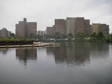
At the subway spans Coney Island Creek turns southeast again and the massive Luna Park Houses come into view. The original Luna Park was a truly wondrous amusement park opened by Frederick Thompson and Elmer Dundy in 1903; thousands of electric lamps lit up the park in an era when lightbulbs were still brand new. The park lasted until 1944 when it was destroyed by a series of fires. Notoriously, Topsy the Elephant was electrocuted at the park to prove that alternating current was superior to the competing direct current. ML
Also up ahead are the Peter Warbasse Houses, which opened a few years later in 1963.
No matter how cruddy our waterways might be in NYC, our wildlife is super-resilient and adapts to any situation. ML
School bus parking and shacks along Neptune Avenue, which runs south of the creek. Make sure those buses aren’t in reverse! ML
Coney Island Creek ends at Shell Road. Shell Road first appears in 1829, when the Coney Island Road and Bridge Company built a toll road spanning the strait separating over Coney Island Creek. The road led to the first Kings County seaside resort, Coney Island House; it may have been paved with oyster shells. Luminaries like Washington Irving and Walt Whitman stayed at the resort.
The elevated railroad is the Culver Line, or the F train. It was named for Andrew Culver, who built its progenitor, the Prospect Park and Coney Island Railroad.
When the Belt Parkway was built in the late 1930s the elevated had to be jacked up and relocated to clear the highway. ML
Editor: Kevin Walsh
Writers: Kevin Walsh, Mike Olshan
Photographers: Marie Lorenz, Duke Riley, Mike Olshan
Photographed August 26, 2006; page completed September 16, 2006


3 comments
Always wondered about the history of this creek and surrounding area. Great info. Would love to take an actual tour.
Amazing photos. Of Coney Island Creek And it wonders!! I can imagine in my mind that Sheepshead Bay was connected to
Coney Islan Creek. I wonder that any of the
Route of the Landfills are there Buildings are settling because of the soil content of the Creek?
Does anyone remember the WW PT Boat Hull in the Boat Graveyard during the 1950’s? And the old tugboat washed up along the Railway tTracks Named “Cambria”. With the giant Gas tank on the left. Just before You enters the last stop. Coney Island Via the West End Express, and The Sea Beach line.