Your webmaster would have to say that October, and even November, are my favorite times of year for picture taking. For one thing, those months contain my favorite weather, with a lot of days clear and cool, jacket weather in the 50s and 60s, until mid-November that is, when the weather in NYC becomes drizzle and 45 degrees pretty much the next few months, with a couple of breaks for blizzards; it thereafter becomes hot and humid for 5 months, press reset. For another thing, the leaves are scarce or down, which leaves a lot of architectural details exposed.
A drawback is the extremely short length of daylight that time of year and an extreme sun angle. The darks are really dark, as you’ll see on this page, which was photographed in early November on a crystalline weekday in northern Staten Island.
Livingston is a community along the northern shore of Staten Island. It runs roughly from Snug Harbor west along Richmond Terrace to about Bement Avenue and from Richmond Terrace south to Casleton Avenue. Though there have been European residents and farmers in the area since the mid-1660s, the community was founded in the mid-1800s and was originally known as Elliottville, named for Dr. Samuel Elliott, a famed ophthalmic specialist and surgeon, who built an Episcopal church in 1848 at Bard and Castleton Avenues; St. Mary’s parish is going strong today. Livingston is named for a long-demolished Staten Island Rapid Transit stop which was, in turn, named for a 19th Century local landowner, Anson Livingston. The SIRT stop was eliminated in 1938 and the SIRT North Shore line itself in 1953, though the right of way is still in place. Livingston had been a hotbed of abolitionism in the runup to the Civil War; several houses along Davis Avenue, it is rumored, were stations on the Underground Railroad. Dr. Elliott’s home still stands on Delafield Place.
A Livingston resident, Col. Robert Gould Shaw, led the first black regiment, the 54th Massachusetts, during the Civil War. He is remembered on Davis Avenue by a street sign, “Robert Gould Shaw Glory Way”; the 1989 feature film “Glory” with Matthew Broderick and Denzel Washington depicts the regiment’s exploits; and the regiment is commemorated by an 1897 Augustus Saint-Gaudens bronze memorial in Boston Common.
GOOGLE MAP: LIVINGSTON-WEST BRIGHTON (open in a new window)
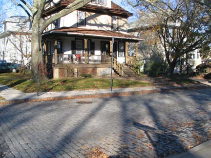
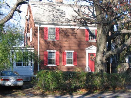
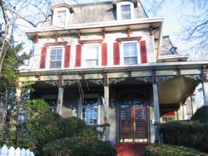
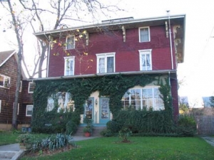
above, two houses on Delafield Place;
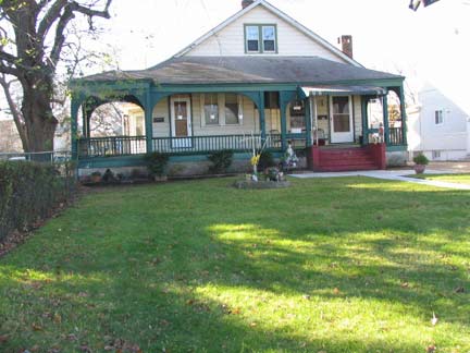
Davis Avenue
Of chief interest to your webmaster are the elegant, occasionally bricked streets containing a variety of beautiful homes from a variety of architectural eras, all of which, or nearly all, are accompanied by spreading trees and wide lawns. This has not gone unnoticed by Hollywood, which has filmed scenes for “The School of Rock,” “A Beautiful Mind” and televison’s “The Education of Max Bickford.”
The neighborhood has been rezoned to avoid teardowns and boxy “Fedders specials” cannot be easily built, but new streets have appeared with newer homes not quite up to the old standard. Nevertheless, Livingston hasn’t been ravaged like other neighborhoods with similar demographics such as Whitestone or Flushing in Queens.
“God might have made a more beautiful spot than Staten Island, but he never did.” –Novelist, abolitionist and 19th Century Livingston resident George William Curtis. After a stroll in Livingston, you just might believe him.
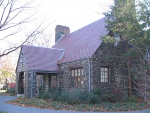
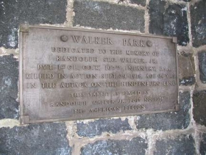
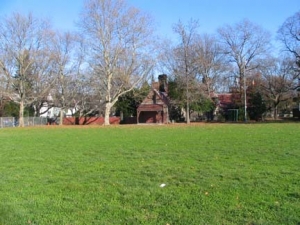
Named for World War I hero Private Randolph Walker, Walker Park is Livingston’s largest park save Snug Harbor. The handsome ashlar-walled park building was built in 1934, but looks rather older.
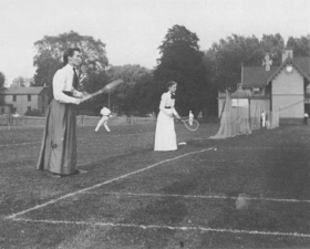
As we finish up the US Open in Queens as I write this in September 2007, it’s appropriate to note that the USA’s first national tennis tournament was played here, when it was known as Delafield Park in 1880. According to many sources, a local resident, Mary Ewing Outerbridge (1852-1886), introduced lawn tennis to the USA here after playing the game in Bermuda in 1874. Tennis and lawn bowling are still played at Walker Park.
Alice Austen, the longtime Staten Island photographer, eagerly participated in the new sport, as well as captured early tennis players on film: here is a doubles tournament at the Staten Island Ladies’ Club in 1892. Alice Austen, Her Life and Times
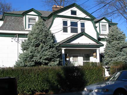
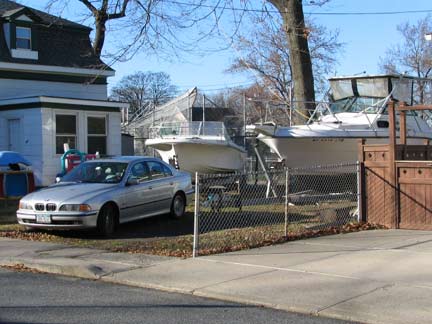
There are several handsome dwellings on Livingston Place, just south of the park, including this two-boat household.
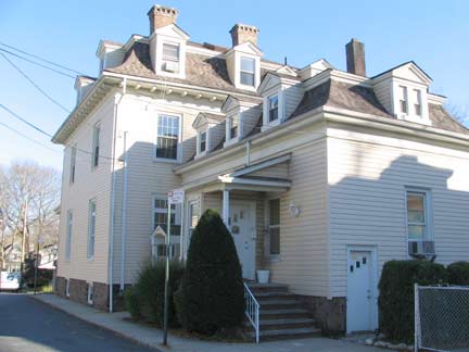
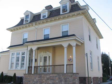
The largest home on Livingston Place is the 1860 Stewart Brown House. Though it has been given an armor of aluminum siding to protect it from salt air and winter winds, a good deal of its old grandeur is still apparent.
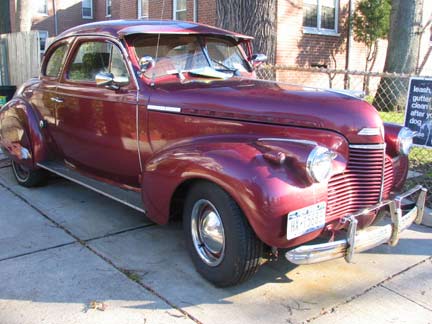
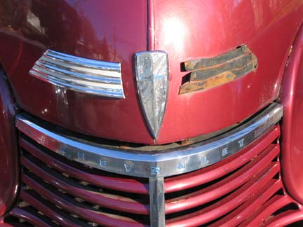
Name that car…the Chevy grille is apparent but what model and year? Davis Avenue, south of Livingston Place.
A 1940 Chevy Special Deluxe, I hear. Another image.
West Brighton
The New Brighton neighborhood near St. George was originally conceived in 1834 by a group of wealthy businessmen. Its street pattern, curving around the high hills fronting Staten Island’s waterfront, survives to the present; the organization’s name, the New Brighton Association (named in honor of Brighton, a British resort town), became the name of the entire region, which stretches from St. George on the east to Hamilton Park on the west.
West Brighton, originally Factoryville and then West New Brighton, is west and south of Livingston and is named for its older predecessor. Though it has fared worse than Livingston (the streets surrounding Markham Houses between N. Burgher and Broadway along Richmond Terrace became hotbeds of drugs and crime) West Brighton retains an enjoyable collection of 19th-Century houses and its main business strip along Castleton Avenue has been making a comeback. Currently (2007) the Markham Houses, built in the 1940s and named for Staten Island poet Edwin Markham, are being redeveloped and tenants relocated for the present. After years of neglect, the Markham buildings were plagued with sewage backups, termite infestation and buckling roofs.
West Brighton is home to the Staten Island Zoo, home of Staten Island Chuck and NYC’s foremost rattlesnake collection, and the historic Gardiner-Tyler House in its southern reaches.
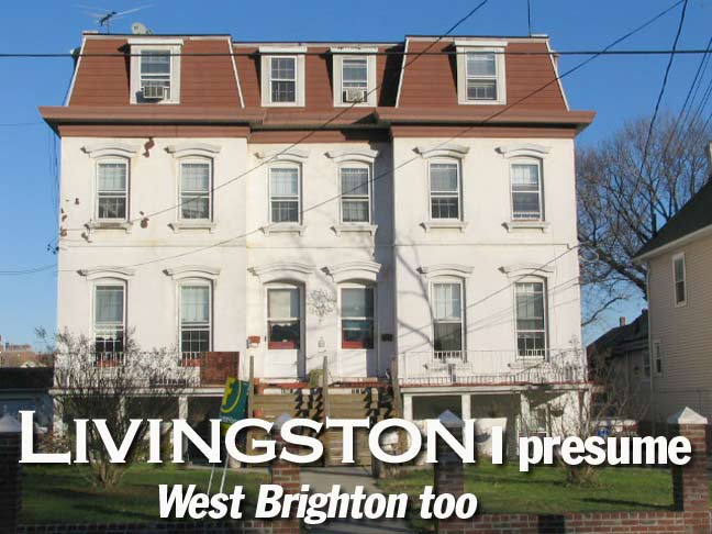
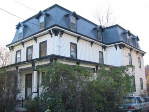
A sampler of some of the magnificent dwellings on Taylor Street. Below right: proof that you can build multifamily housing that’s esthetically pleasing. Note the subtle touch of the shadows produced at the left of every window lintel by afternoon sun.
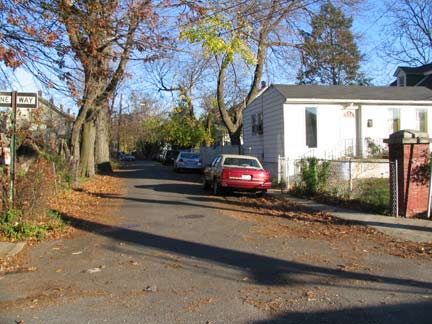
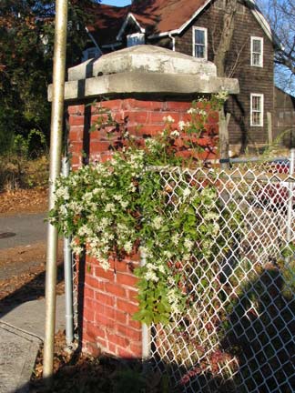
Taylor Court, off Taylor Street north of Castleton Avenue. The brick post indicates that it was a long-ago private real estate development.
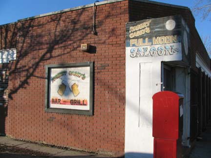
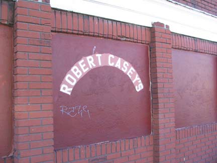
Robert Casey’s Full Moon Saloon, by all indications a longtime neighborhood saloon, Castleton Avenue and Dongan Street. Castleton, the “twistiest” street in Staten Island, is a prime candidate for a future FNY page.
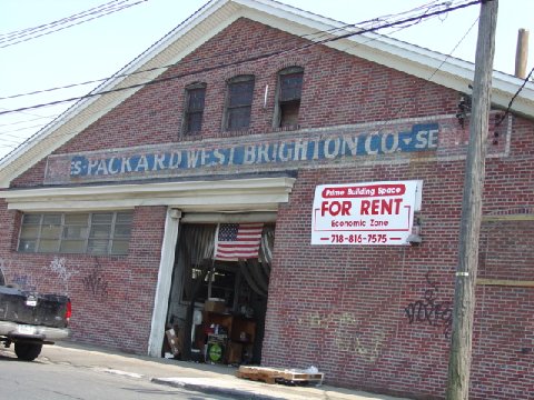
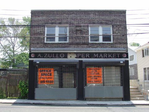
A pair of old West Brighton businesses: A. Zullo Supermarket on Castleton, and Packard Service on Richmond Terrace. The last Packard was rolled out by Studebaker in 1958. photo: Jeannie Siegel
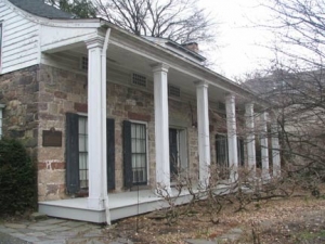
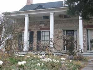
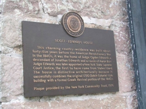
Scott-Edwards House
This one-story brownstone house was built in about 1730 at what is now 752 Delafield Avenue at Clove Road. It was originally owned by Captain Nicholas Manning and later by New York State Supreme Court Justice Ogden Edwards, who added the Greek-style portico in the 1840s.
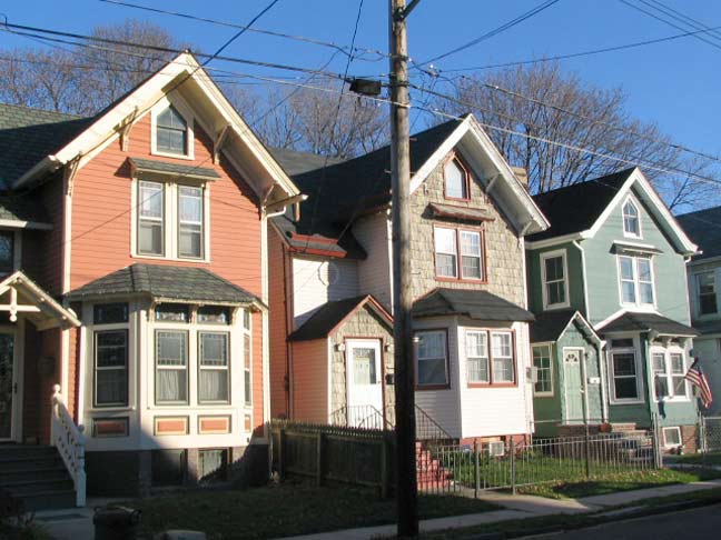
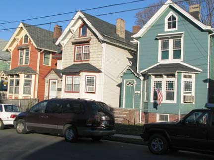
I enjoyed this tricolored trio on Bodine between Castleton Avenue and DeGroot Place so much, I’m showing them twice. Note that all three buildings are essentially the same. I’ve decried cookie cutter housing all over Queens; most new construction in my neck of the woods in northern Queens consists of buildings that are built to one template or formula or the other.
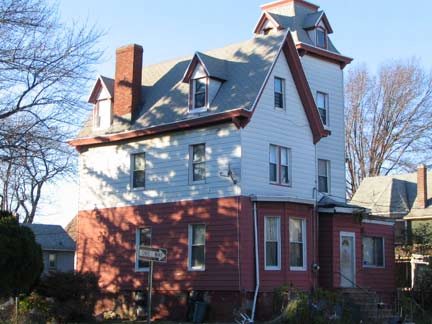
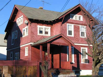
Corner Bodine and DeGroot; DeGroot between Bodine and Dongan. Note the tower on the building at left. It may have overloked the Kill Van Kull with the original owner being a captain or seaman.
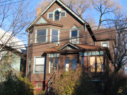
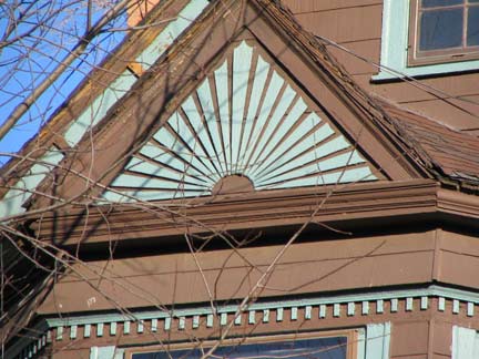
Buildings dating to 1880-1910 often used unusual color combinations and treatments. Not sure if these are the original colors (probably not) but the building at 19 Dongan combines brown and light sea green. Also note the sunrise window detail.
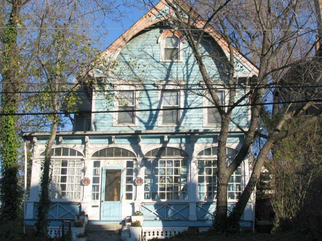
Busy, but in a good way. 13 Dongan.
Photographed November 2006. Page completed September 9, 2007.
erpietri@earthlink.net
©2007

