It was a day of crystalline cold in December 2010. The streets were still barren of snow, and no one in NYC yet knew that almost five feet and counting of white and quickly grey matter would soon be mounting in piles and drifts. It had been a good five years since I had set foot in Woodhaven: though I have been a Queens-ite since 1993, the southern half of the borough, much like the USA south of the Mason Dixon line, was still largely a mystery to me. (Any ForgottenFans want to name the imaginary line that separates northern and southern Queens?) And for all that it’s a fairly easy matter for me to get out to Woodhaven and Ozone Park, since I can take the LIRR to Penn Station, board an A train and I’m there in 75 minutes or so. On ForgottenWalks® I like to travel between neighborhoods that have absolutely nothing at all to do with each other, so I set off to begin in Woodhaven, stalk through the Cemetery Belt and wind up in East Williamsburg, a land currently being conquered by the cognoscenti, if you believe the blogs.
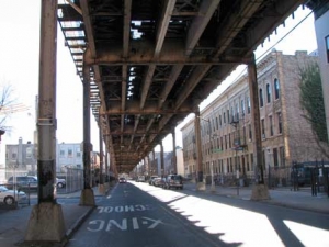
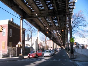
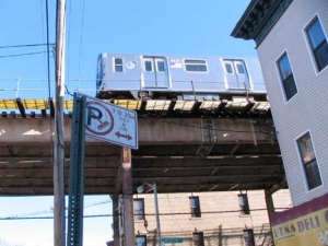
I alit from the A train at the 80th Street/Hudson Street station, in a section of Woodhaven once known as Eldert Park (named for the street that serves as the dividing line between Brooklyn and Queens). This section of the elevated preserves the last remaining section of the Fulton Street El, which was built in the 1880s and rumbled and rambled its way to Lefferts Boulevard in Ozone Park. When the IND was completed out to East New York in the 1930s, it was decided to extend it along this section of the el, which was permitted to remain after everything west of it was demolished in the 1940s. A spur from the el in Ozone Park allows A trains to run to aqueduct racetrack and the Rockaway Peninsula across Jamaica Bay, a connection made via a purchase from the Long Island rail road in the 1950s. (The NYC subways, once a dynamic, growing road, has become more or less frozen the last 50 years, with extensions of the Flushing Line to the Far West side and perhaps Secaucus, NY, and the Second Avenue Subway, are still years, if not decades away.
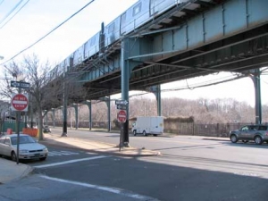
As in other parts of Queens, subway stations preserve long-dead street names that were changed as early as the 1910s (in fact Woodhaven was Ground Zero for the Great Renumbering of Queens streets, in which a borough-wide numbering system was imposed). 80th Street preserves Hudson Street (it was earlier called Bengal street on maps), 88th, Boyd Avenue; 104th, Oxford Avenue; and 111th, Greenwood Avenue. Photo above right: The el runs over Liberty Avenue, which abuts the Mokom Shalom, Bayside, and Acacia Cemeteries, now horribly overgrown with weeds, their tombstones largely forgotten; see more on FNY’s Ozone Park page.
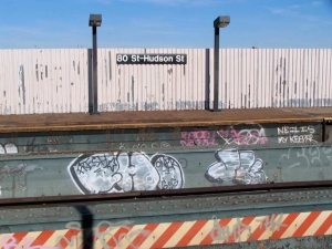
As a rule graffiti is nonsense, gang symbols, meaningless scrawling. But a message emerged from the miasma at 80th-Hudson: “Neil Is My Keeper.” We can only wonder at what unnamable relationship this scrawl describes, and it is best to not inquire too strenuously.
WAYFARING ROUTE: WOODHAVEN to EAST WILLIAMSBURG
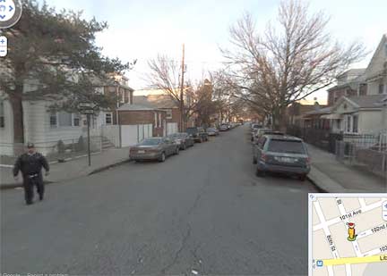
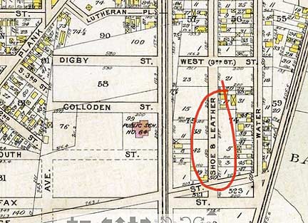

 I struck off north on 81st Street. The first street you run into is 102nd Avenue, which was once known as Shoe & Leather Street, probably reflecting the presence of a nearby factory. I decided to make a couple of street signs depicting how it would have looked, had the old name survived and not been numbered 102nd Avenue. Bromley Queens atlas 1909
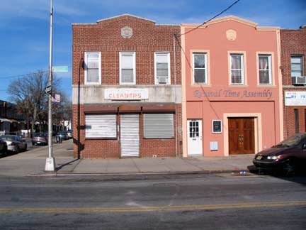
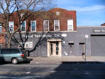
All is quiet on 101st Avenue, formerly known as Broadway (despite the Queens Broadway in Astoria).
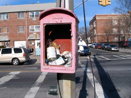
At 82nd Street is a former FDNY fire alarm. Many of these now serve as trash bins.
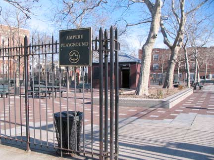
Though the Bronx honors electrical engineering pioneers in the Pelham Bay Park section with street names like Ohm, Watt, and Ampere, the Parks Department has also bestowed southern Woodhaven with the Ampere Playground in front of the Joseph P. Addabbo Senior School at 101st Avenue and 82nd Street. Andre Ampere (1775-1836), an accomplished French physicist and mathematician who is considered the father of electromagnetic theory. NYC Parks
The school was named for U.S. Representative Joseph P. Addabbo (1925-1986), who served in Congress from 1961-1986. His son, Joseph P. Addabbo, Jr. has served as a NY City Councilman and then as a member of the New York State Senate. The stretch of Cross Bay Boulevard between Howard Beach and the Jamaica Bay Wildlife Refuge, spanning Grassy Bay, was named for the Congressman after his death.
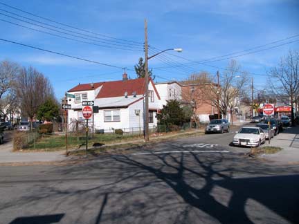
Culloden Place …
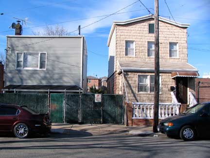
…and Digby Place are two named streets in a sea of numbers, issuing from 97th Avenue northeast against the overall grid to Rockaway Boulevard at 82nd Street. Checking the Bromley 1909 atlas, you can see they were originally north-south streets, but when Queens streets were numbered, Culloden and Digby were given to the two short one-block streets originally called South 2nd and South 3rd Streets.
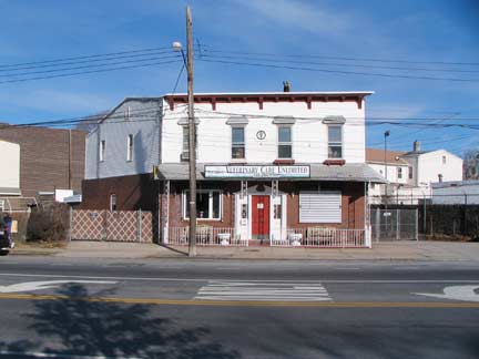
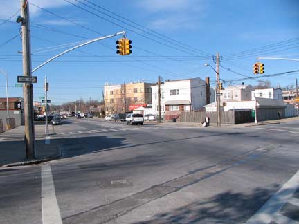
Rockaway Boulevard runs from the Brooklyn border at Eldert Lane and 90th (Ridgewood) Avenue southeast past JFK Airport and across the Meadowmere marshes to the Five Towns in Nassau County (specifically, it is the boundary between Inwood and Cedarhurst) where it’s called Riockaway Turnpike. The “Turnpike” portion preserves an old name, since Rockaway Boulevard was once known both as Rockaway Turnpike and Rockaway Plank road for its full length as it was once a toll road. In the early 1800s, the roadbed was made of planks, but engineers found this an unsatisfactory means of pavement (winters would be hell on plank roads) before the macadamization process produced the black pavements we know today. Older buildings, like the veterinarian above left, mark the route as an old highway.
In the 1920s, the Queens portion became a “Boulevard”. It’s rather sleepy as main Queens routes go, though there’s a theatre and a cluster of businesses at its junction with Woodhaven & Cross Bay Boulevards and Liberty Avenue. In the 1970s I was fascinated when, bicycling from Bay Ridge to Rosedale, I found a cache of very old castiron lampposts along the boulevard near the airport. A few of them persisted until about the year 2002.
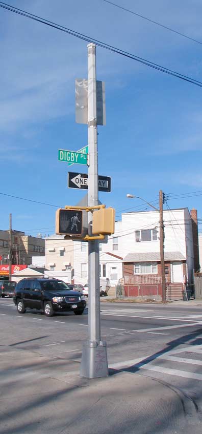
Former stoplight (you can tell by the thick shaft) now a utility post.
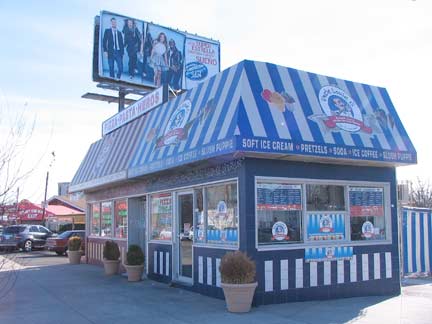
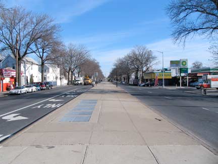
One of Woodhaven’s main intersections is at Rockaway Boulevard and Atlantic Avenue, where there is an ice cream stand that doesn’t get much business in the winter, but fortunately there’s pizza in the same building. The LIRR branch between Brooklyn and Jamaica runs under Atlantic Avenue (sometimes over). Before the early 1940s the railroad ran at grade, in the middle of the road, but in a massive rebuilding project the tracks were electrified and placed in an underground tunnel, emerging occasionally on an el in Brooklyn depending on the topography.
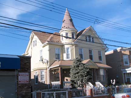
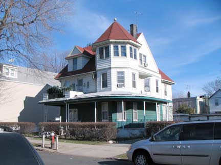
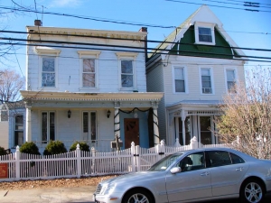
I pressed north on 80th Street, known as Shaw Avenue before the 1920s. The two distinguished buildings, each with their own cupola stylings, face each other across the church. They have been heavily resided in recent years, but the old character can’t be completely erased.
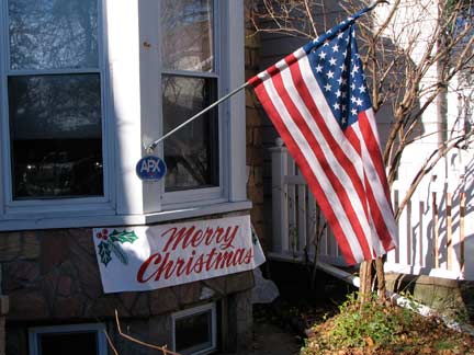
In contrast to the heavily decorated and lit buildings in places like Dyker Heights, Brooklyn and Pelham Gardens, Bronx, I found this place on 80th Street, which keeps it short and sweet. Why not hang the flag during the Christmas season? It’s a holiday too.
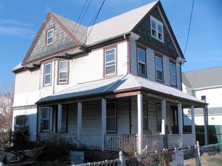
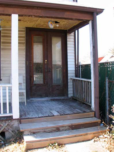
I found this literally unvarnished place on 80th Street south of 91st Avenue. The porch is apparently underoing renovation, with bare planks showing through, and the longtime double door is still there.
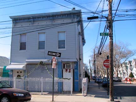
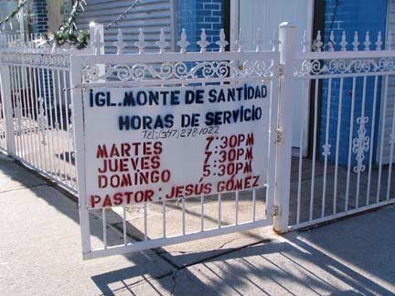
You know about storefront churches, here’s a ground floor church, at 91st Avenue and 80th Street. I like the spray paint sign that used stencils, or cut out alphabets. The roof corbelling gives away the building’s great age.
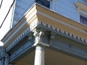
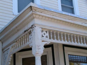
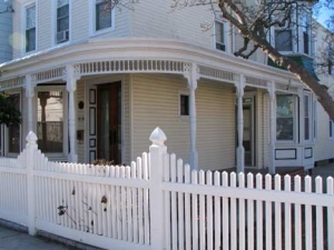
Two more of the classic buildings of the Union Course area, on 80th Street just south of 88th Road. Both have porches with intricate and detailed woodwork. Check the lengthy windows on the building on the left, and the wraparound porch.
This particular section was built up relatively early in the late 19th-early 20th Century on the grounds formerly occupied by the Union Course:
Woodhaven became the site of two racetracks: the Union Course (1821) and the Centerville (1825). Union Course was a nationally famous racetrack situated in the area now bounded by 78th Street, 82nd Street, Jamaica Avenue and Atlantic Avenue. The Union Course was the site of the first skinned — or dirt — racing surface, a curious novelty at the time. These courses were originally without grandstands. The custom of conducting a single, four-mile (6 km) race consisting of as many heats as were necessary to determine a winner, gave way to programs consisting of several races. Match races between horses from the South against those from the North drew crowds as high as 70,000. Several hotels (including the Snedeker Hotel and the Forschback Inn) were built in the area to accommodate the racing crowds. wikipedia
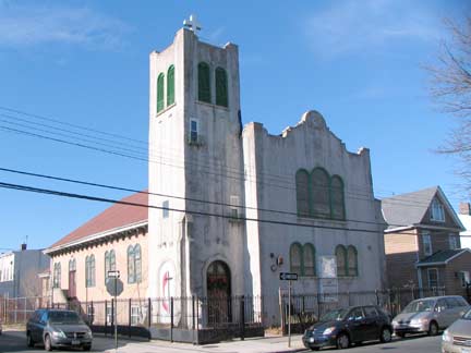
New Life United Methodist Church, 80th Street and 89th Avenue, was built in what looks like a Spanish Baroque style in 1928. It serves a primarily Chinese congregation.
Neir’s of Woodhaven
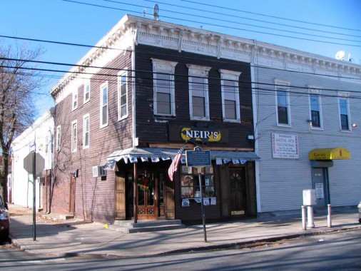
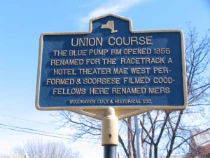
At the corner of 78th Street and 88th Avenue (formerly Snedeker, Snediker, or Sneideicker Avenue, depending on what map you consult, and 3rd Avenue, stands one of New York City’s oldest taverns, Neir’s, opened in 1855 (or 1829, depending on what account you read; the tavern itself says 1829) as The Pump Room, or Old Blue Pump House, to serve Union Course patrons.
Though Neir’s is one of the oldest drinking establishments in the city — even if it was founded in 1855, that puts it only a year or two younger than the purported age of McSorley’s in the East Village — it gets little notice or press outside of Queens. The founder was Cadwallader Colden, and that name might raise a scintilla of recognition for New York State history scholars: his great-grandfather, who had the same name, was acting governor of NY State and mayor of NYC in the colonial era. The Neir’s name comes from Louis Neir, who purchased the place in 1898, adding a bowling alley, ballroom, and rooms for rent upstairs.
Entertainer Mae West’s (1893-1980) name is attached to a number of institutions in Brooklyn, notably the Astral Apartments and Teddy’s in Greenpoint and North Williamsburg, and she is said to have begun her showbiz career singing here; a plaque marks her former home on 88th Street. At times, the ghost of Mae can sometimes still be seen here. Her association with Neir’s has been disputed, however. What is indisputable is that several scenes of Martin Scorsese’s mob epic Goodfellas, with Robert DeNiro and Ray Liotta, were filmed here.
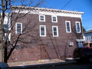
Whenever you see a lengthy rear section on a tavern or former tavern, you suspect a bowling alley or two may have once been part of the establishment and as these historic photos from Neir’s interior on their website show, that instinct is correct in this case.
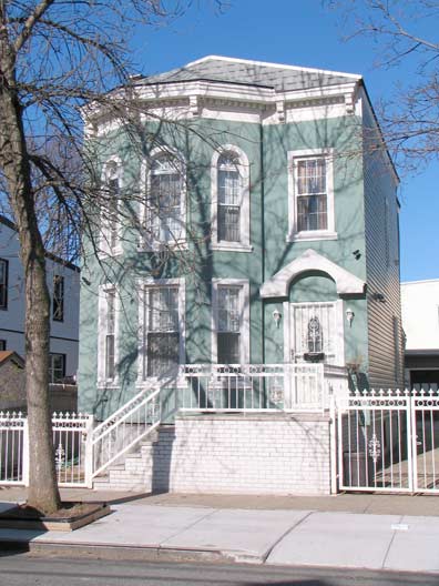
A jewel box on 88th Avenue and 76th Street.
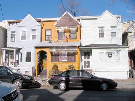
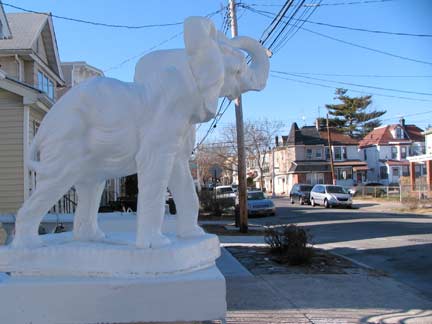
3 houses likely loooked the same when first built but their various owners have altered them to suit tastes. A lucky elephant, trunk raised, surveys 88th Avenue.
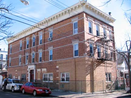
At 88th Road and 74th Place (formerly Graves Place and Court Street) Brooklyn is so close you can smell it! (Just kidding!)
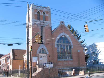
At Eldert(s) Lane, the numbers become names, as Queens becomes Brooklyn, and 88th Road metamorphoses into Etna Street. The Presbyterian Church of the Redeemer (erected 1909) is on the Brooklyn side.
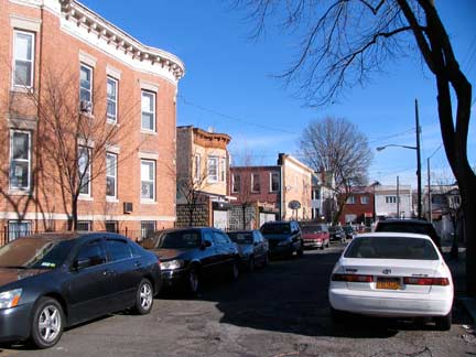
Cypress Hills, Brooklyn, contains a number of alleys and one-block streets such as Karweg (once Liberty) Place, which runs for a block between Eldert(s) Lane and Grant Avenue south of Etna Street.
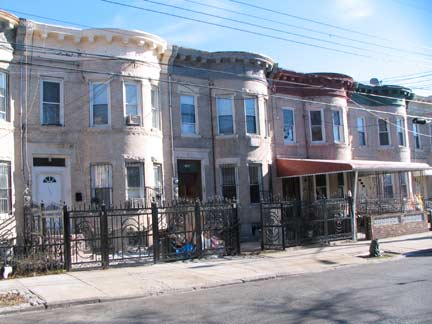
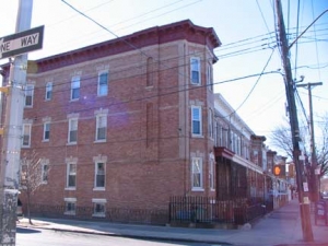
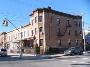
These are the attached brick buildings with bowed fronts typical to this area; ugly additions have been placed in front of them to replace what may have been grassy areas.
O’Brien Place, the only street in Brooklyn that begins with “O apostrophe”, is a bit odd– it runs northwest against the grid from Grant Avenue almost at the intersection of Ridgewood a few blocks to Autumn Avenue. The odd-shaped plot created a strangely oblong building at Nichols Avenue.
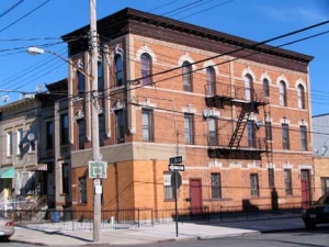
Two more of the distinctive multifamily buildings at O’Brien and Nichols.
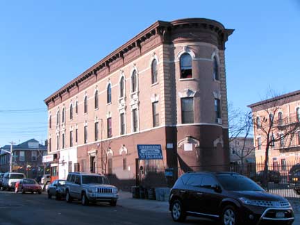
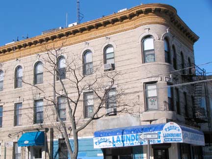
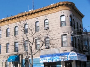
A second look at that oddly oblong building on the lengthy near-triangular plot formed by Ridgewood and Nichols Avenues and O’Brien Place. Though Ridgewood Avenue is miles away from the neighborhood it is named for, it was likely named for the nearby Ridgewood Reservoir.
Danforth Street is an odd alley that runs fro two blocks from Autumn Avenue west to Crescent Street south of Etna Street. The eastern block hasn’t been paved for a number of years, and I found this small house on the corner of Autumn that appears as if it hasn’t had any work for several decades. Better-kept attached brick homes face it across Autumn.
Crescent Street in Cypress Hills is strangely named — while its counterpart Crescent Street in Long Island City is gently curved and crescent shaped, this Crescent Street runs in a straight line from Jamaica Avenue south to Flatlands Avenue. Perhaps there was once a nearby Crescent Club, like the former Crescent Athletic Club in Bay Ridge. Between Jamaica Avenue and Fulton Street the street is shadowed by the eastern section of the Brooklyn Broadway el (J train) which runs on Broadway, Fulton Street, and Jamaica Avenue to an underground terminal at Parsons Boulevard, Jamaica. This section of the line was opened May 30, 1893.
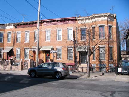
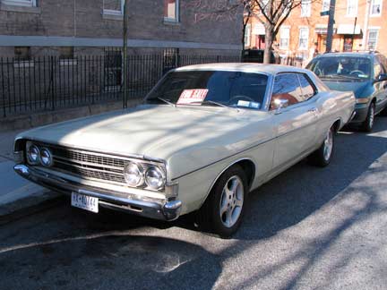
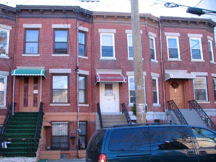
Etna and Pine Streets. I think everyone knows by now I’m a fan of this type of attached brick residential buildings. Right: Name that car…Pine off Etna. It’s a Ford, that’s all I know.
ForgottenFan Mark Nahmias: The Ford you inquired about is a 1969 Torino, a direct descendant of the Fairlane & predecessor of the Gran Torino (which Clint Eastwood cherished in the film with the same name). Joe Hedio: The car that you were wondering about in your latest FNY thingie on Woodhaven is a 1968 Ford Torino/Fairlane 500 coupe. Steve Okonski: 1968 Fairlane
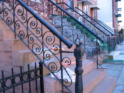
Wrought iron railing stoops, and the handsome buildings on Etna they’re attached to, between Pine and Euclid.
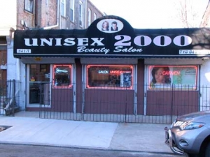
Etna and Euclid. There was a time when dates like 1984 and 2000 seemed impossibly remote, and then they passed by without a whimper. Now the establishments that had “2000” in the name sound quaint. Even 20th Century Fox studios was named in the early 1900s, when anything called “20th Century” seemed fresh and new.
Bookend buildings at Etna and Euclid. The contractor built rows of brick buildings, with more prominent 3-story buildings at the ends.
In this part of Brooklyn there seemed to be a halfhearted attempt to give streets a classical feeling or atmosphere, with streets named for a Sicilian volcano and the Greek “father of geometry.” There’s also Hemlock Street, the plant being Socrates’ method of execution.
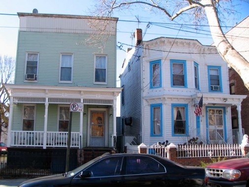
A pair of handsome frame residences on Euclid Avenue, just south of Jamaica Avenue.
CONTINUED ON PART 2: The Road to Ridgewood
1/23/11




5 comments
I AM JUST CURIOUS BUT DOES ANYONE REMEMBER A CATERING PLACE WHICH WAS DIRECTLY ACROSS FROM THE INTERSECTION OF HIGHLAND BLVD N JAMAICA AVE? MY DEARLY DEPARTED WIFE AND I ALWAYS SAW THIS PLACE WHEN WE CAME HOME FROM OUR SOCIAL FUNCTIONS. WE LIVED IN WOODHAVEN JUST A BLOCK FOM FOREST PARK. I HAVE SOME EXTTREMELY FOND MEMORIES OF THOSE TIMES.
Was it The Showboat? My cousin had his wedding reception there.
Can I ust say what a comfort to find somebody that truly understands what
they’re discussing oon the internet. You certainly know how to bring a problem to light and make it important.
More and mor people really newd to check this out andd understand this side of your story.
I can’t berlieve you aren’t mre popular given that you definitely possess the
gift.
Feel free to ssurf to my homepage – Villa st Martin
Don’t know how the cafe would feel about having a pizza delivered
There is no monument dedicated to the memory of a committee.