A mystery about Bay Ridge, Brooklyn was cleared up for me today, and I had Woody Allen, however indirectly, to thank for it.
Sometimes it takes unusual convergences to come together to make up a Forgotten NY page. Today, two separate websites, my childhood nerdiness, and the 1977 Academy Award® winning picture came together to solve a mystery that had been in the back of my head for years.
I was a very strange kid. Now, if you have been reading Forgotten NY for 13 years, that comes as no surprise to you. However: while I had my share of friends as a kid, I was never the most popular and got bullied a lot, decades before pop and sports stars started making videos encouraging kids not to do it. My father was right about many things, and to his eternal regret I was not more athletic and chose to run off instead of confronting tormentors.
One of my odd habits was collecting as many street maps of NYC as I could (in those days, Hagstrom and Geographia pretty much dominated 90% of that market). Rand McNally’s NYC maps were inferior, and still are, and though there’s a large number of NYC mapmakers now (and I’m not even including the ones in the GPS devices) Hagstrom went to a computerized version years ago, while Geographia, a company about which I know very little — they have never done much to publicize their stuff — has wisely stuck with the hand-drawn editions they have used for decades.
Geographia would also put out what they called Little Red Books — not the philosophies espoused by history’s great butcher, Mao Tse-Tung, but a list of all the streets in a borough, where they began and where they ended, what bus and train lines went there, and what the house numbers were. I pored through these Little Red Books like they were the Talmud, the Pentateuch, the Federalist Papers, the Necronomicon.
I also rode my bicycle to every nook and cranny in western Brooklyn, with an especial emphasis on Bay Ridge. I knew and still know where all the hidden alleys were, named and unnamed; I knew where the haunted houses were before the wrecker’s ball visited them; and I knew about the half-block long cemetery containing the bones of Revolutionary War fighters was (Narrows Avenue and Mackay Place)
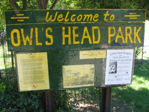

Close by that little cemetery is Owl’s Head Park, a green oasis on a hill overlooking the Narrows, with views of Staten Island and the Verrazano Bridge. No one quite knows how the park got its name, though it’s speculated that the gateposts of an estate belonging to a senator who lived in the area sported a pair of carven owls’ heads.
(Brooklynite and Fiery Furnace Eleanor Friedberger wrote the first song about Owl’s Head Park that I know of, and it’s quite affecting.)
But Owls Head Park is not the mystery.
When looking through the Little Red Book for Colonial Road, the book stated that it ended at Wakeman Place and 1st Avenue. Now, my perambulations had already revealed that 1st Avenue ended at 58th Street, at the gate of the Brooklyn Army Terminal, about 8 blocks away.
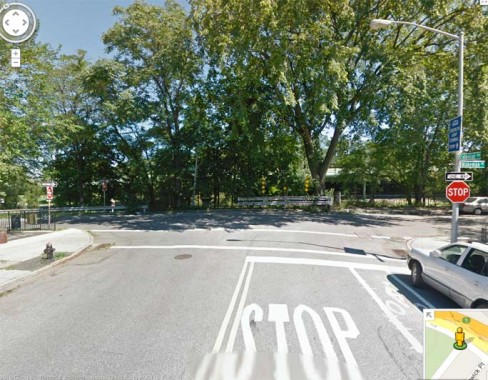
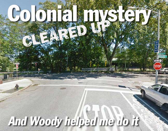
When I ride the ForgottenBike to Colonial Road and Wakeman Place, I found no trace whatsoever of 1st Avenue. Colonial Road ends abruptly, with no trace of it continuing on as 1st Avenue, as Ridge Boulevard continues north as 2nd Avenue a block east. I filed that Little Red Book listing away in my brain as an archaism or atavism that the book’s editors had never bothered to correct. And so it sat there, in the back of my brain, for over 30 years.
Then, in the latest Scouting New York entry that lists the film settings of the Woody Allen/Diane Keaton classic Annie Hall and what the various NYC settings look like now, there’s a bit about stone eagles at the Central Park Zoo “that came from a 1912 bridge that went over Shore Road from First Avenue in Brooklyn. The eagles found their way to Central Park in 1941 after the bridge was demolished.”
Inquiring further about that bridge, I was directed to an Ephemeral New York listing that discussed it:

It was a magnificent arch bridge that carried Colonial Road over the twisting Shore Road Drive, which originally connected Shore Road and 4th Avenue but now serves as a feeder road for the Belt Parkway. Once over the drive and on the grounds of the Brooklyn Army Terminal, which opened in 1919, Colonial Road became 1st Avenue. While the bridge, according to New York City Parks opened in 1912, traffic flow may have been restricted into the BAT as early as its opening in 1919.
So, Colonial Road once did indeed turn into 1st Avenue at one time. But when the Belt Parkway was built by Robert Moses from 1938-1941, the bridge was destroyed, but the eagles wound up at the Central Park Zoo. And that’s how Woody Allen helped me clear up my confusion about an outdated listing in Geographia’s Little Red Book.
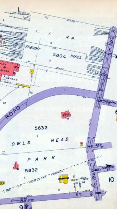
1929 atlas plate showing Owls Head Park, Colonial Road and its continuation north of Wakeman Place.
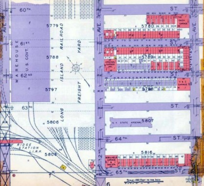
North of that, we see 1st Avenue (extreme left) running through the Brooklyn Army Terminal, as well as the tracks of the Bay Ridge Branch of the LIRR, which are still there.
7/30/12

29 comments
Well done, sir!
As a former, Long-time homeowner(Sedgwick at Wakeman) I applaud your scholarship and
perspicacity. What can you tell us about Barkaloo Cemetery and it’s historic he’d stones at McKay Place?
Didn’t you say the stones had been removed? I haven’t been at the cemetery for a couple of years.
I fondly remember those little red books, especially the Brooklyn one, as I was born and raised there as well. If I’m not mistaken, they also used to have the bus routes and train routes in the back, along with all the stations. Although rush hour lines like the NX and RJ were no longer in use by the time I got to the books. I used to make up bus routes for streets that I thought needed them. We eventually had the books for at least four of the boroughs. When I next visit my Mom, I’ll have to see if they’re still in existence buried somewhere there.
I discovered your web site about 2 years ago and I look forward to your posts every week. I grew up on the border of Bay Ridge and Sunset Park in the 60’s but left for Florida (by way of upstate New York) with my family in 1974. Some of my fondest childhood memories include my mom walking my brother and sister and I down past Leaf Ericson park to Owl’s Head park and on to Shore Road and past the Verrazano. Florida is great but I miss the days and the memories of growing up in the city.
Thanks for the endless supply of New York history.
Remembering something from 30 years ago is a REMARKABLE achievement; I’m lucky if I can remember what I had for lunch yesterday….
“I was a very strange kid. Now, if you have been reading Forgotten NY for 13 years, that comes as no surprise to you. However: while I had my share of friends as a kid, I was never the most popular and got bullied a lot, decades before pop and sports stars started making videos encouraging kids not to do it. My father was right about many things, and to his eternal regret I was not more athletic and chose to run off instead of confronting tormentors.”
I’m not really sure why this was included in the story unless you just wished to vent. I would have been quite happy reading the rest of the article without any knowledge of this. 🙂
Exposition.
As another very strange, bullied kid (50 years ago), I found Kevin’s revelations informative and satisfying. At the end of the day, Pat, it’s his blog. No one is forcing you to view it.
People are strange when your a stranger.
Personal observations make this blog better – don’t change.
SOME people don’t want Too Much Information.
Kevin, especially not those would-be bullies 🙂 Your revelations, honesty and humor infuse every ultra-informative page, driving me to the next one always riveted. For those who don’t appreciate the details, read the captions!
When i was a kid in the early 50’s we called Owl’s Head Park Bliss Park
A Bliss family member also had a mansion where the park was eventually built. A nearby street is called Bliss Terrace.
Owl’s Head Park had the best sleigh riding hill in all of Brooklyn (if you didn’t want to get hit by a car). And I can remember many Saturday mornings in line for the ferry to Staten Island. Nice memories!
I was sleighriding down the hill on my father’s back and we hit a tree – knocked me out cold. That was over 60 years ago!
Rand McNally’s recent folded maps and atlases are now by far the most accurate maps available. Hagstrom’s new maps are quite distorted in many locations and Geographia is better than it was in the 1950’s, but still has a long way to go. (e.g. They still show Linden Blvd with a fancy interchange at Conduit Blvd and continuing straight through to Cross Bay Blvd and then across the NW corner of Aqueduct Racetrack). I have a few of the Little Red Books by Geographia, as well as other similar books. They were interesting to peruse, but never very accurate.
In any case, there are now only a very few companies that actually collect the map data from aerial photos. The map publishers merely pay for licenses.
In Hagstrom’s good old days, both theirs and Geographia’s maps beat RMcN’s coming and going as far as rendering is concerned. But for some reason, they have always gotten Conduit Boulevard wrong. It’s a double 2-lane road separated by a median in Brooklyn, gaining extra lanes from interchanges with Linden Boulevard and finally getting true Parkway status once encountering the Belt Parkway. Also, it’s Conduit Boulevard in Brooklyn, only becoming North and South Conduit Avenues ince in Queens. I don’t know why this has to consistently be wrong.
I used to submit additions and errors to Hagstrom. This got me 2 job interviews in 1981 and 1992 as a fact checker/surveyor but they would have been way underpaid positions.
Where in Central Park are those eagles? I found a photo from 1959 of my sister and I posing by one of them. I’d like to rediscover it in her memory.
At the Zoo entrance
I lived in Bay Ridge for over 30 years. I was in that area often spending time on the dock and later the rebuilt dock. I was completely unaware that there was a connection between Colonial Road and 1st Ave. Great detective work. I have seen pics of the old 3rd Ave El that terminated a couple of blocks east and that was pretty amazing but nothing like the find that you have here with that impressive bridge. Robert Moses should be ashamed for tearing it down.
Like the previous entry I too never knew that this bridge existed. If you look at the Parks Dept site under “Parks before they were Parks” there is a section regarding Owls Head Park. There are two aerial shots from the 1930’s that show the bridge but it already seems to dead end and not continue over the railroad tracks. As you mentioned the bridge was built in 1912 and the BAT was built in 1919. Could the bridge have only existed as intended (a link between Colonial Rd. and First Ave.) for 7 years? If so it is probably one of the shortest lives for a bridge especially such a grand structure in the history of NYC. If it had remained standing as a dead ended bridge it could have become the High Line of Brooklyn.
Thanks for clearing something up for me. I grew up on 56st & 8ave back in the ’70s. I was looking at the citymap for 1924 a while back and “found” the bridge but couldn’t find any info on it.
Another interesting find was that shore pkwy ran all the way to Ft. Hamilton pkwy. I used to play baseball with my friends at the “dustbowl” on 8ave & 65st.
http://gis.nyc.gov/doitt/nycitymap/
Hi, came across your site after checking out the photos on the NYC municipal archives site. On that site I saw a picture of NYC Mayor Hylan giving a speech in Bay Ridge at the opening of a tunnel that connected to Staten Island. Do you know where I can look for more info on it? Is it still around?
Found this on http://www.vanshnookenraggen.com/_index/2010/07/the-futurenycsubway-staten-island/ :
Supposedly, when the 4th Ave subway in Brooklyn was being built, a short tunnel was started from Bay Ridge to Staten Island but was never completed since there was no addition funding.
The demolition of this very magnificent structure is a great loss indeed !
How sad I lived in the first house on the corner of wakeman place exactly across from bliss pat park aka owls head park.. had no idea about the story behind the owls heads.. wow. Bream
Is my heart I was born in1941 so don’t remember the owls..
Richard Croak
Born 1934. Bliss park, Owl’s Head Park. One of my old hangouts especially in snowy winter when sleighing was in. Remembering stone building at bottom hill with toilets and steam radiator to warm by and dry your mittens.
Forgot to say lived on 72nd st and Narrows ave. Girl friend 68th st and Narrows ave. Marilyn young at that time.
Anyone remember during the WWII when the guns were at Bliss Park with the army? My mom use to make homemade donuts and apple cider for the boys in uniform. They loved them.
I could go on and on but my 84 year old finger gets tired.