Well, I see I’d better kick this series in the head, since my daily ratings are way down since I began it three weeks ago. ‘S’matter, you don’t like Staten Island? It’s truly the ForgottenBorough, stuck between urbanity and suburbanity, with a few pockets of wild in the country scattered around here and there. The only reason I don’t visit oftener is my blissful car-free existence and sheer distance away from Little Neck. Just to get to my temp job in Manhattan it takes two hours with a bus I take from terminal to terminal and a subway line in which I do the same! But I have always been a chickensh!t about driving, and I don’t want to shell out for gas and insurance. After all these years I’m still in a state of wonderment about people who can get into a two-ton piece of metal, hurtle it along at more than 60 MPH and emerge in once piece. I couldn’t do it, that’s for sure.
My current series features the walk I took from Arrochar, the first neighborhood in Staten Island you’re in when you exit the Bridge from Brooklyn, through Grasmere, Concord, some of Park Hill, and into Clifton and Rosebank, from whence I got back on the bus and back home, 3 hours later on a weekend. I love Staten Island. I went from Arrochar, which is rather middle-class Bay Ridge-esque, through Grasmere, which has pockets of opulence, especially along the ponds and lakes, and then into the poor side of town in Concord and Park Hill. What did I see in Clifton and Rosebank? Keep reading…
WAYFARING MAP: Arrochar, Grasmere, Concord, Clifton, Rosebank
Staten Quo Part 1 | Staten Quo Part 2
I left off at the Vanderbilt Cottages on Vanderbilt and Tompkins Avenues, which are some of the greatest collections of Tudor architecture you’ll see in the Greater NY metropolitan area, but they’re in Staten Island so no one knows about them. They’re part of a small pocket of premium architecture you’ll find along Vanderbilt and Norwood Avenues between Bay Street and Tompkins (most of the great homes along Townsend Avenue, which is the next avenue after Norwood, have been razed since I spotted them in 2005). The Landmarks Preservation Commission is as stingy when handing out designations in Staten Island as it is in Queens, so these places are subject to the predations of developers.
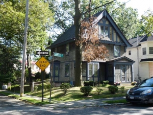
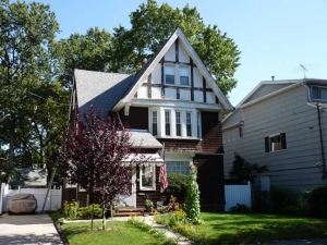
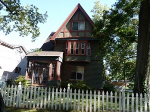
Some of the great Norwood Avenue Tudor-ish homes, seen between Talbot Street and Tompkins Avenue.
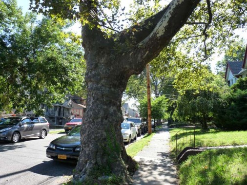
In their old age, London plane (sycamore) trees can get thick around the trunk, like people. This one has probably been on Norwood Avenue close to a century.
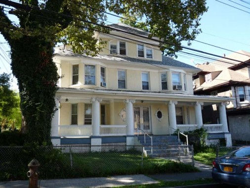
Ionic-porch-columned house at Norwood Avenue and Errington Place. It’s a hot day, but who needs AC — just sit and have an iced tea or something stronger.
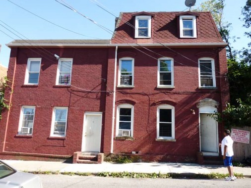
Basic brick on Norwood near Bay Street. The mansard roof with the dormers was likely added a couple of decades after the building was built, likely the 1880s or 1890s.
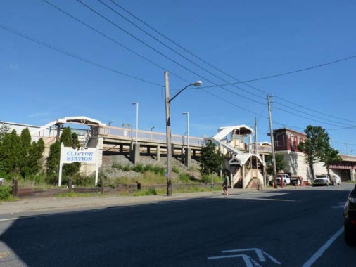
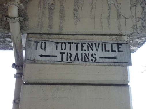
Clifton Station, Staten Island Railway at Bay Street and Norwood Avenue. The SIR, formerly Staten Island Rapid Transit, parallels Bay Street along the Narrows for a few miles, but here crosses Bay St and makes a southwest run to Tottenville.
For many years, the SIRT used simple stenciled signs like this for station ID and other messages until the MTA completed revamping most stations in the system in the 1980s, replacing them with standard MTA black and white signage, but here’s a vestige of the old days on Bay Street under the railroad overpass.
We’re now in Clifton, which is roughly delineated by the Narrows, the railroad, Osgood and Vanderbilt Avenues and Richmond Road. The region came under the name Clifton, named probably because it faces Grymes Hill, in the early 1810s, shortly after the young Cornelius Vanderbilt organized the first ferry service between Staten Island and Manhattan. The mostly abandoned Bayley-Seton military hospital (U.S. Public Health Service Hospital) at Bay street and Vanderbilt Avenue takes up a lot of Clifton’s acreage. The Kroc family, former owners of McDonald’s, bid to turn the grounds into a community center, but the deal has been stalled.
Once passing under the SIR, we have entered Rosebank, a part of Staten Island I’ve visited often because of its small-town atmosphere and picturesque church buildings.
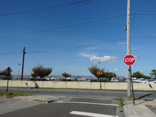
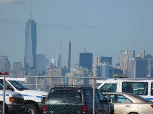
On my previous Rosebank excursions, I hadn’t explored Edgewater Street, which runs along the Narrows between the SIR and Hylan Boulevard, so I thought I’d make my maiden voyage there. There is a tiny street called Camden Street (some Staten Island thoroughfares are named for New Jersey cities) between Bay and Edgewater Streets and if you angle the camera just right and zoom in 18X, you can get a good view of the skyline and #1 World Trade Center… the skyline is visible fleetingly along Edgewater Street.
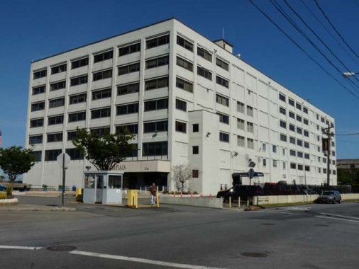
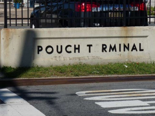
If you will recall, in Part 1 of this series I mentioned the Pouches, father and son Alfred J. Pouch, who founded the American Dock Company, and his son, William H. Pouch, who built Pouch Terminal in 1917, a pier and warehouse complex facing the Narrows on Staten Island’s north shore. “Inbound freight arriving at Pouch Terminal came directly from ships or lighters at the Pouch Terminal piers, by carfloat via the Baltimore & Ohio Railroad St. George Terminal, or via the Staten Island Railway (Baltimore & Ohio Railroad) via New Jersey and the Arthur Kill vertical lift bridge.”
Pouch Terminal ended service in 1979. It later became an electric generating plant, and it is currently a mixed-use building called Edgewater Plaza.
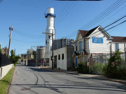
Looking southeast on Edgewater Street. The tower belongs to a New York Power Authority electric generating plant.
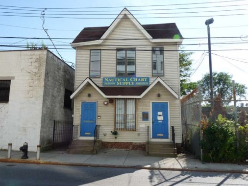
Nautical Chart Supply is a leftover from the days when busy riverine industries, including Pouch Terminal, lined both sides of the Narrows as well as the East and Hudson Rivers. I could not glean much information about the place, except it has been in business for over 75 years. It was late Saturday afternoon at this point, and the shop was closed, but the website, which is pretty no-nonsense without any store history, lists the products sold here, which include maritime maps.
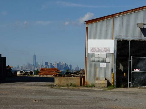
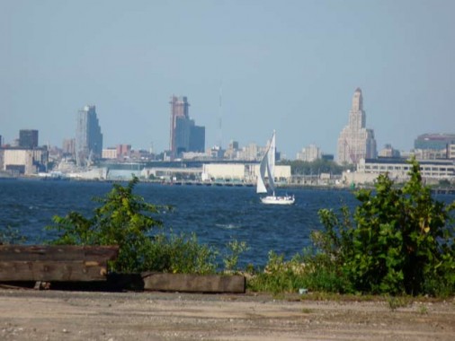
Ruins of former dockside industries line the northern end of Edgewater Street, and through them views of the skyline beyond can be made out, including the downtowns of Manhattan and Brooklyn. As you can see the Williamsburg Bank Tower is no longer the only big dog of downtown Brooklyn, as other residential towers comparable in height have joined it.
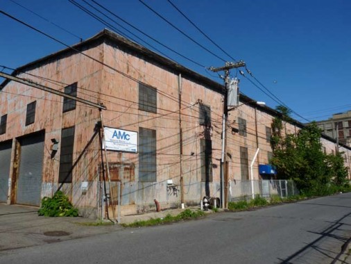
Admiral Marine, Inc., 181 Edgewater Street. Like many other waterside industries it was hit hard by Hurricane Sandy in October 2012.
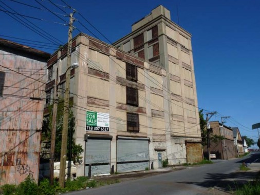
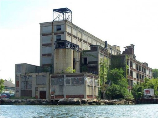
191 Edgewater Street, a former Wrigley gum processing plant… [2nd photo: Massey Knakal Real Estate]
In the 1860s exiled Mexican General Antonio de Santa Anna, who had defeated the Texian* rebels at the Alamo in 1836, stayed with a photographer named Thomas Adams Jr. in Staten Island. Santa Anna suggested that Adams might be able to make a fortune off chicle, a gummy substance Mexicans had been extracting from sapota trees and chewing for centuries. The general believed the chicle could be combined with rubber to make better carriage tires, but that turned out not to be true. After a year, Adams was stuck with a warehouse full of chicle, bewildered about what to do with it. Then he remembered what Santa Anna had mentioned about chewing it, and became rich manufacturing chewing gum, joining forces with industrialist William Wrigley Jr.
*Before Texan became the accepted term, residents of Texas fighting for independence from Mexico called themselves Texians.
The factory was constructed in 1917 and has long been defunct, though it’s being marketed for residential housing. It would have an impressive setting by the Narrows if such as use ever came about.
My pal Nathan Kensinger, who ferrets out abandoned interiors, entered the old factory and got several pictures in 2008.
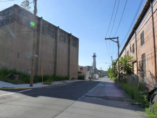
An abandoned Edgewater Street, facing northwest this time.
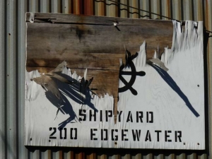
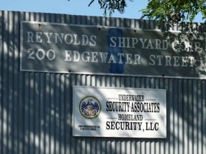
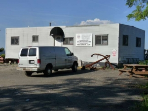
Reynolds Shipyard, 200 Edgewater Street. Note the anchor in the driveway.
Reynolds Shipyard, incorporated in 1983, provides a wide range of maritime services including ship repair, launch/lighterage services and warehousing.
Topside repairs of barges and tugs constitute the majority of our maritime repair services. Our yard is capable of performing pipefitting, burning/welding, metal fabricating, construction and machine shop jobs. In addition to the equipment required to conduct the above, we also maintain heavy equipment, cranes, forklifts and floating equipment….
We provide launch and lighterage services to vessels within the Port of New York. Our service includes the transport of supplies to and from tankers, container ships, bulk containers, tugs and barges. We also provide support services to the Motion Picture and Advertising industries.
Our launch and lighterage service is supported by USCG Certified vessels operated by USCG Certified crew. In addition, our 20,000 sq. feet of warehouse space allows us to assist various ship chandlers and vessel suppliers to service their customers in a more economical manner. Reynolds
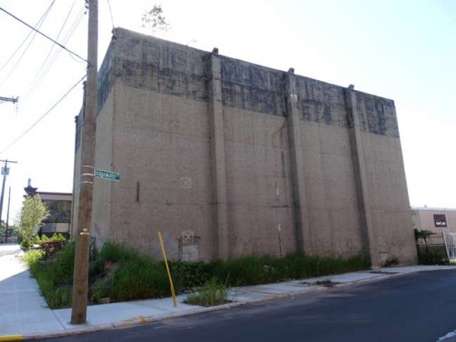
This inscrutable concrete megalith once belonged to the Richmond Ice Company. Look on his works, ye mighty, and despair. According to Ice and Refrigeration, Volume 62 (I keep all my copies in storage), it was constructed in 1922.
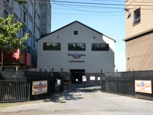
Sandy Hook Pilots, 201 Edgewater Street.
The Sandy Hook Pilots board all ocean-going vessels-passenger liners, freighters, tankers, etc-either at the pier or on the open sea off the entrance to the harbor. Often at the risk of their own lives, the pilot clambers up the side of a vessel on a rope ladder and makes his way to the bridge. The pilot then assumes the con to ensure the safety of the vessel with her precious cargo of lives and goods. ![]() This is where the job really begins. They guide the vessel through traffic, rocks, reefs, shoals and narrow channels to her destination. The vessel is directed either to a safe anchorage or to a point directly off the end of the pier, at which time the tug boats take over and assist the ship into her berth. Sandy Hook Pilots
This is where the job really begins. They guide the vessel through traffic, rocks, reefs, shoals and narrow channels to her destination. The vessel is directed either to a safe anchorage or to a point directly off the end of the pier, at which time the tug boats take over and assist the ship into her berth. Sandy Hook Pilots
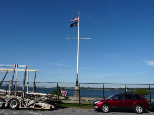
This waterside memorial on Edgewater Street and Clifton Avenue will soon be open to the public.
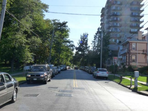
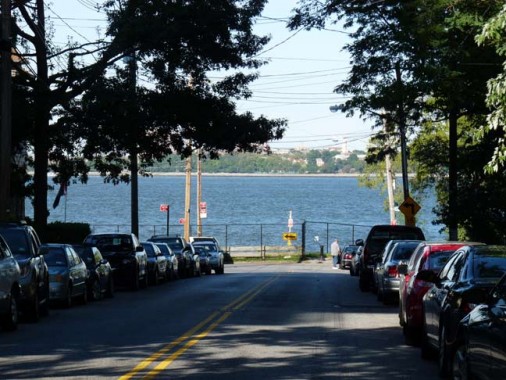
This Could Be The Start of Something Big: Hylan Boulevard, looking north and south from about Edgewater Street. After curving around Rosebank and Grasmere, from Old Town to Tottenville, Hylan Boulevard runs relatively straight down the Island’s south shore. It was built as Seaside Boulevard, but later renamed for former mayor John Hylan (1868-1936), as most of it began construction during his mayoralty. In Rosebank the former Pennsylvania Avenue was renamed Hylan Boulevard.
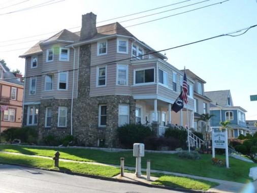
Harbor House is a bed and breakfast inn at Edgewater Street and #1 Hylan Boulevard, with terrific views (see below) from the front porch. I have fond memories of the place — I stayed here (yes, a NYC resident stayed here) while doing a marathon research session for the ForgottenBook in February 2005, and my experience was pleasant…I’d do it again if need be. (I didn’t sleep the first two nights, sleep was disrupted by a crowing rooster. I never sleep when away. My first 3 nights in San Fran in 2008 I didn’t get a wink.)
“…It’s not luxurious in any way, but it does have views over the harbor to Manhattan. The Harbor House feels more like a beach house than anything else, and you can lie in bed and look out to the water. It is distinctly un-New York in feel. Rooms tend to be large, with a clock radio, TV, dresser, armoire, ceiling fan, but there are no phones in the rooms. A good-sized continental breakfast is offered. Having your morning coffee on the porch would be a treat. It’s the water, the Verrazano, the Statue of Liberty, Manhattan, and it feels like it’s all yours.” NY Times review
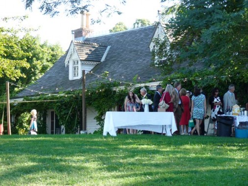
A wedding reception was taking place at #2 Hylan Boulevard, the historic Alice Austen House across the road from the Harbor House. It’s an excellent place for parties because of its sweeping views, and not only does this building have historic connections (some of it was built in the 17th Century) but it was also home to one of history’s most pioneering photographers.
Here’s the unabridged account I submitted for the ForgottenBook, which was edited down a little for print:
Staten Island’s longest street, Hylan Boulevard, begins and ends with 17th Century houses: Clear Comfort, which for many years was home to Alice Austen, features an original section dating to as far back as 1691, while the Conference, or Billopp, House in Tottenville at the other end of Hylan, was built in 1680.
Alice Austen (1866-1952) was born to a prosperous family in what was then a part of Clifton and is now Rosebank. Her father, Edward Munn, disappeared before her birth; her mother, Alice Cornell Austen, moved with her daughter to her parents’ house, Clear Comfort, shortly after that. The house, at 2 Hylan Blvd. (then 2 Pennsylvania Avenue) had been purchased and later completely renovated from a simple farmhouse to a Victorian cottage by John Haggerty Austen, Miss Austen’s grandfather, in 1844.
Miss Austen was introduced to photography by her uncle, Oswald Müller, in 1876, when she was ten. Aside from Müller’s original demonstrations, her photographic skills and techniques were entirely self-taught. In the latter years of the 19th Century, photography was a burdensome business; cameras were large and bulky, made of mahogany or cheaper wood with a leather cover. Negatives were produced on large glass plates covered with chemical emulsion and a number of these had to be carried, along with a selection of lenses, cartridges of magnesium powder, cables allowing the photographer to insert herself in her own photographs, and tripods. More than one camera had to be taken, since in that era, larger cameras took larger prints; cameras could only take one proportion. As much as fifty pounds of equipment accompanied Miss Austen on her journeys. She maintained her own darkroom, spending many hours indoors processing her photographs.
Her subjects ranged from her family and friends on Staten Island, engaging in all manner of activities from lawn tennis, bicycling, beach outings, and costume parties. While in Manhattan, she captured images of newsboys and newsgirls, pushcart vendors, bootblacks, organ grinders, and rag pickers, subjects you would not expect a woman of privilege to entertain. Miss Austen traveled frequently, all over the east coast, Pennsylvania, Chicago, and Europe. She loved to capture the constant parade of ships that passed in clear view in the Narrows, just beyond her front lawn. Her work was intimate, personal, and while curious about its subjects, never intrusive or exploitative. Some of it was frank; she was unafraid to let down her hair and be photographed smoking, quite daring public activities for women in the 1890s.
Unlike the great women photographers who followed her in the 20th Century, Jessie Tarbox Beals, Berenice Abbott, Margaret Bourke-White, Diane Arbus and others, Miss Austen never thought about selling any of her work. She never had to, since her family was wealthy and prominent. As the decades rolled on Miss Austen and her companion, Gertrude Tate, became the sole residents at Clear Comfort and settled into a comfortable life of dinner parties and gatherings; but the 1929 stock market crash relieved her of her life savings at age 63: she had speculated unwisely on land out west. The women subsequently operated an unsuccessful tea room and Gertrude ran a dance class for youngsters to no great profit. By 1945 the women were forced to sell their possessions and move out of the house that had been home to Miss Austen’s family for over 100 years.
The final years were an uncomfortable time, with Miss Austen living in one nursing home or another but always having to move due to inability to pay. In 1950, at age 84, she was admitted to the poorhouse…the Staten Island Farm Colony, now in ruins at the center of the island. Toward the end, however, she received some welcome recognition for her decades of photographic expertise.
When she was forced to move from Clear Comfort in 1945, Miss Austen called on an old friend, Loring McMillen of the Staten Island Historical Society, for assistance. McMillen was able to rescue some of the cardboard boxes in the basement containing 3,500 glass plate negatives: these comprise the collection of Miss Austen’s photographs we have today. A young writer, Oliver Jensen, published several of Miss Austen’s pictures in Life and Holidayin 1951, and the proceeds from the sale allowed her to move into a more comfortable nursing home, where she remained until her death in 1952. In October 1951 she had attended an exhibition of her life’s work at Historic Richmond Town.
In 1985 Clear Comfort was refurbished, to the way it appeared in Miss Austen’s day, as a museum. Hundreds of her pictures are on display. The house is open from Thursday to Sunday in spring, summer and fall. Call (718) 816-4506 ext 10.

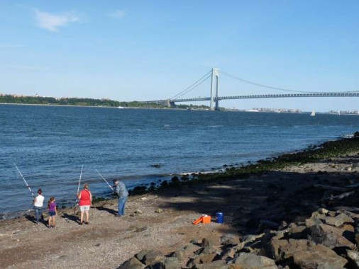
The coveted view of the Narrows, with the distant Manhattan skyline and Verrazano-Narrows Bridge, from Alice Austen Park, which stretches along the waterfront in front of the historic home’s front lawn.
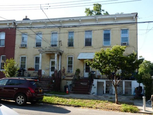
Continuing south on Hylan Boulevard, here are some attached brick buildings subdivided into apartments.
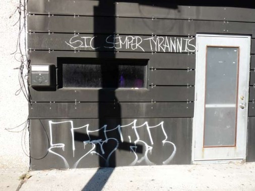

Graffiti along Bay Street, the spine of Rosebank and major shopping and restaurant row. Leftover perhaps from the peak of the “Occupy Wall Street” fuss in 2011?
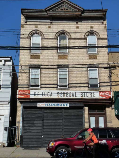
Italianate apartment building on Bay Street. The sign has likely survived several owners after its tenure as a “general store” had ended. Several original elements like the triangle pediment and arched 3rd floor windows did survive.
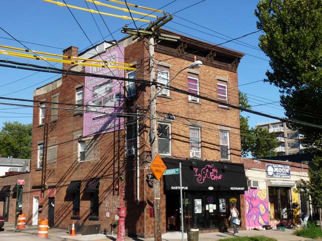
Brick apartment and Moon Recording Studios, Bay Street and Scarboro Avenue. I was impressed by the sheer number of wires suspended on the pole. Virtually all of Staten Island’s streets are accompanied by overhead wiring for electricity, land lines, cable television.
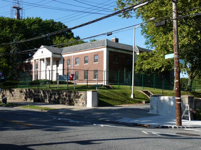
US Coast Guard housing facility, Bay Street and Nautilus Street.
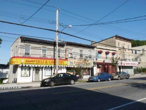
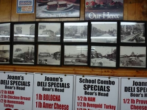
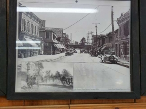
Joanne, or Joann, depending on what store you’re in, has built an empire of two delis and a pizzeria along Bay Street between Nautilus and Cliff Streets. I stopped into the deli for a gatorade and checked out the photos of Bay Street long ago mounted on the wall. Is there a real Joanne? Or a real Joann?

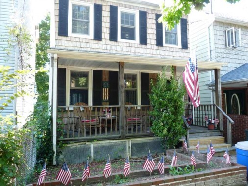
You’re used to seeing a lot of flags around here, but this house on Cliff Street off Bay Street takes the prize.
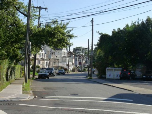
Fingerboard Road looking southwest from Bay Street. As mentioned before, it was given the name when a large, finger-shaped sign was used alongside it, pointing the way to the Richmond County Courthouse then located in the town of Richmond in central Staten Island — today’s Richmondtown.
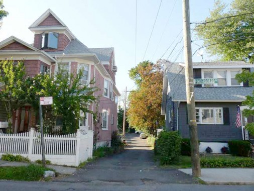
Every time I go past here I can’t resist Bang Terrace, off Fingerboard Road, because of its odd name. It opens into a wider mews toward the back with some relatively new identical homes — see another of my Rosebank pages for views.
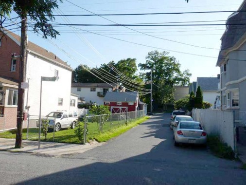
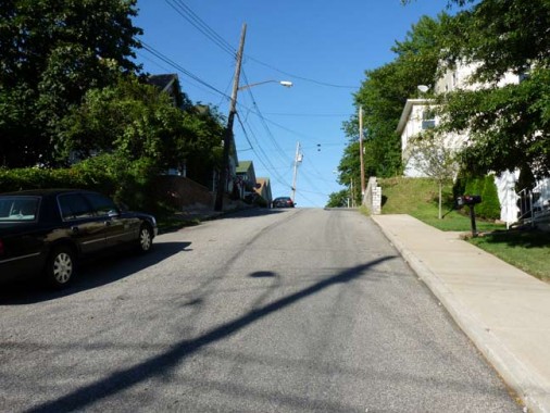
Rosebank is full of short streets that go a block or two and then dead-end, like High Street off Summer. High Street goes up a hill and demonstrates why it’s so named.
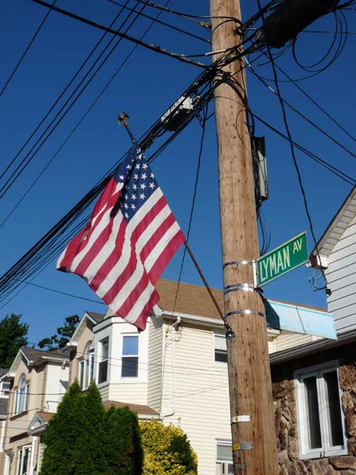
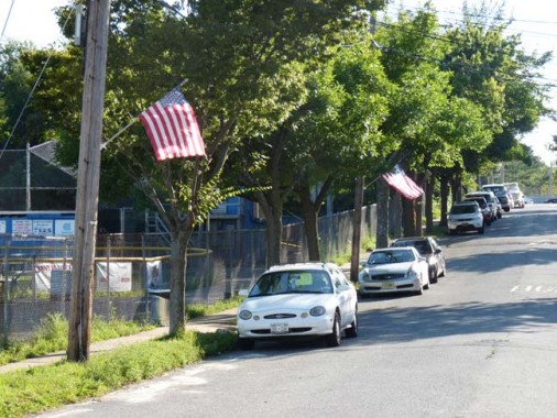
I’d have to give Lyman Avenue the ultimate flag-waving prize on my circuitous Staten Island crawl. Not only will you find flags flying in front of homes (this was the end of August and they may have been mounted for Labor Day) they’re also placed on the telephone poles facing the street.
In Little Neck, an older guy goes around putting plastic flags on lawns all over the neighborhood a few days before Memorial Day. Some survive past Labor Day. I want to catch up with him one day and do a Forgotten feature.
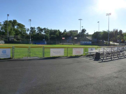
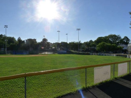
East Shore Little League field, Dennis Torricelli Place between Lyman Avenue and School Road
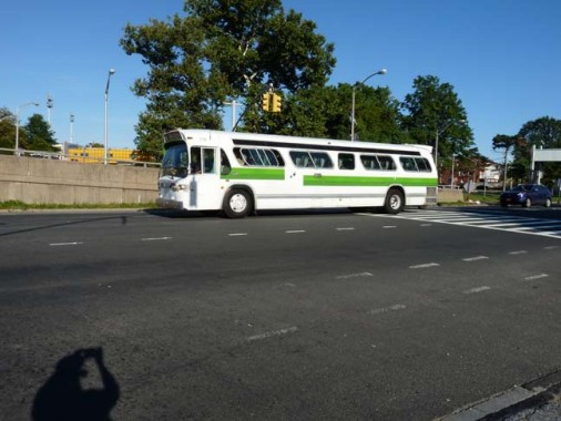
I glimpsed a GM fishbowl bus on Lily Pond Avenue at the Verrazano Bridge entrance. They first saw service in 1960 and the model was produced into the mid-1970s.
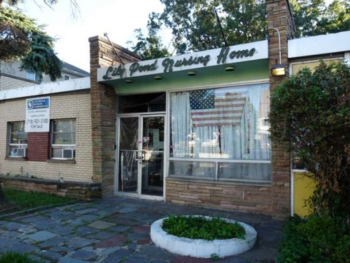
Your webmaster’s future home, maybe, Lily Pond and Major Avenues.
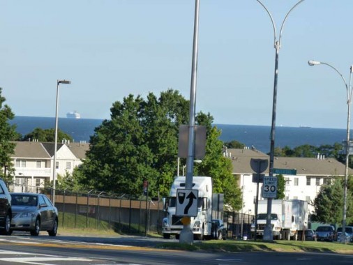
Lily Pond Avenue runs down a steep hill toward the Atlantic Ocean, where it becomes Father Capodanno Boulevard, named for a Staten Island priest who won a posthumous Medal of Honor for his actions under fire during the war in Vietnam in 1967. A large cruise ship can be seen anchored offshore.
From here, I got the bus back to Brooklyn, the subway to Penn Station, the railroad to Little Neck. I do this all for you!
9/15/13

15 comments
Wow, how can people be turned off about Staten Island??!! I grew up there and while being part of NYC it was a different world..in fact there was a farm across from our house. Thanks so much for spotlighting our forgotten borough!! I have to laugh seeing that Lily Pond Nursing Home is still in business…my grandfather was there was there for about 30 years.
Many thanks….
Never understood the anti-SI feelings myself, other than a lot of NYC residents are a bit provincial and lazy. I’ve had a good number of friends visit me at my various North Shore apts, and after riding the ferry, taking them to Snug Harbor, having an awesome (and way inexpensive) lunch, and hitting Richmondtown, they absolutely love it. They are always very surprised at how quiet, clean and pretty much of the Island is, and many of them have lived in NYC for years (if not their whole lives) and just never made the effort to visit. Weird.
Now you know why S.I. is the Rodney Dangerfield of boroughs (i.e. your readership). It all started after the mistake of ’98, well actually 1896, when a plebiscite was held and Richmond County voted to become part of NYC. The Greater New York crowd told the people that it would lead to all kinds of improvements. In 2013 much of S.I. is still waiting for storm drainage. Some of it is what you opine about- inaccessibility by public transit. I am a native that relocated 10 years ago but will always be “an Islander” at heart. Not to be confused with the L.I. hockey team.
Kevin, I am one of your loyal followers who appreciates all the shoe leather and burned up Metrocards that you have expended on our behalf. Even some of the more obscure posts have interest. You do get into some nooks and crannies that I never would. We are about the same age and have the same view of automotive conveyances. In a world of Subways and METROS and the like I have always found it more convenient to use mass transit. Plus you see so much neat stuff that way.
I read all three parts! Nice job. dc.
In addition to being called Texians, residents were also called Texicans.
It you get to meet your flag planter, do him a favor & don’t reveal his identity. He’s probably an elderly military veteran of European extraction which gives him an unfavorable Dept. of Homeland Security profile (see Napolitano’s comments, cica 2009). I’m sure he’s a citizen patriot who has many interesting anecdotes & opinions to share. However, this is The Era Of BO which resmbles Super Man’s Bizarro World so enjoy our alternate universe of traditional values, especially in your blue state bubble.
Excellent job, Kevin!
I have learned so much about the city (and borough) of my birth (Queens) since I first started visiting your website many moons ago….
Your dedication and hard work are much appreciated by all your loyal readers….
As someone who loves NYC yet hates to travel, I love these looks at parts of the city that I would likely never be able to find on my own. Especially locales such as those on Staten Island, which is (to folks who’ve never been to New York) that place named after the ferry.
I thought it was named by an old Dutchman, who asked the ship’s captain “Es schtat an island?” Great memories! Keep up the good work, Kevin.
Kevin don’t feel bad about what you had to say about this borough. I haven’t set foot much in Staten Island either. A number of times, I usually refer to it as the journey to the unknown. Maybe if that subway connection was built, that could have done something, but it was shelved due to costs especially with the Narrows being a long span for even having it. Also, the reason why there are only a handful of high rises throughout this place is because much of the island has a clay foundation that would make it difficult to have them. Still, it was nice to see these pages especially in a place where the guidebooks won’t show. Even though Staten Island is considered part of NYC, it can almost feel like a world away.
I enjoy your Staten Island reports. I have made that turn at Alice Austen’s place many times. 6:30AM ferry, Front Street, Edgewater Street, pick up a coffee on Bay Street and pedal my way down to the Conference House, more or less via Hylan Boulevard.
I’m not the one driving down your ratings.
On Greenfield Avenue, 2 blocks east of Norwood, there are duplicates of the Tudor-ish houses you feature. I own one of them, though it;s got white aluminum siding! It was built in 1895. If anyone knows who built it, what it looked like back when, I would love to hear! THank you for featuring my neighborhood, it has SO much potential, a great place to have raised my family.
Very good article.
But having witnessed first hand the complete destruction of what made Staten Island one of the most beautiful places on earth I shy away from it, and anything to do with it. Nevertheless, I am still very interested in its history and your article was historically informative and interesting.
I still, however, mourn for the Staten Island of my youth, before the construction of that cursed bridge which shall be un-named.
Left S.I. in 1995. Born and raised on the rock. Great place to grow up in the 50s and 60s