Taking advantage of a recent break from the draining and oppressive humidity of the New York summer, in late August I made a circuitous walk in Staten Island, taking the LIRR, a subway and a bus to Arrochar, the first Staten Island neighborhood traffic coming off the Verrazano Bridge encounters, pressed south into adjoining Grasmere, then turned north into Concord and then slowly shifted southeast through Clifton and Rosebank, finishing opposite the bus stop where I had alighted, returning to “the city” after that.
This kind of sojourn encompasses many different “atmospheres” as well as several different income and demographic brackets. City planners who slaver over the “vibrant diversity” of Queens would be fascinated by this walk, though appalled at the class divisions and income inequalities. Personally, I leave the worrying about such things to others. I’m looking for things the guidebooks won’t tell you about.
Having alit in Arrochar, I’ll refer to, and crib from, a previous FNY page on that neighborhood I committed to pixels in 2009, if you don’t mind — quoting myself makes writing FNY pages faster. Since I acquired about 250 photos on this trip, I’ll be splitting my coverage into three FNY pages.
WAYFARING MAP: Arrochar, Grasmere, Concord, Clifton, Rosebank
Arrochar, on Staten Island’s easternmost extension, encompasses Fort Wadsworth, now a Gateway Recreation Area, as well as the northern section of South Beach and its lengthy boardwalk. The area was settled by Scottish immigrant W. W. MacFarland in the 1840s; he named his estate, Arrochar, after the small village NW of Glasgow he hailed from. MacFarland’s home still stands on the St. Joseph Hill Academy campus.
It’s yet another NYC place name of which I’m unsure about pronunciation. I’m certain it’s a hard “ch” but is it a-ROW-kar, or ARROW-car?
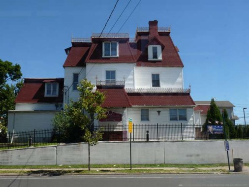
At Lily Pond (the signs spell it as two words) and McClean Avenue is a massive Victorian-era mansion I had marveled about for years from boyhood to manhood when traveling by bus from Bay Ridge to Staten Island on the S53 bus (in my youth it was the R7). It was built by a prolific American architect who didn’t design in NYC much, Henry Hobson Richardson (1838-1886).
 After the architect married Julia Gorham Hayden the couple settled in Staten Island at the encouragement of HHR’s friend, Frederick Law Olmsted, co-creator of Central and Prospect Parks, who was also a Staten Island resident at the time at the south shore in Eltingville. Richardson designed and built his family’s home here in 1868 and it was finished the following year. In 1874, however, the Richardsons moved to Brookline, Massachusetts so he could supervise what many architectural critics say is his masterwork, Trinity Church in Copley Square in Boston. The house was landmarked in 2004 after some up-and-down years. [Landmarks report by nyc.gov]
Henry Hobson Richardson was a robust man, standing over 6 feet tall and checking in at a Taft-esque 300 lbs. Born in Louisiana, he attended Harvard University, where he became interested in architecture, traveling to Paris and studying at the Ecole des Beaux Arts during the Civil War. He moved to Staten Island in 1866, at Olmsted’s urging, as mentioned above.
Richardson’s style was not the more classical style of the Ecole, but a more medieval-inspired style, influenced by William Morris, John Ruskin and others. Richardson developed a unique idiom, however, improvising in particular upon the Romanesque of southern France. The term “Richardsonian Romanesque” has sometimes misled people to assess it as one of the Victorian revival styles, akin, perhaps to Neo-Gothic, but it was actually much more personal, a synthesizing of the Beaux-Arts predilection for clear and legible plans with the heavy massing that was favored by the pro-medievalists. Anne Marie Stillwell, MD, whose office is in the building.
Richardson died at the young age of 48 after battling kidney disease for many years.
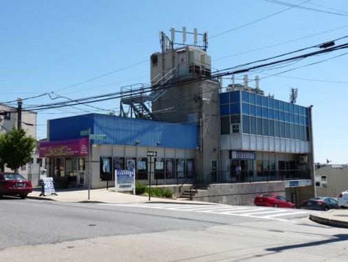
So, you’ve seen what they were building in 1869. Here’s what architects are up to in the early 21st century. Telephone, electric and cable TV wire have been around for a long time, but the proliferation of cellphone relay stations amalgamate on some buildings like clusters of large stinging hornets. It seems that the only way to de-uglify our communications systems is to bury them underground –but can that be done with cell phone stuff?
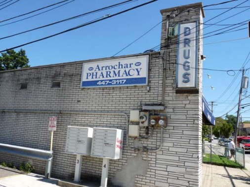
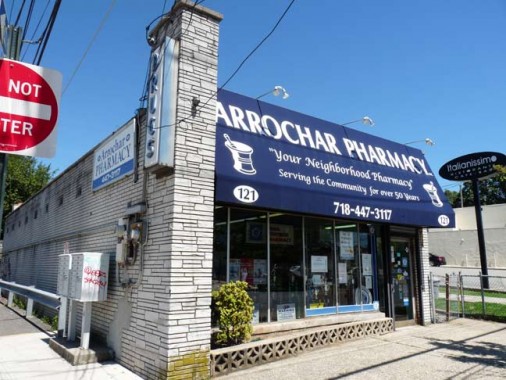
The Arrochar Pharmacy sports architecture that looks like it’s from between about 1957 and 1963, or the same age as me. Late 1950s buildings just have this go-go streamlined style about them, a sort of fresh exuberance. This was before the Brutalist style, which began in the 1970s, arrived and made everything look Orwellian, like that thing in the above photo.
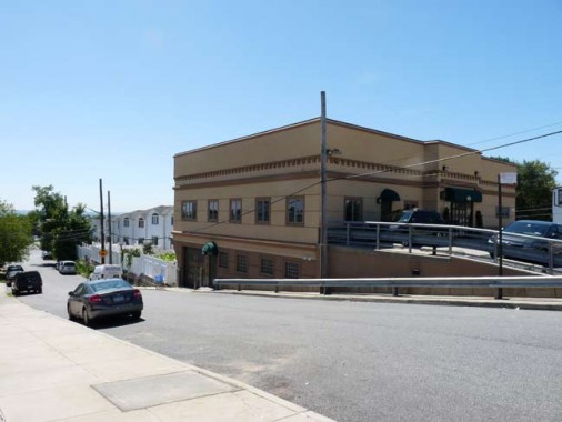
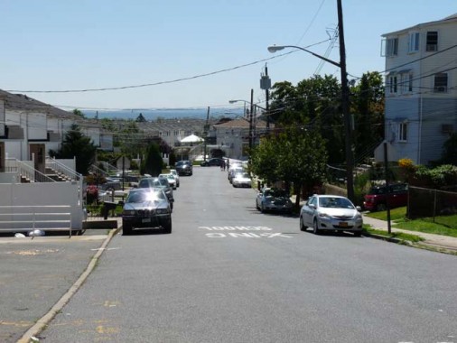
Railroad Avenue (1st photo) and Conger Street (2nd photo) ran on either side of the South Beach Branch of the Staten Island Rapid Transit, which ran passenger service through these parts until 1953. The old right-of-way was allowed to remain and deteriorate in large part until the 1990s — the houses you see on the right side of the Railroad Avenue photo and the left side of the Conger Street photo were built in the early 2000s on top of a landfilled open railroad cut. Gradually, the old railroad trestle overpasses were scrapped as well, though there is still one over Robin Road a couple of blocks away. I’d have to think its days are numbered too.
Gary Owen has an excellent site about the South Beach line, a lost piece of NYC history.
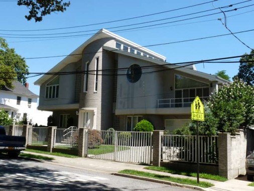
Modern residential on Hastings Street. I really don’t object to this sort of thing — it has its own sort of charm. They’ve kept those quaint mid-20th Century affectations likek a green lawn in front and no visible meters from the street.
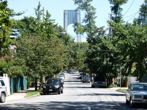
Looking north on Major Avenue from Hastings Street. This view looking right at the Verrazano Bridge is better in the fall and winter months, and there must be a couple of times a year when a rising moon can be seen right between the “tines.”
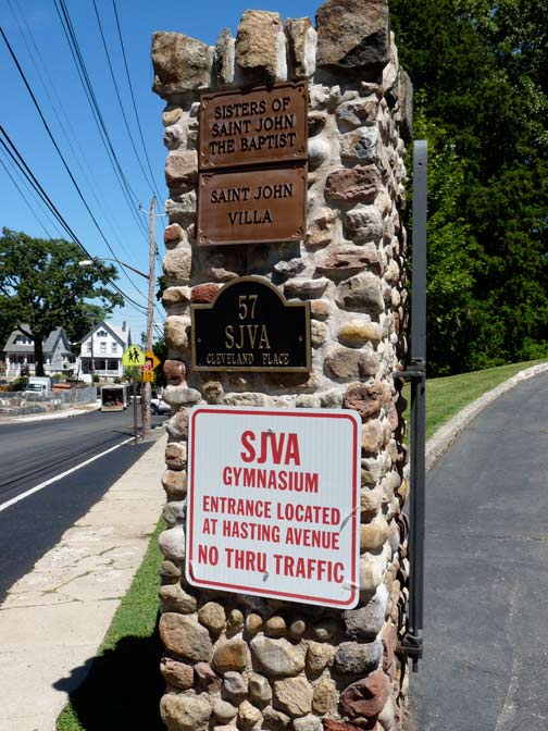

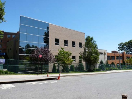
St. John Villa was founded in 1922 by the Sisters of St. John the Baptist (the Baptistines) on the grounds of the former Clair Estate. Like St. Joseph Hill down the road, the academy operates a co-ed grade school and female-only high school. A newer building (third photo) was opened in 1999 on nearby Landis and Chicago Avenues.
(The sign at the gate says “Hasting Avenue” — close… it’s Hastings Street.
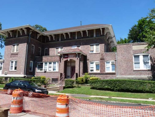
Here, some streets are named for Midwest cities Chicago and Cleveland. There must be a reason for that, lost to history. This handsome brick building on Chicago and Landis Avenues, the Geller House, is a “residential center for adolescents that provides short-term evaluations, crisis intervention and treatment services, and the Staten Island Community Residence, which provides 24-hour residential care for severely emotionally challenged children” run by The Jewish Board of Family and Children Services.
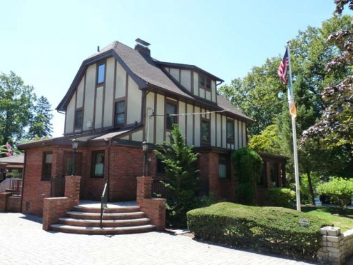
Large Tudor on Chicago Avenue flying the USA and Irish flags. As we’ll see, Staten Island is the US flag capital of NYC.
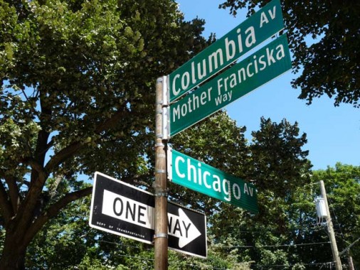
We’re beginning to enter the “mature” phase of the new Clearview font street signs, and the city’s beginning to hit its graphic stride in figuring out how to use the font. Many signs have eliminated the white racing stripes at the top and bottom of the signs, freeing the whole sign to be filled with the lettering, and the letterspacing has been tightened up. They make more signs like these, I might start warming up to it.
Mother Franziska Lechner (spellings vary) founded the Sisters of Divine Charity, an order of nuns, in 1868 in Vienna, Austria. The Mother Franciska Elementary School is nearby, on the grounds of the St. Joseph Hill Academy; the order teaches at both schools.
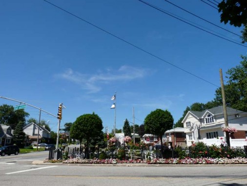
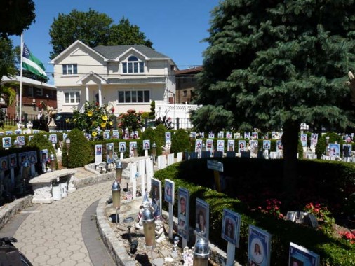
Angels Circle, Fingerboard Road and Hylan Boulevard, a tribute to the 170 Staten Islanders killed on 9/11/2001, has previously been covered in FNY. I’d add a caveat: this is one of the busier intersections in the area, so take care crossing whatever road you use to visit it.
“Fingerboard Road, which snakes through Arrochar and Concord, is one of the more curious names on the East Shore. It was previously known in the early 1800s as Roguery Hill Road because ‘a robbery and murder was once committed on a small elevation over which the road passes,’ according to [a] 1877 history book. After a ‘guide-board and post’ were erected at the start of the road, pointing the way to Richmond Road, it began to be called the Fingerboard Road, and the name stuck.” –says the Staten Island Advance, whose page on Staten Island place names is behind a pay window.
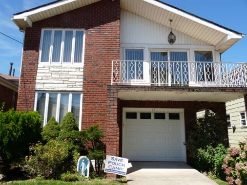
Windermere Road, on which this house stands, runs from Hylan Boulevard west to Clove Road and has busy stretches, and parts where it’s just a trickle of a road. There are two streets with quite similar names in Staten Island: this one, Windermere, with an “R” in front of the M, and Windemere Avenue in Oakwood Heights, which is without the R in front of the M. I’ll keep this between me and my readers. If I brought it up to a Staten Islander, they’d likely give me the hairy eyeball.
The “mere” which comes up in several names around here… Grasmere, Windermere… is a British term for lake or pool, and a bit later, we’ll see why.
The name “Pouch” comes up in Staten Island here and there, and it has nothing to do with kangaroos.
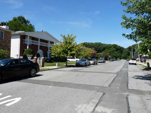
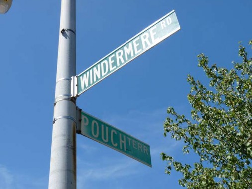
There’s Pouch Camp, seen on the lawn sign above, Pouch Terrace, above, which intersects Windermere Road, and Pouch Terminal, which I’ll discuss later in this series. All are named for the Pouch family: Alfred J. Pouch, who founded the American Dock Company, and his son, William H. Pouch, who built pouch Terminal in 1917, a pier and warehouse complex facing the Narrows on Staten Island’s north shore.
The “Save Pouch Camp’ signs seen on Island lawns to the Pouch Boy Scout Camp, the only Boy Scout camp in the five boroughs in the Willowbrook Park area. Founded in 1949, it had been in danger of being sold off to developers, but funds were secured for its preservation.
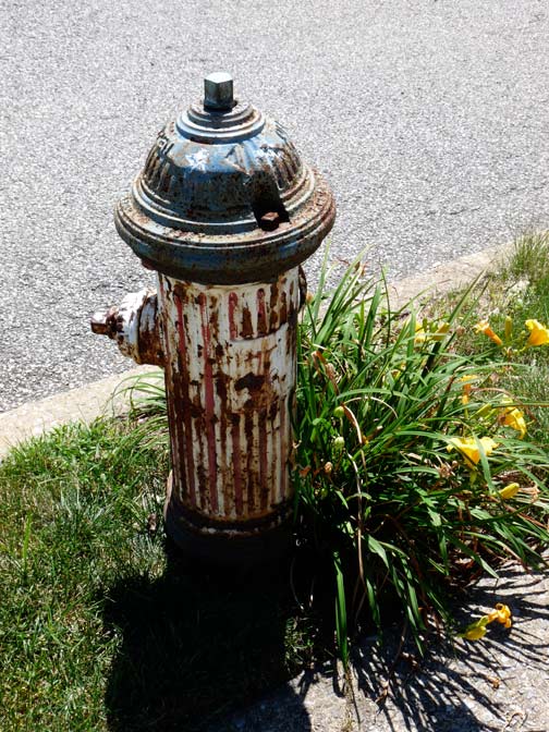
A Bicentennial Hydrant painted red, white and blue on Windermere Road, a leftover from 1976 celebrations. There are a few dozen of these remaining around town.
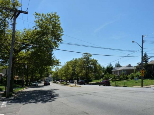
Steuben Street, which meets Windermere Road here without a stoplight, is a fast and furious 4-laner running from the Staten Island Expressway south to Hylan Boulevard. The section here in Grasmere sees a lot of traffic (not as much on Sunday, shown here) but it has a separate piece in Concord that’s very quiet. I’ll discuss Steuben Street’s split personality later in the series when we get to Concord.

If you get down deep enough past the blacktop on most NYC streets you can still see the brick pavements beneath. Belgian blocks were the stones of choice in 4 boroughs, but Staten Island made extensive use of red bricks. Here’s an exposed section on Windermere Road north of Steuben Street.
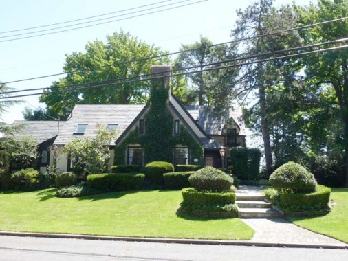
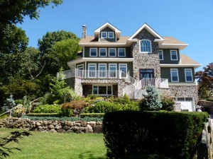
A wide-lawned Tudor mansion on Windermere.
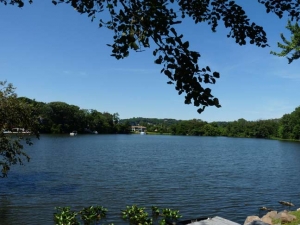
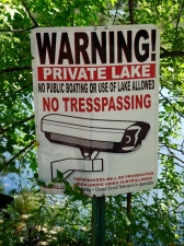
If you turn right on dead-end Overlook Terrace, you’ll soon be overlooking a fairly large, semiprivate body of water known alternately as Grasmere Lake and Brady’s Pond. Throughout Staten Island, there are vest pocket ponds like this, some large enough to make the Hagstrom maps, and some of which I never suspected the existence of before eyeballing them myself on neighborhood jaunts. The lucky folks with the big mansion at the end of the terrace have a private dock.
In the mid-19th Century, the lake and much of the surrounding territory were acquired by a Canadian-born shipping baron and knight, Sir Roderick Cameron, who named them Grasmere after a British Lake District town of which he was fond. In the 1880s, Sir Roderick sold a swampy portion of his property to a Philip Brady, who dammed the swamp, creating a pair of ponds, Grasmere Lake and Cameron Lake (see below). Brady then went into the ice harvesting business — winters were colder here in the 1800s, and ice readily formed on standing freshwater.
Though Brady’s Pond Park borders Hylan Boulevard/Steuben Street and the Staten Island Expressway, I failed to see an entrance when I walked past. The lake is the only one on the island where swimming is permitted, though much of it is privately held.
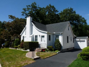
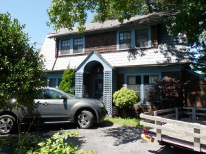
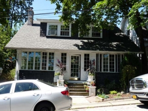
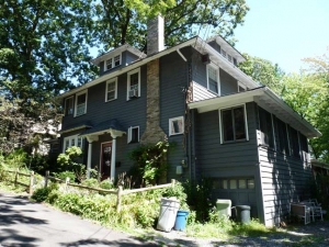
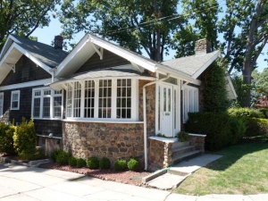
Back on Windermere Road, a selection of the picturesque housing stock. The monster truck parked in front of the cottage is half as big as the front of the house!
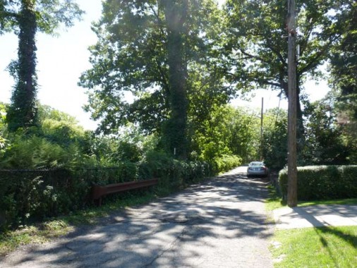
West of Fingerboard Road, Windermere Road turns into a one-lane path…
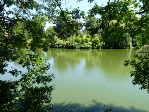
… and runs past the mostly hidden, private Cameron Lake, named for the old landowner knight. As you can tell there’s more algae here than in Grasmere Lake. I noticed several turtles happily paddling around, but there was also a bank of solar panels on a man-made island.
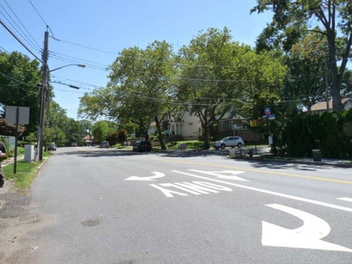
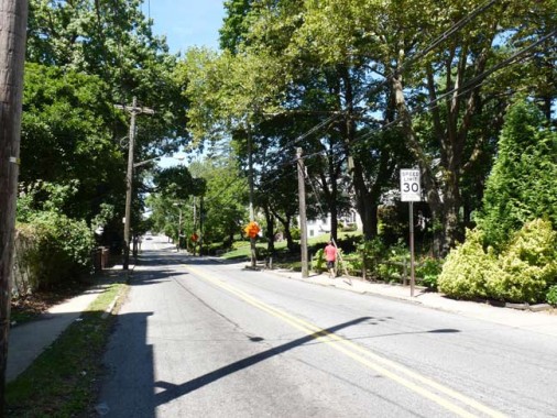
Windermere Road empties onto Clove Road, one of Staten Island’s longer roads, running from Grasmere to Port Richmond. The road must have more width variations than any other in Staten Island, if not the city. These two photos were taken on either side of Fingerboard Road, where Clove Road turns from a 4-lane to a 2-lane. Around Clove Lakes Park it widens again considerably and narrows again once past St. Peter’s Cemetery in West Brighton.
Clove Road is so named because it “cleaves” the valley between Emerson and Grymes Hills.
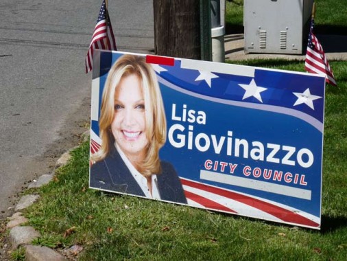
If I’ve noticed nothing else about Staten Island, it’s that at election time, candidates plaster everything in sight with campaign signs. And if it’s a Republican, they’ll be accompanied by as many American flags as can be squeezed in — and in a borough with an American flag mania, that’s a lot of red, white and blue. This candidate has signs every few feet in some places, and also on presumably private house fences, with all signs flanked by two little flags.
I wonder whether this sort of thing is legal in Staten Island but illegal in other boroughs — in Little Neck, for example, you’d expect to see it, but you never do.
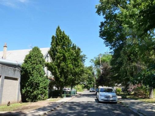
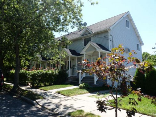
I wandered up Crist Street, one of a network of tiny streets west of Clove Road on either side of Staten Island Railway, mainly because nobody but me gets photos of NYC streets like this. This may as well be in any of the small, innumerable New Jersey towns across the Arthur Kill. Some pleasant attached homes stand at the intersection of Crist Street and Grasmere Avenue, and this may be the first photo ever taken of them.
Some maps misspell “Crist” as “Christ.”
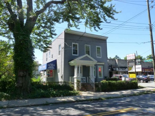
The cleverly-named Hall of Frames, in what is probably a very aged salt box type house, Clove Road and Crist Street.
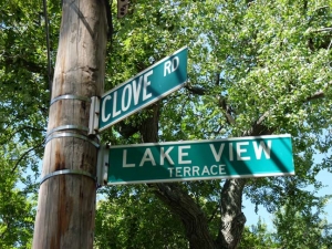
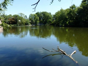
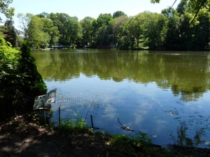
You know, with many Lakeview Terraces or Bayview Places around town, it’s all hat and no cattle, all sizzle and no steak, all talk and no action — the view is blocked by private property or some other impediment. Not so here, as there are plenty of accessible views of Grasmere Lake, though you’re reminded it’s pretty much private territory.
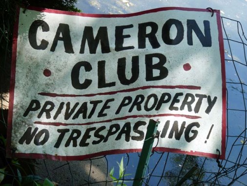
The pond is surrounded by a gated community and is owned, along with Brady’s Pond, by the Cameron Lake Club. This privately-owned club was established in 1930. Not only must the members of the club live in Staten Island, they must live within a certain distance of the pond. If you are one of the more fortunate residents who have “lake rights,” you will have access to a sand beach, as well as a club house and row boats. Being that Brady’s Pond is also owned by the Cameron Lake Club, the public may not use non-motorized boats in the pond unless they have these “lake rights.” Real Estate Staten Island
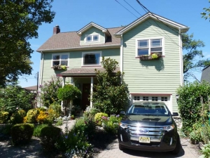
Lakeview Terrace ascends a hill, where it meets the appropriately named Hillcrest Court. This is the well-off part of town and there are several attractive homes built here, with many having indeed a decent “lake view.”
![]()
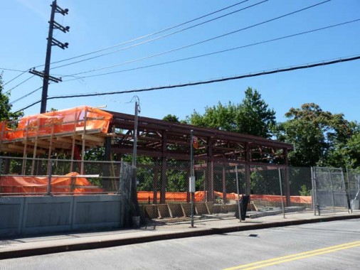
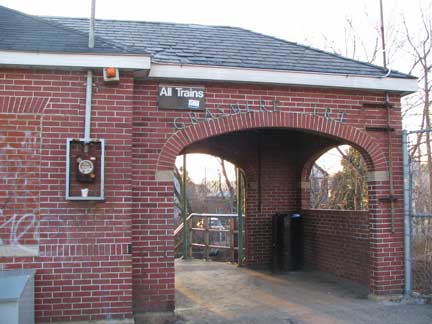
The Grasmere Staten Island Railway station on Clove Road is getting a top to bottom makeover…new stationhouse and new platform. Here’s what it looked like a few years ago. I wonder if all the stations are in line for new stations and platforms.
Since tickets are no longer sold here, and there are no turnstiles, you winder why a stationhouse is needed in the first place. The SIR is free of charge — except if you’re entering or exiting at Tompkinsville and St. George, and the vast majority of SIR passengers use those stations to get to the Ferry.
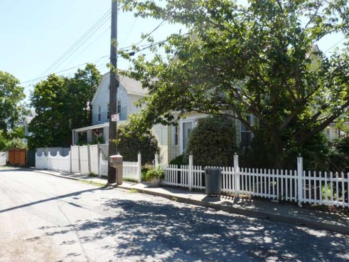
Small-town USA, at Sheridan Avenue and Giles Place, north of the station.
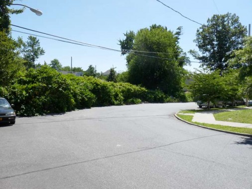
You never know what you’re going to find around the bend. This is the beginning of North Railroad Avenue, which with its partner South Railroad Avenue parallels the Staten Island Railway through several neighborhoods. If you look at the map, they might more logically be called East and West Railroad Avenues, but no one’s going to change the names now.

With a name like Cobblers Lane, you might expect a tree-shaded country road with, perhaps, a shoemaker next to the barber pole, but alas, it’s a modern prefab cluster. Developers often give aw-shucks names to impart a mood that doesn’t match the reality.
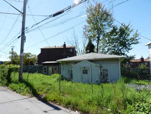
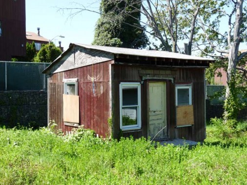
Pressing further on North Railroad Avenue you find a long-abandoned house with what was likely a garage or toolshed in the back.
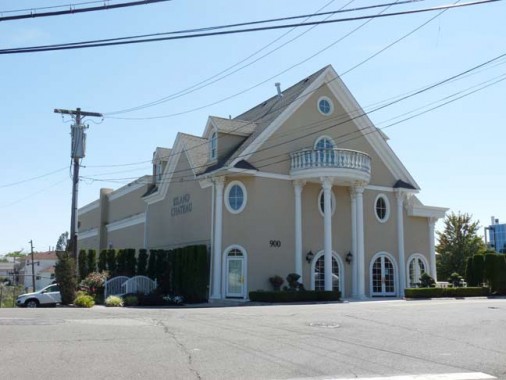
The old shacks are in view of the catering hall Island Chateau on West Fingerboard Road…
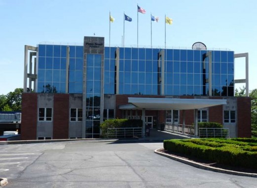
… which adjoins the headquarters of Staten Island’s borough-wide newspaper, the Staten Island Advance. The newspaper still has loading docks that connect to Staten Island Railway tracks but I’m unsure if there are still any deliveries by rail. The Advance has been publishing since its 1886 founding by by printer John J. Crawford and businessman James C. Kennedy as the Richmond County Advance. Offices have been here on West Fingerboard Road since 1960.
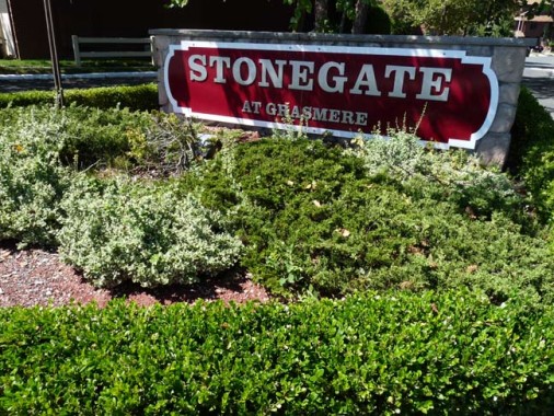
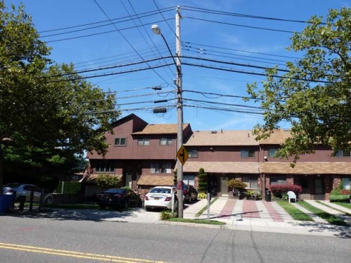
The Stonegate community, north of West Fingerboard Road west of the railroad, was supposedly founded by Alan Stonegate, a roller coaster repairman, but I haven’t found anything to substantiate that rumor.
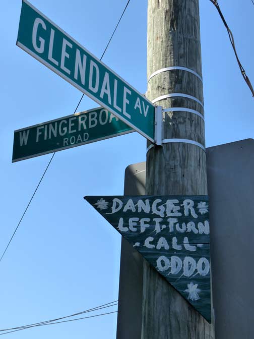
On Glendale Avenue, a handmade sign urges neighbors to “call Oddo” about a dangerous turn. James Oddo is the local City Councilman and presumably, stoplights for the intersection are being requested.
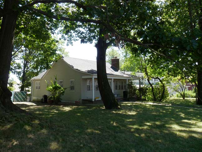
1010 West Fingerboard Road opposite Stanwich Street, on its large, grassy plot and a Dutch-style roof, looks like it could be from the colonial era, but there’s no documentation to that effect, and it could merely be an early 20th-Century dwelling.
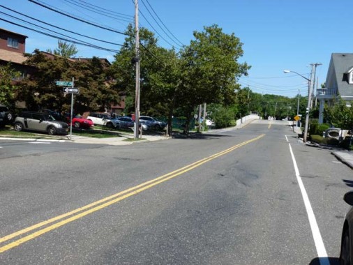
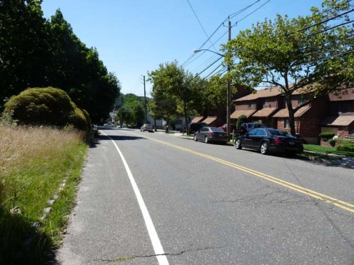
You rarely see white lines marking the shoulder on roads in New York City, which are usually accompanied by sidewalks, which makes West Fingerboard look like a true suburban route.
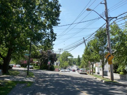
When I see a fork in the road, I take it, like Yogi Berra. I used the right fork, Columbus Avenue, to reach Targee Street, where you will find…
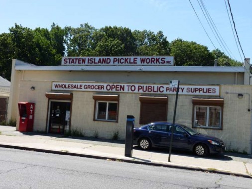
… Staten Island Pickle Works…
a third-generation family business operating in the same location on Targee Street since 1928…
“Only one percent of our business is pickles, but we just can’t change the name,” said James Pfisterer, Jr., recalling his grandparents, who devoted their lives to the store. Frank Pfisterer, Sr., his grandfather, was born in Manhattan, of German heritage; his grandmother, a native Staten Islander, was born Patricia Julian, with Irish roots.
“I started working there after school, when I went to PS 48,” Pfisterer said, explaining that he stocked shelves under his grandfather’s supervision.
He’s still there, owner of the business with his uncle, John Pfisterer. Staten Island Advance
9/1/13



24 comments
Great job! I recently visited these neighborhoods following the AIA Guide to New York City. There may be no world class architecture there but many worthwhile historic details if you look closely. Good catch with the brick sidewalks!
“Arrow-car”.
Henry Hobson Richardson also designed train stations in Boston for the Boston & Albany RR.
the old Grasmere train station with its wonderful brickwork , graceful arches etc. is a delight to the eye, wonder if the new station will be so? My guess it will be all glass, aluminum framework and plastic. Progress.
My guess is the old (1930s) station house was too small for current needs. Grasmere has become a rather large transfer point between the Staten Island Railway and people traveling to Brooklyn via the S53 (yes, I remember when it was the R7 too). I imagine the MTA will install a few MetroCard machines and other transit info/maps inside the new station house. A rendering of the new station house shows it to be typical MTA: bland, uninspiring, and will probably be a rusty mess by 2025:
http://media.silive.com/latest_news/photo/grasmere-newjpgjpg-75bf1bc6c3a208cd.jpg
I haven’t lived on staten island since 1992 but its nice to see that some things haven’t changed that much. I grew up in newbrighton went to Curtis in the early 70’s and i won’t trade that for anything.
Real estate developers seem to use a manual of standard nomenclature which includes Lakeview & Stonegate. 2500 miles away in San Tan Valley, AZ is Johnson Ranch, the largest of many communities near Queen Creek. And wouldn’t you know it, on opposite sides of the golf course are Stonegate (because, surprise!, it’s gated) & Lakeview (because it’s off the water hazard). If you too are a member of the NYC diaspora, & you live in this type of development I’m sure you can cite other examples of the book of developer’s standard nomenclature.
The NYC.gov/map shows 1010 Fingerboard Road being built in 1945, so it definitely is not a colonial-era leftover. May be a bit older than 1945 (the map routinely has wrong construction dates for buildings), but although that Dutch roof looks authentic, the house is a 20th Century creation. Not a bad one at that, but what’s up with the bars on the windows? This part of SI is very, very quiet and safe.
I attended grammer school at St. John’s Villa during the 1950’s and occassionaly walked past the “Geller House’ ,on my way to the bus stop, at Chicago and Landis. Back then, the building was reported to be a sancuary for unwed mothers.Never saw much activity there except on ocassion young women could be seen sitting on blankets on a side lawn during the spring and early summer months. Things were different back then. I took a city bus to and from school, St. George to Fingerboard Road, changing buses at Bay street in Tompkinsville.
I had a rich Aunt and Uncle who were part of the Cameron Lake Club back in the 50’s and 60’s and remember I had to be with one of them when I went to the lake, otherwise I risked being expelled for life. I used to to take the SIRR from the S.I. Ferry terminal to Grasmere and, for whatever my Uncle wanted to pay that day, did yard work and others chores. Considering the travel time and expense of the bus and train and…………..well it wasn’t cost effective!
Thanks for the tour, it brought back a lot of memories. I look forward to the next FNY page
I had always wondered if “Fingerboard” had anything to do with the necks of string instruments, for my part.
And BTW, “Cobblers” is a British expression having roughly the same meaning and politeness-in-mixed-company quotient as, say, “bushwah”. I can see the planner in that area having been an Englishman being asked what to call the last street to be named– “Oh, any old ‘cobblers’ name is fine with me.”
Or else, somebody liked peach pie, with the crust only on top, served with ice cream.
Any idea what the new station house will look like or will it just be getting new bricks?
I went to St. John Villa. The nuns were MEAN. I lasted less than half of first grade.Seeing the photo of the school gave me the heebie jeebies.
Kevin, if you like Brutalist architecture you would love the FBI building in D.C. It looks like the Ministry of Truth. Of course tongue is firmly in cheek.
“Like” is a strong word…
Kevin, Thanks once again for your amazing blasts from the past! I attended St. Joseph Hill Academy in Arrochar for 12 of the longest years of my life (I’m now 62 and living near Tucson). My mother, being German, thought that the Daughters of Divine Charity–being an Austrian order of nuns–would give me an outstanding education. Being a gifted child, that was important to me too, and I continued to excel academically, but those nuns seriously damaged me for life! One of the advantages of the school is the playground which was/is? on the highest point of the hill and has a perfect, complete view of the Verrazzano Bridge. As a nine year old I was able to watch the day the final center section of the bridge was lowered into place, and was surprised and pleased to see a photo of that in “Life” magazine the following week. You mentioned that MacFarland’s home still stands on the SJHA campus. Is that the large brick building at the top of the hill (adjacent to the playground or where it used to be) that used to house grades 6 through 8? Also, do you have any information about the small building we used to call “The Bungalow” which housed grades 1+2?
Thanks again for your outstanding work. I thoroughly enjoy all your entries and have donated several times on your website, and urge everyone reading this to do the same and make a donation to help continue your excellent work in preserving history.
With much appreciation, from Renee Neumann in Green Valley, AZ
The students and faculty at St Anselm in Bay Ridge messed me up in equal measure. I didn’t go onto the campus… 50-something guys shuffling about with cameras don’t get the benefit of the doubt from the rent a cops.
P.S. The reason that so many American and other “patriotic” flags are displayed in Staten Island homes and front lawns is that–unlike the other 4 boroughs of NYC–Staten Island is overwhelmingly Republican. Flags and what they represent aren’t nearly as important or even relevant to the progressives in the rest of the city.
I LIKE flags.
Rene:
Even though you live near Tucson, a blue dot in a red state, you’re still in “A NY State of Mind” which is too bad for you. I read the internet edition of the NY Post daily & my resolve never to return to NYC or the east strengthens. Don’t “Californicate” AZ.
? from whence does this outburst come?
I commuted from Brooklyn to Wagner College from 1964-68, first via the 69th Street Ferry, then via the “Gangplank” by bus from 95th Street. Traveling the winding roads of Staten Island in the 60’s was like being in the country, very rural and laid back. 30 years later, while training at Coney Island Hospital, my car was impounded (long story). The car was towed to the Brooklyn piers, but I had to pay the fine at the City Marshall’s office in Staten Island, of all places! Same bus ride to Clove Rd, but the scenery had become more urban. I’m happy to see from your photos that some of the rural atmosphere has been preserved. And I’m glad that Camp Pouch has been saved. I didn’t care much for the Boy Scouts, but the unique camping experience so close to home was memorable. Keep up the good work!
When do you plan on doing the second part of this?
Sunday
There was a bakery on Fingerboard Road back in the 50’s and 60’s – – maybe it was there earlier. Best fresh, still warm rolls on Sunday morning I’ve ever had. . . ah. . .
Anyone remember it? And the name? To us it was just, “Fingerboard Road,” as in, “Let’s go to Fingerboard Road and get some rolls.”