
I’ve spent time both on New Utrecht Avenue and under elevated trains in my Forgotten New York years. I’m absolutely fascinated by streets that run underneath elevated trains, and New York City happens to be the epicenter of “streets under els.” Boston has now got rid of most of its el lines; the Orange on Washington Street was rerouted in the 1980s and the Green was rerouted off Causeway Street, which ran past the old Boston Garden “back in the day.” In Philadelphia, there are just three major “elled” streets, Market Street and Kensington and Frankford Avenues; while in Chicago, except for the downtown Loop, most of its elevated trains run in their own rights-of-way, with no streets underneath them at all.
Why els? Often, the streets beneath them conceal old, leftover signage and streetlighting schemes. I’m also fascinated with transit and subways and they’re an ever-present factor when walking the route of an el.
New Utrecht Avenue always featured “my” el. It was the el I passed under as I rode the B16 bus down 13th Avenue for innumerable trips to my uncle and aunt’s apartment or feared visits to my childhood doctor’s office on 49th Street. In all those years I was passing under it, or rode the M, W or D trains on it (the letter for the line keeps changing) I had never once walked its entire length. No more. I got that out of the way in September 2016. These pages will relate what I saw.
When There Wasn’t an El
As mentioned in Part 1, New Utrecht Avenue received the elevated train that shadows most of it in 1916. Before that, Charles Godfrey Gunther built a passenger stem railroad in 1863 that ran along the Brooklyn, Greenwood and Bath Plank Road built between Greenwood Cemetery and Bath Beach beginning in the 1830s and completed in the 1850s. The line was electrified in 1893, and finally raised on an elevated structure in 1916.
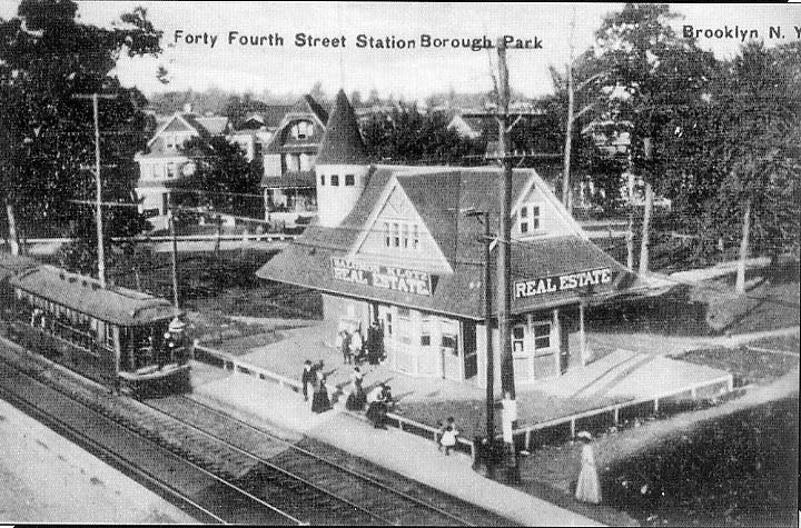
New Utrecht Avenue and 44th Street, sometime between 1893 and 1916. A real estate office doubled as the train station. In Midwood, the former T.B. Ackerson real estate office serves as the current station for the Avenue H stop on the Brighton (B, Q) Line.
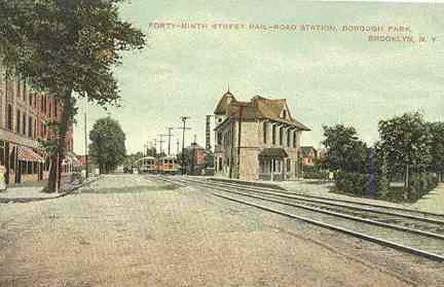
Rail station, New Utrecht Ave. and 49th Street, ca. 1910.
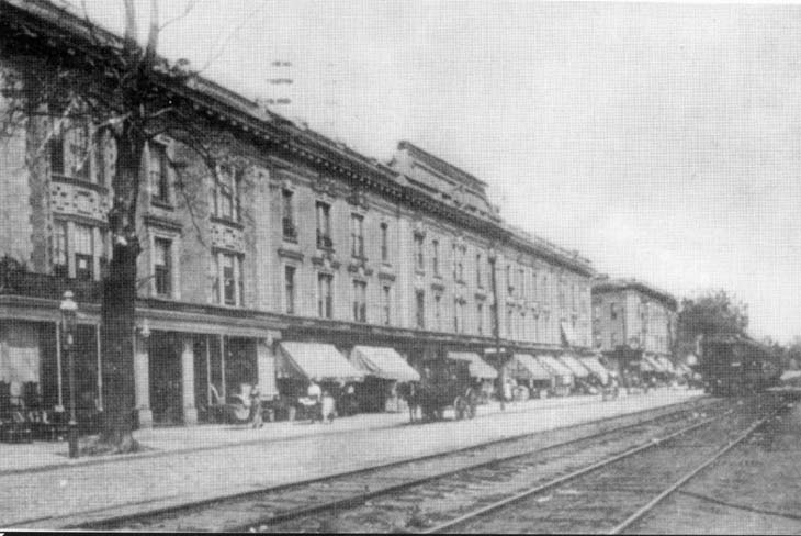
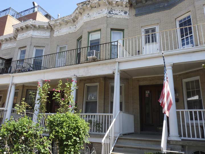
West side of New Utrecht Avenue between 49th and 50th Streets. All of these buildings are still standing.
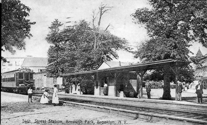
East side of New Utrecht Avenue at 54th Street. 13th Avenue is in the background right, and the peaked corner turret was still in place until fairly recently.
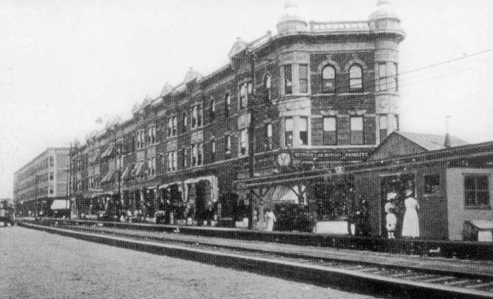
A bit further north at the 54th Street station. The building shown here is also still standing, though I believe the triangle shaped pediments on the NUA side have been removed. (See below for a modern view)
Above photos: Borough Park Centennial Edition 1898-1998, Oscar Israelowitz


Picking up where I left off at 50th Street, we see the remnants of a paint store on the east side of New Utrecht Avenue between 50th and 51st; in Part 1, we saw a Sherwin-Williams sign, now here’s one for Dutch Boy,
founded in 1907 by the National Lead Company. Dutch Boy is currently a subsidiary of, and is owned and operated by the Diversified Brands Division of the Sherwin-Williams Company, which acquired it in 1980.
The Dutch Boy symbol was painted by Lawrence Carmichael Earle and modeled after an Irish-American boy who lived near the artist. wikipedia
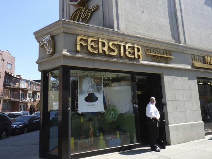
I was here on a Sunday, so many of the businesses were open in this heavily Orthodox and Hasidic Jewish neighborhood (Borough Park). Hat shops abound, especially on the commercial strips of NUA and 13th Avenue.


L.B. Electric Supplies Co. remains in business on NUA and 52nd Street. And, its 1940s-era enamel sign, placed to attract southbound passengers on the West End el, is still in place.
About 15 or 20 years ago, the city replaced the Dwarf lampposts on this stretch of New Utrecht Ave. with uniform short L-shaped posts, many with large round luminaires I call the New Gumballs. The city did spare a few of the old school lights, though, like this now-rare Dwarf double-masted post at NUA and 54th Street, and I’m always happy to see it when I’m here. The city recently equipped it with Cooper Industries VRDN Light-Emitting Diode lamp, which seems to be universal in Brooklyn and Manhattan thus far, but the city has gone on to using other makes.
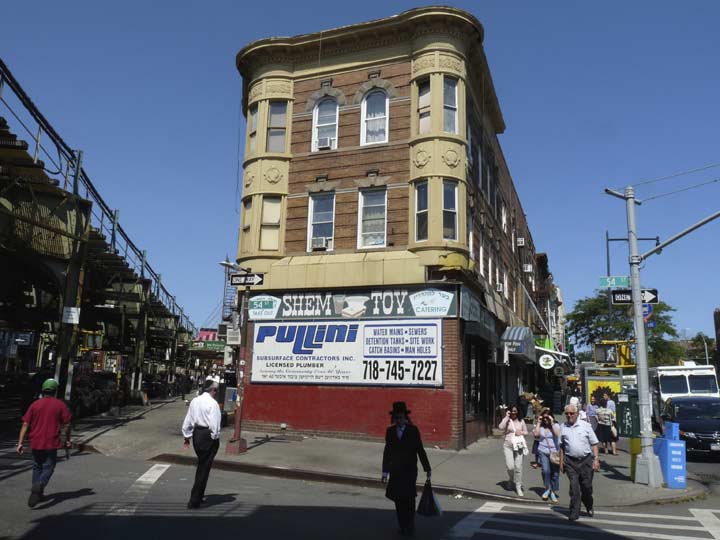
Remember the building seen in the above photo at NUA and 54th Street? It’s still there and largely unchanged. Shem Tov Restaurant/Catering has been on the ground floor at least since I was a boy riding past on the B16 bus, and that’s a long time ago now.
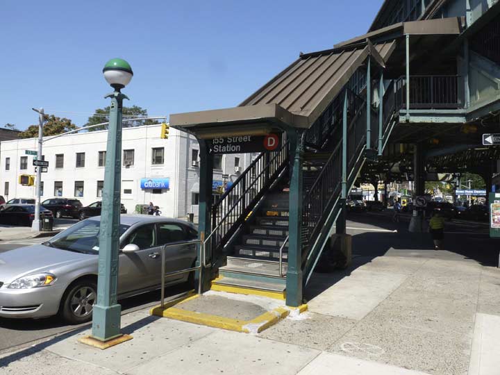
Here’s the entrance to the southbound platform of the West End el 55th Street station on 13th Avenue. When riding past on the B16 bus I would always notice one unusual thing about the entrance: the signage where the modern black and white sign is now…
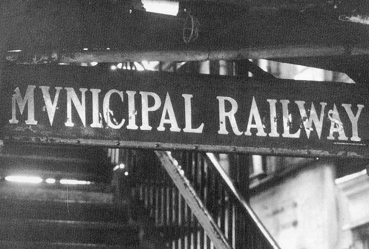
… because well into the 1980s the entrance was marked by a leftover navy and white sign from when the el was run by Brooklyn Rapid Transit, with the words “MVNICIPAL RAILWAY” with the Latin “V of Importance” instead of a U (back in the imperial Roman era, stonecarvers found it much easier to sculpt a “U” with an angled bottom, and that’s how the V was born. It was only centuries later when the two letters U and V were assigned to two different sounds). Photo: Oscar Israelowitz


Here’s a look at the two US Post Offices Borough Park has had in my lifetime: the “new” (1970s) facility at 12th Avenue and 51st, and the former one, on 13th Avenue between 56th and 57th Street. In both cases the post offices were called the “Blythebourne” branch, after its original name when first developed in the 1880s by Electus B. Litchfield.
The 1970s building is not quite Brutalist, but is fairly domineering in “personality,” while the former building, now a Jewish institution (please translate the Hebrew for me and send on to kevinjudewalsh@gmail.com), is a handsome brick building, casually elegant in its own way.
Changing Brooklyn
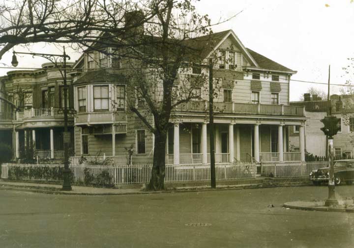
The B16 bus has an unusual route employing 56th and 57th, both narrow side streets, to get between Fort Hamilton Parkway and 14th Avenue (I’d think the wider 60th would be easier to negotiate.) Until about 20 years ago, 13th avenue was a two-way avenue and the bus used it in both directions. It would make the turn at 13th and pass this rambling house on the corner of 56th. Years later, Anthony Catalano, who resided in the house, uploaded his photo collection onto flickr (he has since passed away). According to Anthony the house once sat on property owned by the Dutch colonial Kouwenhoven family and was built in the mid-1800s.
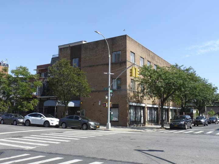
The house was torn down in 1985 and this object was built in its place. Sick transit, Gloria!
As a consolation prize, the attached brick houses on the same side of 13th, across from the former post office between 56th and 57th Streets, are still there.
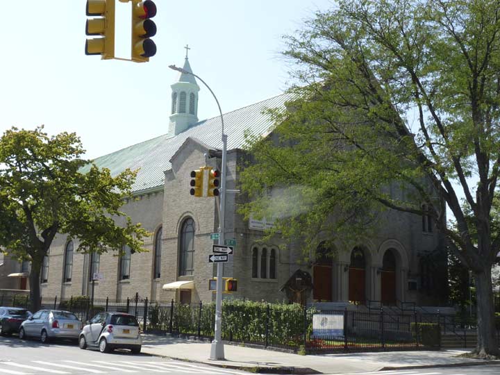
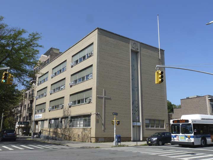
St. Frances De Chantal Catholic Church’s parish was established in the mid-1890s and the present building was constructed in 1925. The church school across 57th Street, built in 1957 (like me) became a private academy about 20 years ago. This was the parish attended by my uncle and aunt and their children, who lived on 13th Avenue and 50th. It’s also where the B16 bus makes a turn when it is Bay Ridge bound.
Returning to New Utrecht Avenue…


There’s a multi-bayed, multi-turreted creation on 58th Street that predated the el and may just well predate the steam railroad itself (which was established in the 1860s!)
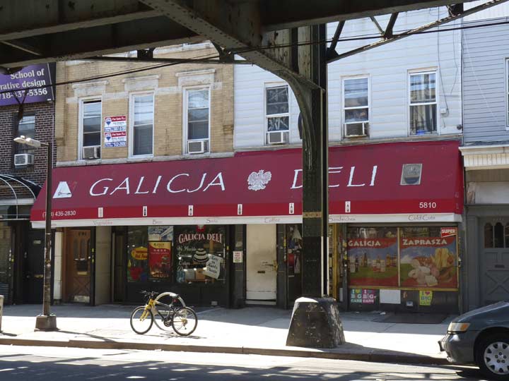
The Galicja Deli, between 58th and 59th, adds to Borough Park’s bonafides as a Polish stronghold. While Galicia is today a modern province of Spain, during the medieval period, a different Galic(j)a was a kingdom located in today’s Poland and Ukraine.


Savarese Italian pastry shop, corner of 13th and 60th. This is the unofficial and undefended boundary line between Borough Park and Bensonhurst. The latter until recently had been a majority Italian-American neighborhood, but the last two decades have seen an influx of Asian and Eastern European immigrants. However, many old school Italian business still exist here (the original Sbarro’s, now a pizza chain, had been on 17th Avenue and 65th Street). The building itself had probably been a Victorian-era wonder before aluminum siding tamed it to its present appearance.


New Utrecht Avenue has kept most of its old-school fire alarms, but there’s a couple of different models on 60th and 62nd Streets. The FDNY produced the peak-roofed models through 1913, while the ones with the squarish boxes go back to 1921. Amazingly there are still hundreds of these relics all over town; the commoner streamlined standalone version first appeared in 1957. The torch, or “ice cream cone,” appears on all models produced from 1912 through 1931. Also, note the striations in the top of the base on the 1921 model; those were introduced that same year.
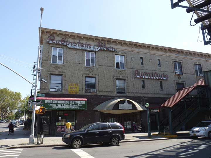
Yet another former Rubenstein & Klein furniture showroom turns up, this one at 14th Avenue and 60th Street. In Part One, we saw the first in what had been the Loew’s 46th Street Theatre, used in the 1970s for concerts by the Grateful Dead and other top rock acts. Just like that old barn, the store signage has been retained here too, at least 25 years after the store went out of business.
The subway entrance below was featured at the conclusion of a famed car chase in William Friedkin’s 1971 film The French Connection, in which Detective Popeye Doyle (Gene Hackman) races a subway (an N train, which usually doesn’t use the West End) that was hijacked by a drug kingpin’s enforcer. Doyle shoots him dead on the staircase after the mobster had fled from the stopped train.
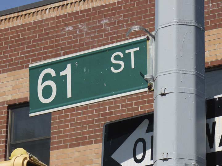
It must have been an oversight at the shop, but this street sign at 14th and 61st would up in Helvetica instead of the usual Highway Gothic or Clearview.
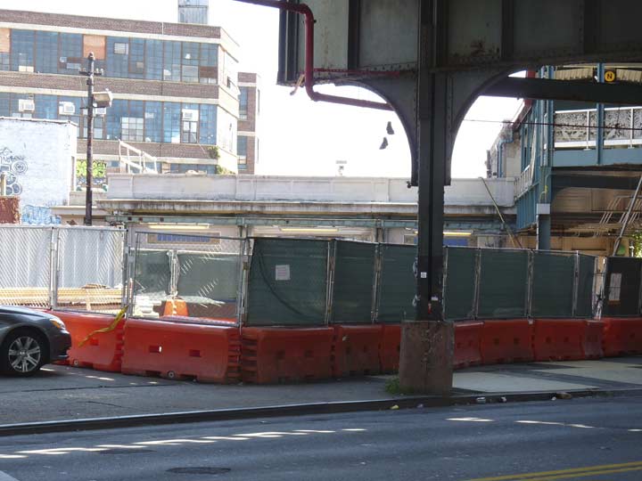
I had hoped to get some photos of the busy subway interchange at 61st in which the Sea Beach (N train) intersects the West End (D), but as part of ongoing rehab on the Sea Beach that will continue into 2018, things are largely ripped up thereabouts, with plenty of construction machinery and not much else. You can see that this was also once a trolley transfer point, with a decommissioned trolley wire post. The #38 ran here and ended service on June 28, 1947.
The Sea Beach parallels the old LIRR Bay Ridge Branch, now a NY & Atlantic freight line (but I’ve always said a revival of the line for passenger service, either for the LIRR or the subways, would open up a lot of Eastern Brooklyn and mid-Queens to subway service.
However the MTA does not have the cash or the inclination to pursue the idea.
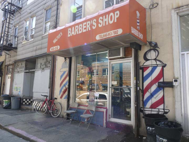
Though this stretch of NUA is fairly nondescript there are some ancient symbols to be ferreted out. The red stripe in the traditional barber pole once signified arterial blood and the blue striped symbolized venous blood, as medicinal bloodletting used to be handled at barbershops, which doubled as surgeons during the Middle Ages. Beginning in 1163 in Europe, the clergy was banned from the practice of surgery and barbers took over those practices.
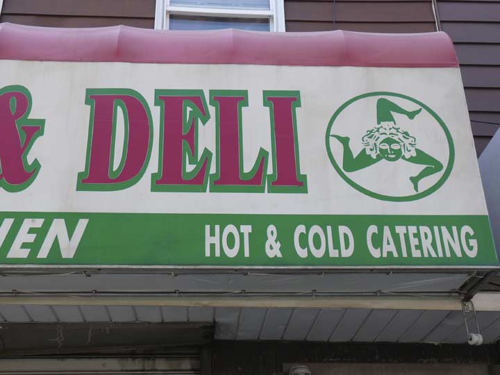
Yet another ancient symbol. The awning on this sign on NUA between 64th and 65th Streets features a triskelion, or a symbol consisting of three bent human legs, with the head of Medusa, the three-headed Greek/Roman snake-headed goddess. This particular iteration can be found on the flag of Sicily and may indicate the owners are of Sicilian origin.
The flag is characterized by the presence of the triskelion (trinacria) in its middle, the (winged) head of Medusa (Gorgon) and three wheat ears. The three bent legs allegedly represent the three points of the triangular shape of the island of Sicily, or the historical three valli of the island. The present design became the official public flag of the Autonomous Region of Sicily on 4 January 2000, after the passing of an apposite law which advocates its use on public buildings, schools, city halls, and all the other places in which Sicily is represented. wikipedia
Of course, I know about the triskelion from the Star Trek episode “Gamesters of Triskelion” in which Kirk alternately fought and romanced a green-haired lady.


New Utrecht Avenue crosses 15th Avenue at 66th Street. The common practice of the Department of Transportation is to leave illegible, sun-faded signs in place as long as possible and to replace relatively new signs first. This rationale is probably explainable in bureaucratese, but I for one do not understand this particular policy.
At 15th and 66th I found another 1920s-era fire alarm painted completely in light green (they are, as a rule, painted red). I imagine this was done by neighborhood denizens who preferred this color.


Ovington Avenue
If we look at an 1873 atlas of the old Town of New Utrecht (I do this all.the.time) we see that an east-west road called Ovington Avenue was among the first routes that was built across the area, along with 60th Street and Fort Hamilton Parkway. It still runs parallel to the grid and misbehaves a bit, causing shorter blocks than usual. Today it runs, with some interruptions, between Ridge Boulevard and New Utrecht Avenue.
The street is named for Ovington Village, an artists’ conclave in the mid-1800s in the vicinity of 3rd and Ovington. The village was formed by a group of artists and artisans in 1850 who had purchased the Ovington family farm. Incorporating under the name Ovington Village Association with Charles Parsons as president, they opened Ovington Avenue through the region, lined with spacious homes on 400-foot wide plots.
The Ovington family owned a farm in the vicinity in the 1840s. Henry Alexander Ovington, who bought the property for use as a summer home, was the assistant chamberlain of New York City. Three of his sons owned Ovington Brothers, a china shop on Fulton Street whose name can still be found on vintage crockery. Another son, Earle, was the first air mail pilot employed by the U.S. Post Office.
However, the most famous member of the Ovington family was Mary White Ovington, a co-founder of the National Association for the Advancement of Colored People (NAACP), and a moving spirit behind the Niagara Movement.
The history of the area is not limited to the annals of the Ovington family. Rather, the intersection of Third Avenue and Ovington Avenue was the site of a skirmish between colonial forces and British troops a few days prior to the 1776 Battle of Brooklyn.
Ovington Avenue was originally named Cedar Lane. It served as the gateway from the local concert hall, the Atheneum, to Ovington Village. Historic Districts Council
In Part 3: further into Bensonhurst
9/18/16
3 comments
what was the pizza place I think at the intersection of 13th ave and new utecht ave under the L 56th street I think during the 60,s , I thought maybe Vitos? Thanks
Great walk back in time! I grew up on 57th and New Utrecht. Thank you very much for the wonderful features of “The Old Neighborhood .
Do you know where or have a photo of (if it still exists) of an old cinema house at 49th and Utrecht? My father’s
maternal grandfather died in 1925 en route to a fire there. He was a fireman.