
Here’s a look at Union Turnpike looking east from 233rd Street in Hollis Hills in 1932. Besides the work of intrepid photographers and chroniclers Percy Loomis Sperr and Eugene Armbruster (both of whom I’d humbly like to be compared to) in the early 20th Century, we also have to thank various street paving companies for views of New York City that don’t involve heavily chronicled landmarks, amusement and beach areas typically found in postcards.
Today (3/30/17) I walked Union Turnpike and the Motor Parkway from Little Neck Parkway west to 164th Street and would have continued on west to the subway at Kew Gardens had not a bad right leg caught up with me after the 4th mile; I hope the knee or the joints aren’t injured– I’ll have to see. I haven’t been on the Motor Parkway much since I lived in Flushing between 1993 and 2007, and am beginning to revisit the route that once stretched a full 45 miles between eastern Flushing and Lake Ronkonkoma. To that end I’ve discovered a helpful site, Vanderbilt Cup Races, which includes the photo above.
Here’s the thing about this view: pretty much everything in the 1933 photo, except for the Corvington lamppost, is still there from the low-rise, tidy Tudor-style homes on Union Turnpike’s south side to the institutional buildings and smokestacks in the Creedmoor Psychiatric Institute seen on the horizon. At left, land is being cleared so Union Turnpike can be expanded into the fast and furious 6-lane median’ed roadway it is today. Even the fire hydrant is still in place! Land north of Union Turnpike, farmland then that was bisected by the Motor Parkway, was turned into Alley Pond Park. A parcel has been kept as farmland and is now the Queens County Farm Museum.
Union Turnpike evolved from a short road in Glendale called Union Avenue. As it was built east and gained length in the early 20th Century, it was renamed Union Turnpike, but it was never a traditional turnpike, e.g. a toll road in which a pike, or lengthy barrier, was turned when a toll was paid to allow through traffic.
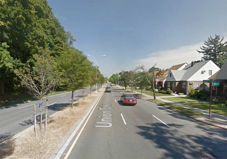
This is a recent Google Street View. One thing you notice right off the bat when looking at old photos of Queens or other boroughs is the lack of street trees. In 1932 some had just been planted and some of those sprigs may still be there today, especially the ones further up the road.
“Comment…as you see fit” in Comments.
3/30/17
5 comments
I love seeing those vintage photos of eastern Queens, where open farm lands, country estates and golf courses still dominated large swaths of the landscape prior to WW II. It reminds me of Joni Mitchell’s song “The Big Yellow Taxi”, where the lyrics contained the words “paved paradise and put up a parking lot. I think that is especially aprapoe here. Thanks Kevin for the photos and the history behind them.
In comparing photos from the 1920’s through the 1950’s with shots of the same places in later years, it always surprises me how few trees are in the older photos and how many are present now. Indeed, we certainly paved paradise and put in a parking lot, but we also planted an awful lot of trees while we did it. I don’t have statistics, but would bet that there are more trees in Queens today than there were in 1950! This is most welcome.
Good stuff
This piece reminds me of the old “New York’s Changing Scene” in the old NY Daily News.
More please !
Great pics, and northeast queens is still a great area. As said above, with the mature trees, the place looks better now than it did in the 30s or 40s.