
In the 1970s, Sheepshead Bay, Marine Park, and Bergen Beach had not become fully homogenized into the Brooklyn “beautiful mosaic” and were still rough around the edges in spots. There were lanes that led nowhere (still are if you know where to look), empty lots, and occasional unpaved roads. Much of this has been smoothed over in the 40 years since, but I can still recognize signs of when this was a separate town in Kings County.
I have not made many forays into Marine Park or Bergen Beach — the last was in 2008(!) when I wound up in Georgetown, so although I have a lot of photo albums in the ForgottenQueue, I decided to use this batch, obtained in October 2017, right away. My favorite FNY forays always seem to be in Brooklyn as it was originally my home borough, though I have been based in Queens since 1993.
GOOGLE MAP: SHEEPSHEAD BAY TO BERGEN BEACH
When I left off in Part 1 I was at Avenue S and Nostrand Avenue at Buckley’s Tavern…
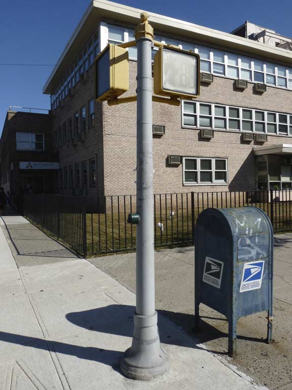
… and, at the northwest and southeast corners are a quartet of pedestrian control stanchions. These, though, are older than 1965 and probably once held plain 3-color stoplights. How can I tell? The answer is simple. Note the flanged design on the bases. This design was used since the city began installing these cylindrical poles to support traffic and pedestrian signals in the mid-1950s. But in 1965, a change occurred in the design when the bases became plain boxes. The design has remained the same since then.
Note the pushbutton signal controller. This is mainly a placebo as very few of these work, or ever did. Imagine if traffic signals were controlled by the whims of mere pedestrians!
The mailbox next to it has its installation date embossed near the bottom, as all of these kinds of mailboxes do, but I failed to take note of the date. That means I’m slipping.
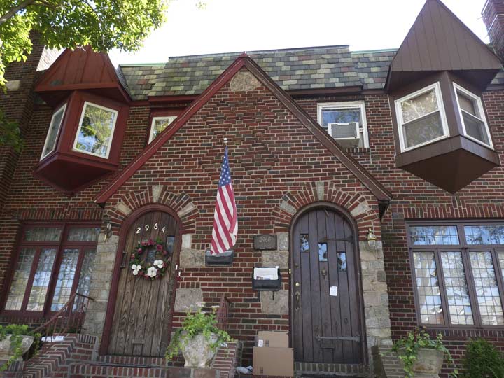
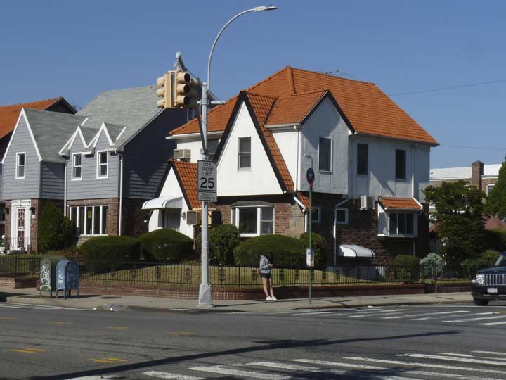
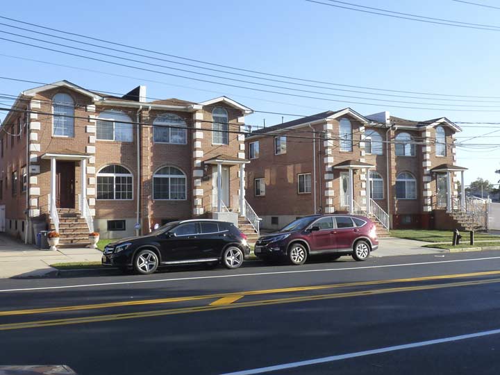
This section of Sheepshead Bay, and neighboring Marine Park, are Tudor paradises with both attached and detached houses built with the style; I especially admired this pair on Avenue S east of Haring Street, especially for the arched doorways.
South of Gerritsen Avenue and east of Nostrand are a group of named streets, Haring, Brown, Batchelder, Coyle, Ford, Bragg, Brigham, and Knapp. These take the place of numbered streets that would have begun with East 31st. Why does that occur?
When Gerritsen Avenue was laid out in the late 1800s (see this outline map), it more or less followed the NE to SW path of Gerritsen’s Creek, around which Marine Park would eventually be laid out. Streets adjoining it paralleled Gerritsen Avenue and so, there is an anomalous group of streets angled northwest to southeast between Gerritsen and Flatbush Avenues, in lieu of the prevailing north-south grid. Those streets got the numbers from East 31st to East 38th, but replacing East 39th through 42nd are four more named streets, Ryder, Kimball, Coleman and Hendrickson. I’m a little stumped why these names (which are of early area settlers) are in place of the numbers, since there wouldn’t be a conflict. The Sheepshead Bay names are those of assistants of the land commissioner surveying the bay area in the 1870s.


Good Shepherd Roman Catholic Church, Avenue S between Brown and Batchelder Streets, has a handsome Spanish Colonial-styled church building constructed in 1940 and a 1931 Art Deco school building, not pictured, on Brown. Parish administrative buildings can be found on Batchelder and there is a large grotto devoted to Mary Mother of Christ, found in may Catholic church properties. The parish was established in 1927 and the current church dedicated after the original burned down in 1939. Unlike a lot of churches, Good Shepherd has a detailed historical booklet available online (originally published in 1975).
The name of the church comes from a New Testament parable. From John 10:
11 “I am the good shepherd; the good shepherd lays down His life for the sheep.12 He who is a hired hand, and not a shepherd, who is not the owner of the sheep, sees the wolf coming, and leaves the sheep and flees, and the wolf snatches them and scatters them. 13 He flees because he is a hired hand and is not concerned about the sheep. 14 I am the good shepherd, and I know My own and My own know Me, 15 even as the Father knows Me and I know the Father; and I lay down My life for the sheep.
The Latin inscription above the church door means: “Dedicated to the Good Shepherd.” For several years, a former teacher of mine, the late Father Thomas Brady (brother of the late syndicated columnist and author James Brady) served at this parish.
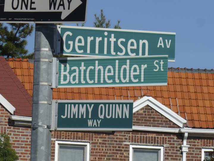
Circa 2005 signs in the now-disused Clearview typeface. The DOT returned to Highway Gothic around 2013 (though still upper and lowercase), though thousands of signs in the derided Clearview font have already been installed. The Jimmy Quinn sign is older and was not replaced; it remembers a Gravesend Cantor Fitzgerald employee killed in the terrorist massacre on 9/11/01.
Gerritsen Avenue is a main northwest to southeast artery running from Nostrand Avenue and Quentin Road southeast into the Gerritsen Beach community.

Gerritsen Mill, courtesy Gravesend Gazette
Gerritsen Creek, and nearby Gerritsen Avenue, take their names from the Dutch Gerritsen family, who owned property where Marine Park is now as early as the mid-17th century. The family had a milling operation that ran continuously from two buildings in the Marine Park area until 1935, when the second of the two mill buildings burned down…perhaps by arson. Reportedly, it was the largest working grain mill on Long Island. Its presence was not forgotten by surveyors and mapmakers, who named surrounding waterways, locales and streets Mill Basin, Mill Island, Mill Avenue and Mill Lane.
The mills had wooden machinery, leather beltings and large revolving millstones. They was on the edge of the basin into which poured the sea when the rising tide opened the flood gates of the dam that crossed the narrowest part of the creek (originally Storm Kill, later called Gerritsen’s Creek). When the water reached the top of the dam, the gates closed with a full pond behind them. A gate in the sluiceway in the back of the mill could be raised by hand by means of a ratchet wheel, and thus allow the water to flow over the mill wheel as needed.
The second of the two mill buildings was most likely built around 1755. The mills were in continuous operation by the Gerritsens until the late 1890s; William S. Herriman, the last person to run the mill, sold the property in 1899 to former US Navy Secretary William C. Whitney. His son Harry Payne Whitney used the acreage as a training area for his stable of race horses. Harry’s daughter, Joan, was the original owner of the New York Mets.
These days the old mill is represented only by a group of wooden pilings in the creek, though the mill wheel can also be seen on the western shore of the Marine Park Golf Course.
The magnificent Gerritsen family mansion, constructed in 1830 near the mill, was purchased by the Whitneys in 1899 and was in use as a residence during the summer racing season. Stables, barns and servants’ quarters were also built on the property. All were torn down when Marine Park was constructed in the late 1930s.
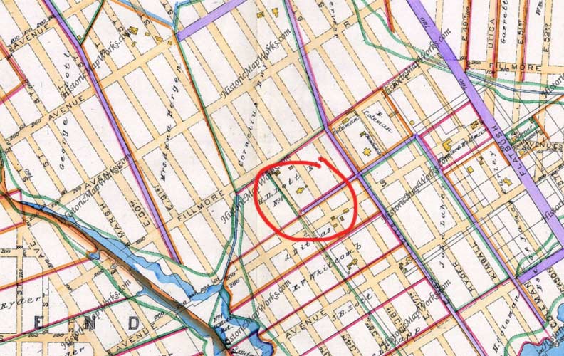


Now we come to something of a puzzlement, for me especially: the presence of Fillmore Avenue. It runs from Gerritsen Avenue northeast to Flatbush, and continues east a little further south on Flatbush till meeting its end at Avenue T and East 57th. It is paralleled on the north by Avenue R and on the south by Marine Park and eventually, by Avenue S. The question is, what is it doing here, and what Fillmore is it named for? It does not take the place of a lettered avenue, after all (unlike Quentin Road, which stands in for Avenue Q, which was renamed for one of Teddy Roosevelt’s sons who was killed in World War I). Leonard Benardo and Jennifer Weiss, in Brooklyn By Name, aver it was named for 13th President Millard Fillmore (1800-1874), but I think that explanation is a bit facile; Fillmore (who resembled Trump imitator Alec Baldwin), while from Buffalo, NY, doesn’t seem to be connected to the Marine Park area, which was just marshy territory with scattered homesteads and farms in the late 1800s.
I reproduced a Kings County atlas from 1890 that indicates that Fillmore Avenue was on the drawing board at that time, though the roads in beige had not yet been built; in 1890 only the roads in purple were then in existence. Most have vanished except for Flatbush Avenue. I circled in red the Hendrick I. Lott House, a small yellow square on the map on today’s East 36th Street, which still stands today (see below).
So what the heck is a Fillmore Avenue doing down here? I have no idea.
I enjoy Spanish Colonial style architecture and here’s a good example at the NE corner of Gerritsen and Fillmore. You could cut your finger on those gables in the front.
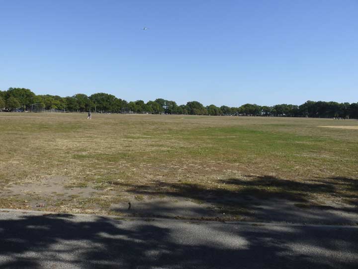
Like Vasco Núñez de Balboa first glimpsing the vast Pacific Ocean in 1513, I first bicycled out to Marine Park in the Super 70s and was duly impressed by its vast lawn, which occupies most of the park’s territory between Fillmore Avenue, Avenue U, Stuart Street and East 33rd Street. I was also fascinated to see it populated by cricket teams on weekends; on this, a Wednesday afternoon, it was still and quiet. It’s one of the largest curated lawns in the NYC Parks system and can take its place alongside the ones in Central Park and the Bronx’s Van Cortlandt Park.
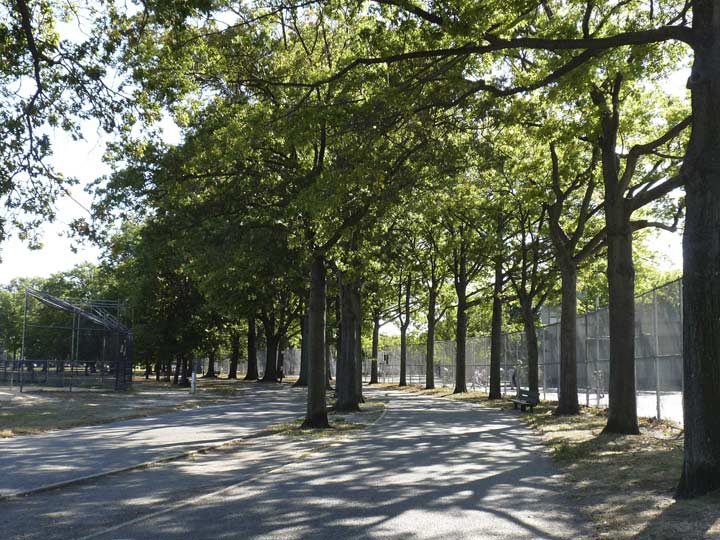
The oval is surrounded by a running and bicycle track that I took frequent advantage of.
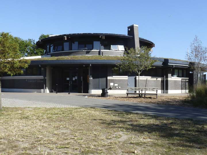
Resembling a flying saucer from 1950s science fiction flicks, is the Carmine Carro Community Center, opened in 2013 and named for a local community park advocate. The building features solar panels, geothermal heating and a “green” roof, and provides activities for seniors and kids.
Until a few years ago, Marine Park south of Avenue U was mostly ‘wilderness’, but trails are now maintained and residents of Gerritsen Beach and the surrounding neighborhood, also called Marine Park, can enjoy a shoreline nature milieu.
The park surrounds Gerritsen Creek, an arm of Jamaica Bay. The creek was a freshwater stream that once extended about twice as far inland, all the way up to Kings Highway. The creek had been converted to a storm drain by the early 1920s. The creek’s fresh water, however, supports a wide range of plant and animal life.
A speculative building boom occurred around 1900 when developers expresed interest in turning Jamaica Bay into a deepwater port enabling large ships to enter a proposed harbor. Fearing that the relatively untouched marshland around the edges of the bay would be compromised, local landowners Frederick Pratt and Alfred Treadway White offered 150 acres to the city for use as a park in 1917. Jamaica Bay never became an important port.
Any improvements to the 150-acre tract were slow to occur and it wasn’t until 1937, when land purchases and fill increased the park’s area, that the region became an official park and was given its name. Gradual improvements, like baseball fields and recreational facilities were gradually added over the years.
Over the past sixty years, portions of Marine Park have been improved with recreational facilities, while other areas have been conserved to protect wildlife and plant life. In 1939 the Pratt-White athletic field, north of Avenue U, was dedicated in tribute to the two fathers of Marine Park. A 210-acre golf course opened in 1963. Nature trails established along Gerritsen Creek, on the west side of Burnett Street, in 1984-85, invite parkgoers to observe a wealth of flora and fauna. Ongoing improvements at the end of the 20th century include the reconstruction of basketball, tennis, and bocce courts; of baseball fields; and of Lenape Playground at Avenue U. New ballfields, on the west side of Gerritsen Avenue, were opened in 1979 and named for local baseball lover and police officer Rocco Torre (baseball’s Joe Torre’s brother; Rocco Torre passed away from a heart attack in 1996). A new Saltwater Marsh nature center opened in 2000.


In Marine Park the new bocce courts feature sun shades. This variety of lawn bowling is practiced in NYC mostly by older Italian immigrants, though youngsters have been joining in.


I admired these attached brick Tudors on Fillmore between East 32nd and 33rd, but I can do without those Tuscan-style columns one of the owners installed. No idea why they are so popular.


On one of the largest surviving colonial-era tracts in southeast Brooklyn is the Hendrick Lott house at 1940 East 36th Street between Fillmore and Avenue S.
Johannes Lott built a small house on his Flatlands property about 1720 on land first settled by Dutchman Hugh Aerens as far back as 1636. In the 1700s, Gerritsen Creek still flowed nearby. Johannes bequeathed the house to his son, also named Johannes, who became a colonel in the Kings County militia and fought in the French and Indian War. His son, Hendrick I. Lott, inherited the small house and farm and built a much larger addition in 1800 for his bride Mary. The house remained in the Lott and Suydam families until 1989, when Ella Suydam, great-great-great-great-granddaughter of Johannes Lott, passed away. The farm had been sold off when the city began to lay out streets in Flatlands and subdivide property in the mid-1920s.
In 1998, Brooklyn College researchers and archeologists with the aid of New York Unearthed recovered a treasure trove of artifacts from the house, revealing precious secrets of daily life in New Netherland.
In 2000, a small trap door was discovered in the house in the ceiling of a closet. The trap door led to three worn steps leading to a boarded-up door, and in the two cramped, dusty rooms behind the door, there was an amazing discovery beneath the floorboards: corncobs, a cloth pouch tied with hemp, an animal’s pelvic bone, and an oyster shell. The corncobs were arranged in a specific pattern. It was key evidence of African rituals among the Lotts’ slaves. Though records show the Lotts were among Flatlands’ largest slaveowning family, they also show that the Lotts freed their slaves two decades before slavery was outlawed in New York State in 1827. The Lott House may even have been a way station in the Underground Railroad in 1844.
In recent years, NYC Parks has taken over the house and refurbished the property.


A pair of murals, either side East 36th Street at Avenue S
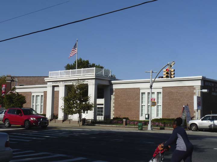
I have yet to walk the full length of Flatbush Avenue; I did walk about 20 blocks a few years ago, further north from “The Junction” at Nostrand up as far as Church, but my hard drive failed and swallowed them (I thought I had backup activated, but I didn’t — I’m more diligent now). One of the more impressive buildings on the southern stretch is Torregrossa Funeral Home at Fillmore Avenue.
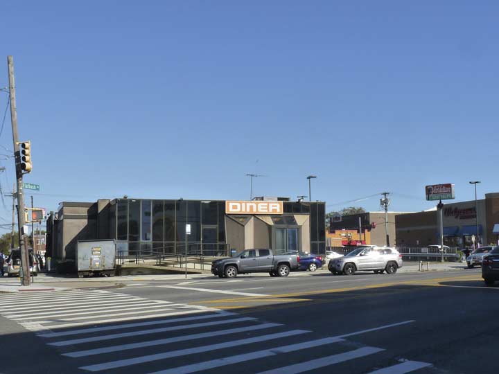
As ForgottenFans know I’m a big diner backer, but as for the Floridian at Flatbush and Fillmore, oo-fah, or as they say in Borough Park, “man, oh Manischewitz.” This is the ugliest diner design I’ve ever seen, coated with impenetrable non-reflective black glass. Miasmic odors greeted me as I passed the rear service area fronting Fillmore Avenue. Well, you can’t judge a book by its cover and here’s some Yelp reviews.
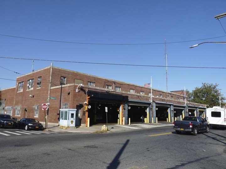
Directly across the street, the MTA Flatbush Bus Depot has a century-plus legacy. A streetcar depot first opened here in 1902, serving most southeast Brooklyn lines, and began servicing buses in 1931. The current depot opened in 1950 and today serves the B2, B31, B41, B44, B46, B46 SBS, B4 lines.
Utica Avenue is one of the busiest of Brooklyn’s “New York city” avenues, which beginning with New York and ending with Buffalo, are named for towns proceeding north along the Hudson River and then west along the Erie Canal. Utica is near the geographical center of New York State east of Syracuse and was home to over 62,000 residents in the latest census. Utica was founded on the site of the former Fort Schuyler in 1798, and named for a Roman-era city in what is now the modern country of Tunisia in north Africa. Utica was the girlhood home of actress Annette Funicello.
In 2015 NYC Mayor Bill de Blasio floated an idea for a Utica Avenue subway extension, but the MTA has not made any moves toward creating it.


Fillmore Avenue ends at Avenue T and East 57th Street, Firefighter Gregory Saucedo Triangle, named for a hero firefighter killed on 9/11/01.
We are now skirting the north end of Mill Basin, named for a Jamaica Bay inlet that was engineered into western and eastern sections in the early 20th Century by the Flatbush Improvement Company. The area was industrial after 1890, with Crooke Smelting, National Lead, Gulf Refining, and other industries lining the basins; before that, the region was known for the tidal mills that gave the neighborhood its name. The Schenck (pronounced Skenk) and Crooke families owned much of the land in the 17th and 18th Century after the Canarsee Indians vacated it. Jan Martense Schenck’s house was disassembled and then put back together by the Brooklyn Museum, which displays it.
The industries moved out in the 1940s and the former Mill Island, south of Avenue U, was connected to the mainland by landfill. A semicircular street layout was built, followed by residences; near the water, some have palatial and eclectic styles, and some are owned by mafiosi. Best not to inquire too closely.
Brooklyn’s first indoor shopping mall featuring a number of major chains, Kings Plaza, opened at Avenue U and Flatbush Avenue in late 1970.


Ralph Avenue ends its occasionally interrupted journey south from the Bushwick-Bedford Stuyvesant border at Avenue T and East 60th Street. After an interruption at East 98th Street, it begins again at Remsen Avenue, forming the west border of both Canarsie and Bergen Beach. It’s one of not one but two avenues named for Ralph Patchen, a wealthy landowner in the Brooklyn Heights area in the colonial era. Not only that, the old name for Menahan Street in Bushwick and Ridgewood was Ralph Street, and occupies the roadbed that Ralph Avenue would assume if it turned northeast at Broadway.
Its ending here on Avenue T is rather ignominious, with a small unnamed green patch and a dying tree. Sorry, Mr. Patchen, but at least you got two avenues.
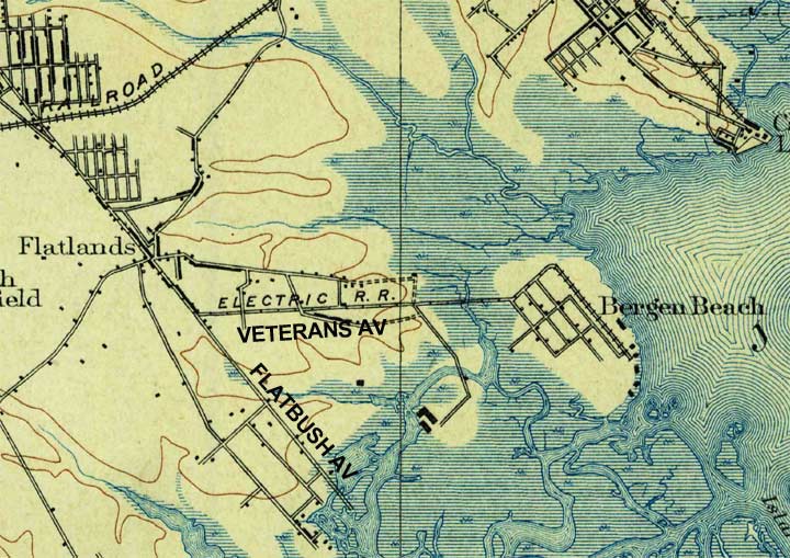
Bergen Beach in the late 1800s
Bergen Beach is another southeast Brooklyn former island community. In the mid-1600s after the Canarsee Indians left, the island was owned by Dutchman Hans Hansen Bergen, whose property was later occupied by British troops during the Revolutionary War. Early on, the island was connected by a causeway to the mainland, which featured an electrified trolley that today limns the route of the B41 bus along Veterans, formerly Island, Avenue. The island was connected to Brooklyn by landfill in 1918. During that era it was home to an amusement park co-sponsored by Chicklets gum king Thomas Adams Jr.
The amusement park suffered because of competition with Coney Island and shuttered in 1925. The ensuing Depression and World War II spelled an era of slow growth for Bergen Beach and its roads were not fully filled out with housing until the Easy Eighties. When I first bicycled into the area, I found empty tracts for the most part east of Ralph Avenue and north of Avenue T. That space has since been filled by the relatively new development called Georgetown, which began construction in the 1960s and continued very gradually well into the 1990s.


Much of Bergen Beach is so relatively new that its first Catholic parish, St. Bernard of Clairveaux, wasn’t established until 1961. Services were held in an outdoor tent for three years until the avant-garde building (by Catholic church building standards) opened in 1964. There was some controversy in 2016, when a Star Wars-themed Mass for kids was celebrated.
The first pastor, Father Patrick Joseph Kenney (1908-1986) is remembered by a traffic triangle at Veterans Avenue and Avenue T.


As stated earlier I had not been in Bergen Beach for awhile and I was unaware of any overwhelming patriotic fervor until I saw American flags flapping from nearly every telephone pole, and there’s a critical mass of them at Pvc Cosmo Barone Triangle at Veterans and Avenue U, named for a local soldier who died from injuries suffered in the Vietnam War.
During his tour of service, Pfc. Barone was awarded the Purple Heart, the Combat Infantryman Badge, the Sharpshooter Badge with Rifle Bar, the Vietnam Service Medal with a Bronze Service Star, and the Republic of Vietnam Campaign Medal. His name is listed among the fallen on both the New York Vietnam War Memorial and the National Vietnam War Memorial in Washington, D.C. NYC Parks
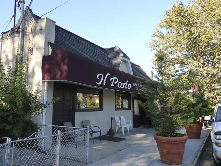
Something “new” has been added, Il Posto, an Italian restaurant at Avenue U between East 74th and Royce Street. It was unusual to locate a restaurant smack in the middle of an otherwise 100% residential realm. Reviews are solid.


Though it was here when I lived in Brooklyn, I had never before explored the grounds of the Hudson River Yacht Club, which is not located on the Hudson River, but on Paerdegat Basin. The reason for the nomenclature is simple, according to their Facebook page:
The Hudson River Yacht Club is now located at the Foot of Avenue U and Bergen Avenue. The original site of the club was the Foot of West 70th Street on the Hudson River in New York City where it’s name became established. The Hudson River Yacht Club was organized in 1873 and Incorporated in 1875 and is one of the oldest organized yacht clubs in the United States. At the present day, it has 90 Full and Associate Members.


Part of the reason I hadn’t wandered in is that heretofore, the entrance was a dirt road through the woods. Now it’s tree-lined Maxie Boulevard, named for a popular club member, Vincent Mascarella (1920-2002).
Once attaining the grounds, I wasn’t shooed away, but was unsure of being in a semi-private area, and never being mistaken for someone who would ever own a yacht, I beat a retreat back to Bergen Avenue.
This stretch of Bergen Avenue, incidentally, was just an underdeveloped dirt track when I first found it by bicycle around 1975 or thereabouts.
Heading north on Royce, I found this clutch of slant-roofed residences north of Avenue T. The road did not exist when I first explored the region in the 1970s. This is the south end of the relatively new Georgetown.
New homes on Avenue N and East 72nd Street.


I did find a pair of undeveloped plots — probably among the last in Bergen Beach — at Avenue N and East 72nd and also at East 69th.


Peri Lane dead ends off Avenue N near East 72nd. It has a somewhat weighty monument at its entrance.


Firehouse, Avenue N at Veterans Avenue and East 64th. I had said previously that there was little development east of Ralph and north of Avenue T, but a shopping and residential strip along both Avenue N and Island (later Veterans) Avenue had sprung up as early as the 1930s. Proof positive is this firehouse, Engine 323, whose plaque is dated 1932, the last year of the Jimmy Walker mayoral administration.
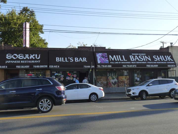
A “shuk” is a Middle Eastern marketplace. It can be spelled in a number of ways using Roman letters, since it is usually spelled in Arabic characters: suq, souq, sook, etc.


Mister Auto Repair, Avenue N and East 63rd. I found a classic 1972 Plymouth Fury station wagon adapted for NYPD use parked outside, painted in the color scheme used that year for NYPD vehicles.
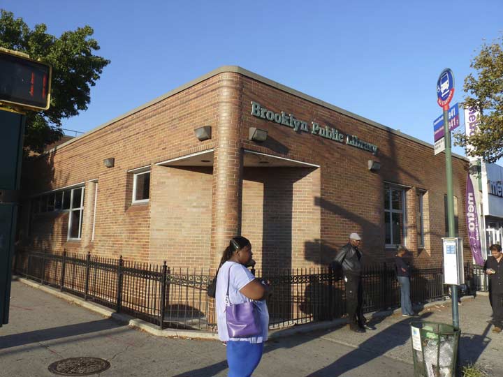
Believe it or not, when bicycling through the area in the 1970s and 1980s I would occasionally secure the bike and stop in here, the Mill Basin Brooklyn Public Library branch, for a read break before heading back to Bay Ridge. I found it closed in October 2017 for heating, ventilation and air conditioning replacement work.
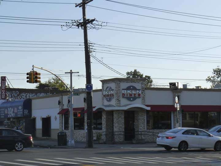
BKLN Diner, Avenue N and Ralph Avenue. The design is much more inviting than the Floridian’s.
Civic association shopping street medallion. When I get enough of these, I’ll do an FNY page on them; I always found the different designs intriguing. This one is rather plain Jane.
Almost time to kick it in the head for the day, but not before snagging this terrific vinyl sidewalk sign for another neighborhood “pork store” on Avenue N west of Ralph.
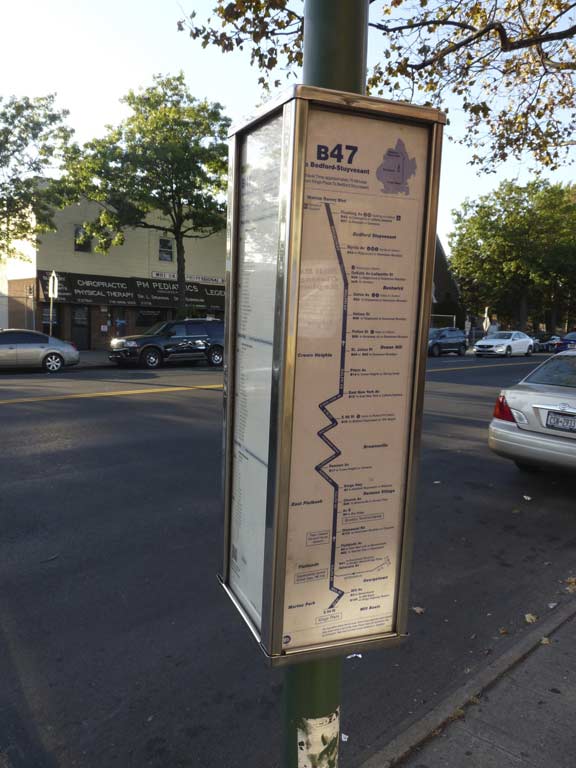
I had my choice of buses. I wanted to do the B 47 up Ralph Avenue and switch to the C train at Fulton, but it was too crowded for my taste and I grabbed the tried and true B 41 that goes back to the #2 train at Flatbush Avenue.
Check out the ForgottenBook, take a look at the gift shop, and as always, “comment…as you see fit.”
10/15/17
19 comments
Ben Maksik’s Town and County night club used to be on Flatbush Avenue in the 50’s, past Avenue U. I saw Sophie Tucker perform there one evening……They have been talking about extending the former IRT lines out Utica and Flatbush Aves for years…I doubt anything will ever come of it…..Bergen Beach was very rural and had a riding stables that rented horses at one time…..
ALWAYS great info. FYI, the B.47 is a “Semi-Recent” route in Brooklyn. It starts in Bushwick at Woodhull Hospital and has its terminus in Mill Basin at Kings Plaza. It is a pretty lengthy route, similar to the B8.
The B.47 replaces the old B.78 route that started at the Rutland Road-Sutter Ave Subway Station in Brownsville and terminated at Kings Plaza. Just a wee bit of info for you.
Thanks to FNY for another delightful and informative two-part tour! This is a part of our Town a geezerly Bronx boy never saw, and will never see, but FNY makes it feel like home.
I’m constantly amazed by the volume of research FNY crams into every new page!
Re industrial Mill Basin – A building that was used by National Lead Co remains – the one with the RED’s sign on it across the basin from Home Depot. An interesting facility that has left no trace to my knowledge was the Atlantic, Gulf and Pacific, which was a dredging company that had a large boatyard running along Strickland Ave. (then called Kemble Ave). It was a repair facility for their equipment, but they also built boats, including some lighters during WWI and a ferry, the “Poughkeepsie” for the Poughkeepsie and Highland ferry company. There was an isolated railroad there for use in moving materiel around the facility.
In spite of never reaching the goal of becoming a major port, Mill Basin did support local water transportation for bulk materials, like oil, coal, sand and concrete until fairly recently. In the late ’50’s and early ’60’s I remember seeing Circle line boats tied up around E60th St and Ave U. Don’t know if they were just stored there or if maintenance/repairs were being done.
John – Please see my comment below about the Atlantic, Gulf and Pacific company. -Jeffrey H. Wasserman
John – Please see my comments below about the National Lead Co. and about Strickland Avenue. – Jeffrey H. Wasserman
I am a former resident of sheepshead bay miss it
Just a few notes. I remember when the first push button walk signals were installed and they did work for at least five years. They were first put in where there was no intersection. After a wile all they did was change the signal to “walk” but had no effect on changing the green signal any sooner and were really useless. Many were removed. The ones that are installed now do work. You can count them on your hand. No more than ten per borough or maybe less.
Fillmore Avenue exists because where the grid shifts at Gerritsen Avenue they wanted to continue Avenues R and S as close as possible. You can see that on the map. That left space for a new Avenue. Guess it didn’t matter which letter was the lead letter. Don’t know why they picked Fillmore though.
I remember the original Floridian Diner at Winthrop Street and Utica Avenue before they moved the their current location. The old building is still there.
The B4 is not out if Flatbush. Think you meant 47.
Guess you missed the nautical design of the Chase Bank at Avenue N and Ralph, I believe. It was originally built as an Anchor Savings Bank, which accounts for its architecture. On a similar note, there is another Chase Bank in Brighton Beach that was originally a Lincoln Savings Bank and has an engraving of Lincoln in the concrete. For a time is became Washington Mutual with Lincoln’s head right underneath. Wonder how many noticed that. That same bank had also been an Anchor Bank too when it took over Lincoln.
I don’t think 47 is based out of Flatbush these buses come from Flatbush:
B2, B31, B41, B44, B46, B49, B99 B44 SBS, B46 SBS i think B47 is based out of
Regarding Mill Basin… Here’s an interesting article about the Atlantic Gulf and Pacific Company. It was a ship-building and dredging firm that created the channels around Mill Basin, connecting Mill Island to Brooklyn, eventually owned Mill Basin, and attempted to turn Mill Basin into an industrial harbor. The officers of the firm were the source for three Mill Basin street names: McMullen (later renamed Mayfair), Barlow, and Gaylord drives.
http://members.trainweb.com/bedt/indloco/agp.html
Here’s an aerial view of Marine Park from 1924. The RED STAR is the current intersection of Stuart Street and Avenue U. Note the Avenue U bridge over Gerritsen Creek to the northwest. You can see the Whitney mansion just to the southwest
http://maps.nyc.gov/doitt/nycitymap/?z=8&p=1002504,158692&c=GIS1924&s=i:STUART+STREET,AVENUE+U,BROOKLYN
Sorry…
Note the Avenue U bridge over Gerritsen Creek to the NORTHEAST
You can see the Whitney mansion just to the SOUTHEAST.
A possible hint about Fillmore’s origins. This needs more research but multiple descendants of Wolphert Gerretse Van Kouwenhoven (upon whose land Fillmore Avenue sits) became Mormons and migrated to Illinois, Missouri until finally settling in Fillmore, Millard County, Utah territory.
site:freepages.genealogy.rootsweb.ancestry.com/~conover/connet/ fillmore
When I was growing up in Bergen Beach during the early 1950s, it was definitely semi-rural. The large parcels of vacant land — mostly wooded or marshy — vastly outnumbered the houses.
Every house had a “cesspool” (no city sewer lines yet) and was heated by coal (grimy men pulled up in a coal truck, filled a wooden barrel, and rolled it up to the cellar window). There were few streetlights, and those that did exist had rusted-out radial reflectors. Almost no one owned a car anyway, which made the bus line (recently converted from trolleys) a life line.
During the warmer months, an ancient man would pilot his rickety wooden wagon around the neighborhood, collecting junk. The broken-down horse pulling it always seemed to be in the process of dropping dead.
When mosquito-season kicked in, a large tanker truck would patrol the streets spraying everything with a fine mist of DDT — including all the local kids, who’d pile out their homes to run through the chemical cloud.
When I went out to Bergen Beach awhile back — for the first time in 50 years — people literally came out of their houses to stare at me warily. They turned only slightly friendlier when I showed them some old B&W snapshots of their street.
Many of the descendants of people my family knew are still living in the same houses. So it’s still very much the Land That Time Forgot.
SOMEHOW CAME ACROSS THIS WHEN I GOOGLED “OLD PICS OF BERGEN BEACH” MY MOTHER MOVED TO BERGEN BEACH IN 1950[FROM PARK SLOPE] SHE WENT TO SCHOOL AT PS 236 AND HUNG OUT IN CARROLS STABLE ON 69 STREET. I ALSO GREW UP THERE DURING THE 70’S-90’S MUCH DIFFERENT PLACE NOW
More about Mill Basin…
The National Lead Company had purchased the Crooke (Lead) Works firm, the latter having been founded by an ancestor who had married into the Schenck family (hence the “Crooke-Schenck house”). The company had come into ownership of Mill Island/Basin through this marriage and purchase. I’d hazard to guess that National Drive was named after the company.
https://books.google.com/books?id=3zAoAAAAYAAJ&pg=RA4-PA24&lpg=RA4-PA24&dq=crooke+lead+company&source=bl&ots=VVZQXip1ZB&sig=ACfU3U2Z175WuVm6p0l56R9PuCh16RNUlQ&hl=en&sa=X&ved=2ahUKEwjA8JOsx9TlAhUQVd8KHc6kAJwQ6AEwCXoECAkQAQ#v=onepage&q=crooke%20lead%20company&f=false
More Mill Basin…
Strickland Avenue was re-named from Kemble Avenue probably to honor the treasurer of the Mill Basin Civic Association in 1927.
https://bklyn.newspapers.com/image/58225782/?terms=%22mill%2Bbasin%2Bcivic%22%2Bstrickland
I did a little more research and found that Kemble Avenue must have been named after William F. Kemble who served as a bookkeeper, superintendent, director and treasurer for National Lead Company/Crooke Lead Works that abutted the thoroughfare. Here is Mr. Kemble’s 1949 obituary…
https://bklyn.newspapers.com/image/52877952/?terms=kemble%20obituary&match=1
A glaring omission from the “New York city” avenues is Syracuse, which is a larger city than many of the other “New York city” avenues in the series. I used to live in Syracuse.