
As Mr. Spock would say, I was “in pursuit of a feral waterfowl.” In August I went tearing about the extreme northeast Bronx because I saw a singular item on Street View I wanted to photograph. Did I find it? I’ll get to that. It was avery humid, changeable day, with sun one minute, rain the next. I’m fascinated with areas on the NYC borderline, and like most of them, you’re more or less immediately aware when you have left the city and entered the suburbs. I had not been in these parts for a decade or more, and I had never been on some of these streets at all, so this trip was a treat. I had to cut it a bit short, though, since on weekdays, I need to get to Penn Station by my 3:48 train to avoid those usurious peak Long Island Rail Road fares, which begin at 4 PM.
GOOGLE MAP: EASTCHESTER-PELHAM MANOR


I began my trip by changing from the #2 train to the #5 at East 180th Street. I had no need to go down to the street here, but East 180th Street boasts one of the largest “headhouses” or station buildings in the subways. Not every station has one; the original IRT had just a few, at stops like Bowling Green, 72nd Street and 116th, and Atlantic and Flatbush Avenues in Brooklyn, but many have been razed over the last century. In the Bronx, they are found exclusively on what is now called the Dyre Avenue Line but was originally built in the 1910s as the New York, Westchester and Boston Railroad. The line never reached Boston, but did get as far as the center of Westchester County. The railroad went bankrupt in 1937, but NYC purchased its assets and repurposed it for the NYC subway system beginning in 1940. Back in 2012, I walked its entire route from 180th Street to Dyre Avenue.


My walk began at the Baychester Avenue station, one of the stops “captured” from the NYW&B. The avenue is a major northwest-southeast avenue in Wakefield, Edenwald and the Baychester neighborhoods–the latter was a real estate development of the 1890s, combining the “chesters” of Eastchester and Westchester with nearby Eastchester Bay. “Chester” and European names such as Castro are derived from the Latin castrum, meaning a military camp or fort.
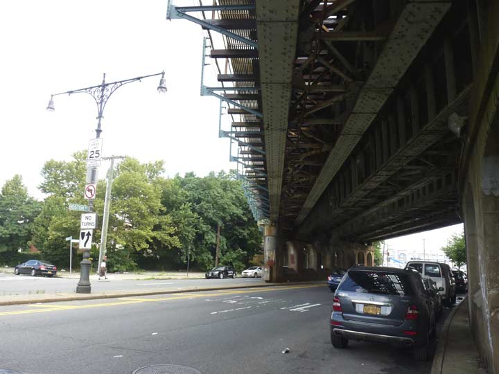
In New York City, the usual practice with building els has been to build them along existing streets, instead of building them on their own rights-of-way, which is generally the practice in places like Chicago. There are exceptions to the rule, such as here in the northeast Bronx, where the Dyre Avenue line is a successor of an actual railroad; parts if the M train Myrtle Avenue line also run on an individual ROW at its eastern end. At times, these ROWs featured trolley lines or surface railroads beneath them, but that doesn’t seem to have been the case here.
Just north of the Baychester station I found this curious curb cut. My sleuthing instincts pointed me to the possibility there was a long-lost street here. However, a number of maps do show a road running on the west side of the NYW&B in these parts — without a name. Possibly, the city wanted to build a road here and indicated that on the planning maps that cartographic companies consult, and got started on the road, but never gave it a name. Only the curb cut exists now to hint at that possibility.
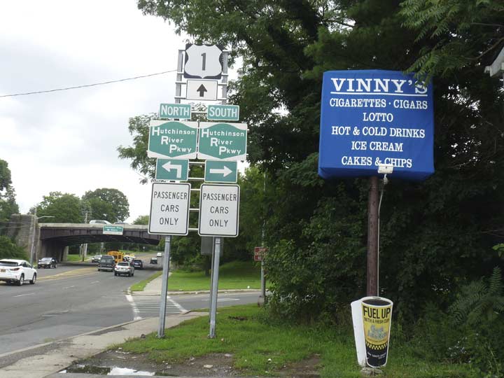
I turned north on Boston Road. I won’t elaborate much on Boston Road here–I’ve previously mentioned that in the stretch north of Bronx Park, it’s part of the colonial-era Boston Post Road and, since the early 20th Century, part of US 1, which runs from Fort Kent, Maine to Key West, Florida. In NYC, streets aren’t necessarily named for where they are, but where they lead; thus, Flushing Avenue runs from downtown Brooklyn to Maspeth, where it meets roads that do go to Flushing.
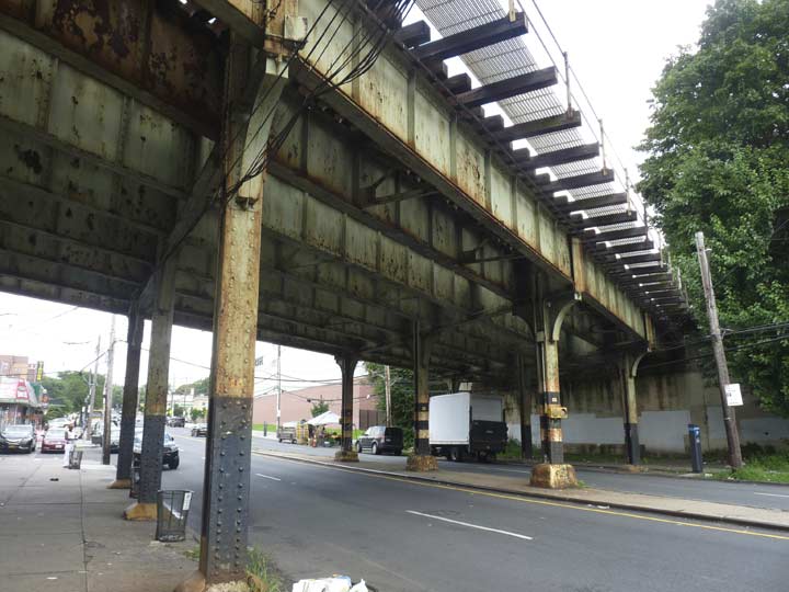
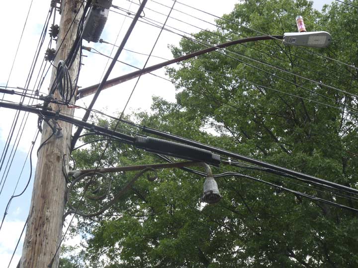
Here Boston Road passes under the NYW&B railroad, now the Dyre Avenue line. In the center median is one of the twin Corvington-style lamps installed in the 1990s. Old-time Corvs, designed in the 1910s, never came in twin versions, but they were produced as part of the modern-day retro versions that have been installed the last few decades. Speaking of illumination…


…the underside of this trestle is replete with now-defunct sconces for illumination. They once likely held crescent moon, radial-wave or gumball incandescent fixtures; in fact, one ancient gumball is still in place. I also included the modern mercury vapor lamp that is the current illumination in the gallery.
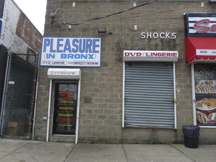
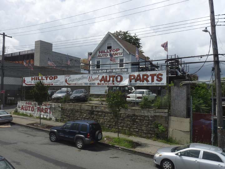
In the 1990s, “adult” businesses were zoned out of Midtown and other prominent areas and may were forced to relocate. Some, like this one, can be found in outlying areas of the city. Boston Road in Eastchester is mostly otherwise given over to car repair joints, junk dealers, and tire shops.


Outcroppings of schist rock are frequent in the northeast Bronx. The street grid was constructed to avoid them (some were dynamited so streets could be put through) but other streets like Rombouts Avenue simply do without sidewalks to get around the boulders. Françoise Rombouts was Belgian by birth and served as NYC mayor from 1679-1680. Back then his name was probably pronounced Ram-BOO, but today, it’s pronounced as spelled. Dozens of streets in the northeast Bronx are named for early NYC mayors.
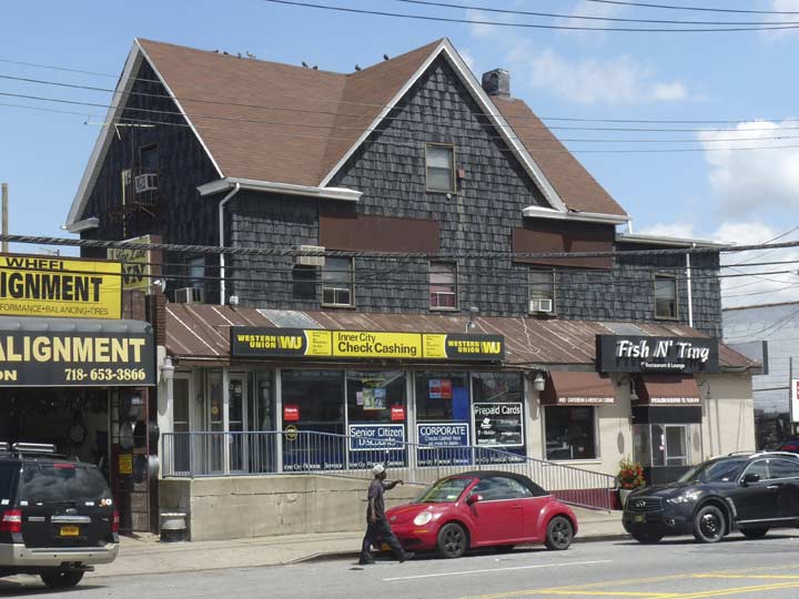
Decades ago, when this stretch of Boston Road was more suburban, or perhaps more rural, this 4-gabled building was probably a farmhouse. These days it serves a number of businesses: wheel alignment, check cashing, and a seafood restaurant.
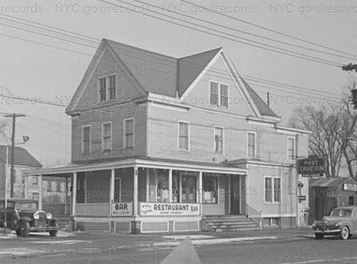
1940s NYC Tax Photo
ForgottenFan Don Gilligan:
“Decades ago (in the 1950’s) the four gabled house was Duffy’s Roadside Tavern owned by a short, bandy legged Irishman named Duffy who capitalized on the popular radio program “Duffy’s Tavern.” It was our local watering hole where we mis-spent many an underage night swilling beer and playing shuffleboard to determine who would pay for the beer. The building was probably never a farmhouse. More likely a 1920s roadhouse.
The Holler family was an old Eastchester family and arguably the last of large landholders in NYC. Their holdings included Hollers Pond, Hollers Ice House, Holler’s Flats (six rental units) and a lot of undeveloped acreage and, of course the Holler Mansion, a large shingle style house that fronted on Boston Road. It was our favorite childhood Trick or Treat stop as the Holler family was generous as befits the “Lords of the Manor.” We grubby urchins were doled a quarter each when we were lucky to get a nickel from our own families. Their property was acquired by NYC in the 1960s and used to build the Boston-Secor Houses.”


Allen Place is a tiny alley off Delavall Avenue south of Boston Road. No commercially available paper map showed it when I was poring over them as a kid; only detailed maps like the Sanborn property atlases or the Belcher Hydes had room for it. The rise of Google Maps and Open Street View allow depiction of even the tiniest routes and so, Allen Place gets its due.
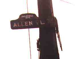 I was tipped off about the presence of a 1910s-era humpbacked blue and white NYC street sign here in 1999, and duly went over to shoot it. My shot wasn’t really satisfactory because of the sun angle. I have to relocate it and rescan. In any case, the sign had been replaced by what you see now shortly after that; its partner Delavall Avenue sign was gone, leaving just a frame.
Mayor Stephen Allen served from 1821-1824; I found his grave at the NYC Marble Cemetery in 2014. Thomas Delavall served three terms as NYC mayor in 1666, 1671 and 1678. He was the second mayor of NYC appointed by the British after their 1664 takeover from the Dutch.
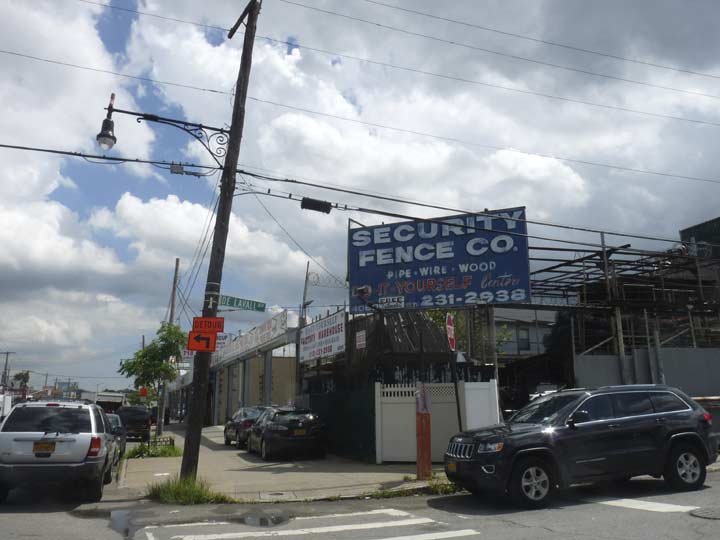


Some of the many industrial concerns found along Boston Road in Eastchester, this one making security fences in a variety of materials. Others have impressive painted signs.
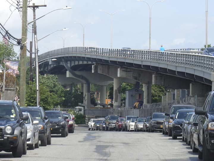


I crossed the Eastchester Bridge, which takes Boston Road over the Hutchinson River, twice on this walk. I consulted my copy of Sharon Reier’s Bridges of New York, published by Dover Books in 1977, which states the bridge is a bascule and opened in 1922; the design seems a bit newer than that to me, so perhaps the bridge was replaced since 1977. I also did not detect a split where a bascule, or drawbridge, would open to admit shipping, so I believe the Eastchester may be a fixed bridge constructed after 1977.


The Hutchinson River and the nearby Hutchinson River Parkway and Hutchinson Avenue are named for the colonial-era Hutchinson family. Pioneer settler Anne Hutchinson’s farm was located just over the river.
William and Anne Hutchinson had espoused religious freedom after arriving in Massachusetts from Anne’s birthplace in Alford, England, but the Puritans had none of it and expelled them. After a brief stay in Rhode Island (Roger Williams’ colony was an early outpost of tolerance) William died and Anne and her family moved to this far-off outpost in what was then rural Westchester. But most of the family, including Anne herself, was killed in a Siwanoy Indian raid in 1643. According to legend, Anne was killed while attempting to hide the crevice of a nearby rock known as Split Rock (more later) by an Indian sachem named Wampage.
For more on the Hutchinson River and its importance to the northeast Bronx, I’lll direct you as usual to the Hidden Waters Blog.
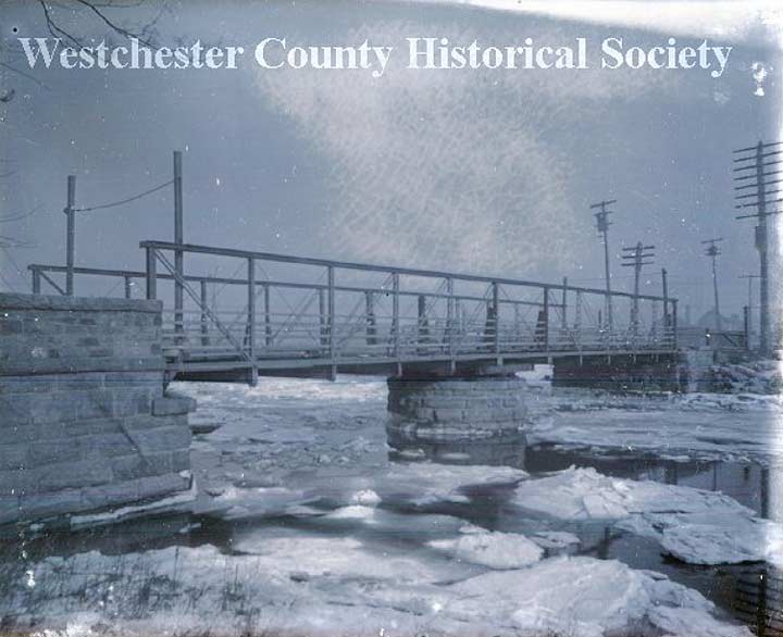
Here’s a 1910 look at an older Eastchester Bridge, carrying Boston Road over an ice-clogged Hutchinson River.


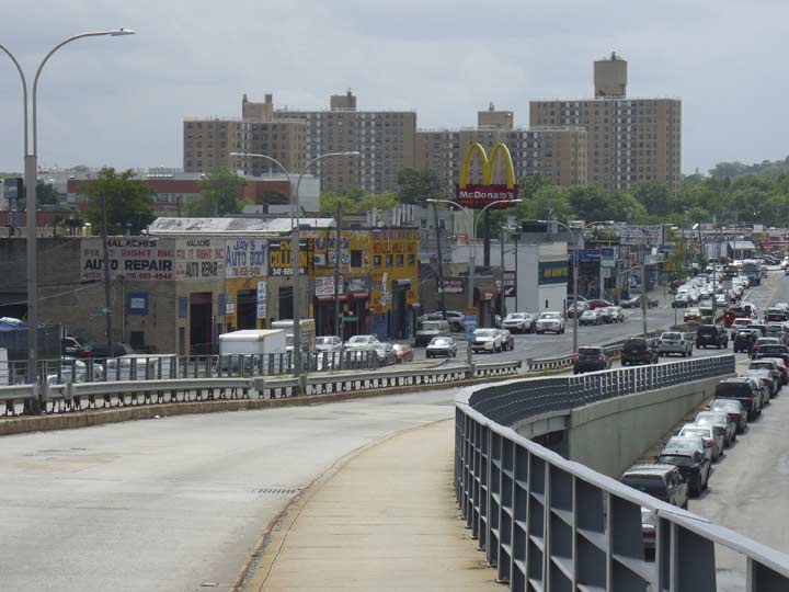
The approaches to the Eastchester Bridge are steep and the bridge rises high over the river. Looking over the south side of the bridge, though, gives you mostly a view of the scrapyards, storage facilities and industrial areas that cluster along Boston Road. The view from the north side of the bridge are a bit more expansive, and I’ll get to those presently.


It’s wrong to say that the Eastchester Bridge crosses over into Westchester County as the Hutchinson River does not form the city line–there is still a small piece of the neighborhood of Eastchester, still in the Bronx, once you get across the river.
One of the side streets in this small slice of a neighborhood is McOwen Avenue (not to be confused with St. Ouen Street, which is also near the undefended border of the Bronx and Mount Vernon in Wakefield, a few miles to the west). Anthony McOwen, an Irish immigrant from Wicklow, was a 19th Century deputy tax commissioner and later served as the Bronx’s first coroner.
I noticed some Manhattan schist, again poking above the ground, on my way down the street.


This house, at the corner of Hollers and Ropes Avenues, was so entrancing to me I took its photo twice. It’s such a suburban scheme–for one thing, there are no sidewalks to be found )surrounding streets do have them) I doubt you could pick 100 people from a NYC sidewalk and have them tell you correctly where Ropes and Hollers Avenues are, and indeed, this was the first time I had been here. Both streets are named for area Bronx families and poperty owners in the 19th Century. The streets in this chunk of Eastchester were laid out in the 1920s.
Here’s an old-style fire alarm indicator lamp stanchion at the same corner. Neither the city nor the FDNY maintain these anymore, but they’ve all been left in place. I estimate there are about 100 such stanchions remaining in NYC–one day when I really have some time to kill, I’ll do a map pinpointing where they all are. The masts could be long like this, or quite short.


Because of the way the city line was surveyed, it cuts across a number of streets, some of which are in Eastchester, others across the border in Pelham Manor. West Street is one of these–it runs from Flint Street in the Bronx to the Boston Post Road — Boston Road gets the “Post” once it’s in Westchester. A trained eye (like mine) can spot which parts are in NYC because of NYC’s typical street sign design and street lighting, such as this Crouse-Hines lamp on a double-masted pole. West Street was so-named apparently because it’s the westernmost street in Pelham manor, though part of it is in Eastchester.
ForgottenFan Alan Cohen: “The neighborhood which you featured here between Pelham Bay Park and Pelham Manor is called Bronx Manor and is an anomaly in New York City. Although it is part and parcel of The Bronx and thus New York City, all of its residences have Pelham Manor postal addresses and are within the Westchester 914 area code. Additionally although they pay city taxes, the City of New York made an agreement with the Pelham School District in 1949, to serve the neighborhood’s students with public education within their schools. This is a situation that exits no where else within the five boroughs and likely never will.”


I explored Good Place, a dead end off West Street, because it’s rather strange. Most of it is in Pelham Manor, but it extends west far enough so that the extreme western end is in the Bronx, and you can tell by the streetlamps. The lamp on the west end is a typical NYC telephone pole finned mast. There are other strange examples of Westchester streets ducking briefly into NYC I’ll talk about soon. Good Place was named for real estate broker Thomas B. Good, who arranged the sale of an incinerator to Pelham Manor in 1935.
This is as good a place to discuss Pelham Manor, the first municipality you enter after crossing over the city line along Boston Road. There are a number of towns and roads in the northeast Bronx and southern Westchester named Pelham.
Englishman Thomas Pell, a physicist, purchased a vast tract of over 9000 acres of land (most of what is now eastern Bronx) from the local Siwanoy Indians in 1654, and established the Manor of Pelham in 1666. Among the Siwanoy sachems who sold the territory is believed to be Wampage, who had killed Ann Hutchinson. About ten years later, Thomas’ nephew John Pell built the first of the three Pelham Manors that have occupied its site on 895 Shore Road in the middle of Pelham Bay Park. Descendants of the Pells occupied the manor houses for nearly 150 years, though a great deal of the property was sold off just before and after the American Revolution. By 1813 the remaining 233 acres was sold out of the Pell-Bartow family (Ann Pell had married John Bartow), but in 1836 John’s grandson Robert reacquired the property and built the mansion in 1842 that is there today. It’s open as a museum, complete with a graveyard that has some truly ancient markers in it.
Pelham Manor is chi-chi, ritzy, and about as suburban as it gets just outside NYC. The average income is over $250K a year, and the private homes are well-cared for, as are their lawns.
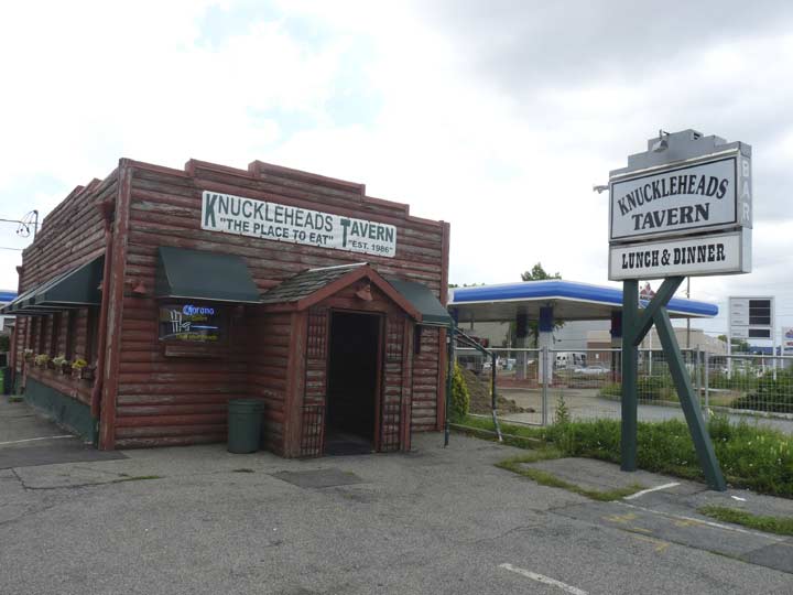
Actually the little piece of Boston Post Road between the borderline and the Hutchinson River Parkway is far from ritzy and that’s where we find the Knuckleheads Tavern, “the place to eat.” Had I had someone along, I would definitely ducked in here.
You can tell a lot about a business by its customers’ loyalty, but few have as many longtime patrons as Pelham Manor’s Knuckleheads Tavern. “Probably sixty percent of our customers have been coming here for twenty-five years,” says owner Lenny Collura. That is, since Knuckleheads opened its doors. “They’re not just customers; they’re friends.” They come for the homey grub specials, the beer, the sports on the 47-inch flat-screen TV, and the camaraderie. “It’s a nice place to bring your family,” Collura says. [Westchester Magazine]
A plethora of signs, all with helpful information.

According to Bronx historian John McNamara, Boston Road was constructed by surveyor John B. Coles in 1794. It is a reroute of the original Boston Post Road, which was started in 1672 as a mail route between Boston and NYC (a 270-mile distance), following a network of Indian trails. The original branched off north of the present Boston Road in the Bronx; its present route is marked by Kingsbridge Road in Mount Vernon and by Bussing Avenue, Barnes Avenue and Gun Hill Road in the northern Bronx. Lewis Morris, an early Bronx honcho (as were many of the Morrises) wanted the Post Road to run through his property; enter John Coles. In fact, early on, that road was known as Coles’ Boston Road. North of what would become the Bronx-Westchester line, the two roads converged and continued north. Further north, the Post Road would separate into more tributaries, each reaching Beantown via a separate route. In those days, what takes a few hours by car now took a few days by horse or coach.
Though the actual “Split Rock” where Anne Hutchinson was killed is not in the immediate vicinity, Split Rock Road is the first cross street encountered on Boston Post Road east of the Hutchinson River Parkway. The actual rock is a bit hard to find: it’s off a service road that connects the Hutchinson River Parkway to the New England Thruway.
On foot or bike, walk along the Split Rock Trail that runs west along Orchard Beach Road from Bartow Circle on Shore Road within Pelham Bay Park and north along the Hutchinson River Parkway deep into Pelham Bay Park, skirting the Split Rock Golf Course. Just below the junction of the Hutch and New England Thruway, cross the service road (gingerly: watch out for auto traffic) into the triangle formed by the service road, the parkway and the expressway. You will see a large rock that looks as if it has been cleft in two by lightning. This is the Split Rock for which the trail and the golf course are named.
Split Rock Road, if followed all the way to its southern end, reaches a short dead end called Park Drive…which is in New York City. I’ll explain why in my entry for Peace Street, below.


I chose to walk on Peace Street instead, which will be apparent in a minute. It’s typical of quiet Pelham Manor streets — handsome dwellings, almost mansions, with well-kept lawns and a tree canopy over the streets. It’s also the only really unusually named street in the area; what treaty does it commemorate?


There is a “village green” of sorts, at the triangle formed by Hudson Street and Washington Avenue where they meet Peace. The historic plaque celebrates the Battle of Pelham, or the Battle of Pell’s Point, which took place nearby, about a mile south in what is now Pelham Bay Park.
There’s a large boulder on the side of Orchard Beach Road, midway between Bartow Circle at Shore Road and Park Drive near the beach. It looks as if it was deposited by the retreating glaciers at the close of the last Ice Age.
As much as can be determined, it was used as an Indian lookout; the area had an Indian trail long before Shore Road appeared. The rock’s main claim to fame, though, was that on this spot during the Revolutionary War in October 1776, Colonel John Glover (1732-1797) and his 14th Continental Regiment, largely made up of militia from Marblehead, Mass. engaged the British during the Battle of Pell’s Point and took heavy casualties, allowing a retreating General Washington to escape. The Redcoats had planned to cut off the patriots at Rodman’s Neck, a nearby peninsula jutting into Eastchester Bay. Glover’s men, who numbered just 750, had to deal with as many as 4000 British and Hessians. Glover placed his regiments behind stone walls lining the Pelham Road. Glover’s brigades held their positions as long as they could until the enemy advanced, and then retreated to join the next regiment’s position. Thus the enemy was forced to engage more and more patriots as the battle unfolded. Washington’s forces were able to move north to White Plains due to Glover’s delaying strategy. Glover’s regiment took 12 casualties while claiming nearly 1000 from the Crown. His Marbleheaders later assisted Washington in his famed Delaware crossing.
Glover’s Rock is marked by a tablet erected in 1960 by the Bronx Historical Society, replacing an earlier one placed in 1901 by the Daughters of the American Revolution.


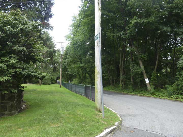
Peace Street ends quietly, at a tree-shaded road that marks the boundary of Pelham Bay Park. But what’s this? New York City street signs, and streetlamp styles? Yes indeed, this is a continuous section of Park Drive, which is in New York City while every other street that feeds traffic to it is in Pelham Manor. It’s one of those geographical quirks that make urban exploration, if not interesting, at least engrossingly time-consuming. In this neck of the woods, in order to get to Park Drive in the Bronx…you have to go through Pelham Manor!
Originally, the northern edge of Pelham Bay Park was the Westchester/NYC border, but in 1892, legislation was passed that shifted the city line a few yards to the north. That means that when Park Drive was constructed here it fell within the Bronx and any residence along it pays NY City tax, as well as conforms to other legal details. The southern extremities of other Pelham manor streets are also in the Bronx, as I’ll demonstrate a bit later.
Why was the line shifted? At this late date, there are a number of theories. One was that the City wished to make sure that some islands in Eastchester Bay such as Hog Island were within the city limits. In any case, it makes for a very unusual occurrence since some streets are within NYC but unattainable except by leaving the city. They are taxed as NYC residences. Con Edison provides power for both NYC and Westchester County (were this Long Island, LIPA provides power for Nassau and Suffolk).
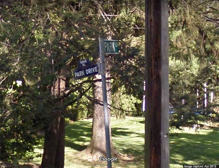
Now for that wild goose. Notice on this Street View shot from 2012, there’s an oldstyle humpback Manhattan.Bronx street sign affixed to a relatively new pole at Park Drive and Ridge Place. As explained above, there’s just a stub of Ridge Place actually in the Bronx, as most of it is in Pelham Manor. How this old veteran had gotten to this spot is hard to say. Either it had been there all the time, or a local collector thought it would be good to put it out in the open where the Department of Transportation could find it and replace it. Predictably, the sign has disappeared (it should have faced Park Drive in any case) and Street View has a newer shot of the corner from the summer of 2018, sans sign.
My photograph shows that the DOT hasn’t replaced it, so I imagine a fellow collector prised it off. I would have left it in place — I like my landmarks in situ. There signs fetch a pretty penny on EBay. I bought one at a flea market in 1988 for $50.


This odd Bronx route ends at Edgemere Street just short of the New England Thruway. Some maps used to show it continuing east of the Thruway, but it that ever was the case, it isn’t anymore. But wait. We’re not quite done with our run of Pelham Manor streets seeping into the Bronx.
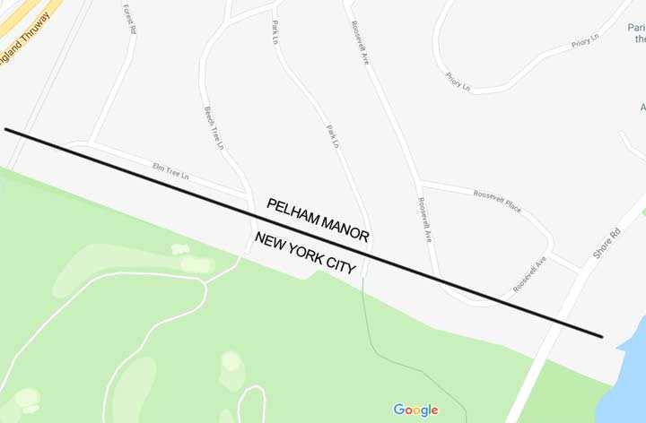
Here’s a Google map of Pelham Manor east of the Thruway and just north of Pelham Bay Park. I have drawn in the NYC city line’s approximate locations. See what’s happening? Two streets–Park Lane and Beech Tree Inn–just barely make it into New York City before they dead end, while Roosevelt Avenue, which is on an arc, has the lower limb of the arc within NYC. I did not have time to check out these occurrences on foot, but I did check with Street View…
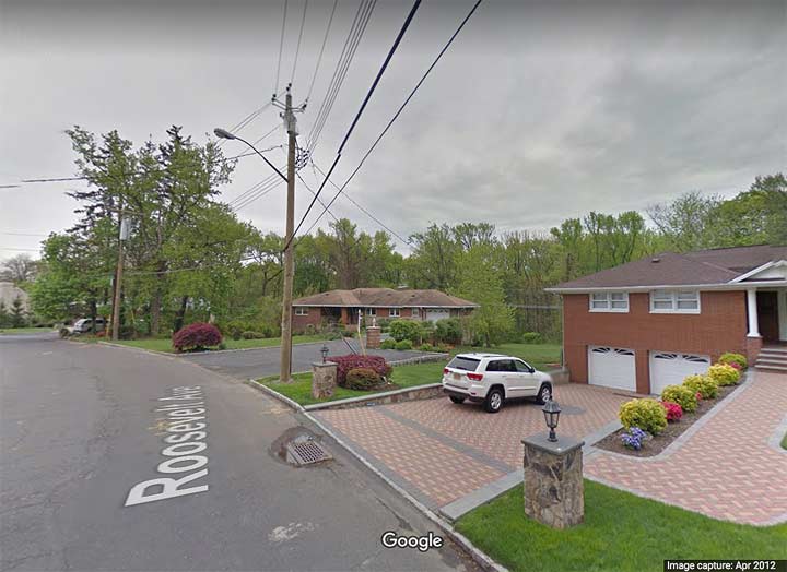
…and the lampposts, once again, give NYC away. NYC DOT-style finned telephone pole masts can be found on the lowest limb of Roosevelt Avenue, and they can also be found at the end of Park Lane. Street View did not let me zoom in enough to see if the houses are numbered differently, so if they are, let me know in Comments.
This is one of NYC’s quirkiest aspects, and it’s no wonder I pronounce these hinterlands as …”Borderline Crazy!”
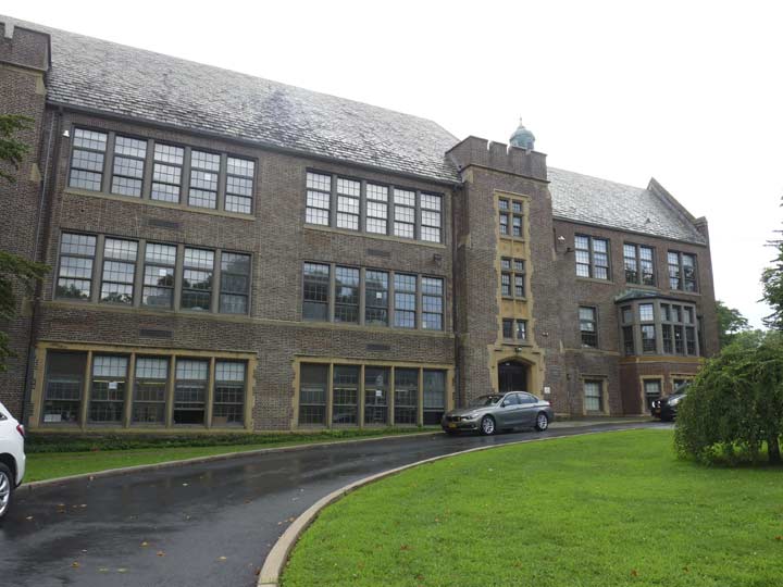


Before retreating from the tranquility of Pelham Manor, here’s a look at a few more Pelham Manor palaces, including the handsome Prospect Hill School.


While I struck out trying to find that ancient NYC humpback street sign, I noticed that there are still some older Pelham Manor street signs here and there. It looks like the village hasn’t maintained them in years, though, since some are illegible or are missing letters.


Boston Post Road is a quiet two-lane route in Pelham Manor, but the Hutchinson River Parkway junction amps up its traffic considerably.


Crossing the Eastchester Bridge again on the north side, it’s another sea of scrap parts and industry along the Hutchinson River. But there’s gold in that thar junk.
Another possibly repurposed farmhouse along Boston Road.
Descending the Eastchester Bridge looking west toward the Boston-Secor Houses.


On the left, Conner Street east of Boston Road; on the right, Conner Street west of Boston Road.
One of 1960s TV’s “The Prisoner”’s more intriguing episodes is The Schizoid Man, in which The Village attempts to confuse Number Six by creating his doppelganger, hoping he will be so disoriented that he will quickly spill the required information. Number Six is able to dispose of his double and nearly escape the Village.
Eastchester has a schizoid street. Its name is Conner Street, named for a former small settlement known as Connersville after a local landowner. There was an amusement park known as Eagle Grove on the Boston Post Road in the area in the 1870s. If there weren’t any street signs, you’d have a hard time convincing anyone that this is the same street on either side of Boston Road. East of Boston Road, Conner becomes a six-lane behemoth, ferrying traffic to the very busy New England Thruway, but to Boston Road’s west, Conner becomes a country lane, with no sidewalks and recent blacktopping. Provost Avenue, which has some weird twists and turns of its own, becomes Eastchester’s main truck route to the city line and Mount Vernon. How this arrangement came about, who can tell, but few NYC streets utterly change character so abruptly.
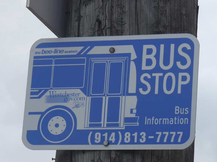
I like the Bee Line bus stop signs better than the MTA’s bus stop signs…


Now heading for the Dyre Avenue station, I turned north on Secor Avenue for some choice elevated train infrastructure at the north end of the Dyre Avenue Line. There are also a couple of brown New Gumball lampposts that have been used under eleveated trains for nearly 30 years, but are increasingly getting replaced by LED lamps now. I’ll bet since that these are in an outlying area, they’ll survive for some time to come.
The Secor family were Huguenot settlers in the colonial era; they also spelled their name Secord or Sicard.


Dyre Avenue is the Ultima Thule of New York subway terminals. As stated earlier it wasn’t supposed to be part of the subway at all, but was “captured” by the Transit Authority in 1940. And, until fairly recent times, the Dyre Avenue was a breed unto itself. Like Staten Island Railway there were no turnstiles in the stations — you handed the fare to a conductor when (s)he came around, and you received a transfer ticket which you would use upon boarding a connecting train at 180th Street. The rise of the Metrocard doomed that arrangement.
The MTA regularly paints the elevated here, unlike other spots along the line. There’s a no longer functioning Crescent Moon underpass lamp that it’s too much trouble to remove.
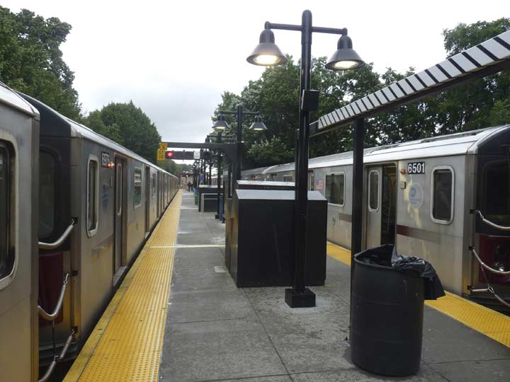
The MTA installed retro-style hooded platform lamps to replace some 1950s-era iron poles bearing incandescent lamps in the early 2010s.
Please help contribute to a new Forgotten NY website
Check out the ForgottenBook, take a look at the gift shop, and as always, “comment…as you see fit.”
10/22/18
25 comments
There are more of these Bronx homes “landlocked” by Pelham west of I-95. I have friends that own one and they pay about 1/4 less in taxes than their neighbors across the street in Pelham and can send their children to Pelham Public Schools. NYC Sanitations picks up their garbage and plows the street in the winter. City politicians love this area as they can maintain NYC Residency but live in Westchester. Another interesting group of private homes is at the end of Shore Road where Bronx and Pelham meet. I always though that these homes were cut off when they built I-95 through Pelham Bay Park. Also, was the Co-Op City land a cucumber farm at one point.
Great job thanks for the extremely interesting information!
The lower reaches of the Hutchinson River is a navigable waterway, hence the high bridge clearances. Tugboats and barges use it. In fact, as I’m writing this the tug Eastern Dawn is in the river, courtesy of the worldwide ship tracker Marinetraffic.com.
One of the best articles I have read on the part of the Bronx that I grew up in. Lived on Allen Plcce which was also called Colasurdo Alley because my family..the Colasirdos..lived. In the houses that had been built by our grandmother and grandfather..one aunt lived on Rombouts Ave. Many friends lived on Dellaval and surrounding streets. Still keep in touch with old friends. It was a great place to grow up in. Today it is terrible.
The neighborhood which you featured here between Pelham Bay Park and Pelham Manor is called Bronx Manor and is an anomaly in New York City. Although it is part and parcel of The Bronx and thus New York City, all of its residences have Pelham Manor postal addresses and are within the Westchester 914 area code. Additionally although they pay city taxes, the City of New York made an agreement with the Pelham School District in 1949, to serve the neighborhood’s students with public education within their schools. This is a situation that exits no where else within the five boroughs and likely never will.
General John Glover’s more famous contribution to the colonial cause was saving the Continental Army after the Battle of Long Island by ferrying them across the East River ot safety, they were involved in both Long Island and crossing the Delaware because of one very good reason: Marblehead is a fishing port and all of the Marblehead men knew how to sail and handle boats. They saved General Washington twice and if not for their enlistments running out may have been some of the most crucial soldiers in the Continental Army that Spring and Summer.
“Rom-Boe-tz”, as in ” watercraft belonging to ‘da mare’ of Chicago.” It’s a Dutch name, and that’s how a person from the Netherlands would say it. Now, I’m sure that there were French-speaking Belgians (called “Walloons”) or else they were Huguenots– as in the avenue in New Rochelle (“Nurra Shell”) where many settled– who had fled France, who might have pronounced it “Rom-boo,” but I’m fairly sure that Minier Rombouts pronounced his own name “Rom Boats.”
Decades ago (in the 1950’s) the four gabled house was Duffy’s Roadside Tavern owned by a short, bandy legged Irishman named Duffy who capitalized on the popular radio program “Duffy’s Tavern.” It was our local watering hole where we mis-spent many an underage night swilling beer and playing shuffleboard to determine who would pay for the beer. The building was probably never a farmhouse. More likely a 1920s roadhouse.
The Holler family was an old Eastchester family and arguably the last of large landholders in NYC. Their holdings included Hollers Pond, Hollers Ice House, Holler’s Flats (six rental units) and a lot of undeveloped acerage and, of course the Holler Mansion a large shingle style house that fronted on Boston Road. It was our favorite childhood Trick or Treat stop as the Holler family was generous as befits the “Lords of the Manor.” We grubby urchins were doled A quarter each when we were lucky to get a nickel from our own families. Their property was acquired by NYC in the 1960s and used to build the Boston-Secor Houses.
Thanks for that info Don, I inserted it in the piece.
Hello… an old neighbor shared this with me.. an excellent read…
I grew up in the home Located on the corner of Ropes and Hollers Avenue in the Bronx. Built by my parents, Thomas Robert Hurley of the Bronx and his wife Anna Regina Monahan Hurley of Brooklyn. Though the appearance is quite different from the home I grew up in with the white picket fence, and the rose trellises, and spectacular rock gardens, the memories of that neighborhood, are still as fresh as the flowers that once grew in its gardens. We were a neighborhood like no other, sheltered by the creek, Boston Post Road, Hutchinson River Parkway, and the New England Thruway, few knew of our isolated little paradise. We have all stayed connected throughout the years, a neighborhood, and yet a family… thank you so much for sharing the home that my parents put their blood sweat and tears into, so they could have a home outside of the hustle and bustle of the city they knew so very well. I have many a memory to share, as well as my sister, 15 years my elder, who married a man, not far from split rock in Pelham Manor.
Though we have all moved away, my son being the last to move from our grandparents home, just a few short years ago. We all have stories… I am actually dating a boy from McOwen Avenue I dated 40 years ago… thank you Facebook… for keeping our memories alive and our friendships forever…
Interesting to note the bee-line system sign.
When I was growing up (50s/60s) there was a bus line that operated out of the Jamaica bus terminal that went to Nassau county. It was a bee-line.
Wonder if it was the same company?
Back in the 50’s and 60’s thé eastchester bridge crossing the Hutchinson river used to be a drawbridge. There were two areas to cross. The one nearest the Savation Army and St. Paul’s Church in Mount Vernon was a two lane bridge with a big weight on top to act as a counterbalance. The weight was cement in the form of a big upright rectangle. The bridge itself was metal. We would use this route to travel from White Plains road and E. 238 th street in Wakefield north Bronx to go towards Orchard Beach. The bridge had no elevation so it was a long wait when a barge would glide past on the river. Later in the 70’s or earlier, it was replaced with a high span.
The elevated bridge built in the late 70s, forced the “Famous” Wedge Inn to close its doors as the bridge leveled to the Post Rd. about 20′ past the front door of the Inn. IMHO the best sandwich and soda a buck could buy in that part of the Bronx
any photos of Wedge Inn before and after the bridge Mike ??
Can You shows us what lustre st in eastchester looks like now.
The “mercury vapor” you meontioned on this page, the flood light pic is actually an High Pressure Sodium. aA clear mercury vapor would inluminate greenish hue while a high pressure sodium would glow orange. It also has a NEMA tag that’s yellow and 15. 15 means 150 watt and yellow is High Pressure Sodium. If it was mercury vapor, the tag would be blue instead of yellow.
How could you possibly not include the famous “Wedge Inn” in Pehlam Manor just across the bridge . One of the greatest steak pizzialoa wedge sandwiches ever made , and the worlds hottest cherry peppers in bowls on the counter . Cold beer and soda LOVED that place .
As a child back in the early ’70s I do remember crossing the Eastchester Bridge (as it currently is) when my mother would take me to go to EJ Korvettes at the shopping center. Based on that, I’m guessing that the bridge was constructed sometime in the ’60s to replace the older bridge
The Connor Street/Provost Avenue intersection with Boston Rd. had a big Orange and White (Wetson’s ?) restaurant with its big circles on the Northwest corner that thereafter, kept its building as a plumbing or auto supply store (hard to remember). Next door was the Pine Tavern. However, that intersection serves as a much more important landmark. NY Route 22 starts there, and will take you all the way to the Canadian border in a town called Mooers, NY. That was a major N-S route before there were Interstates!
Grew up in Pelham Manor between 1932 and 1944. Lived on Windsor Place which ran into the Bronx. NYC 45th Precinct Police Cars used to drive down Windsor Pl. to reace the one street in the Bronx. We used to use a bridal path to get to Split Rock where we played Cowboys and Indians and were well aware of the Anne Hutchinson story. Went to Prospect Hill Elementary School. My mother worked for the Black family of Black, Star, and Frost who lived on 4611 Boston Post Road and did much in the early days of Pelham Manor. She was 17 at that time, the days of many servants who lived in the mansion. I believe Aaron Burr owned a house on the Boston Post Rd. just East of the Hutchinson River.
Great read. You have my house pictured here–a few shots after the Prospect Hill pic.
When you went over the old draw bridge going south, just before the foot of the bridge, on the right was House of Triumph Motorcycles owned by Whitey Loud. I spent a lot of time in that shop as a kid, wiping down motorcycles and running errands just to be near the bikes. Right out of high school I got a Triumph Bonneville before I ever got my first car. LOL On the other end of the bridge, on the other side of the Post Road, was the Wedge Inn. Good God. We’ll never
get those days back again.
The Bee LIne buses in Westchester are no relation to the former company in Queens and Nassau. The Bee Line in existence now are operated by either Liberty Transit Lines or PTLA Enterprises. Bee Line is not a company- it is a branding of the Westchester County Department of Transporation. The former Bee LIne bus went out of business in the 1960’s with some routes taken over by NYC Transit Authority and some taken over by Metropolitan Suburban Bus Authority. MSBA is now defunct and the route are run by the Nassau NICE bus.
Hey Kevin, YOU said that you could only get a few people who knew where Ropes Avenue is. I only know, because as a bus operator with the MTA, I worked the Bx16 route. It’s northern terminus is at Ropes Avenue
This brought back memories of my early childhood, being partly raised by an aunt & uncle who lived on Delavall Ave. I especially remember Duffy’s Tavern, where my Grandfather would place me on a bar stool to drink a soda.