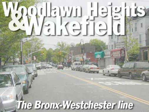
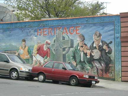
There’s a little corner of the Emerald Island in the far flung northern reaches of the Bronx, past the rolling hills of Woodlawn Cemetery, the duffers in Mosholu and Van Cortlandt Golf Courses and the roaring traffic of the Deegan. It’s in the triangle known as Woodlawn Heights, just south of Yonkers.
Woodlawn Heights’ main drag shares a name with a small town about 20 miles to the north. Katonah Avenue, and the town to the north, are named for an Indian word meaning “Great Mountain.” The area figured heavily in the Revolution: in August 1778, 17 Mohican Indians led by Daniel Nimham, fighting on the side of the patriots, were massacred after their defeat by Colonel Simcoe and his Queens Rangers, fighting for the Crown; the Indians are commemorated in nearby Van Cortlandt Park.
Woodlawn Heights is wedged between Woodlawn Cemetery on the south, Van Cortlandt Park on the west, the Bronx River parkway on the east and the city of Yonkers on the north. Van Cortlandt Park East becomes Kimball Avenue (above) after it reaches Yonkers, and the “border” is marked by a clever civic promotional sign acknowledging its nearby neighbor (right). Note the old Westinghouse OV25 Silverliner “Cheerful” luminaires: Yonkers has retained much of its older street lighting.
As you go north, Kimball Avenue’s first main intersection is with McLean Avenue and on the southeast corner, you’ll find a couple of examples of signage from the Swingin’ Sixties. The classic Carvel neon sign from the Tom Carvel era with the giant ice cream cone, and the big, yellow-lettered Sunoco sign with the arrow. Roadside signs have to be big and bold to vie for speeding autos’ attention. A more modern Carvel sign appears at the bottom. I’ve never understood what an ‘ice cream bakery’ is, however.
The Leprechaun and the Dragon. America’s blender has a way of distilling centuries of civilization into an easily palatable form. Woodlawn Heights’ overwhelming Irishness extends for a brief distance into Yonkers.
McLean Avenue is the main drag of southern Yonkers. It curves, twists and turns for miles between Broadway (Route 9) in the west until it finally meets the city line in Wakefield, where it has an uneasy relationship with The Bronx. It straddles the border between Vireo Avenue and the Bronx River Parkway, where it changes its name to East 240th Street. Only one New York city street sign, just west of Vireo, identifies it as McLean. Here, East 240th turns southwest into New York City and McLean can become a full-fledged Yonkersite.
East of the Bronx River Parkway, the road has yet another name: Nereid Avenue (the correct pronunciation is NEER-ee-id: the MTA gets it wrong on its taped station announcements). A nereid is a minor Greek water nymph; while some Bronxites believe the street was named for an N.E. Reid, it was actually named for a local fire company. Since firehouses and pumping wagons used a lot of water, they all had water-associated names, like Oceanus, Neptune, etc. This is the only street that recollects the old Bronx fire companies. Compare Coney Island’s numerous “water” names like Surf, Brightwater, Seabreeze et al. By the way, nereids had two legs: only the mermaids and mermen, which were not in Greek myths, had tails. There were the occasional mermen like Glaucus, but even the Sirens were birdwomen.
The zigzag City Line. At the Bronx River Parkway and Nereid Avenue, the City Line separating The Bronx from Yonkers turns north along the Bronx River for a few blocks. Unusually, it twists and turns so much that the Bronx River enters and leaves The Bronx four times before it finally enters Yonkers for good!
The City Line is merely following the path the Bronx River used to take; a few decades ago, the river was straightened, but the map was never redrawn.
A similar situation caused a small piece of New York County (Manhattan) to remain on what became the mainland when the Harlem Ship Canal was filled. What is today Marble Hill used to be the northern tip of Manhattan Island, but it became part of the mainland. Nevertheless, after doing so, it retained its Manhattan identity.
Map©1999 Hagstrom Inc.
Another quirk of geography has left a few Bronx streets completely inaccessible from the rest of The Bronx. At the top of the above map, notice Baldwin and Abbott Streets. To reach them, you have to enter Mount Vernon, following Beach Street, turning west and crossing the New Haven Line railroad bridge along South Street, following MacQuesten Parkway north again, and turning west at Bradley Street. You re-enter the Bronx at Baldwin Street.
The South Street railroad bridge: gateway to The Bronx
Two views of Baldwin Street, caught between one city and the next. To the east is Mount Vernon, and to the west is Yonkers. However, only one street connects it to Mt. Vernon and two branches of the Metro-North/Amtrak railroad cut it off further. It’s as much the Bronx as the Grand Concourse is, though.
A mysterious (to me at least) set of railroad tracks runs along Baldwin Street. Possibly, they connected the nearby main branch and took freight trains in to make deliveries to the industries lining Baldwin Street. The tracks end at Baldwin and Bradley Streets.
Bradley Street is the only east-west street in this lonely Bronx outpost. It runs from MacQuesten Parkway to the tracks. North of here, Baldwin Street becomes the western section of MacQuesten.
Maybe I do need bifocals. When I first saw it, I thought this ad said, “Ground meat taste in a pooch.” Actually, if your dog eats Pedigree I suppose the ground meat taste will wind up in your pooch. The ad was mounted on the northern edge of the White Plains Road line of the #2 IRT subway. White Plains Road, like Katonah Avenue and Bayside Avenue and Flushing Avenue in Queens never quite reaches the town it’s named for. Once it reaches Mount Vernon just across the Bronx border, it becomes the rather unimaginative West 1st Street and, to be honest, it connects to a network of roads that will get you to White Plains eventually. Mount Vernon’s trolleyed past is in evidence just across the border (below).
Oddly, there are no Bronx streets named for Mount Vernon or Yonkers; you might expect there to be, since they border The Bronx to the north. Ah, but one short Bronx street does honor Mount Vernon: Nuvern Avenue straddles the border in Wakefield and was so named for New York and Mount Vernon.
Just east of White Plains Road along E. 241st Street you will find a vast complex of railroad yards serving the el. For many editions, Hagstrom listed a Bissel Avenue along the southern end of the yard, and then mysteriously removed it. Now, it’s showing up again! The mystery was too delicious for Forgotten NY to ignore. What did I find?
map ©1999 Hagstrom Inc.
Walking west from Baychester Avenue I did indeed find a road remnant leading off into the weeds along the south wall of the railyard.
It turns out that the roadbed of Bissel Avenue, for most of its length, is now occupied by a handsome community garden. Throughout the city, community gardens are popping up in places the city has no use for…yet.
“Bissel” has nothing to do with vacuum cleaners. It honors George Bissel, a noted 19th-century sculptor.
Do it on Mundy. The northeast corner of Wakefield boasts a street that, due to its twisting nature, has a split personality. Going southeast, as it enters The Bronx at Cranford Avenue, Mt. Vernon’s South 11th Avenue becomes Mundy Lane, and, with the Bronx/Mount Vernon dividing line occupying the central yellow stripe, it meanders south past the Mount Saint Michael School to the Pitman Avenue (Bronx)/Sandford Blvd. (Mt. Vernon) junction, after which the Bronx side becomes Seton Avenue and the Mount Vernon side remains Mundy Lane. South of the next cross street, Bussing Avenue/Kingsbridge Road, it’s Seton Avenue on both the Bronx and Mt. Vernon sides. After Edenwald Avenue, Seton is all Bronx. Got it?
Mundy Lane curves along the Mount St Michael School with the school on the Bronx side.
South of Pitman Avenue, Mundy Lane/Seton Avenue runs southeast. New York City has paved the Seton Avenue side, while leaving Mundy Lane, in Mount Vernon, alone.
Mount Vernon’s fire alarm marker lights bear a strong resemblance to the orange globes NYC used to use (they were changed to cylinders starting in the 1950s). NYC never had these “admiral hat” type luminaires, but instead used similar crescent moons.
7/27/03


