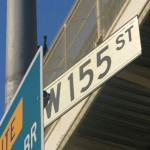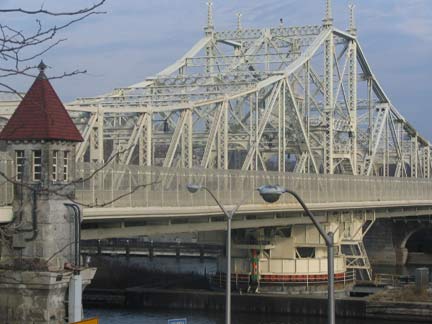


West 155th begins at the Macombs Dam Bridge, where Adam Clayton Powell Blvd. (7th Avenue) and Macombs Place meet at the Harlem River. An old esplanade overlooking the river affords an excellent view of Yankee Stadium, built in 1923 (and replaced by a new version in 2009).
The Macombs Dam Bridge was built in 1895, replacing a couple of earlier spans, and has been given a thorough remake of late, including a very light buff paint job.

At Powell Blvd. and West 153rd Street were a few 90-year-old cast-iron lampposts. We will see this style again at the other end of West 155th.
These ancient posts were replaced by new, different versions in 2012.

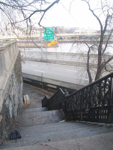
In the West 150s, Manhattan is divided in two by a deep valley, with higher land on the western end. Most of the streets in this area are separated byJackie Robinson Park, which runs along the escarpment, bordered by Edgecombe Avenue (“combe” is derived from an Anglo-Saxon word meaning “hill”). The 155th Street Viaduct spans the valley, with these little-used staircases leading down to street level.
155th Street Viaduct, with the Polo Grounds Houses in the background
155th Street Viaduct, from the Macombs Dam Bridge
This 415-foot long viaduct, originally built for carriage traffic, was completed in 1895, the same year as Macombs Dam Bridge; engineer Alfred P. Boller handled both projects. The staircase railings were originally designed by Hecla Iron Works, which would also design the exit and entrance kiosks for the IRT Subway in 1904. They were restored when the viaduct was repaired in the early 2000s.
Frederick Douglass Blvd. (8th Avenue). The old 9th Avenue Elevated ran under the viaduct on its way to a Harlem River crossing before descending into a tunnel under a high Bronx hill. The construction of the viaduct was a lucky stroke for el travelers in the neighborhood, who, if they lived atop the hill, had to descend from the el and then walk up the equivalent of eight stories! Staircases connected the el to the viaduct when it was built.
A brief section of West 155th between Powell Blvd. and Bradhurst Avenue was built directly under the viaduct, and, like other parts of town under bridges, strange and outmoded forms of street lighting can persist, like this curved-mast lamppost from about 1950. We also find a rare yellow Manhattan street sign, in the borough color-coded system that was the rule between 1964 and 1984, at Douglass and West 155th.
Just west of Bradhurst, West 155th dead-ends at a brick wall abutting some pure Manhattan schist. A steep staircase conveys pedestrians up to the viaduct. If you walked up these stairs every day, there would be no further need for Trimspa, Lucille Roberts or Jack LaLanne.
The viaduct continues west to Maher Circle, at Edgecombe Avenue and the Harlem River Driveway. We are in the former town of Carmansville, one of Manhattan’s small 19th-century towns, this one named for a landowner, Richard Carman, who moved here in the 1840s after making his fortune rebuilding lower Manhattan following the Great Fire of 1835.
Harlem River Driveway denotes a roadway connecting the Viaduct with Harlem River Drive, running along its namesake river. This section is actually the oldest part of the Drive, and got its start as the Harlem River Speedway, opening to horse-drawn carriages in 1898. The Speedway obtained a reputation as a leisure area where aristocrats could show off their horses and livery. It was also a prime viewing area for boat races. In 1922 it was paved and became a vehicular road, and after 1940, Robert Moses turned it into an approach road for his new pedal-to-the-metal Harlem River Drive.
Well, all of the above are true. The highly unusual Hooper Fountain at Maher Circle, West 155th and Edgecombe Avenue and St. Nicholas Place was a gift from civil engineer/newspaperman/entrepreneur John Hooper. In his will, made public upon his death in 1889, he appropriated funds for the construction of two public fountains that had to include horse troughs as well as drinking fountains. Both fountains were built in 1894: the one here, designed by George Martin Huss at Maher Circle and another in Brooklyn at Flatbush and 6th Avenues in Park Slope that disappeared long ago.
The unusual design features a trough topped by an Ionic column with a human-scale drinking fountain appended, while the column is topped by a spherical lantern topped by a weathervane.
After motorized traffic began to overtake equine in the early 1920s the trough became an anachronism and there were efforts made to have it removed to a bridle path. But here it remained, decade after decade with no upkeep and gradually deteriorating. Vandals finished it off in 1981. However, it was renovated, brick by brick, and restored to its old spot in the mid-1990s.
A walk north up Edgecombe Avenue from West 155th and a flat, woodsy area near a playground comes into view. Walk over the Manhattan schist rock that pokes through the dirt and look down into the valley. This is Coogan’s Bluff, and it formerly overlooked the Polo Grounds, the stadium where the New York Giants played for over 5 decades. Here, in 1951, Bobby Thomson hit the “shot heard round the world” off a stunned Ralph Branca to complete one of the greatest comebacks in baseball history (perhaps surpassed only by the 1978 Yankees, who overtook the Boston Red Sox from 14 games back, or by those same Sox, who upended the Yankees from a 3-game deficit in the AL Championship Series in 2004). Yankee Stadium and the Macombs Dam Bridge can be seen between the towers of the Polo Grounds Houses, which replaced the ballpark in the early Sixties after the Amazing Mets moved to Shea Stadium after the 1963 season.
The Coogan in Coogan’s Bluff was James Coogan, Manhattan Borough President, who sold the land to New York Giants owner John T. Brush, who moved the Giants to the second Polo Grounds in 1891. (The first Polo Grounds was on East 111th between 5th and 6th (Lenox) Avenues and yes, it was originally a polo field. The third Polo Grounds was built in 1911 after the second one burned down. The Giants shared the Polo Grounds with the New York Yankees for a few years until Yankee Stadium was built in 1923.
Clint Eastwood starred in a Manhattan-set picture, Coogan’s Bluff, in which he played an Arizona lawman seeking a fugitive. The conceit was used in the long-running TV show McCloud, starring Dennis Weaver.
Does any part of the old Polo Grounds remain?
Heh. Would I ask if it didn’t? North of the playground adjoining Coogan’s Bluff, descend (carefully!) This blocked-off, rusted staircase. It once enabled fans coming from the Polo Grounds to walk up to Edgecombe Avenue. You’ll see the inscription on the landing. Photo right: Mark Feinman.
The Brush Staircase was undergoing restoration in 2012.
West 157th Street is erroneously shown on maps as extending through to Edgecombe Avenue. In fact it exists only as the Bushman Steps. I’ve found no explanation for this name anywhere. Was it named for the Bushmen of the Kalahari? Francis X. Bushman, star of the silent screen? Or someone else?
The Bushman Steps connect to West 157th Street, and the St. Nicholas Avenue. Following it south to return to West 155th, we see some handsome attached brownstones as well as the aptly-named Cliffcrest Apartments; units with an eastern view see the Polo Grounds Houses and Coogan’s Bluff.
I couldn’t resist walking north along Amsterdam after having spotted this ghost of a pawnbroker’s. Pressing a little further north, I spotted this decrepit, collapsing detached house on West 157th. It’s one of Manhattan’s last detached homes and probably has a date with the bulldozer soon. The boxed “X” indicates unsafe conditions. This was probably a doctor’s or attorney’s mansion at one time.
I was surprised to see Prince Hall‘s name here on West 155th near Amsterdam. I had seen it before…at his gravesite in Copp’s Hill Cemetery in Boston. Hall (1735-1807), likely a native of Barbados, was the founder of black Masonry in 1775.
North Presbyterian Church, west of Amsterdam Avenue, unfairly overshadowed by…
…the Episcopal Church of the Intercession in Trinity Cemetery. The original Trinity Cemetery expanded north to beyond the northern boundary of the city, deemed to be West 155th Street, in the mid-1800s. This part of Trinity was originally part of naturalist John James Audubon‘s farm; he is buried in the cemetery’s rolling hills (his grave can be recognized by the tall Celtic cross) along with Clement Clarke Moore. Carolers serenade the “A Visit From St. Nicholas” author on Christmas Eve.
The church, a NYC landmark, was constructed in 1914 by Bertram Goodhue, who was memorialized in the church by an inscription after his death in 1929.
Trinity Cemetery preserves hills that were flattened elsewhere on the island.
Audubon Terrace, on land formerly held by John James Audubon, is an underpublicized mixture of Beaux Arts and American Renaissance architecture, and is home to Boricua College, the Hispanic Society of America, the American Academy and Institute of Arts and Letters, and formerly, the home of the Museum of the American Indian, which has relocated to the Custom House in Bowling Green and larger digs on the Mall in Washington, DC, the American Geographical Society (now in Milwaukee), and the American Numismatic Society (basically the “Money Museum”), now on Fulton and William Streets downtown.
Landmarked Audubon Terrace was commissioned at the behest of railroad heir Archer Huntington in 1907; his wife Anna sculpted the statue of El Cid, the legendary eleventh-century Spanish knight, on the grounds.
Some of the magnificent Beaux-Arts architectural details along Broadway (left) and Morgan Place (right)
Riverside Drive splits in three and becomes the inner and outer spokes of a trident, with West 158th the middle spoke. The drive is lined with magnificent apartment buildings dating to the 1900-1920 period.
Roll out those lazy, hazy, crazy days of winter. On December 31, 2004 (the day I took these pictures) it was sixty degrees and hazy; the view to Fort Lee across the Hudson River is normally much clearer this time of year. (Within a couple of weeks, the temperatures were near zero and a blizzard was raging.) The newly-painted George Washington Bridge is visible from the terrace overlooking the Henry Hudson Parkway between West 155th and West 161st.
These ancient cast iron poles on the esplanade are quite similar (though not exact matches) to the ones on Powell Blvd. and West 153rd (see above). They have retained their old 8-sided jewel-box pendant luminaires.
This page was photographed December 31, 2004 and written January 23-24, 2005.
