University Heights, Bronx, is named for a university that is no longer there; Bronx Community College moved into New York University’s spacious campus, and its collection of historic buildings, some by famed late 19th Century architect Stanford White, beginning in 1973. Generally speaking, University Heights is bordered by Burnside Avenue on the south, Fordham Road on the north, the Harlem River on the west, and Jerome Avenue on the east.
Southwestern Bronx is hilly, challengingly so for walkers in some areas, and the hilliness defies the overall grid and pulls several streets out of their general east-west or north-south routes, For example, Tremont Avenue, the Bronx’ longest street, generally runs east -west from the Harlem River to Fort Schuyler (actually southeast as you reach Throgs Neck) but for a stretch here in University Heights, it actually turns north-south athwart the grid. I thought that point was as good as any to begin my march, and took the D train to the Grand Concourse and Tremont Avenue…
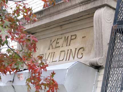
Kemp Bvilding, E. Tremont and Creston, from an age when all residential buildings were routinely named.
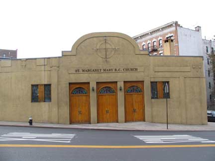
St. Margaret Mary Catholic Church at Morris Avenue, a more modest design than many Catholic churches.
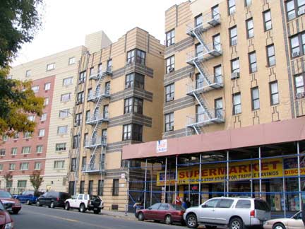
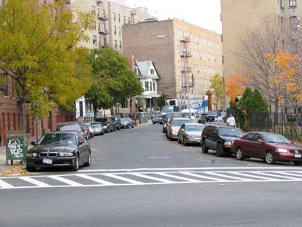
Just west of the el at Jerome Avenue, where Tremont trades in a “E” for a “W” it begins the Big Bend and completely changes direction. It actually assumes the n/s route of Grand Avenue, which it displaces for about two blocks.
The genesis of Tremont’s name is similar to that of Tremont Street in Boston: while that city’s Tremont Street was named for three hills on the originally narrow peninsula where Boston grew and prospered, so the Bronx’ Tremont was named by its first postmaster Hiram Tarbox for three hills in mid-Bronx: Mount Eden, Mount Hope and Fairmount. The main difference is that Bostonians pronounce it Treh- mont, while Bronxites say TREE-mont.
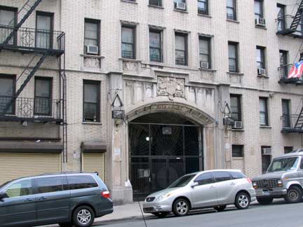
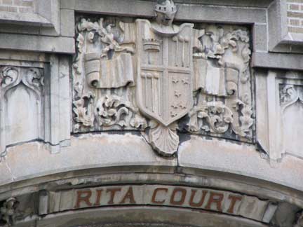
Rita Court, West Tremont near West 177th. Casual, tossed-off ornamentation like this, as well as giving a building a real name, was once a part of tradition in building residential buildings in NYC. “Rita” was a real person no doubt, perhaps the architect’s wife or daughter. I’m wondering if that’s a real coat of arms. It looks like a trio of musical notes or golf clubs.
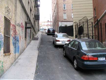
Narrow Kingsland Place climbs a University Heights hill.
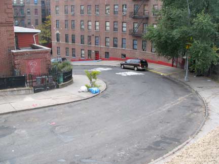
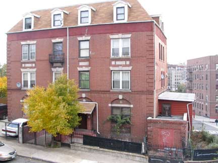
At this point in University Heights, with West Tremont Avenue running south and East 177th Street having to adopt a hairpin shape to ascend the hill, the Bronx is almost San Francisco-esque, at least in street layout. A mystery: my Hagstrom map from the 1990s shows a “University Heights Hospital” at this point, but there’s nothing at all on the internet about it; its history seems to be wiped away as assuredly as from a Communist schoolbook. Was this building part of the hospital?
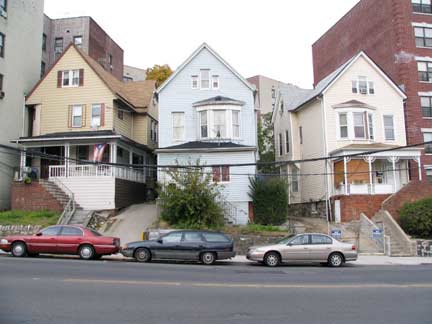
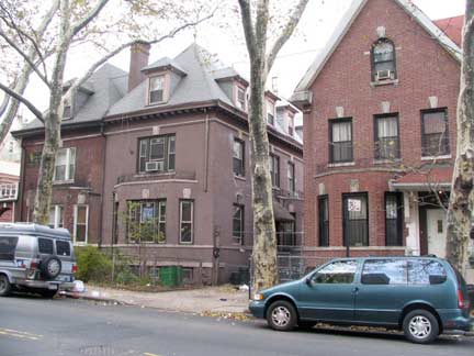
Soon enough Tremont Avenue rights itself and resumes its generally western path. Many who don’t find hemselves there a great deal think the Bronx to be a collection of apartment buildings and projects. To be sure there are plenty of those, yet there are still thousands of private dwellings, some from a period when a little more attention was paid to esthetics. The trio at left are built on the hill and so require steep staircases to gain entrance. At right, some brick houses on Grand Avenue, which also resumes here.
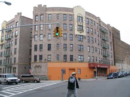
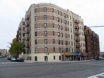
All that said, though, the Bronx, especially in the west, is known for its large apartment buildings; the Grand Concourse, in particular, is lined with huge ones from the 1920s and 1930s. A feature that seems to differentiate the Bronx, though, are the apartment buildings’ curves: they sweep around intersections, like this one at West Tremont and Harrison Avenues; whereas in other boroughs, big buildings like this have a sharper edge.
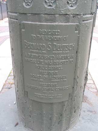
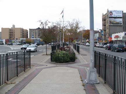
The intersection of West Tremont and University Avenues is marked by a pair of memorials, or used to be, anyway. Here University Avenue (also called Martin Luther King, Jr. Blvd.) is especially wide, with a center mall; the old Croton Aqueduct runs under it at this point.
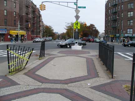
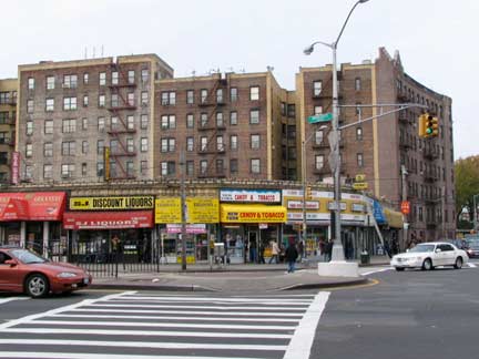
The empty space at the intersection is known as Unknown Soldier Plaza (unless your webmaster is wrong and it’s on the other side of the avenue). According to the late Bronx historian John McNamara, it was named in 1954 to honor American servicemen who “perished unidentified in all our wars.”
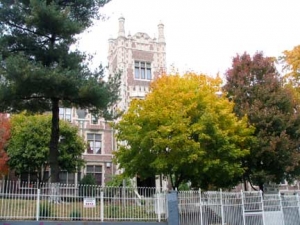
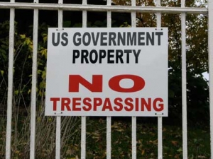
The South Bronx Job Corps Academy campus at another West Tremont bend at Andrews Avenue seems more heavily guarded than Fort Knox; frankly, I’m amazed that I wasn’t harassed by rent-a-cops merely for standing across the street snapping away. For a place that seems to promote personal development in a friendly manner on their website, this is a decidedly mixed message.
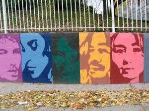
The woman on the right on the mural resembles Squeaky Fromme to me, and while that might sound crazy to everyone west of the Hudson, believe me, in NYC it’s not unusual for muralists to include a Squeaky. The two on the left look like Bob Dylan and Prince.
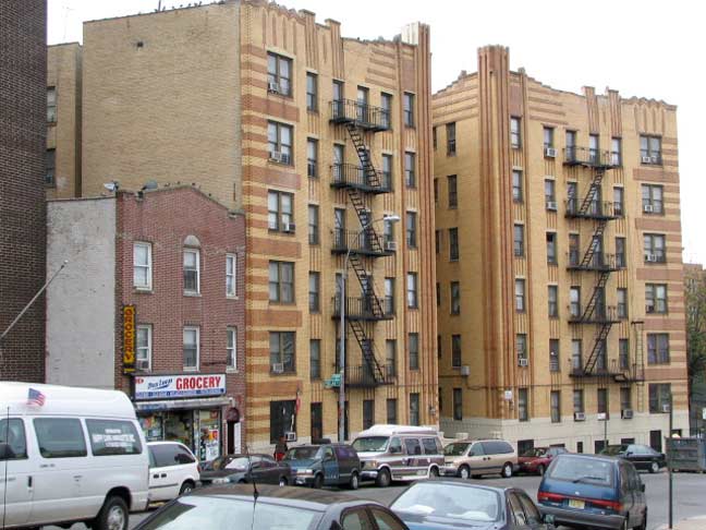
Here’s a little bit of Art Deco extravagance on West Tremont Avenue and Loring Place.
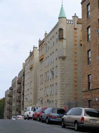
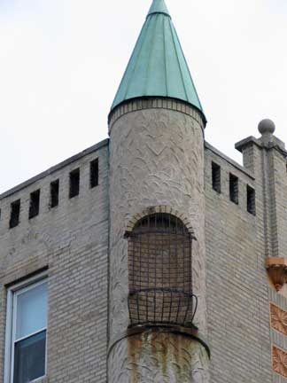
Rapunzel, let down your hair! Castle-like (not sure of the exact adjective) apartment building on Phelan Place north of West Tremont. Why add these touches? Why not?
Ah! Castellated. Per ForgottenFan Mitchell Maiman.
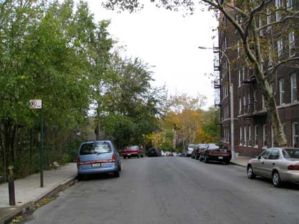
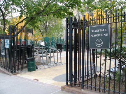
Billingsley Terrace runs in a semicircle on Phelan Place and has a view of the Hudson on the west, especially in winter. Both Phelan Place and Billingsley Terrace are named for the real estate development firm Phelan and Billingsley, which developed this area in 1907.
Logan Billingsley is a fascinating character in Bronx and NYC history…
Billingsley was a prominent real estate developer in the 1920s and 1930s, and an authority on American Indian affairs. He was president of the Bronx Chamber of Commerce from 1928 to 1932. He also served on Mayor James J. Walkerís Planning Committee for the City of New York, and was chairman of a mayoral committee that competed for the selection of New York City as the site of the World’s Fair (it lost to Chicago). In 1951, Billingsley established the American Indian Hall of Fame at Anadarko, OK and served as its executive director. He belonged to the Oklahoma Historical Society, and was also a member of the Association of American Indian Affairs and the New York Historical Association. As a developer, Billingsley built many apartment houses in the Bronx, including the Theodore Roosevelt Apartments on the Grand Concourse. In 1927, he spearheaded a plan to lengthen the Grand Concourse from East 161st Street to East 138th Street. NYC Parks
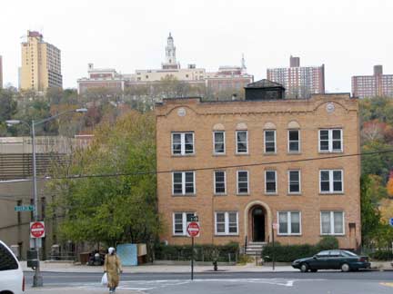
West Tremont Avenue ends, for auto traffic at least, at Sedgwick Avenue. George Washington High Schoollooms in the background across the Harlem River.
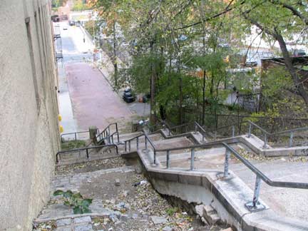
Tremont continues, however, undefeated, as a pedestrian walkway down a steep hill and resumes again at Cedar Avenue and continues west to the Harlem River at Roberto Clemente State Park.
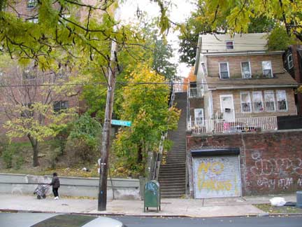
Topography plays an important role here. Palisade Place, left, is one of dozens of “step streets” in the Bronx and upper Manhattan.
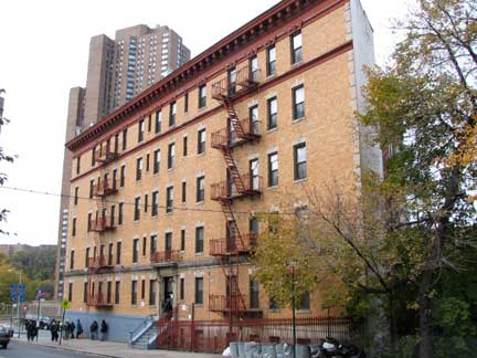
The triangle formed by Sedgwick and Cedar Avenues dictates the shape of this brick building.
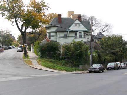
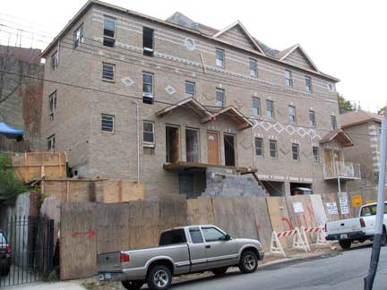
Old school, new school. Different ideas in residential architecture from different decades at Sedgwick and Undercliff Avenues.
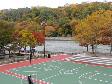
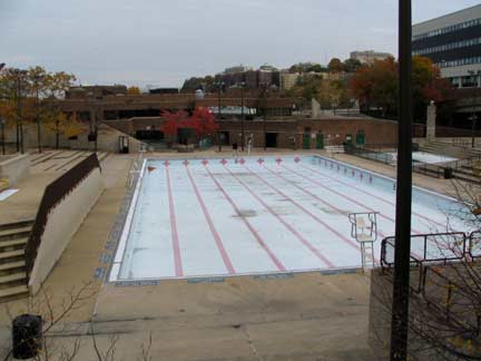
Roberto Clemente State Park opened in 1973 as Harlem River Park along the river for 25 acres from about West 176-West 180th Streets. It was renamed for the Pittsburgh Pirates superstar (1934-1972) who became the first Latino inducted into the Baseball Hall of Fame. He collected his 3,000th and final hit off the New York Mets’ John Matlack September 30, 1972. Clemente perished in a plane crash on New Year’s Eve 1972, en route to earthquake-ravaged Managua, Nicaragua. He had personally arranged the flight, which carried food and supplies.
The facilities include a multi-purpose recreation building, an Olympic-size pool complex, ball fields, basketball courts, picinic areas, playgrounds and a waterfront promenade. The state park, the first within the 5 boroughs, underwent a multimillion-dollar renovation in 2007.
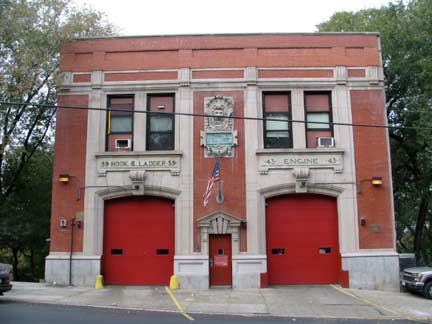
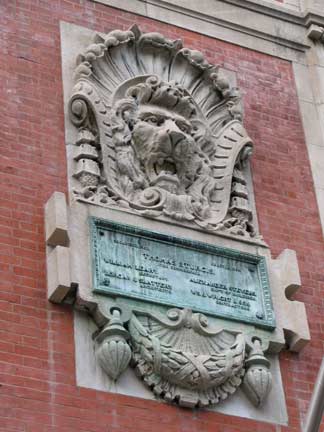
Hook & Ladder 59, Engine 43, Sedgwick Avenue just south of West Burnside Avenue. Look to firehouses around town for interesting architectural detail.
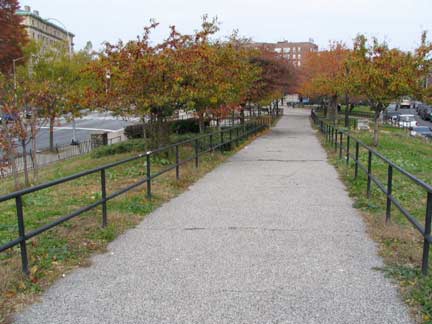
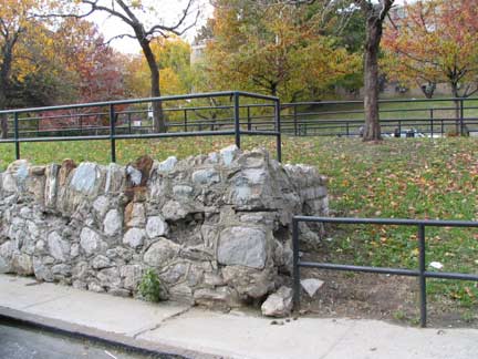
In northern University Heights the Croton Aqueduct moves slightly east of University Avenue but its presence is marked by a pedestrian pathway running along Aqueduct Avenues East and West. There’s some interesting landscaping along the way, like this stone embankment.
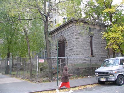
An abandoned gatehouse from the NewCroton Aqueduct, opened in 1897 to augment the older, at West Burnside Avenue and Phelan Place.
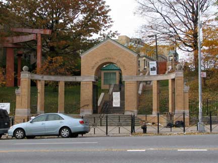
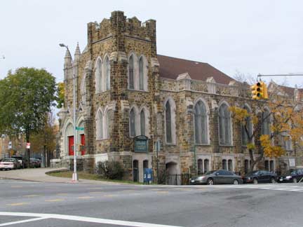
Before entering the Bronx Community College campus from University Avenue I paused at Hall of Fame Terrace for a look at University Heights Presbyterian Church.
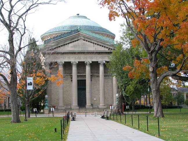
Gould Memorial Library, 1900, McKim, Mead and White. New York University opened its northern campus here in University Heights in the 1890s and sold off the property to the Bronx Community College in 1973, in the process bequeathing it several impressive buildings from the Beaux-Arts architectural era in which Charles McKim, William Mead, and Stanford White were among the most prominent and well-known builders. The Library was named for a prominent donor to NYU, Helen Miller Gould, daughter of railroad “robber baron” Jay Gould.
This video from CUNYMedia shows the Library’s interior and the story of its restoration:
http://www.youtube.com/watch?v=PDuYA1Zc8Ok
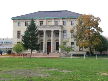
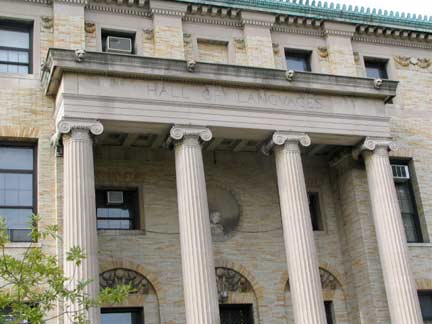
The Ionic-columned Hall of Languages was completed the same year as Gould Memorial Library.
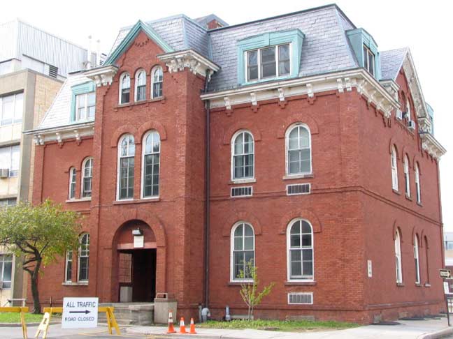
Butler Hall is one of three buildings that were incorporated into the campus when NYU arrived in the 1890s. It was built in 1859 and was originally the William Henry W.T. Mali residence. On Hall of Fame Terrace, you will find the porched residence of Chancellor Henry Mitchell MacCracken, founder of the NYU Bronx campus. And, BCC’s South Hall, the oldest building on the campus, was built in 1857 as the Gustav Schwab residence.
A zealous security guard, after trading several expletive-filled exchanges, prevented me from taking any more pictures of the campus, at least within eyeshot. I repaired to the Hall of Fame. It occurs to your webmaster that many of our outstanding architectural treasures will not be preserved photographically because of…rent-a-cops.
Hall of Fame
The first establishment to be known as a “Hall of Fame” is the Hall of Fame for Great Americans behind the Gould Library. It’s not strictly a hall, but an outdoor arcade that runs for 630 feet over the highest elevation in the Bronx.
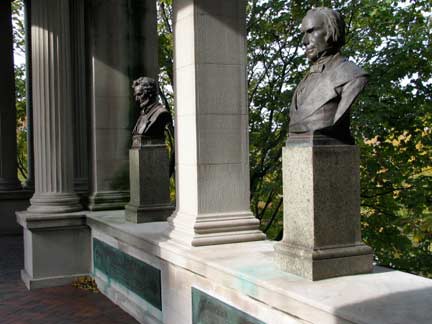
A group of 100 electors culled from the ranks of university presidents, historians, journalists and educators nominated and voted for Hall of Fame admission every five years, later changed to every three. Qualifications for admission included US citizenship. The original 29 inductees included George Washington, with the last bust installed to date being Franklin D. Roosevelt in 1992.
Walking the hall you will find busts of 98 of the countryís greatest politicians, scholars, teachers and authors, created by some of the country’s most noted sculptors. Even the name plates under the busts were made by Tiffany Studios. Most of the names familiar from American history books can be found in the Hall, including Abraham Lincoln, Alexander Graham Bell, Samuel Morse, and Robert Fulton; both Wright brothers and Thomas Edison are represented. There are several lesser-known figures such as astronomers Simon Newcomb and Maria Mitchell, first American Nobel Prize winner in science Albert Michelson, and anaesthetist William T. Green Morton.
At left is Abe Lincoln of course, next to longtime US Representative and Senator from Kentucky, Henry Clay (1777-1852), who was the founder and leader of the Whig Party and a leading advocate of programs for modernizing the economy, especially tariffs to protect industry, a national bank, and internal improvements to promote canals, ports and railroads. He was a leading “War Hawk” and, according to historian Clement Eaton, was “more than any other individual” responsible for the War of 1812. Clay made an immediate impact in his first congressional term, including becoming Speaker of the U.S. House of Representatives. Clay was also called “Henry of the West” and “The Western Star.” wikipedia
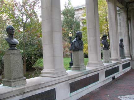
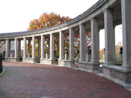
The Hall began to deteriorate after NYU moved out of the campus and the Bronx Community College moved in in the Seventies. The bronzes, which have been cited by the National Society of Sculptors to be “the most significant collection of bronzes in the country” suffered from the effects of acid rain and the colonnade supports were crumbling. Fortunately, funds were found to rehabilitate and restore the Hall between 1980 and 1985. However, four inductees are on hold until funds can be found for the $25,000 apiece each bust will require.
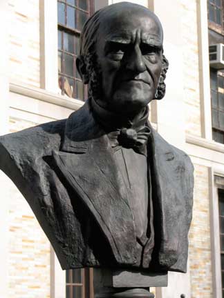
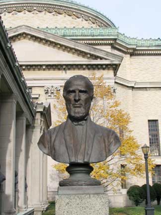
LEFT: Mark Hopkins, educator and theologian, longtime president of Williams College (1802-1887); right: John Greenleaf Whittier (1807-1892) poet and abolitionist. The Bronx’ Hunts Point has a number of streets named for 19th-Century literary figures, including Whittier.
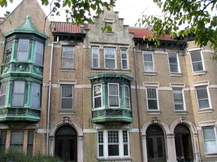
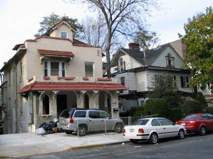
A couple of buildings on Loring Place. Loring, and the parallel Andrews Avenue, are named for 19th Century leather merchant William Loring Andrews. This sort of arrangement is rare in NYC: I can think of only one other case, in Bedford-Stuyvesant, Brooklyn, where two parallel avenues are named for the name and surname: Ralph Patchen, an early-19th Century Kings County landowner.
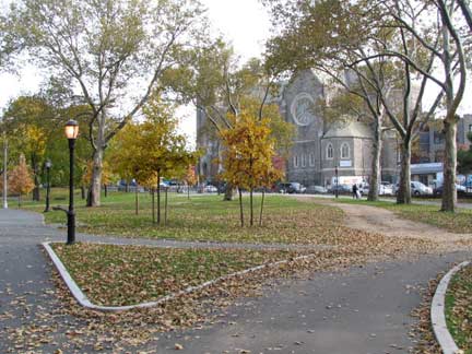
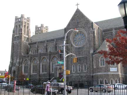
Devoe Park occupies an uneven plot surrounded by West Fordham Road, Webb Avenue, Father Zeiser Place and University Avenue. The church in the distance is the gray Gothic St. Nicholas of Tolentine, completed in 1928. Curving Fr. Zeiser Place, once a part of West 188th Street, follows an ancient brook. It was renamed in 1953 for the longtime pastor of St. Nicholas from 1917-1946, Blasius Zeiser.
When streets are renamed these days, in general the honored party gets only a subtitle under the old street name, but until the 1970s the city went whole hog and did a straight, complete rename (cf. Seaside Boulevard to Father Capodanno Boulevard in Staten Island, 7th Avenue to Adam Clayton Powell Boulevard and 8th Ave. to Frederick Douglass Boulvard in Harlem, and many others). The practice has wimped out since.
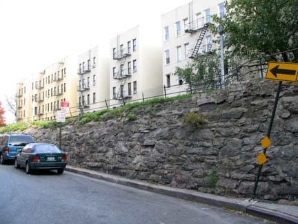
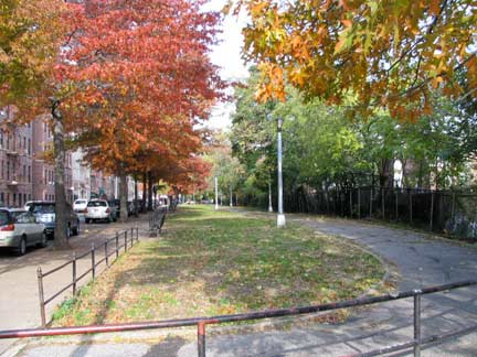
More views of the old Croton Aqueduct route between Aqueduct Avenues E. & W. A hiker can follow the old aqueduct route well into Van Cortlandt Park to the north.
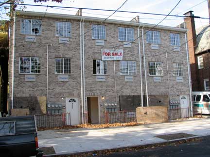
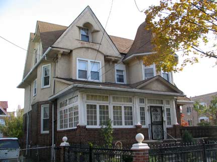
More new school and old school, Grand Avenue between West 190th Street and West Kingsbridge Road.
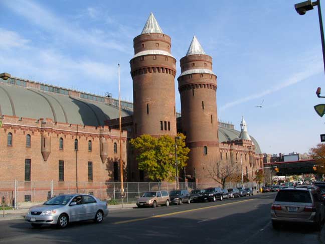
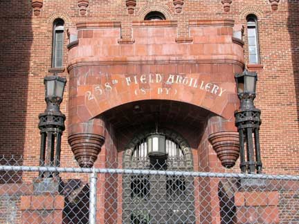
Time to kick it in the head here at Kingsbridge Armory, the city’s largest (it’s outclassed for interior furnishings, perhaps, by only the 7th Regiment Armory on Park Avenue in Lenox Hill, Manhattan).
It was at one time considered a prime NYC tourist attraction: in its tourist heyday in the 40s and 50s it was home to bicycle races and boat shows.
The Armory was built from 1912-1917 by architectural firm Pilcher and Tachau as a munitions storage area; when built it supposedly was the largest armory in the world. The interior dirt drill deck measured 300×600 feet. The Armory housed the 258th Field Artillery; the unit has its roots as a military escort for George Washington at his first inauguration. The best views are from Kingsbridge Road, but it also looms impressively over Davidson Avenue as you approach it from the south.
Photograhed November 2007; page completed March 2, 2008
erpietri@earthlink.net
©2008



1 comment
[…] stretch) where it zigszags, it begins to reveal itself with telltale landmarks, most notably a defunct gatehouse at Phelan Place. Several blocks to the east on Burnside Aveue is where the actual trail begins, […]
Comments are closed.