Park Avenue
When Eva Gabor sang, “Darlin, I love ya but give me Park Avenue” she didn’t mean its lengthy Bronx stretch, which meanders along both sides of the Metro North tracks from the Major Deegan Expressway north to Third (not 3rd) Avenue and East 189th Street. Is has been called thus since 1896, replacing earlier monikers Terrace Place, Railroad Avenue and Vanderbilt Avenue.
The Bronx reveals an endearing NYC inconsistency, though, between Webster Avenue and Claremont Parkway, because while the roadway along the east side of the Metro North is indeed called Park Avenue, the road along the west side there is Brook Avenue (which was built on top of a now-buried waterway called Mill Brook).
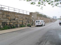
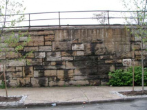
The railway runs along an open cut in the Bronx, and the embankment walls were made of pleasantly unevenly sized stones.

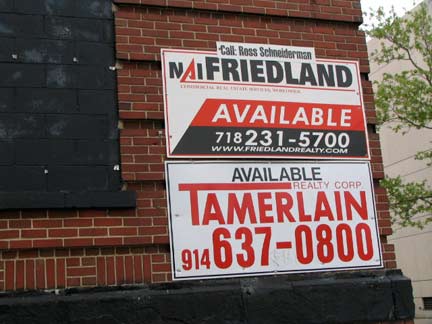
Meandering east on E. 140th, a block from Park on Canal Place, I spied a tremendously large brick building bereft of signage indicating that the building is up for sale. I wonder what its purpose was when built. (A 1911 map shows a “NY Edison Co.” building here, so it may have been a power plant.) Canal Place was opened in 1903 after the Mott Haven Canal was filled in.

An equally forbidding, but newer (looks like the 1970s) structure is on the opposite side of East 140th and Canal Place; it’s an job office.
Lincoln Hospital, Morris Avenue and East 149th Street. I actually favor the burnt-orange brick exterior, though some might think architects Max O. Urbahn Associates may have laid it on a bit thick when it was constructed in 1976. The hospital itself was founded in 1839 as the “Home for the Relief of Aged Indigent Black Persons” by a group of prominent philanthropists.
At Morris and East 148th is the accompanying Lincoln Deli and its signature Godfather sandwich.
On the SE corner of Morris Avenue and East 149th there’s a classic Emerson stereo store logo, with the gigantic G clef logo. In recent years it has been covered over by a vinyl ad.
Though the stretch of East 149th Street between Morris Avenue and the 145th Street Bridge is all about Lincoln Hospital, Hostos University amd the main branch of the Bronx Post Office at The Conk, there are pockets of small-town Bronx there as well, like the Glen Roy Bar, Lincohn Fried Chicken (spelled “Lincohn” on the awning) and the News Room at Walton Avenue.
The Waltons
There’s a curious slice of the Bronx along Walton Avenue just north of East 149th, where you’ll find tree-lined streets, bluestone sidewalks, and wonderful old attached brownstone buildings, none of which quite match their neighbors.
Walton Avenue, between East 149th and East 150th Streets. Why not a landmarked district?
Walton Avenue meets East 151st and East 152nd Streets at sharp angles — those streets were built along the northwest angle of what is now called the Metro North Hudson branch. So, the buildings on the corners have odd angles as well.
The Bronx Terminal Market, along Gerard Avenue north of East 149th, is being redeveloped after several years of neglect into a retail center, park and esplanade along the mighty Harlem called Bronx Gateway. Big ticket tenants such as Home Depot and Bed, Bath and Beyond are involved. The new ownership has served to bland-ify the building on West 149th, though (see photo right).
Strauss Market’s lettering was meticulously matched to the letters chiseled into the facing. Nifty job!
145th Street Bridge
The 145th Street Bridge connects West 145th Street in Hamilton Heights and East 149th Street in the Bronx. Like the Madison Avenue Bridge, the original was an Alfred P. Boller design, and it was constructed between 1901-1905. It is a swing bridge capable of moving to accommodating Harlem River shipping traffic. Between 2004 and 2007 a completely new 145th Street Bridge was constructed that roughly matched the older one, which I had explored in 1999, when the older bridge still maintained archaic elements such as radial-wave incandescent lamps illuminating the walkways.
2007 nameplate; approach from East 149th Street; Boller gatehouse; view of Macomb’s Dam Bridge; view from the walkway; Mission Bell walkway lamps
The 145th Street Bridge doesn’t directly connect to the Harlem River Drive — instead it ramps directly from the corner of Lenox Avenue (Malcolm X Boulevard) where we find vintage Diamond Gym posters featuring gym outfits from, it appears, 1988 or so.
Wall dog ads for Omega Oil, an all-purpose liniment produced between 1870 and 1924, show up all over town, but nowhere nearly as spectacularly as this apartment house wall bordering on a police precinct parking lot between West 147th and West 148th between Powell and Douglass Boulevards. High-grade paint must have been used since the ad gets full sun nearly all day and it has barely faded.
Photography is prohibited from within the parking lot so the best spot is from 147th.
Unfortunately the classic R.H. Macy’s stables ad, on the other side of the lot on West 148th Street, likely dating to the 1870s, has fared much less well. Most of the ad has been sheared off for new construction. This was likely the oldest representation of the Macy’s red star remaining in New York City.
At the triangle formed by Macombs Place, Powell Boulevard and West 153rd Street is Colonel Charles Young Triangle:
Colonel Charles Young (1864-1922) was a distinguished army officer, cartographer, teacher, and diplomat who pioneered the entrance of African-Americans into fields that were previously closed to them. He was born in Mayslick, Kentucky on March 12, 1864, one year before the end of the Civil War. He moved to Ohio at the age of nine and graduated from Ripley Colored High School in 1880. When he entered the United States Military Academy at West Point in 1884, Young was the ninth African-American to be admitted, and the third and last to graduate until nearly half a century later. NYC Parks
Young Triangle formerly featured a flock of rusting Type F posts, but these were removed some years ago.
Though I have noted them before in FNY, I couldn’t resist showing this cache of rusting posts from the early 20th Century that formerly illuminated a ramp from Adam Clayton Powell Jr. Blvd to the Harlem River Drive. This gave me the opportunity to zoom in and show further detail. A separate set of posts in the same genus and species can be found on the Riverside Drive viaduct at West 155th Street. The Westinghouse AK10 “cups” appeared in the 1940s or 1950s.
[Unfortunately, in 2011 the whole flock was removed and/or repaired, with the replacements resembling Type B park lamps.]
May 2009: this photo opportunity showing the New Yankee Stadium (left) and the old Yankee Stadium completed in 1923 and renovated in 1974-1976 won’t be available for too much longer, as The House That Ruth Built’s stands are being demolished as this is written. The field will be known as Heritage Field and will be used for local teams. The Harlem River Drive can be seen in the foreground.
Macombs Dam Bridge
The Macombs Dam Bridge is the third bridge on today’s tour that was designed by Alfred Pancoast Boller. Like the 145th Street Bridge it offers no direct connection with the Harlem River Drive, which must be accessed via a ramp at West 155th Street and Edgecombe Avenue. Manhattan’s peculiar topography here, a high cliff known as Coogan’s Bluff, necessitates an elevated ramp that takes West 155th above Powell Boulevard and Bradhurst Avenue to an intersection with Edgecombe Avenue and the Harlem River Driveway at Maher Circle. This elevated roadway was alos designed by Boller and closely resembles his other bridges in the area.
The bridge is named for a dam and bridge built by Alexander Macomb, who ran a grist mill in the area in the early 19th Century. He constructed a dam and bridge across the Harlem River that was finsihed by 1814, with a toll charged for passage: it became controversial in later years as the toll was forcibly disputed. The original Macomb’s Dam was demolished and a new drawbridge built in 1858, known as the Central Bridge because of its central location on the Harlem River. Macomb is remembered by the bridge, Macombs Place in Hamilton Heights and by Macombs Road in Morris Heights, Bronx.
The second bridge was deemed as irreparable by 1890, and yet another bridge was planned. The 412-foot Macomb’s Dam Bridge, also known by the previous title Central Bridge, opened in 1895. It is the most architecturally ornamented of the Boller Harlem River spans. On NYCRoads, Steve Anderson quotes bridge historian Sharon Reier:
The bridge has been humorously likened to a raffish tiara. Following the precedent of the currently novel Tower Bridge in London, which had used Tudor-style architecture in its abutments, Boller had designed Gothic-revival structures to abut the Macombs swing span. This choice of architectural style makes some sense, as drawbridges did originate with the moats surrounding medieval castles. It is the only movable bridge over the Harlem that warrants a walking tour. The others, also completed around the turn of the century, are less interesting, or are downright blights on the river.
The insignia of the State of New York and the bridge nameplate in bronze on the Manhattan side.
The traditional Boller gatehouse. Even the chain link fence installed decades later to augment the original low railing is executed stylishly. Unlike other Boller bridges, light yellow is the color scheme, unintentionally agreeing with the Pittsburgh, Pennsylvania color scheme for its bridges.
Detail of the bridge walkway, joints and railing scrollwork.
Though new Mission Bell luminaires were installed for the bridge’s last renovation, the busy scrollwork at lamp stanchions and signage have been maintained. Must be tough to paint those, though.
I wonder how long the spikes installed to discourage bridge climbers have been there.
The bridge connects to both the Major Deegan Expressway and directly to the New Yankee Stadium, completed in 2009.
The Yanks were out of town when I passed by, so this is undoubtedly a lot busier on game days. Babe Ruth Plaza, formerly on East 161st street and Walton Avenue, looks somewhat forlorn in its new grotto-ish locale on East 161st just east of the Macomb’s Dam ramp.
A last look at the stands and facade of Old Yankee Stadium, which date to the 1976 renovations.
Your by-now weary webmaster ended this tour at the concrete viaduct taking the Lexington Avenue Line (#4 train) over River Avenue at East 161st Street.
6/12/09
