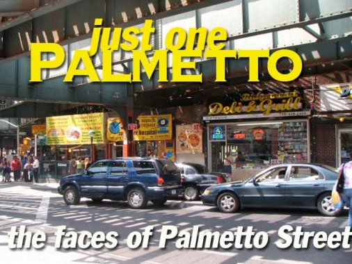
In mid-2009 took a lengthy walk in Ridgewood and Glendale and while there, resolved to detour down Palmetto Street for a little ways, so I could ascertain the contrast between its elled and non-elled blocks. The eastern end of the old Myrtle Avenue El shrouds Palmetto for 3 blocks between Wyckoff and Onderdonk Avenues. The origins of Palmetto’s name is a mystery, since I don’t know why this species would get a Brooklyn street name… but:
ForgottenFan George Miller: In 1850-51 Watson Bowron had surveys and a subdivision map prepared for property including several new roadways in the territory of the Town of Bushwick adjacent to the old Brooklyn city line. This subdivision was known as Bowronville. All of these roadways running somewhat in a southwest to northeast line beginning at Division Ave. (now Broadway) and running to current Evergreen Ave. (part of the old Bushwick Lane) were named by him for trees and vines. The roadways were Linden St., Magnolia St. (now Gates Ave.), Palmetto St., Woodbine St., and Ivy St. (now Madison St.). These names did not duplicate the official names of any existing streets in Bushwick, Williamsburgh or mid-19th century Brooklyn. When these roadways were eventually extended to and beyond the Queens County line, the Town of Newtown in Queens adopted the Brooklyn names for the continuation of these roadways in the Queens territory.
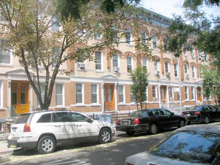
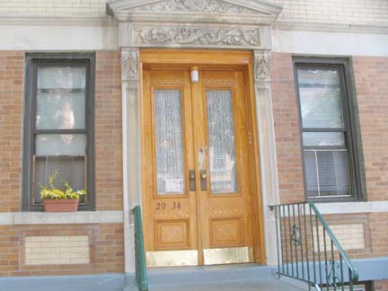
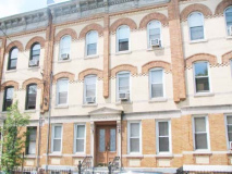
Like many other streets in Ridgewood, Glendale and Astoria Palmetto Street can boast many handsome attached homes built of brown and yellow brick mined from Balthazar Kreischer’s quarries on Staten Island; many were constructed by the prolific Gustave X. Mathews in the early 20th Century. Many of these dwellings still have their original oak front double doors.
Note the house number, 20-34 on this building between Fairview and Forest Avenues. Ridgewood bears an unusual street numbering system; between the Brooklyn line, which runs along Cypress Avenue through much of the neighborhood, and Forest Avenue, homes are numbered from 17-XX to 20-XX, with 16-XX, 15-XX whenever the borough line moves south to St. Nicholas and Wyckoff Avenues. When streets reach Forest Avenue in the northeast, though, house numbers change to 59-XX to correspond to Queens street numbering. Why 17-XX was chosen is a puzzler; on the Brooklyn side, the streets all have different numbering, since they begin at different points west.
Concurrently, Ridgewood Avenues west of Forest Avenue (Grandview, Fairview, Onderdonk, Seneca, Cypress) begin at 1-00 at Metropolitan Avenue (except for Fairview) and rise as the run southeast. I’ve never seen this Queens anomaly noted elsewhere, and that;s partially why FNY has been doing it for over 10 years.
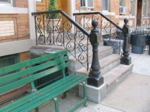
If there’s a more esthetically pleasing method of building attached homes in an urban setting than the Matthews Flats, let me know. Many residents have zealously maintained their buildings, too, keeping the original metal stoop railings. Note that the roof cornices and brackets have been kept, too. These are often the first to go when a building is ‘modernized.’
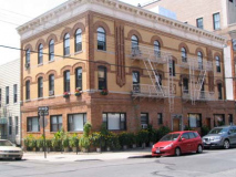
LAST: a Matthews corner building, Palmetto Street and Farview Avenue
Ridgewood’s frame buildings, which predated the Matthews flats, were not to be crowded out of the picture completely. Here are some survivors on Palmetto, albeit aluminum-sided ones. The older siding has a shabby charm all its own.
At Woodward Avenue I found another one of those odd metal signs pointing to a church — I’ve seen a couple previously in Astoria, including Ditmars Boulevard — this one pointing 3 blocks east on Palmetto and 60th Place to Trinity Reformed Church. I blew up the slogan large so someone can help with the translation. Any takers?
ForgottenFan Joseph Ditta of Gravesend, Brooklyn Then and Now fame:
[via wikipedia]: Brooklyn’s official motto is Eendracht Maakt Macht. Written in the (old) Dutch language, it is inspired by the motto of the United Dutch Provinces and translated as In Unity There is Strength. The motto is displayed on the borough seal and flag, which also feature a young robed woman bearing fasces, a traditional emblem of republicanism.
Oddly, though, we’re in Queens!
George Miller: This was an old Brooklyn congregation that moved to Ridgewood during the 1920s (after many of its church members relocated to the Ridgewood area). Trinity was/is not a Dutch Reformed Church, but was and to some extent still is a German language Reformed Church, I believe it is a member church of the Reformed Church of America, successor to the former Reformed Dutch Church. The church corporation may have just adopted the official motto and crest of the City of Brooklyn since it was organized within the former city of Brooklyn.
Some siding gone horribly wrong--there may have been a window there at one time. Near Onderdonk, onto every street some Queens crap must fall; somewhere, an architecture school dropout thought it would be a dandy idea to build rusty staircases in front of the house.
As stated above, for 3 blocks Palmetto Street is shadowed by the eastern end of the Myrtle Avenue El, which at its greatest length ran over the Brooklyn Bridge, then down Adams Street and Myrtle Avenue through Fort Greene, Clinton Hill, Bedford Stuyvesant and Bushwick to Wyckoff, where it turned onto Palmetto and then a streetless right of way over the Long Island Rail Road, ending at Metropolitan Avenue and Lutheran (now All Faiths) Cemetery. The Myrtle was cut back over the years, first in the early 1940s to Jay Street and then in 1969 its present length from Wyckoff to Met Avenue.
The stretch between Wyckoff and Met Avenues began in 1881 as a “steam dummy” line extending the Bushwick Rail Road to Lutheran Cemetery. “Dummies” were trolley-like cars pulled by steam locomotives.
In 1895 the steam dummy line was converted to electric trolley cars, and in 1915, the present el was built as a part of the massive Dual Contracts subway/el construction project as a spur of the Myrtle Avenue El, which had first appeared in 1888.
Is Seneca Avenue named for the Roman statesman/author or the Native American tribe? I’m not sure. When bicycling through Ridgewood in the 1980s I would always gravitate to the corner of Seneca and Palmetto Street. Why? These two catercorner lampposts, with S-curved masts to get them around the Seneca Avenue el station’s fare control walkway, kept their Westinghouse AK-10 cuplight luminaires decades after they had been replaced everywhere else. They finally succumbed to modernity in the late 1980s or early 1990s.
George Miller: Seneca Avenue was reportedly named for the New York State Indian tribe, one of several actual and proposed Kings County roads named for Indian tribes. It was originally a proposed roadway in the city of Brooklyn which was to extend from the Greenpoint community southerly to Flushing Ave. Only a very short segment of this mapped roadway was ever laid out and opened (at current Flushing Ave.) Today’s Seneca Ave. in Ridgewood ( now all in Queens) was earlier partly in Kings County and partly in Queens County. The entire proposed road was mapped several times beginning in the late 1850s before it was actually laid out and it was named Covert Ave, for the Covert family of Flushing Ave. (old #1410, new #1802 Flushing Ave., a circa 1786-87 house demolished during the 1950s for the large industrial building now known as 1710 Flushing Ave.).
This vintage-looking Planters Peanuts ad on Seneca has been the cause of much FNY speculation over the years. I’d maintained that the ad and its ancillary ads for cutlery sharpening and typewriter repair were the real McCoys from the Roaring Twenties, or at least I had hoped they were, while others told me they dated to only 1987, when they were painted there for el train scenes for the film Brighton Beach Memoirs. Anyone know the definitive answer?
Turns out it was, in fact, painted for the movie in 1987, but it survived this long — making it an artifact in its own right.
Palmetto is not quite as shrouded as other el-shadowed streets because in some spots the rails run separately with no structure between, and the sun can reach the street.
Palmetto Street’s dwarf posts are relatively new additions, as the date stamp on the base, 1967, shows. Previous to that Palmetto Street was likely lit by luminaires suspended from the el, and before that, gas lamps. At St. Nicholas Avenue, a 4-sided cyclops light is deemed sufficient traffic control.
The intersection of Myrtle Avenue, Wyckoff Avenue and Palmetto Street was once the site of Queens’ busiest streetcar maintenance shops, and a couple of the barns can still be found in the area. At present, there’s a fitness center that advertises on street level with a pair of murals. Here the el veers west on Myrtle Avenue before joining the Jamaica El at Brooklyn’s Broadway.
Photographed August 7, 2009. Page completed August 11.
