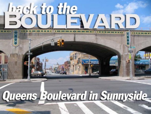
In 2005 FNY did a 2-part survey of Queens Boulevard, a borough aorta running from Queens Plaza, the landing point of the Queensboro Bridge, all the way to Jamaica. Looking at that page again, I gave its liveliest stretch surrounding the elevated viaduct in Sunnyside short shrift. I hope to alleviate that with today’s page.
In contrast to the elevated lines of the 19th Century that tended to shroud the streets underneath them in dust, grime and crime, the Queens Boulevard elevated viaduct (transporting the Flushing El) constructed largely between 1914 and 1917 with Squire Vickers, who was responsible for the “look and feel” of NYC’s subways between the late 1910s and 1940, as its chief designer. The el was built down the center of the road with three lanes in full sun on each side. This has allowed Queens Boulevard to retain a certain liveliness and panache for pedestrians and shoppers (and bar hoppers) for the better part of nine decades. To be sure, traffic is still pedal to the metal coming off the bridge, and pedestrians still have to watch their step, especially after alighting from the el.
In order to do both sides of Queens Boulevard surrounding the el justice. I decided to begin my walk east of the el at Queens Boulevard and 60th Street (just south of the Woodside LIRR station) then walk west, covering the north side of the boulevard, and then turn on Van Dam Street at the Sunnyside Yards and turn east, covering the south side. I found surprising relics and historic bits and pieces.
60th Street
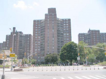
The first thing that meets your eye at Queens Boulevard and 60th Street is the presence of the Big Six Towers, which was developed, like Electchester in Flushing, by a trade union. In 1961 the New York Typographical Union (Local 6) completed the project in 1963 and one-third of its current tenants are active or retired union members. The AFL-CIO invested heavily in the towers in 2008 to help keep its apartments affordable for middle-class families.
Israel Martinez maintained a Big Six Towers blog until November 2008, which is still archived.
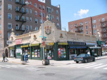
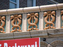
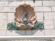
Meanwhile, the NW corner features a nicely preserved terra cotta Child’s Restaurant exterior, with carved seahorses and sea life. Childs, launched in 1889 by brothers Samuel and William Childs, became NYC’s first chain restaurant, with dozens of locations in New York and hundreds countrywide. Most of their restaurants featured this trademark terra cotta decoration.
52nd Street
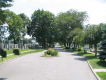
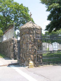
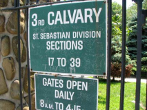
We’ve seen Calvary Cemetery before in FNY on my Blissville/Laurel Hill page. The cemetery was established in the 1840s by the parish of St. Patrick’s in Manhattan, which purchased land here from the Alsop family, whose small burial plot is still contained in the much vaster Calvary.
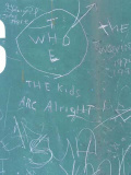
Normally I detest the destructive scrawlings of graffitists, but my opprobrium is alleviated somewhat in this case. The guy had good taste in music.
Check out Mitch Waxman’s erudite ramblings about his rambles in and around Calvary Cemetery in the Newtown Pentacle.
At the NW corner of Queens Blvd. and 52nd street we have a brick building containing two worthy institutions with venerable, handcrafted signs: VFW Post 2813, and a Queens branch of the Irish Apostolate.
Veterans of Foreign Wars Post 2813 was established in 1933 and named for John F. Daniels, Jr., killed in action in France in World War I, whose parents were Sunnysiders. After a number of moves, 2813 has been here on 52nd Street since 2005.
Sunnyside and Woodside are well-known for being home to many Irish immigrants.
According to its website the Irish Apostolate sign can’t be all that old, since the orgranization was founded in 1987:
The Irish Apostolate USA is the response of the Irish and American Catholic Bishops to the needs of Irish immigrants in the United States — the needs of the whole human person. It is the Christian imperative of caring for those who move far from the ancestral home, and welcoming the stranger as one would welcome Christ, once an exile himself.
The Irish Apostolate USA, a collaborative effort of the sending and receiving Churches, began in 1987 in the Archdioceses of Boston and New York. Traditionally two of the largest Irish communities in the United States, these communities were growing as many young Irish left for distant shores in search of work. Irish Chaplains followed these immigrants and have since cared for new arrivals. Irish Apostolate
Above left: relatively old traffic sign (you can tell since it carries a Department of Traffic, instead of Transportation, suffix)
48th Street
Welcome to Sunnyside! You know you’ve entered it when the Flushing El crosses Queens Boulevard. Local businesses have erected a wood sign welcoming visitors and reminding them Sunnyside has been here since 1875. That date jives with the opening of the (long-since demolished) Long Island Rail Road White Line’s opening of a Sunnyside station opposite the Sunnyside Hotel, built at 37th Street and Northern Blvd. (then Webster and Jackson Avenues) in the 1840s. As Christina explains on FNY’s Sunnyside page, the Sunnyside moniker goes all the way back to the colonial era when Dutch settlers called the place Sunnyside Hill.
47th Street
I was attracted to the brick buildings on both sides of 47th Street between Queens Blvd. and 43rd Avenue — they resemble the buildings in my own development, Westmoreland Gardens, in Little Neck. Do these houses have a name? Looks like they came along in the early 1940s. RIGHT: a look toward the el viaduct and the 46th Street station.
46th Street
On Queens Boulevard, 33rd, 40th and 46th Streets are also identified as Rawson, Lowery and Bliss Streets, respectively, as the Flushing Line stations on those streets have been allowed, out of tradition, to keep the names they originally had and were still in wide use when the stations opened in 1917. In fact, in Sunnyside Gardens a couple of blocks to the north, all cross streets along Skillman Avenue are identified by their old names. Most of them recall farm and landowners who originally owned the surrounding property.
Bliss Street was named for industrialist Neziah Bliss, who was responsible for the street layouts of Greenpoint, Brooklyn, what is now Blissville, Queens, and part of Sunnyside. From FNY’s Blissville page:
[Blissville takes its name] from Neziah Bliss, inventor, shipbuilder and industrialist, who owned most of the land here in the 1830s and 1840s. Bliss, a protege of Robert Fulton, was an early steamboat pioneer and owned companies in Philadelphia and Cincinnati. Settling in Manhattan in 1827, his Novelty Iron Works supplied steamboat engines for area vessels. By 1832 he had acquired acreage on both sides of Newtown Creek, in Greenpoint and what would become the southern edge of Long Island City. Bliss laid out streets in Greenpoint to facilitate his riverside shipbuilding concern and built a turnpike connecting it with Astoria (now Franklin Street in Greenpoint, Vernon Blvd. in Queens); he also instituted ferry service with Manhattan.
The great jazz cornetist Leon Bismarck “Bix” Beiderbecke lived and died in an apartment house midblock on 46th north of Queens Boulevard. The building is marked with a commemorative plaque.
44th Street
Passing 44th Street, some storefronts of note, Rose Restaurant, the marquee’d Gaslight and a pair of massive signs announcing the Edward D. Lynch Funeral Home, which #7 riders are no doubt familiar with.
43rd Street
I liked the blue/white color scheme of this Dime bank branch on the NW corner of Queens Blvd. and 43rd Street. We don’t usually think of NYC streets as being New York State Routes but Queens Blvd. does indeed carry Route 25 as far as Hillside Avenue. In Nassau and Suffolk Counties it runs along Jericho Turnpike, Middle Country and Main Roads to Orient Point.
Center Cinemas, where your webmaster saw Toy Story, first opened April 24, 1942 with a double feature of Sullivan’s Travels and The Lady Has Plans, according to Cinematreasures. When it first opened it was called Center Theatre. Would you believe 6 screens are shoehorned into this small space? “Originally twinned down the middle in the eighties. Then one of the sides was cut in half to make it a triplex. Then space was created in the basement for cinemas 4-5-6.” Sunnyside/Woodside’s Irish bars are famed for Guinness and cheeseburgers. I have enjoyed both at P.J. Horgans in 1994 and again in 2006.
42nd Street
This battered Queens Midtown Tunnel sign is a survivor — I know it’s at least 50 years old because it doesn’t use a modern Highway Gothic font as all signs do these days. RIGHT: Tudor-style apartments on 42nd.
Approaching the 40th/Lowery Street station, the King of All Buildings and the Queens Citigroup Tower loom before us. The Empire State seems especially tall from Sunnyside and Blissville — only the Citi Tower can compete with it.
40th Street
Blue and white is again the color scheme at the New Post Coffee Shop, which sports the Mexican, USA and Irish flags.
You say you want more of a selection?
…You can have Romanian and Italian just a couple of doors away.
39th Street
Queens Boulevard changes character again west of 39th Street, as the side streets both north and south are no longer heavily residential but are home to light manufacturing and services. However, as we’ll see, this produces greater opportunities to see decades-old signage and hints of long-vanished businesses here and there.
I count 10 separate signs on the lamppost, but there are instances around town where the DOT can cram even more onto a single post. At the NE corner, what is now a pool parlor was once the home of EPCO.
38th Street
Liberty Brass Turning has a pair of signs in one of my favorite color combinations, black and gold, and rusted signs on the 38th Street side. Brass is an alloy of copper and zinc, though aluminum or lead can be added to produce stronger varieties.
To get out of the hot sun for a bit I walked under the Vickers Viaduct, which is mostly used form parking. At 36th Street I noticed the new La Quinta. Western Queens has seen a number of hotels open in rather odd locales, but this location so close to the Queensboro Bridge makes some sense. On the north side of the street is a blandly appointed warehouse/loft building.
35th Street
Approaching 35th Street I noticed an unusual piece of curbside equipment in front of the blue awning in the center of the block.
A unique, one of a kind lamppost. I recognized it right away, though — it is a hybrid sample of the winner of the City Lights lamppost design competition the City sponsored in 2004. The new design was by Thomas Phifer Partners, though the city pledged to give the top three a try (the runners-up were the architectural companies Skidmore, Owings and Merrill and Atelier Imrey Culbert. I haven’t yet seen the two runners-up produced anywhere, and this lone post, which used to be on the other side of Queens Boulevard, is the only one I’ve seen on city streets yet.
The original winning design by Phifer was on display in the Museum of the City of New York in 2005 (above left). As you can see the luminaire was changed on Queens Boulevard from a lengthy filament to a conventional pendant style, with the addition of two guy wires, that apparently were bent in transition.
While the Donald Deskey posts of the early 1960s were innovative in including two grooves, or slots, on the shaft that could be adaptable for many shapes of masts and adition of signage, the Phifer posts go that six times better and add 6 more such slots on the shaft, for atotal of eight.
Apparently the city has decided to stand pat with lampposts for now and has not begun to grandfather in any new design, at least in the “outer” boroughs, where the octagonal, cobra-mast post introduced in the 1950s still hold sway.
34th Street
At first glance 34th Street, looking north, is just another of those industrial-light manufacturing streets completely barren of activity on the weekend, and indeed it was. But there are two things of interest here.
This coffee shop serves employees of nearby businesses and manufacturers. It has one of the most perfectly hand-lettered awning signs I’ve ever seen, and in a terrific color combination, red, white and black. The owner and his wife emerged and got into the wagon, so had I arrived earlier, maybe the place would have been open. No flourishes or anything. You need coffee or a sandwich, here they are.
I didn’t spot this till after I turned back toward Queens Boulevard — it’s invisible from the el because of the Rawson/33rd Street entrance. It’s a sign for the long-gone Ridley’s candy factory. According to this NY Times article the factory was built in 1923. Whatever happened to Ridley’s, I know not.
33rd Street
33rd Street/Rawson. The street has a couple of classic metallic signs above the entrances of Dierks Heating Company.
Whenever I hear the name “Rawson” I naturally think of The Hut Sut Song…
32nd Place
At 32nd Place Queens Boulevard is about to cross Sunnyside Yards and the concrete viaduct cladding gives way to conventional iron. Here Queens Blvd continues due west as Thomson Avenue, or traffic can continue along Queens Boulevard to Queens Plaza and eventually the Queensboro Bridge.
A manufacturing plant I call The House of Many Windows fills the block between Queens Blvd., Skillman Avenue and 32nd Place . It’s home now to CityView fitness center and a printing plant/lettershop, McVicker Higginbotham. We’ll see another City View soon. The name of the lettershop reminds me of both The Who’s Roger Daltrey and WWE legend Shawn Michaels. In the late 1970s, coming off Tommy and Lisztomania, Daltrey fancied himself a leading man and starred in McVicar, a biography of British robber turned author John McVicar, in 1980. Michaels was born Michael Shawn Hickenbottom — no wonder he uses a stage name.
Looking west now on Thomson Avenue at Van Dam Street we see the Citi tower and another roadside hotel, Days Inn. The structure on the right is a camera used to identify traffic rulebreakers.
The Best Western City View motel, on Greenpoint Avenue and Bradley Avenue in Blissville, can be seen looking south on 32nd Place. It was converted in the 1980s from a grade school, PS 80.
33rd Street
New Thompson’s Diner, 33rd Street and Queens Boulevard, cleverly recalls Thomson Avenue, which extended to Newtown/Elmhurst before Queens Boulevard was built on its path in 1910. It was originally constructed in 1950 by the Master diner manufacturer. It serves a primarily Dominican menu.
Walking on the south side of Queens Boulevard can generally show off the beauty of its concrete viaduct. RIGHT: Between 2002 and 2004, the Museum of Modern Art on 53rd Street in Manhattan was undergoing an expansion and renovation, so many exhibits, including legends such as Picasso, Pollock and Matisse, were exhibited in a former Swingline staple factory on 33rd Street.
34th Street
34th Street passes under the 33rd/Rawson Street station. The 33rd, 40th and 46th Street stations feature stained glass installations by artist Yumi Heo, “Q Is For Queens.” Here, A is for Aqueduct (Raceway), though I haven’t figured out what all the scenes depict yet. The S panel, at 46th Street, shows the now-demolished Shea Stadium.
36th Street
At 36th Street, the forbidding-looking Aviation High School is offset by a nicely-painted sign for the District Council 9 (union) Training Center. The school was completed in 1957, as was your webmaster.
37th Street
Some old-school signs on 37th south of Queens Boulevard, including Hallen Welding and E&T Plastic.
39th – 40th Street
The former Sunlite Diner at 39th is now Pete’s Diner. Lowery’s Wine Factory reminds drinkers of 40th Street’s former name.
41st-42nd Streets
In 2003 the entire row of stores on the south side of Queens Blvd. between 42st and 42nd Streets were destroyed by a 4-alarm fire. The building that later rose on the site was named The Phoenix, after the mythical bird reborn from fire.
The Korean church off 42nd Street was once the John Daniels VFW Post 2813 from 1965-1992 (see above).
45th Street
Tony’s Hardware is remembered by some graffiti on the 45th Street side. What are they trying to spell on the right?
Oof–that was a long walk. Finishing at the world famous Sunnyside Arch, just as I ended my Greenpoint Avenue march in early 2009.
