On the second leg of my quick Bensonhurst trip, I wandered down 84th Street into the heart of ancient New Utrecht. Brooklyn, now co-terminous with Kings County, was once just one, albeit the most important, of six towns that made up Kings County, delineated by British rulers in 1683. “KIngs” refers to the Restoration British monarch at the time, King Charles II.
The history of Brooklyn’s towns is complicated… but the $2 history is: The county’s original towns were Brooklyn (today’s downtown and stretching east and south as far as Bedford-Stuyvesant and Sunset Park), Bushwick, Flatbush, Flatlands, Gravesend and New Utrecht, and after a series of secessions and reorganizations, Brooklyn, by then a city, managed to annex all other towns and cities in Kings County in 1896 — only to consolidate with Greater NYC in 1898.
In the Dutch colonial era (1626-1664) New Utrecht (pronounced YOU-trekt) was settled by Dutch West India Company director Cornelius Van Werckhoven; after he died unexpectedly, his successor, Jacques Cortelyou, bestowed the name Nieuw Utrecht, after Van Werckhoven’s home, Utrecht, Netherlands. The original town boundaries encompassed today’s Bay Ridge, Borough Park, and Bensonhurst.
Bensonhurst, by the way, and Benson Avenue, are named for the Benson family, which included the first attorney general of New York State, Egbert Benson (1746-1833) who was also a US Representative. He was also a historian and author, publishing A Memoir on Dutch Names of Places. Though the Bensons owned property in New Utrecht in the colonial era, Egbert’s grave is in historic Prospect Cemetery in Jamaica, Queens.
The ‘town center” of New Utrecht is trisected by three very old roads, two from the colonial era: the Road from New Utrecht to Flatbush, today overlaid by 18th Avenue; the southwest end of Kings Highway (the original Kings Highway was named in the early 1700s and ran from Fulton Ferry south to about today’s Flatbush Avenue and then southwest and west to Denyse Ferry); and the Brooklyn, Greenwood and Bath Plank Road — today’s New Utrecht Avenue. A steam railroad, the Brooklyn, Bath and Coney Island RR, was built along its length in 1864, and that was replaced by today’s West End El in 1917.
The only trace of Kings Highway’s passage through the neighborhood is 84th Street’s great width between 16th and 18th Avenues, and it’s also a bit askew the overall grid layout.
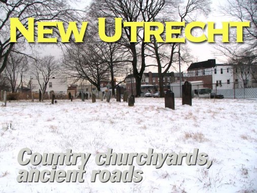
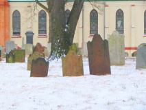
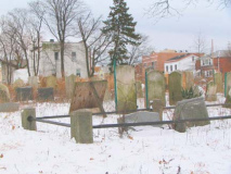
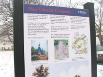
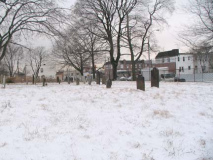
Along 16th Avenue between 84th and 85th is the fenced-in New Utrecht Cemetery, established early in the 18th Century alongside the original New Utrecht Reformed Church. Though the Reformed Church moved to its “new” building in 1828, it continues to maintain this cemetery’s grounds.
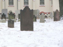
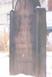
I stuck the camera through the chain link and shot the nearest older stone, which belongs to Maria Lefferts, wife of Jacobus, who died in 1786 — one of the oldest remaining stones in the cemetery. Note the angel head motif at the top of the stone. Angel heads began replacing skulls on tombstones around this time.
New Utrecht Reformed Church
The former town center of New Utrecht, at today’s 18th Avenue between 83rd and 84th Streets, is marked by the 1828 New Utrecht Reformed Church, with a beautiful Gothic style and ashlar walls. The church was established in 1677, and the first church building was built in 1700 at about the same time the accompanying New Utrecht Cemetery (see below) was established about a quarter mile away on a local highway. The present church was built with stones taken from the first one.
Excavations and artifacts from the second church site
In front of the church on 18th Avenue is the sixth Liberty Pole that has appeared on the site.
To harass the British, or to perhaps signal their defeat, Colonial patriots erected “liberty poles” on which the new American flag was raised. The first such pole in New Utrecht was raised in 1783 to celebrate American victory at the end of the Revolutionary War and the evacuation of the Britsh from New York, which happened at the Denyse Ferry in Bay Ridge in 1783. Six poles have been placed here subsequently; this latest pole was raised in 1946. The pole stands on what was Van Pelt Manor, which had been settled by the Van Pelt family in the 1670s and used as a military prison during the Revolutionary War. The manor was deeded to the city by the family in 1910, on the condition that the city preserve an ancient Dutch milestone that stood on the property.
The Reformed Church parish house, right, was added in 1892.
The milestone of Milestone Park, 18th Avenue and 82nd Street, is a replica of the oldest remaining milestone in New York City. The original (above) was moved to the Brooklyn Historical Society in the 1970s; a granite reproduction occupies the same spot where the original was placed on Kings Highway in 1741. One side reads, “8-1/4 Miles to New York Ferry and 2-1/2 Miles to Denyse’s Ferry.” The other is inscribed, “10-1/2 Miles to New York Ferry, 15 Miles to Jamaica.” The Friends of Historic New Utrecht, a neighborhood group, would like to see the original milestone put back. Photos courtesy Brian Hedden
I am afraid that I didn’t spot the cornerstone at the Metropolitan Baptist Church, which replaced the original Reformed Church sometime in the 1800s. The Metropolitan Baptist Church was established in 1974.
The unusual Bay 16th
The Bensonhurst “Bay” numbered streets run between the numbered avenues from 14th Avenue south to Coney Island Creek, and begin with Bay 7th and end at Bay 53rd (there had been a Bay 1st-Bay 5th Streets, but they were swallowed by Dyker Park Golf Course when it was built in the 1930s. Often a Bay number will be skipped, as a numbered avenue takes its place; thus, 15th Avenue is in place of Bay 9th (I’ve always found this a really anal quirk on the part of the forgotten topographer who named these streets, actually).
All the Bay numbered streets come to a dead halt on the east at 86th Street, except for one: Bay 16th, which proceeds merrily on to New Utrecht Avenue and about 81st. As with most NYC street anomalies, there is a reason for this.
Detail, 1873 atlas. What’s now Bay 16th was once a right of way for the Brooklyn, Bath and Coney Island RR, the West End el predecessor. It also traveled the surface of 84th Street, partially accounting for its greater width. Note Van Pelt Manor and the Reformed Church on the right side of the map.
Page completed February 10, 2010.
