

BY SERGEY KADINSKY
Forgotten NY contributor
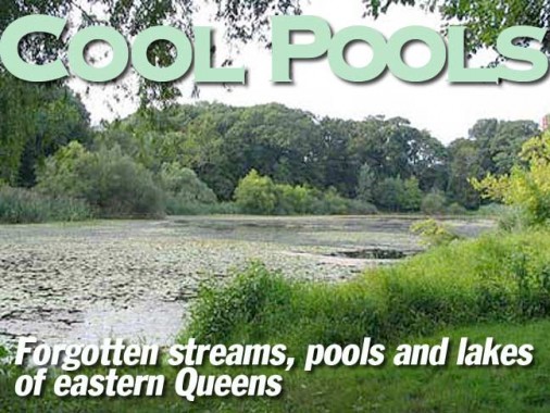
Queens is a borough containing many streams. It has numerous creeks, basins, inlets, bays, and rivers. Deeper inland are a few ponds, remnants of the last ice age, a respite from the chaotic urban development that surrounds them. The eastern half of Queens in particular still has ponds, tucked away deeply in forested parks and amid the suburban sprawl. Here’s a comprehensive look at Queens’ eastern waterways, formerly a part of the Northeastern ecosphere and now subsumed into Queens’ urban fabric.
Bowne Pond


Bowne Pond is located in eastern Flushing, named after a landowning family from the colonial period. The park is named after Walter Bowne, a Queens resident who served as NYC mayor from 1829 to 1833. The site of the 11.8 acre Bowne Park once had his summer residence, which burned down in 1925.
The pond can be found in the park, located on 32nd Avenue between 155th and 159th Streets.


Fort Totten Ponds
The ear-shaped Fort Totten peninsula sticks out at the confluence of East River, Long Island Sound, and Little Neck Bay. On the border between the peninsula and the mainland, there are two small nameless ponds.
Fort Totten was initially called Willet’s Point, not to be confused with the other Willets Point, the Iron Triangle east of Citifield in Flushing Meadows. (That Willets Point is named for the avenue that runs through it, Willets Point Boulevard). In 1862, the army bought the peninsula from the Willet family and it served as an active army base until 1974. Fortunately, neither the British, Confederates, Spaniards, nor Germans ever invaded and it was a silent sentinel.
As a fort, it was a self-contained community, with unique street names, and its own zip code. Nobody lives here today. The site is split between the Coast Guard, police K-9 training, firefighter training, and a 49-acre public park. Fort Totten is the site of the August 2011 World Police and Fire Games, where athletic rescuers and their dogs compete.
In the 1960s, the army base was the proposed site for CUNY’s York College, but local leaders protested arguing that low-income students needed a school that is closer to public transportation. Downtown Jamaica was chosen instead.

Golden Pond
Bayside’s Golden Pond is a kettle pond located on the former estate of John Golden, a Broadway producer who donated his land to the city for a public park in 1955. In his career, Golden produced over 150 musicals and plays. A century ago, the north shore of Queens once had several mansions as part of the larger Gold Coast of Long Island.
To this day, some of the borough’s toniest housing can be found along a stretch of shoreline from Malba towards Little Neck.
This pond is located at the eastern end of 35th Avenue south of Crocheron Park and east of 215th Place and Corbett Road.

Oakland Lake
Oakland Lake is located in a ravine in Bayside. It was also once called Douglas Pond after a local landowning family. They also developed nearby Douglaston. Oakland took its name from “The Oaks,” estate of Frederick Newbold Lawrence, who also descended from a local colonial settler family.
In 1896, his estate became a golf course, and in turn, it became CUNY’s Queensborough Community College in the 1960s.The lake was is subject to algae and silting and still requires plenty of care to ensure its preservation.
This pond can be found at Cloverdale Boulevard and 46th Avenue, one block south of Northern Boulevard.

Aurora Pond
Aurora Pond is located in the Udalls Cove Preserve on the Queens-Nassau border in Little Neck.
The pond’s namesake is local resident Aurora Gareiss, who fought to save the ravine around Udall’s Cove from development. The pond was formed when Sandhill Road was paved through the ravine. Excess water flows into the cove through Garbler’s Creek.
This pond can be found at the bend on Sandhill Road just west of Little Neck Parkway at the LIRR Little Neck station.


Alley Pond Park
Long before urban development, the valley separating Bayside from Douglaston was known as “The Alley,” and like Flushing Meadows, it is a valley and salt marsh with its own forgotten streams and ponds. Within the 635-acre Alley Pond Park, there are 8 named ponds. The map on the left shows seven of them plus nearby Oakland Lake.
The names reflect local flora and fauna: Turtle Pond, Muskrat Pond, Lily Pad Pond, Cattail Pond, Windmill Pond, Little Alley Pond, and Alley Pond. All were formed as kettle lakes after the last ice age.
The construction of the Long Island Expressway and Cross Island Parkway nearly erased Alley Pond from the map, more on that below. On this map, the pond is covered by the compass rose.
The entrance to Alley Pond Park at Kingsbury Avenue offers a dramatic view, with the Motor Parkway trail cutting across the scene. In the parkway’s heyday, dandies in newsboy caps and their girlfriends in flappers paid their toll and raced through the woods with hooch hidden in their new Model A Fords.
The Great Depression put an end to the two-lane speedway, which ran from Fresh Meadows to Ronkonkoma. From 1908 to 1911, the parkway hosted racing, but deadly results led to a ban.
If I had my way, there would be an annual world-class race on the Long Island Expressway- Riverhead to Midtown. All speed demons would be welcome to apply, but I know it will never happen.


ABOVE: Little Alley Pond is hidden in the summer by reeds, but it has a long history of some 15,000 years since a loose block of ice sunk into the ground and formed this pond. BELOW: Muskrat Pond is even smaller in size, but like many kettle ponds, it can be deep. During the rainy seasons, it expands, but it never completely disappears.


Kettle holes throughout the park turn into vernal ponds after heavy rains. Ridges separate the kettle holes.
Cloverdale Boulevard


Cloverdale Boulevard (above four photos) is one of the borough’s unfinished boulevards, initially slated to stretch from Northern Boulevard in Bayside to Union Turnpike. Instead, it runs in four segments, separated by Long Island Expressway, Alley Pond Park, and Motor Parkway. While real boulevards connect major thoroughfares and often defy the grid, Cloverdale is nearly useless as a through street. In this neighborhood, it acts as a border between suburban tract housing and the natural forest of Alley Pond Park, sort of like a “before and after” shot of Queens. Cloverdale is popular with bikers and it connects to Motor Parkway.

Birdhouses line the southern edge of the park on Kingsbury Avenue. When you consider Fort Totten, Udall’s Cove, Alley Pond Park, Douglaston Park Golf Course, Queens County Farm Museum, and Creedmoor Psychiatric Center, it is clear that eastern Queens has a series of connected parks that act as travel corridors for airborne and land-based wildlife.
The large parks and preserves of Queens are stopovers for long-distance birds on the Atlantic Flyway. It is one of four major air routes used by birds during their seasonal migrations. Some 270 species of migrating birds have been spotted visiting Central Park. Now that’s tourism!


Alley Pond Co-Ops
Eastern Queens is the land of garden apartments, where low-rise co-ops and rentals sprawl across super-blocks with large, carefully maintained lawns and patriotic displays.


The Stump ends here
73rd Avenue is a 4.3-mile stretch running from 141st Street in Kew Gardens Hills towards its end at 230th Street at Alley Pond Park. Its last 9 blocks has the appearance of a country lane, with a forest and wooden telephone poles. When the grid was imposed on Queens, the colonial-period Black Stump Road was renamed as 73rd Avenue. It used to continue eastward through the woods towards the city line. When Alley Pond Park was acquired in 1929, the planners chose to end the avenue at 230 Street, restoring a part of the forest. The park can be crossed by only 4 roads, dividing Bayside and Oakland Gardens on the west, from Douglaston and Little Neck on the east.


On the right tract
This 1927 Red Book map (sorry about poor resolution) of the proposed street grid only makes a small concession for Alley Pond Park. The green line superimposed on the map shows the approximate boundaries of the present-day park. It’s interesting to see how little concern urban planners gave to public parkland.
Their main idea was to cover the borough with thousands of identical rectangular boxes, erasing the unique villages and colonial-period paths that once dotted the landscape. Malvina Reynolds couldn’t have said it better:
“And they’re all made out of ticky tacky
And they all look just the same.”
— Little Boxes, 1961


East Meets West
East Hampton Boulevard is another incomplete boulevard, running for 9 blocks along the western edge of the park. I have no clue why it was named after East Hampton. Perhaps a pretentious developer was trying to attract an upscale clientele to the neighborhood. In the photo above, West Alley Road is actually to the east of East Hampton Boulevard, the highway sign on the left has more accurate compass directions. That’s how the city is: Southern Boulevard is up in the Bronx while Northern Boulevard is down in Queens. On the right above is Alley Pond, a kettle lake that was the centerpiece of The Alley. Highway construction gradually reduced the size of the pond until it disappeared. A highway interchange reconstruction project in 2000 included the restoration of this pond. Hooray!


The first incarnation of the Long Island Expressway was Nassau Boulevard, which had a dramatic arch bridge proposed in 1929 to span across Alley Pond. But in reality, a simple beam bridge rises above The Alley.


A 1998 and a 2008 aerial show the improved LIE-Cross Island interchange and the restored Alley Pond. Two of the cloverleaf’s leaves have been removed, but their traces are still visible from space. Aerial composite courtesy of Todd Berkun’s Facebook page “Places in NYC That Are No More”


Where horses passed by…
Potamogeton Pond is tucked into a narrow strip of parkland alongside Grand Central Parkway and named after an aquatic plant. It once had a bridle trail that connected Cunningham Park to Alley Pond Park. But when local stables closed, the trail was abandoned. Nearby Motor Parkway became the preferred corridor between the two major parks. The parkway runs along the top of the glacial ridge where the ice sheet once terminated. South of the terminal moraine, the borough is a plain that gently slopes towards the ocean. North of this ridge are hills, kettle lakes, and boulders. This pond can be found at 86th Avenue and 217th Street.


Before we head south on Cross Island Parkway, let’s take note of a few more forgotten ponds. Just north of the Cross Island-Grand Central Parkway interchange is an unusual modernist Catholic institution: Immaculate Conception Center, previously known as Cathedral College. Designed as a college for future priests, it moved to Douglaston in 1967, peaking in the 1970s, but then suffering a decline in applicants. During its peak, a promotional video was made showing life for priests in 1970s New York City. The college closed in 1987, but the campus still serves the church.
The cash-starved church sold some of the land around its seminary in 1989, which resulted in the Oak Park development (below right). To its east is an earlier enclave, Castlewood, which dates back to around 1954. Here, a small segment of 72 and 73 Avenues connect to nothing. A third site across Grand Central Parkway is Iris Hill, an undeveloped 7.5 acre site that the state recently transferred to the Association for Neurologically Impaired Brain Injured Children (ANIBIC), which plans to develop the wooded site.


3 ponds are safe within Douglaston Park Golf Course, while the fourth, which I would dub Oak Park Pond, is squeezed in by the highway and tract housing. All four date back to the Ice Age. Queens has the most kettle ponds among the five boroughs. The ponds are numbered here in the 1951 and 2008 aerials.