

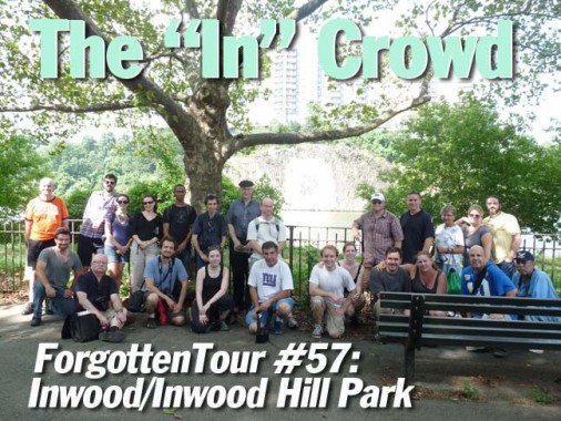


On a Saturday when the predicted rain did NOT materialize (in 2012 there has not been a drop of rain whatsoever during ForgottenTours so far) almost 30 ForgottenFans assembled at Dyckman Street and Broadway and 4 hours of Forgottening began. Humid and tropical it may have been, but we saw an area of Manhattan that few but its residents know.
Inwood is located in a fairly well-defined area: Manhattan is so narrow at its northern end that you can say that anything north of Dyckman Street is in Inwood. On a map, that works out just fine. By walking around, though, you can detect three separate sub-neighborhoods: anything east of the el on 10th Avenue is gas stations, auto repairs, and supermarket wholesalers; between 10th and Broadway are apartment houses, mom and pop shops, and bodegas; and west of Broadway is the most unusual Inwood of all, since mixed in with the apartments (some of them in gorgeous Deco) you find standalone single and two-family homes, a true rarity in Manhattan, as well as the vast, wild Inwood Hill Park.
Our first stop was a building used for a different, yet fitting, purpose than for what it was built to do.


The Packard showroom at Broadway and Sherman Avenue was designed in 1926 by architect Albert Kahn, who designed Packard showrooms across the country and, although he is now little-known, was in his day one of the highest compensated architects. Fittingly enough, it now serves as a parking garage. Packard, famed for luxury autos, was in business from 1899-1958.


The crowd pauses inside Hawthorne Gardens on Broadway, which has likely never been a tour stop before. It is an example of the casual elegance architects imparted residential buildings until just a few years ago. These days only luxury buildings get decorative touches, and even they don’t get terra cotta panels and inner courtyards.


The Dyckman Farmhouse was the tentpole attraction on his tour. Located at Broadway and West 204th Street, it has been here since about 1785 and is Manhattan’s last remaining Colonial farmhouse. It was built by William Dyckman, grandson of Jan Dyckman, who first arrived in the area from Holland in the 1600s. During the Revolutionary War the British took over the original Jan Dyckman farmhouse; when they withdrew at the war’s end in 1783 they burned it down, perhaps out of spite.
The farmhouse was rebuilt the next year, and the front and back porches were added about 1825; the Dyckman family sold the house in the 1870s and it served a number of purposes, among them roadside lodging. The house was again threatened with demolition in 1915, but it was purchased by Dyckman descendants and appointed with period objects and heirlooms. It is currently run by New York City Parks Department and the Historic House Trust as a museum. A copy of one of the occupying British soldiers’ log huts, with a log roof, can be found at the back of the house. The cellar kitchen is particularly engaging, with old waffle irons, sausage stuffers and a child’s game board.
The house is so small on the inside that only ten of us were allowed to enter at the same time. In the 1700s, people were generally smaller than they are now, both in height and girth. Washington, at 6’4″, was a giant of his time.


Good Shepherd Church, Broadway and Isham Street, is celebrating its 100th anniversary in 2012. The first church was a wood frame building that was moved across Cooper Street around 1930 and was later razed to make way for an addition to the elementary school.


A pair of decades-old street fixtures can be found on Broadway and Isham. A 1913 fire alarm still has the fixture that used to hold its spherical red glass lamp. And, a pole that could have been put there as early as the 1860s once held either a gaslamp or a mailbox and street sign combo.


What is likely Manhattan’s longest public staircase ascends a steep hill in the path of West 215th from Broadway west to Park Terrace East. There are 10 landings with 11 steps each. Along the way there can be found some ancient lamppost fixtures. Also note the chiseled West 215th Street sign.


The concrete arch in back of the auto body shops on Broadway and West 216th is the last remnant of the Seaman-Drake Estate. John and Valentine Seaman obtained 25 acres of land from Broadway to Spuyten Duyvil Creek and what would be West 214th-218th Streets in 1851 and set about building a hilltop mansion. The arch, 35 feet tall and 20 feet deep, meant as a gateway to the estate, was first built in 1855.
Inwood Hill Park
Inwood Hill Park is 196 acres of primordial forest (with the occasional path and rusting park lamppost). It was the site of Native American habitation; deer and raccoon were hunted for food and clothing. After the Civil War, prominent families built large mansions here overlooking the Hudson, among them Isidor Straus, who perished aboard the Titanic in 1912, and the Lord family of Lord & Taylor. The area officially became a park in 1926. The park contains the last remnant of the tidal marshes that once surrounded Manhattan Island. The marsh receives a mixture of freshwater flowing from the upper Hudson River and saltwater from the ocean’s tides. The mix of salt and fresh waters, called brackish water, has created an environment unique in the city.


Supposedly, this is the site of one of the greatest, or worst, real estate swindles in history, depending on your point of view. In 1626, the story goes, Dutch governor Peter Minuit purchased Manhattan Island here from the Weekquaeskeeks, or possibly the Canarsie or Lenape, for a collection of beads and trinkets valued at 60 Dutch guilders. Minuit is remembered by a plaza at Whitehall and South Streets all the way downtown. The Indians, however, were unaware of property rights as the Europeans thought of them and believed they were paying to enter an alliance with the Dutch.
This misunderstanding led to rancor and disputes between the colonists and Native Americans, and the last of the Lenape left Manhattan Island in 1715.

Just past the Rock, the path leads you along the hill. You will see rock formations that were dragged here by the Wisconsin Ice Sheet during the last ice age. Native rocks like this are visible in many areas in Manhattan and the Bronx, but are especially noticeable in Inwood Hill and nearby Fort Tryon and High Bridge Parks. In the natural hollows formed by the rocks, the Weekquaeskeeks found shelter, cooking clams and oysters. In the past, pottery artifacts have been found in these crevices.
These days, beer cans and the occasional needle can be found within.

Henry Hudson Bridge. The original single-deck steel arch structure was built for the Henry Hudson Parkway Authority by the American Bridge Company at a cost of $4,949,000 and opened to traffic on December 12, 1936. The upper level was opened two years later.
A bridge at this location was proposed as early as 1906, but Spuyten Duyvil residents and other civic groups opposed the bridge, arguing that it would destroy the virgin forest of Inwood Hill Park and bring traffic congestion to the communities on the Bronx side of the river. Meanwhile, traffic czar Robert Moses preferred the route along the Hudson River because he was able to receive the land to build the Henry Hudson Parkway at no cost and use federal labor to construct the parkway. The construction of the bridge helped open the Riverdale neighborhood to development.

The blue and white 60-foot by 60-foot Columbia University “C” has been painted and repainted on the rock facing the Harlem River since 1952. It was originally conceived by Robert Prendergast, a medical student of Columbia University and coxswain on the heavyweight rowing crew team. Prendergast approached the New York Central Railroad for permission (which was given) to have this sign painted on the 100-foot-high wall of Fordham gneiss, which was completed in the fall of 1952 by the rowers of the crew team, which continues to maintain it.
Photos: Joe DeMarco, Bob Mulero, Emily Sharp
8/14/12