GOOGLE MAP: WOODLAWN HEIGHTS TO RIVERDALE
Where was I? At the confluence of 5 streets at one intersection: Webster Avenue, East 238th, East 240th/McLean Avenue and Bronx River Road, and Nereid Avenue if you count what the locals call the bridge over the Bronx River and its parkway.
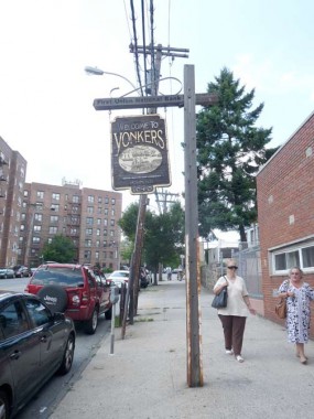
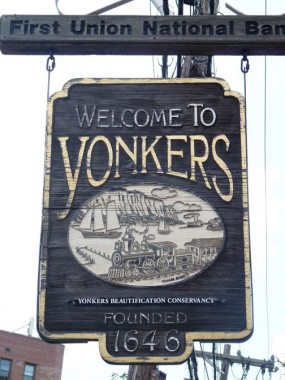
Heading west again on McLean, here’s a wood sign welcoming travelers to Yonkers, featuring the relatively rarely-used Korinna type font. The art shows what is now the NY Central Hudson Line, boats in the Hudson River, and the NJ Palisades.
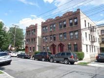
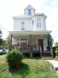
The ‘first’ north-south street west of Bronx river Road is First Street. There’s no Second or Third, so it was likely named First because it’s the first street when you enter Yonkers from the west. There’s an interesting mix of country suburban (with siding) and apartment buildings.
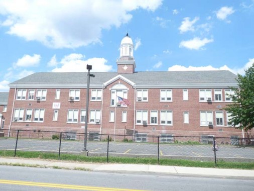
Originally School #11, this handsome building on Wakefield Avenue between Hyatt and Woodlawn is now the Yonkers Montessori Academy.
Montessori education is an educational approach developed by Italian physician and educator Maria Montessori. Montessori education is practiced in an estimated 20,000 schools worldwide, serving children from birth to eighteen years old.
Montessori education is characterized by an emphasis on independence, freedom within limits, and respect for a child’s natural psychological development, as well as technological advancements in society. wikipedia
Wakefield Avenue ascends an especially steep hill to its western end at Kimball Avenue and the edge of the Hillview Reservoir.
The Hillview Reservoir is at the crest of this hill at Hillview and Harding Avenues. The reservoir, which spans 164 acres and holds 900 million gallons, was built by the NYC Board of Water Supply from 1909-1915 to receive water from the new Catskill Aqueduct in southern Ulster County; ultimately water is drained from the upstate Ashokan Reservoir. Water enters NYC through Water Tunnels #1 and #2.
Crossing McLean Avenue and heading west on Delano Avenue, I found a couple of notable street names.
Aqueduct Avenue, which runs from Van Cortlandt Park North to Hillview, runs on top of the underground New Croton Aqueduct, constructed in 1890 as an addition to the older Croton Aqueduct.
Old Jerome Avenue, which runs a couple of blocks from VCP North to a dead end just north of Delano, is indeed part of what used to be an northern extension of the Bronx’ Jerome Avenue.
In this 1908 map, what would become Van Cortlandt Park is on the left side of the map. We see Jerome Avenue entering and intersecting at Jerome Avenue near a now-filled in pond. The Hillview Reservoir now takes up most of the right side of this map.
Today, Jerome Avenue ends at East 233rd and the Major Deegan Expressway in Van Cortlandt Park. But, in this map produced before the Deegan was built, we see Jerome Avenue making a straight line for the Bronx border at the top of the map. The Deegan would later cover this part of Jerome Avenue. Van Cortlandt Park East is the road that curves northeast above Woodlawn Cemetery.
Picturesque but small, on Devoe Ave south of McLean, west of the NYS Thruway, which is what the Major Deegan becomes north of the Bronx
On Lee and McLean Avenues, this stoplight is not quite as vintage as the one I showed in Part 1, but it’s still an old model, possibly the 1950s or 1960s.
The local denizens must know what this barber shop is called. There’s no awning sign on the outside.
School No. 21, on Lee north of McLean.
Church of St. Paul Apostle at McLean and Sherman Avenues. The parish was founded in 1923 and the church building was completed in 1925.
To get around a steep hill, here McLean Avenue takes a severe turn to the north, turning west again after a few hundred feet. Curving Lawton Street connects the two curves of McLean Avenue.
This domed residence on Lawton Street was more impressive before it was visited by the God of Siding.
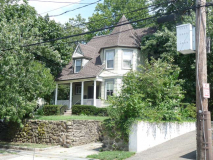
Country cottage on a severe Lawton Street curve.
A domed house similar to the one on Lawton, this one at McLean and Sedgwick Avenues.
Roadside flower and vegetable stand on McLean Avenue west of Saw Mill River Parkway, which is what Henry Hudson Parkway becomes at the Bronx line. NYC has proprietary names for its expressways; the Horace Harding becomes Long Island Expressway at the Nassau line. Sunrise Highway enters Queens for just a couple of blocks in Rosedale. The Grand Central becomes the Northern State and Laurelton Parkway becomes the Southern State. Only the New England Thruway pretty much keeps the same name in and out of NYC.
This development is called Stonehedge, not Stonehenge. Which makes sense, anyway. What’s a henge?
Since McLean Avenue runs northwest and ends at Broadway pretty much in the heart of Yonkers, which was further than I had time to go, I detoured left on Caryl Avenue, which has some picturesque houses on its eastern end.
Caryl Avenue runs down a hill to Van Cortlandt Avenue, named for the colonial-era family whose mansion still stands in Van Cortlandt Park in the Bronx.
In fact south of Caryl Avenue, Van Cortlandt Avenue dead-ends at Van Cortlandt Park, which is wholly in the Bronx.
I found another classic Yonkers stoplight in front of a brick Tudor apartment on Caryl and Saratoga Avenues. This stretch of Caryl Avenue doesn’t resemble the other, as it’s lined with tall multifamily houses.
This house at Caryl and Landscape Avenues seems to be protected by a high stone wall.
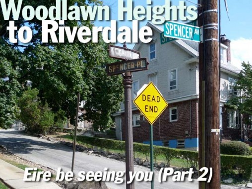
Zigzagging north on Broadway, west on Fanshaw and south on Leighton Avenue, I once again paid tribute to this survivor at Leighton and Spencer Place. Note the blue and white street signs, the manufacturer’s stamp on the base, and the NYC signs saying Spencer Avenue and the Yonkers sign saying Leighton. What happened is likely the city line runs between the signs. In the Bronx, Leighton becomes Spencer Avenue.
Meanwhile, Spencer Place begins in Yonkers, but curves south to a dead end in Riverdale!
I liked the multicolor brick on this apartment building at Huxley Avenue and West 262nd in Riverdale.
West 261st, west of Huxley.
Forster Place, a dead end lined with nearly identical dormered homes, on Huxley south of West 261st.
I liked that the owner of the corner house on Huxley and West 260th used the same maroon and beige color scheme on both the house and garage.
I packed it in at Broadway and West 260th. As Albany Post Road, NYS Route 9 and other names, this road runs north almost all the way to the Canadian border.
Here’s a fascinating film, shot around 1931, that shows Broadway from Yonkers all the way down to the Battery.
8/24/12
