

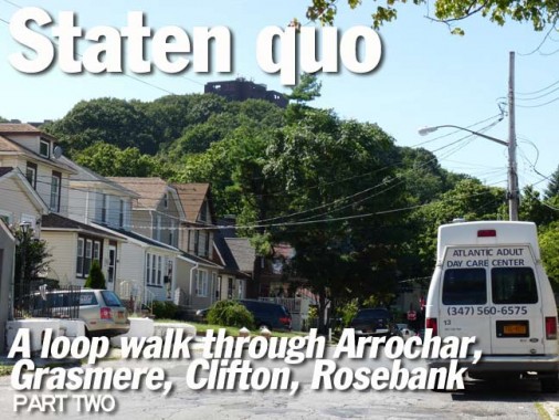
Pictured in the title card is Grymes Hill, part of a string of hills that are New York City’s highest and, believe it or not, among the highest peaks along the immediate East Coast. I visited the scene of the Grymes a few years ago — it was a fun trip since I hadn’t scaled the hill before, and I haven’t since. Each month, I try and visit NYC locales I have never seen before. I wonder what that building is atop the hill — I can see it from the ferry on the way over to the island. Is it part of Wagner College?
This time in Staten Island I was doing a Round Robin walk beginning in Arrochar, just off the bus over the Bridge, circling around through Grasmere, Concord, Clifton and Rosebank, finishing at the same bus where I started. Part 1 of the walk is here.
WAYFARING MAP: Arrochar, Grasmere, Concord, Clifton, Rosebank
I had left off in Part 1 at the Staten Island Pickle Works on Targee Street, a name I have always been fascinated with. It parallels Richmond Road for a couple of miles, relieving the 18th Century colonial route of some of its traffic. Staten Island was a very self-contained community in the centuries before the bridge opened, and some names crop up in its histories and cemetery stones over and over, such as Mersereau, Decker, Van Pelt, Disosway, Prall, Zeluff, and several others, but the name “Targee” seems to be absent from such histories, and I have always wondered what Targee the street is named for…
.
Many Staten Island neighborhoods are identified by signage sponsored by various entities, such as this American Legion post. The signs are set in eye-pleasing Zapf Chancery and Garamond Bold.
Concord is a Staten Island neighborhood neatly self-contained by West Fingerboard Road, Richmond Road, Staten Island Railway, and since 1964, the Staten Island Expressway, though at one point it extended further north into the Park Hill area: see below for Concord High School on Steuben Street. As the sign says, Concord was “established” here in 1845, but there had been human habitation here before that: the region had been called Dutch Farms, but it was renamed for the Massachusetts town after several famed writers from the MA town lived here, such as Henry David Thoreau and Judge William Emerson, from whom nearby Emerson Hill gets its name, the brother of Transcendentalist-philosophy writer Ralph Waldo Emerson. Thoreau tutored Judge Emerson’s children here in the spring and summer of 1843, the only time in his adult life Thoreau lived outside Concord, MA.
It should also be noted that in its early days, Concord was heavily settled by German immigrants and many of the community’s streets are named for German rivers: Rhine, Oder, Neckar, Weser, Elbe and Mosel(le). The Baltic Sea, which borders Germany on the northeast, is also name-checked, as is Baron von Steuben, the Prussian-born Major General of the Continental Army during the American Revolution.

Speaking of fonts and signs, this ad for local medical offices at Targee and Rome Avenue (Italy is given a nod in Concord, with Rome and Venice Avenues) hopes to revive Century Bold, rarely seen in modern typography these days.

Same corner. Periodically, I find old survey markers embedded in sidewalks. They are generally marked “City Monuments” but in Queens, they are marked Queens Bureau of Topology (or something similar to that).


Dueling PS 48s: The just-completed new building faces off across Targee Street with the old building. The new school replaced the old Doctors’ Hospital, but it is named Atlas Academy after the now-razed hospital’s founder, Dr. Teddy Atlas. The old school will become PS 9, accommodating pre-K and kindergarten students.

One of the tinier residences that survive in the area, at Targee and Hay Streets.

Nearby is a porched house completely dominated and surrounded by flora, as it the flora had evolved to produce a house instead of leaves.


Staten Island has more flags per square mile than any other borough by far (Republican-leaning districts as a rule tend to fly more flags) and there are also Bicentennial Hydrants left over from 1976. I suspect this telephone pole also sports bicentennial leftovers.


At Targee and Roosevelt Streets there’s a bend in the road but the traffic is not busy enough to rate a full stoplight, so there are a pair of cautionary Cyclops lights that blink yellow. Note the two flags in the distance.

The section of Concord just south of the Staten Island Expressway wasn’t developed until the 1950s and 1960s, and there are blocks of elongated ranch houses popular in those decades.

Candidate Giovinazzo and her flags are on the corner lawn at Targee and Baltic Avenue, but is there also a ice skates dealer here?

St. Sylvester Roman Catholic Church, Targee Street just south of Clove Road. Saint Sylvester was a 4th Century pope who served for 33 years; his feast day is the last in the year on the Gregorian calendar on December 31st. He was pope during the reign of Constantine, the first Christian Roman emperor.


The church was founded in 1923, while this postcard was produced soon after that. Emerson Hill can be seen in the rear. The parish school, founded in 1930, closed in 2011, a victim of diocesan financial cutbacks.

The Staten Island Expressway was built along Clove Road in Concord, as the road was named in the 19th Century for the cleft between Emerson and Grymes Hills that it split between. The expressway connects the Goethals and Verrazano-Narrows Bridges and, like the Gowanus Expressway in Brooklyn, opened in 1964, one of the busiest years in NYC traffic engineering history.


Green space facing Targee Street on both sides of the expressway is punctuated by World War II and Prisoner of War monuments.


For years I had thought I had located the city’s rustiest lamppost on the corner of Targee and Narrows Road South — especially when I lived in Bay Ridge, I had gone past it on the bus for decades, and year after year it hung in there. When I walked Targee, I found another that was no slouch in oxidation, either.
Since the octagonal poles made their debut in 1950 the city has periodically painted the mostly aluminum posts silver or gray. However, rusted poles are not painted and some do the job for decades coated in rust, which in the case of aluminum, can actually protect the unrusted metal underneath.

Near Pierce Street, a house doubles down on green by using green siding and a coating of ivy. I like the look.

Steuben Street just east of Targee, named for the Prussian commader who assisted Washington during the Revolution. It’s a tale of two Steuben Streets — compare this to the 4-lane speedway Steuben Street becomes when, south of the Staten Island Expressway, it connects Hylan Boulevard at the expressway and then ends at the Boulevard in Arrochar.


Steuben is one of my favorite streets on the Island. It has the tiny dwellings that dominate Concord and parts of neighboring Park Hill and Stapleton, plus this compact apartment building. But putting the dot on the i and the cap on the toothpaste tube is…

… Concord High School (PS 12) a deep red brick edifice built in 1894.

A couple of dwellings on Rhine Avenue at Steuben Street that hide their age under layers of siding.

Targee Street and Vanderbilt Avenue form an “X” in the midst of Park Hill, which with Stapleton forms some of Staten Island’s poor side of town, along with locales like Mariners’ Harbor and parts of New Brighton. This is another aged building camouflaging its age under several layers of siding at Targee and Metcalfe Streets.
The Park Hill Apartments, a privately owned but federally subsidized low-income housing complex on Vanderbilt Avenue, and also on Park Hill Avenue, became the site of steadily increasing crime and drug abuse beginning in the mid-1960s; by the late 1980s it had gained the nickname of “Crack Hill” due to the many arrests for possession and/or sale of crack cocaine that were taking place in and around the development and the adjacent Fox Hills Apartments to the south. However, crime in this area has dramatically decreased since the late 1990s. Community activists are addressing the ongoing conflict between Liberian and African American youth, primarily between the ages of 10-14. The community organizations run after-school programs to help keep the youth occupied in a productive way. This helps curb gang and street violence. The community tension that occurs in Park Hill is based on poverty and unemployment. wikipedia
Park Hill became known as “Little Liberia” after refugees from a civil war in 2007 in the western African country immigrated to the neighborhood.


Delford Street, a weed-strewn one-block street between Roff Street and Irving Place. I just stuck it on because who else would show you this street?

There must be a reason but this ancient dwelling at Delford and Irving Place has completely stuccoed over the ground floor windows, but the 2nd floor still evinces signs of habitation.

A feature throughout the neighborhoods I’m covering here… Park Hill, Concord, Rosebank… is that they eschew sewer metal openings on favor of simple openings in the pavement, covered by a slab of concrete.

You can’t tell very well but this porched house at Targee and Irving Place is completely covered in stucco.

Roots of Peace community garden, across the street on Targee and Irving Place.

Simple rectangular-shaped brick construction, Waverly Place and Targee Street. The building is home to a couple of moving van agencies, whose trucks are parked in a large lot in the back of the building.

Waverly Place was named for the Greenwich Village street, which in turn had been named for an 1814 novel by Sir Walter Scott. This pair of attached houses are about a century old — their decorative corbelling gives that away.

Another painted telephone pole, this one with the Italian tricolor. This isn’t a particularly Italian section, so I wonder what the pole once signified.

I left Targee Street at Osgood Avenue, as I cut across the back streets of Park Hill to attain Vanderbilt Avenue, where there were some buildings I wanted to see (below). Here are a couple more Staten Island miniature dwellings.


Wiederer Place, a two-block street between Osgood Avenue and Waverly Pace, looks unchanged for a century, with its collection of tiny porched homes. The stucco theme continues with the concrete duplex.


One onscure path leads to another in northeast Staten Island. Prince Street, with a charming bend in the road, issues from Wiederer Place and runs a few blocks to Vanderbilt Avenue. It features somewhat lager homes and plots. You can always tell you’re in an older neighborhood when the sidewalks feature bluestone slabs.

Hardy Street, yet another ancient Park Hill lane, runs between Prince and Roff Streets.


Turning onto Vanderbilt Avenue, I found some interesting homes, including a house guarded by concrete gateposts and an abandoned home on Pleasant Place.

The blacktop has worn down on Coursen Place to reveal the Belgian block paving underneath. You have to know your Coursens from your Corsons on Staten Island: Corson Avenue is in New Brighton.
Vanderbilt Avenue is of course named for Cornelius Vanderbilt (1794-1877). The railroad and shipping magnate, born on the Island, began his career in 1810 by instituting a ferry from Staten to Manhattan. Many Vanderbilt family members are buried in the private family vault in Moravian Cemetery in Grant City.


Unremarked about in any NYC architectural guidebook, 110-144 Vanderbilt Avenue are some of the most beautiful Tudor-style dwellings you will ever see. In 1900, the firm of Carrere and Hastings built eight houses along the family’s namesake avenue, from 110 to 144, between Talbot Place and Tompkins Avenue for George Vanderbilt in 1900. Other houses were built for Vanderbilt on neighboring Norwood Avenue; additional mansions were found on nearby Townsend Avenue, but many of them have been lost to redevelopment. The firm also designed the NY Public Library main branch at 5th Avenue and 42nd Street, and Staten Island Borough Hall.
9/8/13