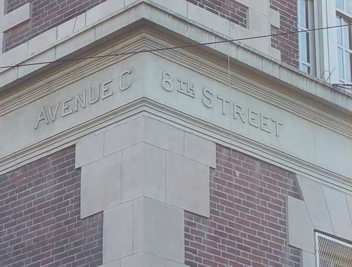
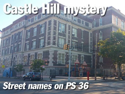
Students, teachers and administrators on PS 36, on Castle Hill Avenue south of the Cross Bronx Expressway, if they even notice them, may be mystified about the carven street names on the corners of the building: “Avenue C,” “8th Street” and 9th Street.” The actual streets are named Castle Hill Avenue, Blackrock Avenue and Watson Avenue.

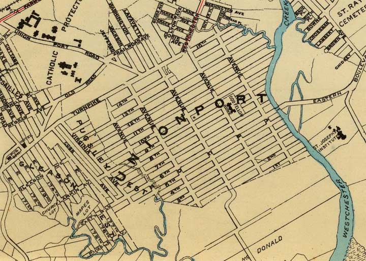
A clue can be found in this Hyde & Co. map of Unionport produced in 1900. You can find a grid layout west of Westchester Creek, with lettered avenues running north and south, and numbered avenues running east and west.
Unionport, laid out in 1851, was among the first towns in the Bronx to adopt a grid street system, and streets were named simply, by alphabet for north-south streets, by numbers east to west. Avenue A is now Zerega Avenue, Avenue B is now Havemeyer Avenue and so on. Its name seems to have something to do with the navigability of the adjoining Westchester Creek, and at one time it was hoped that a major port could be built here.

PS 36 was completed in 1901 and at that time, the bordering streets still carried their older names. Thus, the Blackrock Avenue side has “8th Street…”
… and the Watson Avenue side carries the name “9th Street.” Both sides have “Avenue C” for Castle Hill Avenue.”
Soon after this, streets in Unionport were given different names and when adjoining neighborhoods were built up they did not extend the Unionport numbering system. In 1895, all of the Bronx became part of New York County, which also included Manhattan at the time, and in time, the house numbering became based on Manhattan’s; west of the Bronx River (and in some cases, east of it) Manhattan’s street numbering system leaches into the Bronx. The Bronx became a borough of its own in 1898, and a county on its own in 1914.
Photos: Gary Fonville
8/14/15
