

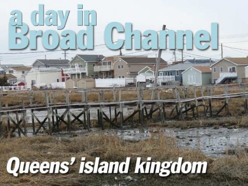
I’ll admit it. Broad Channel, other than damage caused by Hurricane Sandy in 2012, or a couple of businesses closing here and there, is the pretty much the same Broad Channel I saw during my first visit for Forgotten New York in 1999, and again in 2007. It’s Queens’ island kingdom, much as City Island is the Bronx’ island kingdom, and Coney Island used to be Brooklyn’s island kingdom before Coney Island Creek and Sheepshead Bay were severed by landfill. But every so often, I’m drawn there if only to see if anything has changed. But it changes little and that’s the way its residents prefer it. I was here to photograph a presentation for my partners the Greater Astoria Historical Society, but here I’ll be able to show a few mor scenes that I discovered.
Giving the usual historical background: Broad Channel (Island) is the only permanently inhabited island in Jamaica Bay, located between Howard Beach in Queens (Long Island) and the Rockaway peninsula. The small town on the island was largely built by the Broad Channel Corporation, which in the 1910s filled in marshes and rented parcels of land for $116 per year for anyone building a summer home in the area, which first gained attention when the New York, Woodhaven and Rockaway Railroad bridged Jamaica Bay in the 1880s. For many years, Broad Channel and three other stops along the NY,W&RR were summer havens for fishermen. By the 1910s, however, Jamaica Bay began to be too polluted for any recreational or commercial fishing to be feasible.
The Roaring Twenties brought Prohibition and concurrent rum-running on the isolated island, which had no vehicular connection to the rest of New York City until Cross Bay Boulevard was built in 1925. The boulevard is connected to Howard Beach by the Joseph P. Addabbo Bridge and to the Rockaway Peninsula by the Cross Bay Veterans Memorial Bridge. The Marine Parkway Bridge, later renamed the Gil Hodges Memorial Bridge for the Brooklyn Dodger first baseman and New York Met manager who lived in Marine Park, bridged the bay beginning in 1937.
When the Broad Channel Corporation went bankrupt in 1939, the City took title to all homes on the island; residents did not truly own their own homes until around 1980, when “tenants” finally purchased the land from the City. Broad Channel did not have sewers until 1988.
I arrived in Broad Channel on a February Sunday in 2016 where I met an associate for over 30 years, Vinny L. who has endured my presence on these FNY voyages of discovery for 17 years. On this occasion I took the Q53 express bus from the LIRR in Woodside, which deposits you in BC in about 30-40 minutes. The usual method of approach for me has been the A train from Penn Station, but weekend service is now spotty and a trip to BC can be made in about an hour. The bus is a lot faster if you live in Queens and want to connect from the #7 train or LIRR.


The weather was murky and mild, like much of the winter of 2016, but there was sufficient visibility for decent pictures; this is looking west from Cross Bay Boulevard and 8th Road. Looking across Jamaica Bay you can make out the Marine Parkway Bridge that connects Flatbush Avenue and Riis Park on the Rockaway peninsula.
Geographically, Broad Channel is laid out much like the Bronx’ island kingdom, City Island. There is a central spine (Cross Bay Boulevard) and ribs (numbered Roads with East counterparts east of Cross Bay Boulevard). Surrounding the subway station the island is sufficiently wide to support additional north-south streets, which bear actual names: Church, Walton, Lanark and West Roads. Noel Road runs east between East 7th and 8th Roads, and a Shad Creek Road runs a few blocks between Cross Bay Boulevard and 10th Road. And, there’s Channel Road which is a special case as you will see.

Turning my 18x zoom to the max to get this view of the Shining City from Cross Bay Boulevard and 6th Road. I read recently that a commercial digital camera with an 83X zoom went on the market last year [2015]. Anyone have experience with it? Let me know in Comments.
In the foreground is the Broad Channel Wetlands, a part of the Jamaica Bay Wildlife Refuge.

There was no vehicular connection from Broad Channel to the rest of New York City until Cross Bay Boulevard was built in 1925. The boulevard is connected to Howard Beach by the Joseph P. Addabbo Bridge and to the Rockaway Peninsula by the Cross Bay Veterans Memorial Bridge. The Marine Parkway Bridge, later renamed the Gil Hodges Memorial Bridge for the Brooklyn Dodger first baseman and New York Met manager who lived in Marine Park, bridged the bay beginning in 1937.


There’s very little commercial activity on Cross Bay Boulevard, which I found a bit odd. There’s a short commercial strip around 9th Road with the basics, but most island residents own automobiles and rive to Howard Beach for anything more than groceries or a slice of pizza. Much of the stretch is lined with private homes, many of them newly-aluminum sided post-Sandy.


Broad Channel’s only two churches, St. Virgilius Roman Catholic and Christ Presbyterian are only a half block away from each other on Noel Road and Church Road (the road is probably named for the Presbyterian church). The Catholic church and school are refreshingly modest buildings dating to 1924. The St. Virgilius convent, which appears similar to a regular residential building save for the presence of a cross above the front door, is a few blocks away at Noel and Lanark Roads. St. Virgilius merged with St. Camillus on the peninsula in 2008; when Christ Presbyterian was damaged by fire and storms, St. Virgilius welcomed its congregation.
The parish namesake was a medieval Irish churchman and astronomer; he maintained the earth was spherical centuries before it became common knowledge.


The Broad Channel Volunteer Fire Brigade was organized as bucket brigade to help minimize property loss due to fires. In 1907, this brigade was formally organized into the Broad Channel Volunteer Fire Association under its first Chief, Edward H. Schleuter. The current firehouse at 15 Noel Road, still in use, was opened in the summer of 1908.


At #204 East 6th Road near West Road is a bungalow with a wide yard and carport, home to either an enthusiastic ceramic collector or perhaps, manufacturer.


The Long Island Rail Road acquired the New York, Woodhaven and Rockaway Railroad in the early 1900s and ran trains across a succession of wooden bridges until 1950, but after a series of devastating fires the railroad sold the right-of-way to New York City, provided part of the island could be retained as parkland. A new metal bridge was built, and subway trains began crossing Jamaica bay and stopping in Broad Channel in 1956. Until 1975, passengers were compelled to pay an extra fare upon exiting from Broad Channel and the Rockaways, since the stations were so far away from everywhere else in the system.
Both the Broad Channel station and its powerhouse present a utilitarian face of the island community.


Here’s a look at the platform early on in operations that began in the summer of 1956. More photos from the Broad Channel station at NYC Subway.


A classic car collector lives ay West Road and East 9th Road and seversal of his masterpieces were parked near his home, including this General Motors “old look” bus, most of which rolled off the assembly line between 1940 and 1959 (when GM began producing the “fishbowls” that ruled city streets well into the 1980s). GM old looks dominated in NYC as well and some routes (some in Staten Island) continued with them well into the 1970s, along with similar models produced by Mack.


One of the Ford “F” series of pickup trucks and other commercial vehicles made between 1948 and 1952. The F-1 through F-3s were pickup trucks.


Willys Jeep Trucks were produced from 1947 to 1969. The company was founded by John Willys in 1912 after he purchased Overland Motors. Willys-Overland was a top manufacturer in the early days of the automotive industry. The brand survives today as Jeep, a vehicle first produced during World War II.

West 9th Rd. between Lanark and West Roads, to give you an indication of how narrow most of Broad Channel streets are.

A Brooklyn-bound A train is about to arrive at Broad Channel.


Unmarked on most maps, Lanark Road extends south past East 9th Road to an arm of Jamaica Bay where some new-ish houses have been constructed. It’s a semiprivate area some of whose mailboxes are clustered at the junction of Lanark and East 9th.
Like the Rockaways, Broad Channel has its own street and house numbering system independent from the rest of Queens. There was once a plan to have Broad Channel join the overall numbering system, but that plan was scrapped. It would have meant avenues ending at 205th Avenue.

Along with some other houses on East 9th Road the backs of the houses seem to face the road. I did some research on this perplexing situation.


If you look at a 1949 Hagstrom showing Broad Channel, there was a tiny road running east to west accessed by Walton Road south of East 9th Road called Essex Court. Today, Walton Road still extends past East 9th a little, and there’s still a remnant of Essex Court there marked by a few nonfunctioning General Electric M-100 lamps. These were once found on NYC streets by the thousands on side streets, with dim whitish mercury vapor lamps and no diffuser bowls. In the 2010s the diffuser-less design has been revived with the takeover of Light Emitting Diode lamps, which also shine white light, though somewhat brighter.

An Irish immigrant influence is still felt in Broad Channel and especially in Rockaway Park, the “Irish Riviera,” and in Breezy Point, said to have the largest concentrated Irish-American population anywhere in the city.
Irish language orthography has nothing to do with English. The name of this Irish town is approximately pronounced “croc widda” though some say “k’nok widda.” In English, it’s plain “nok.”

The former Wharton’s Apothecary, on Cross Bay Boulevard and West 9th Road, had been Broad Channel’s only drugstore. There are delis and pizzerias but many Broad Channelers drive to Howard Beach or the Rockaway peninsula for provisions, gasoline, clothing and other necessities.
The building is a decent facsimile of the detailed styles favored in the late 1800s, and received an award from the Queens Chamber of Commerce in 2006. The interiors also continue the period feel.
There is no Wharton, by the way; owner and builder Charles Howard, a Channeler, called it Wharton’s Apothecary because he noticed that names of many great American companies – Wal-Mart, Woolworth’s, Waldbaum’s – start with the outsize letter W.


Broad Channel’s brief business section, boasting two pizzerias on the same block. As mentioned, most Broad Channelers travel to Howard Beach for most necessities.

East 12th Road is where reality gives way to the Unknown and Unfathomed. A rickety boardwalk leads out over the marshes.


At low tide, a sticky, soggy, muddy mess appears under the almost-swaying structure, revealing the long-empty mussel shells that have been there for perhaps years.


A small sign admonishes the visitor to not attempt the splintered, creaking walkway that once accessed waterside docks serving the homes splayed out between the walkway and Jamaica Bay.


We did not linger long at this redoubt, as we suspected that whatever denizens that still lived here would remonstrate with us severely about what “keep out” means.

Sometimes, it is not wise to look back upon where one has been; Horror is the only realistic response. This bridge separated us from a demise in the murk and feed for shipworms.

We (in NYC) don’t give names — or at least well-known ones — to bridges that carry rail traffic, as a rule; there’s the Hell Gate Bridge, but that’s too massive to ignore. This unsung bridge, seen from the giddy bridge over the Broad Channel swamps, carries the IND Rockaway Line over lower Jamaica Bay between Broad Channel and the peninsula. The Dayton Towers loom in the background.

Returning to Cross Bay Boulevard, the notations on the dwelling reflect a seeming tardiness by the authorities in restorations following Hurricane Sandy in October 2012.


The roads west of Cross Bay Boulevard peter out at the water’s edge, allowing superb views of Jamaica Bay, its marshes, and Manhattan and Brooklyn beyond. At the end of 14th Road, we happened upon Dan Mundy Senior, the chief of Jamaica Bay Eco Watchers, a group dedicated to the preservation, protection, enhancement and restoration of the fragile ecosystem of Jamaica Bay. Dan appears in this new film that discusses the ongoing restoration of the bay and the wildlife that inhabits it.
Meanwhile, the Jamaica Bay Wildlife Refuge just north of the town of Broad Channel offers one of the very best opportunities to observe migrating birds, including some rare ones like the piping plover; according to the Brooklyn Bird Club, birds that frequent the area surrounding the over two miles of trails include the yellowthroat and redstart warblers, osprey (a small eagle that catches fish), oystercatchers and willets. Herons, egrets, ibis and barn owls make themselves less obvious, though sharp vision and a pair of binoculars and perhaps a spotting scope will see you through. The trails themselves offer a wide, flat expanse with views of Coney Island to the west and midtown Manhattan to the northwest. The Refuge seems to be a world away from bustling New York City, yet it is just a short ride away.

Leaving Broad Channel for now with a demonstration that at least some of its needs are immediately taken care of. And never was there a more appropriate place fpor a dead end sign…
3/27/16