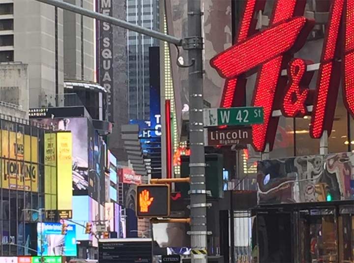
In 2009, the Department of Transportation posted a Lincoln Highway sign in the maroon color generally used to denote NYC Landmarked districts at West 42nd Street and Broadway in Times Square. Like Route 66, the old Lincoln Highway has mostly been decommissioned or goes by different names now, but it was once the sole vehicular roadway in the United States connecting the East and West Coasts.
Times Square was originally the eastern terminus of the intertranscontinental highway, which was privately constructed by an association formed by Indiana businessman Carl Fischer beginning in 1913. The 3,389-mile road originally traveled through 13 states, matching the United States’ original complement: New York, New Jersey, Pennsylvania, Ohio, Indiana, Illinois, Iowa, Nebraska, Colorado, Wyoming, Utah, Nevada, and California; a 1928 realignment took it through a 14th state, West Virginia. The route can be retraced along existing roads today, mostly along US 30; the government-sponsored state numbered system of roads was instituted in the 1920s, and the US Interstate system in the 1950s. Today the main cross-country Interstate is I-80. The Lincoln was developed in the era before many of today’s bridges and tunnels were constructed, and was carried by ferry across the Hudson River from Manhattan to Weehawken, NJ. The road ended at the California Palace of the Legion of Honor in Lincoln Park, San Francisco, where there is a substantial memorial to it.
Along the route, statues of Lincoln were installed as well as hundreds of markers, some of which are still in place today. NYC unveiled its sign in 2009, the bicentennial of Lincoln’s birth. This is the second sign — originally in capitals, it was changed out for a sign in upper and lower case a few years ago.
The Lincoln Highway: Coast to Coast from Times Square to the Golden Gate
Check out the ForgottenBook, take a look at the gift shop, and as always, “comment…as you see fit.”
2/16/18