

I had no idea I would be writing about either Donald Byrd or Teasdale Place in the Bronx today, since I was scouring Google Street View looking for something else, but it just goes to show that there’s always fodder for a Forgotten NY page and I rarely run out of material. Which is a good thing in the spring of 2020.

Boston Road branches off from Third Avenue in the Bronx a bit north of East 163rd Street (in that borough, it’s always Third, never 3rd) and basically runs a few hundred miles to Boston, as part of US Route 1. However: in a long story I won’t duplicate here as I have mentioned it elsewhere in Forgotten NY, it doesn’t replicate the old Boston Post Road route until you reach Westchester County.
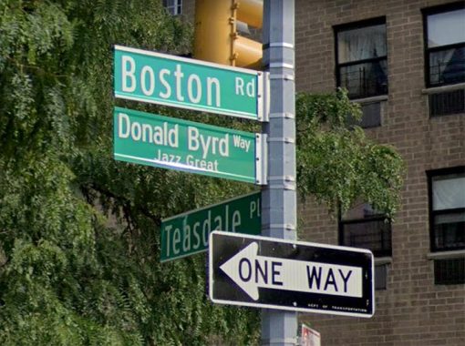
In 2017, the Department of Transportation subnamed the intersection of Third and Boston Road for jazz great Donald Byrd. I’m not a big jazz guy (I dabble in John Coltrane and Miles Davis) but I consider myself something of a pop and rock historian at least in the Age of Rock, 1955-2000; show tunes and big band came before 1955, and hip hop and beats music dominated after 2000. Thus, my only pure acquaintance of Donald Byrd came via a pop hit that he had when he produced the Blackbyrds, a group of student musicians at Howard University, who had this 1975 smash:

Byrd was much more than that; he was a great jazz trumpeter of the 1950s and 1960s, and had a generous outlook that incorporated elements of R&B. As a member of the Jazz Messengers, he played with Coltrane, Sonny Rollins and Max Roach. He “discovered” Herbie Hancock, who first appeared on vinyl on Byrd’s 1961 Royal Flush collection.
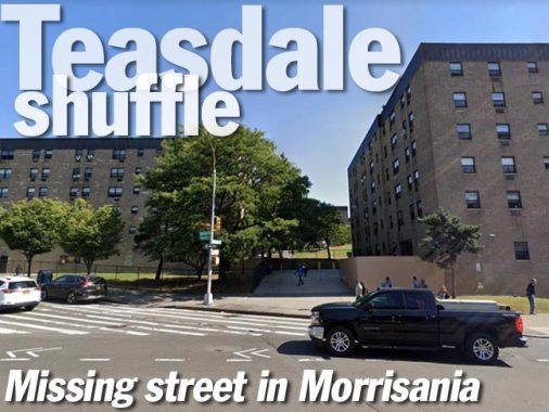
Though a Detroit native, Byrd resided for a time in the unnamed housing project seen to the rear of the signs.

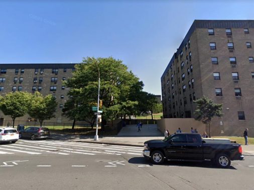
Speaking of the signs, note the sign for “Teasdale Place” in the rear. As you can see from the above image, there’s no such street there; it’s a walkway through the housing project, and if you followed it all the way through to Cauldwell Avenue, you’d find a Teasdale Place street sign there, too.

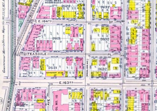
Well, you might have guessed it, s this 1911 map indicates, Teasdale Place was a real street at one time and it went two blocks, running east as far as Trinity Avenue. However when the housing project was built, it swallowed the Place whole… and it exists now only on the street signs. I strongly suspect that some of the houses in the project were given Teasdale Place addresses, which explains the sign’s persistence. If you know of anyone who can confirm, let me know in Comments.

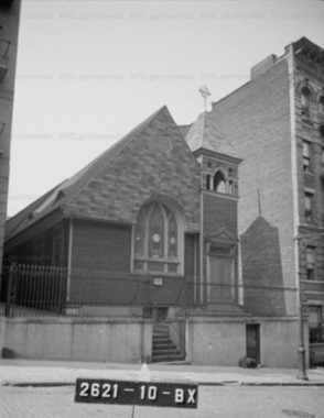
Of course, Teasdale Place was once a through street as these 1940 photos from the Municipal Archives show. This was the Bethany Lutheran Church, shown on the map…

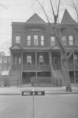
… while these were #650 and 652 Teasdale Place, just off Cauldwell.
Check out the ForgottenBook, take a look at the gift shop, and as always, “comment…as you see fit.”
3/24/20