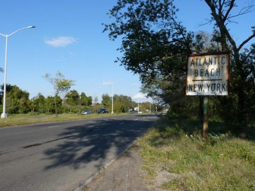
This white enamel directional sign can be found on Seagirt Boulevard just east of Beach 9th Street. It was probably placed there and is incomplete; it likely had an arrow at one time, as traffic needs to be prepared to turn right in order to cross the Atlantic Beach Bridge, at the end of the boulevard. Seagirt Boulevard was constructed in 1952 as an express route connecting Beach Channel Drive and Beach 35th Street with the bridge. It overlies much of a preceding route, Seagirt Avenue, and there are a pair of orphaned sections of Seagirt Avenue in Far Rockaway south of the Boulevard.

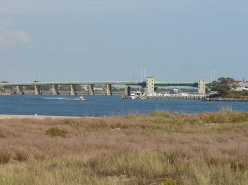
The Atlantic Beach Bridge connects the communities of Lawrence and Atlantic Beach, each in Nassau County just east of Far Rockaway, Queens. It also connects two islands, Long Island and Long Beach Barrier Island; travel east from Atlantic Beach and you will arrive in the popular seaside community of Long Beach. This is the second Atlantic Beach Bridge on the site; the first was a 120-foot drawbridge that opened in 1927. It was replaced in 1952 by the current span, also a drawbridge but 1175 feet long and with six traffic lanes instead of the former three.
One quirk of the Atlantic Beach Bridge was not only an original vehicular toll of 25 cents but also a toll on the pedestrian and bicycle lane of five cents, enforced by a turnstile. The walkway toll was eliminated when the vehicular toll was raised for the first time. Also, on the approach ramps, you’ll see a set of metal “Whitestone Bridge” lampposts, now a rarity in the five boroughs.
Check out the ForgottenBook, take a look at the gift shop, and as always, “comment…as you see fit.”
8/12/20
