The railroad tracks running along Manhattan and the Bronx’s Hudson River frontage are on what is among the oldest railroad right-of-way in the country. The New York and Hudson River Railroad was incorporated in 1847 and laid tracks along the river to connect mid-Manhattan with upstate locations; by 1849 the railroad had reached Peekskill. A wood trestle was built across Spuyten Duyvil Creek. At the creek, the division between Manhattan and the Bronx is quite clear. East of there, though, things get complicated.
In a little-known quirk of geography, a small piece of the borough of Manhattan, known as Marble Hill, is on the mainland. It is surrounded on three sides by the Bronx and on the south by the Harlem River. It shares its character with the neighborhoods of Kingsbridge and Kingsbridge Heights on its north and east. It is protected from Spuyten Duyvil, on the west, by a steep hill.
In 1895 it was separated from the island by the newly straightened, dredged and deepened Harlem River Ship Canal, leaving Marble Hill as an island itself. When, in about 1917, the creek was filled, Marble Hill became a part of the mainland!
No one cared much until the el was built through Marble Hill and apartment buildings were constructed in the 1920s, joining the few frame houses that were already there. Marble Hill never changed its designation as part of Manhattan, and so a part of Manhattan it stays, separated from the rest of the borough by the Harlem River.

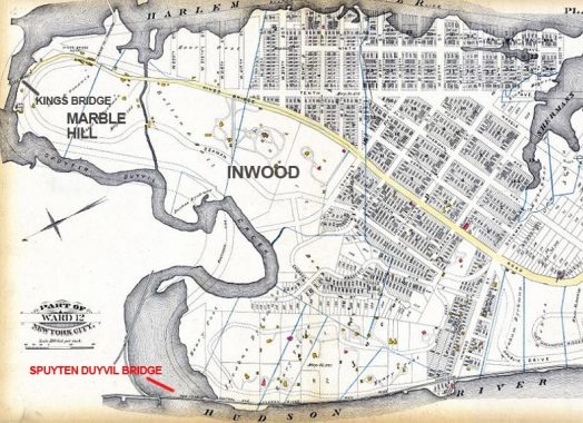
Here’s an 1885 map showing Manhattan, Bronx, and Spuyten Duyvil Creek. At this point, Marble Hill was an island separated from Manhattan Island by a narrow channel which would be expanded into a canal. later, of course, the Harlem River was redirected west to join the Hudson River. However the western end of Spuyten Duyvil Creek is unchanged in width from 1885, and is still spanned by a bridge of about the same length.
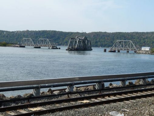
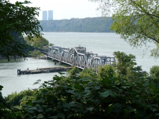
The swing bridge we see today was built in 1899 by engineer Robert Giles and is about 600 feet in length. The central section is 290 feet across and can be swung round to allow shipping to pass with the aid of an electrical engine. In 1983 a Circle Line boat struck the bridge and necessitated an overhaul. The boats that use the Harlem River at this point for the most part are Circle Line boats. The captain places a call to the bridge operator to swing the bridge open to allow passage.
New York Central/Conrail used the tracks exclusively until 1991 when Amtrak switched its terminal from Grand Central to Penn Station, necessitating running some routes along the tracks.

On October 10, 2020 I was lucky enough to see the swing bridge in both closed and open positions from the Spuyten Duyvil Metro North station, though I did not see it actually turning, nor did I see what boat required passage to the Hudson River.
Check out the ForgottenBook, take a look at the gift shop, and as always, “comment…as you see fit.”
10/12/20
