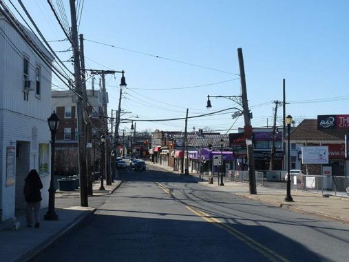
AMBOY Road, seen here near Nelson Avenue Giffords Lane in Great Kills, is one of the lengthiest routes in Staten Island, splitting off from Richmond Road in New Dorp and running through Great Kills, Annadale, Pleasant Plains and other neighborhoods to the Arthur Kill waterway in Tottenville. Interestingly, Amboy Road house numbering in New Dorp doesn’t begin at #1; rather, it continues Richmond Road’s numbering in the 2500s, with Richmond Road skipping to #3009 and continuing west from there. Though a busy route, it is mostly a two-lane road with parking, occasionally expanding to four but never becoming a behemoth as say Richmond Avenue does.
The street name can also be found in Brooklyn and Queens. Irving Shulman’s novel The Amboy Dukes tells the story of East New York street gangs in the 1940s; Ted Nugent’s first band in the 1960s, which had the big hit “Journey to the Center of Your Mind” was named for the novel.
Staten Island is a borough whose street names have changed more than once over the centuries. In southern Staten Island the few routes that ran through the area have changed: Washington to Arden; Bridge to Richmond; Fresh Kills Road to Arthur Kill Road. Yet, Amboy Road has remained consistent since at least 1873, as on this set of maps. Also see another set from 1917.
Amboy Road is named for Perth Amboy, New Jersey, which in previous centuries was accessible by ferry from Tottenville. The city, in turn, has two names of wildly different origins: Amboy from the Lenape Indians, who called the region Ompage, and Perth after Scotsman James Dummond, 4th Earl of Perth; in the colonial era, Scottish immigrants settled in the area (across the Arthur Kill, southern Staten Island was dominated by French Protestants called Huguenots, and immigrant Belgians, called Walloons.
As always, “comment…as you see fit.” I earn a small payment when you click on any ad on the site.
9/8/21
