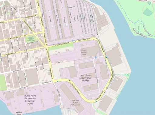
TAKE a look at this section of a vintage 1922 Hagstrom Bronx map … I isolated Hunts Point. There is an entire section of streets that has been completely wiped out where the Hunts Point Cooperative Market is now. All north-south cross streets were eliminated in the early 1960s when the complex, which now hosts the former Fulton Fish Market, was constructed.
The eliminated streets had been built and weren’t paper streets, though the westernmost were paved and had houses along them; the easternmost were dirt roads, with sheds and warehouses, I’m not sure if there were streetlamps or signs. There were nine such eliminated streets:
| STREET | ORIGIN | ||||
| Payne Street | John Howard Payne, author of “Home Sweet Home” | ||||
| Bacon Street | Sir Francis Bacon | ||||
| Sacrahong Street | Stream separating Hunts Point from Morrisania; now buried | ||||
| Farragut Street | Admiral David Farragut | ||||
| Falconer Street | Poet William Falconer | ||||
| Preble Street | Admiral Edward Preble | ||||
| Kane Street | Explorer Elisha Kent Kane | ||||
| Porter Street | Unknown | ||||
| Dahlgren Street | Admiral John Dahlgren |
Sections of Caswell, Ryawa, Viele, East Bay, Oak Point, Randall and Spofford Avenues as well as Edgewater Road along the Bronx River also were paved over to make way for the Hunts Point Market.

Today, a busy 4-lane roadway prosaically called Food Center Drive makes a semicircle in the market. Unlike the Brooklyn Navy Yard, it’s accessible to the public and even has a bicycle lane.

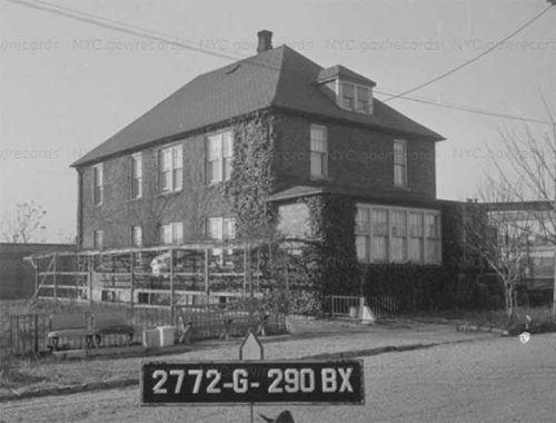
House on Payne Street in 1940. Photo: NYC Municipal Archives
Kane Street, at the east end, wasn’t as developed and was left unpaved, with some garages and sheds.
A short piece of Farragut Street, unmarked by the Department of Transportation, is a dead end off Food Center Drive. It leads to Hunts Point Landing, a public park.
As always, “comment…as you see fit.” I earn a small payment when you click on any ad on the site.
11/2/22
