

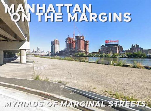


As many Forgotten Fans know, I am a voracious map reader. I consult old maps mostly online these days, but I have dozens, perhaps a hundred or two, ancient street maps from around the country collected in milk crates in my closets. They’re in fragile condition…and when I acquired them in the 1970s, they tore easily even then, and I foolishly tried to repair them with tape, which has gotten brittle and yellowed. I would like a library to take them off my hands. These maps, produced by Rand McNally, Hagstrom, Geographia, Gousha and other makes, are now unusable because streets have changed so much since then, especially the downtowns; in most cases, small streets and alleys have been eliminated in favor of building projects or superblocks. (Ebay? All those shipping costs? Please.) Those maps, though, work for me as historical records of former street layouts and were all hand-drawn by mapmakers, an art that is simply lost these days.
Marginal Street, Hudson

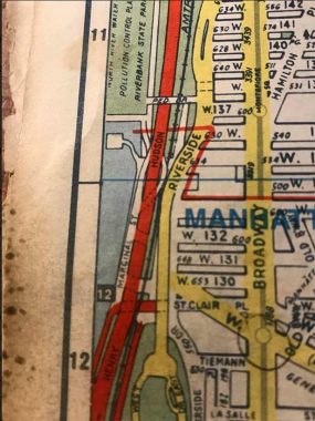
Here’s an excerpt one of those hand drawn maps I was talking about. I keep a very battered and yellowed Hagstrom NYC 5 Borough Pocket Atlas made in 1997, a couple of years before Hagstrom switched to computer rendered maps, by my computer at all times. (I have factory-fresh versions of the Hagstrom Pocket Atlas and the full size atlas on my bookshelf that I refuse to crack in hopes of keeping them pristine.)
Today, I want to talk about a number of streets in Manhattan and the Bronx called “Marginal” or “Exterior.” There are, or were, multiple versions of these streets, and Hagstrom, in particular, was fond of marking them…in some instances, whether they existed or not! They are found literally on borough margins, along the Hudson and Harlem Rivers.

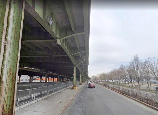
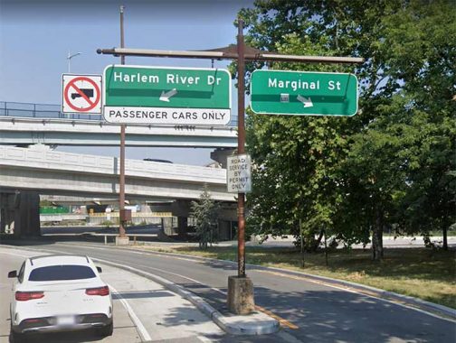
However, the Marginal Street shown on the map above does exist and is even given a green and white street sign or two. It is located beneath the elevated Henry Hudson Parkway and begins at a southbound off ramp at west 133rd Street, running along the Hudson River Greenway bike-pedestrian path as far south as St. Clair Place, where a ramp rejoins the HHP.
Marginal Street, Harlem

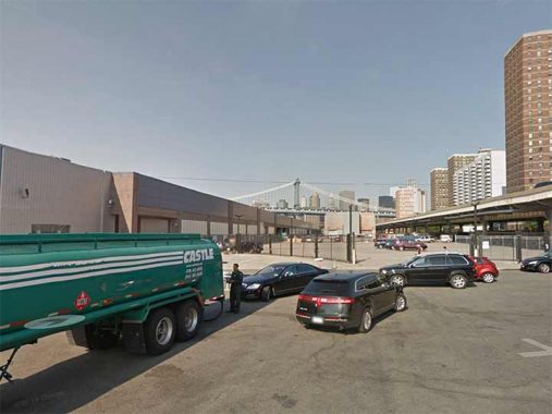
For Manhattan’s second Marginal Street, we move all the way east, to 2nd Avenue and East 127th Street at the “Crack Is Wack” playground, where there is an entrance ramp to the Harlem River Drive (as the Franklin D. Roosevelt Drive is known north of the Triboro Bridge). Oddly, though, the ramp is bifurcated with one side going to “Marginal Street”….


…and the other going to a dirt road by the side of the Harlem River, unfenced, and unlit by streetlamps. Any motorist straying here runs the risk of heading straight into the drink. Needless to say the Street View camera didn’t get this far and I have no idea how long this Marginal Street extends; it seems to be an area for truck parking.
Of interest nearby are a pair of original iron Harlem River Drive sign stanchions, one of which is shown above.
Marginal Street, Stuyvesant Town

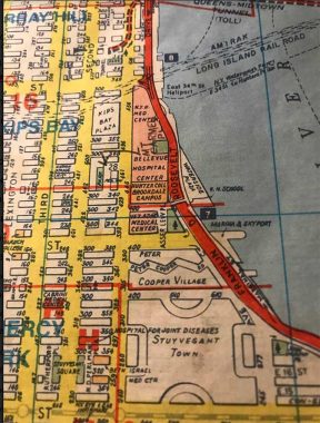
The next Marginal Street marked by Hagstrom is at the east end of East 23rd Street where it meets the FDR Drive.

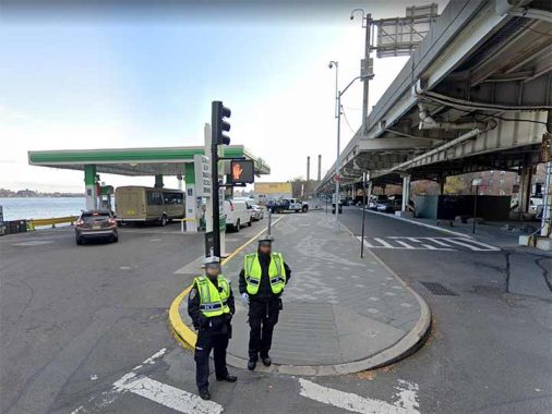
There is sort of the remains of a street here, though it’s now occupied by a parking garage (out of the picture behind this, a BP gas station, and a pedestrian/bike path further south.
Marginal Street, Turtle Bay

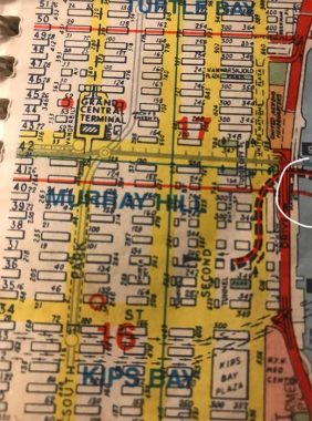
The Marginal Street marked by Hagstrom at the east end of East 42nd Street, in the shadow of Tudor City and the UN headquarters, is barely perceptible even by the most eagle eyed map enthusiast. I circled it in white here. This is why I loved the old hand drawn Hagstroms, as additions were scribbled in with every new addition. I sent in corrections, some of which were done in later editions, and at least the first time I did this got me an interview in 1981. I didn’t get a job, but it was fun to be ushered into the inner sanctum. I interviewed again in 1992 when the company was in Queens and struck out again: but just as well, as the fact checking positions I was angling for paid poorly.

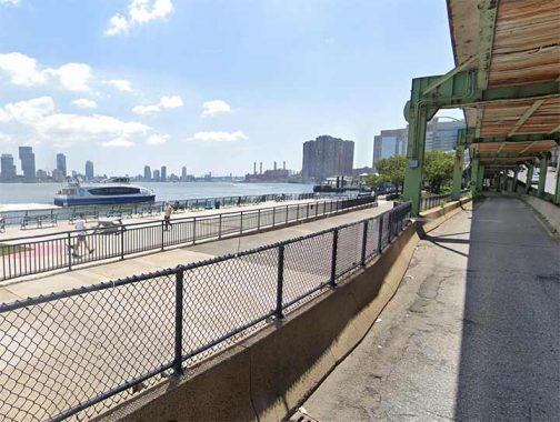
This Marginal Street, if it existed at all, has now been converted to a bike and pedestrian path, as the one at 23rd Street was.
Marginal Street, Lower East Side

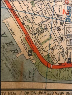

The last hand drawn Hagstrom placed a Marginal Street at South and Montgomery Streets at Corlears Hook, where the coast of Manhattan makes a curve to the north. This is the point that the East River Drive becomes the Franklin D. Roosevelt Drive.
From 1941 to 2002, all of Hagstrom’s New York City maps were based on a single master map that was updated by hand. This produced a number of other visual artifacts; new streets and neighborhoods had to be shoehorned into layouts designed around previously existing features. A number of quirky and archaic labels also remained, such as “The Shed”, a large disused building on Pier 42 on the East River [wikipedia]
Exterior Street, Park Avenue


The Bronx cognate of Marginal Street is Exterior Street, which pops up at various locations but always adjacent to the Harlem River. The southernmost section runs along the Major Deegan Expressway, beginning at a stub of Park Avenue at East 153rd Street and continuing north along the MDE and eventually, beneath it. Probably the most-traveled section of Exterior Street runs north from East 149th Street at River Avenue under an elevated section of the Major Deegan along the Bronx Terminal Market, disappearing into a thicket of ramps about a mile north of there.
Exterior Street, High Bridge

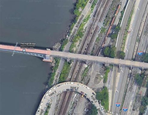
A second section of Exterior Street runs for quite a distance between the Deegan and Harlem River, accessible from Depot Place, which spans the Deegan from Sedgwick Avenue. The Street View truck didn’t bother with it…or was denied access, but the overhead view captures its location. It is unmarked by street signs and has no lamps.
Exterior Street, Fordham


A third section of Exterior Street, also unmarked by signs or streetlamps, is accessible by the westbound lane of Fordham Road at the university Heights Bridge. it runs north past storage facilities and a concrete plant, which is likely why it exists.
Exterior Street, Kingsbridge

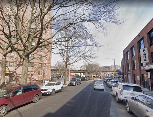
A lengthy one-block, yet decently traveled, section of Exterior Street runs a block from West Kingsbridge Road north to Broadway at west 230th Street along the Marble Hill Houses (shown at left).
Marginal Streets, Highland Park


Brooklyn is not to be outdone with Marginal Streets: however, Marginal Street East and West are well inland. They are lengthy dead end streets, with residences, that appear on either side of the Jackie Robinson Parkway with one meeting Bushwick Avenue and the other Jamaica Avenue, facing green spaces on either side of the parkway. Why they were named “Marginal” is an exercise for the reader.
As always, “comment…as you see fit.” I earn a small payment when you click on any ad on the site.
12/10/22