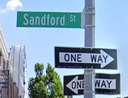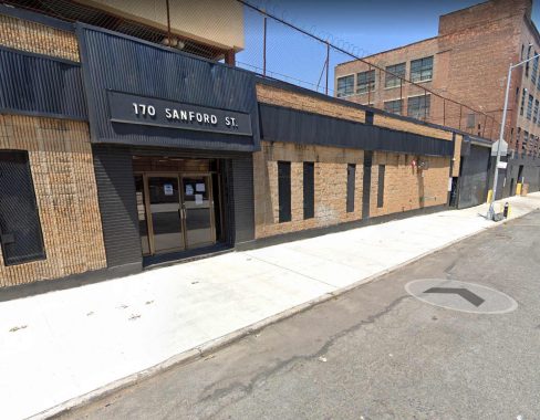
I have written before about Beverly Road in Brooklyn, which runs from Kensington all the way east through Flatbush to the border of Brownsville, since the city really can’t decide whether to spell it Beverly or Beverley; its two subway stations, on the Q and the 2/5, have Beverly for the former and Beverley for the latter. Street signs have had one or the other.

I’ve found another example of the genre, Sandford (or Sanford) Street, which runs from Myrtle Avenue south to PS 54 just past Willoughby. It used to extend north to Flushing Avenue, but I’ll get to that in a sec. In the title card is #170 San(d)ford on the corner of Willoughby, and above we see a relatively new sign with the extra “d” at the same intersection…

…while at Myrtle Avenue, it goes without that extra “d.”

While Google Maps has “Sanford”, Open Street Map has “Sandford”…
…and in the 1970s, the city washed its hands of the whole thing and named the two-block stretch between Flushing and Myrtle Avenues as “Warsoff Place.” Unfortunately I know of no Sandfords, Sanfords or Warsoffs for whom these streets were named as my usual reliable references are silent. Just another quirk to point out in this, your Forgotten NY website.
As always, “comment…as you see fit.” I earn a small payment when you click on any ad on the site.
12/19/22
