I have written about Kings Highway a number of times in FNY and have walked much of its length over the quarter century I have posted on Forgotten NY. I have always been fascinated with it because it meanders across the street grid of southern Brooklyn, seemingly aimlessly. It follows a colonial-era road that likely overlaid a Native American footpath. However, the modern Kings Highway, which runs from Bensonhurst to Brownsville, is actually an amalgamation of two separate roads. The road has a split personality; the west end, up to Ocean Avenue, is two lanes but is one of Brooklyn’s busiest shopping strips. East of Ocean Avenue and Avenue P, Kings Highway gains multiple lanes and acts as a surface highway; both Kings Highway and Linden Boulevard were converted to their current form at the dawn of the auto era in the early 1920s.
The term “highway” refers to a main road between two towns or cities, one that was under the special protection of the monarch as an essential communications link (hence the later phrase the “king’s highway” to refer to such important roads). Kings County’s Kings Highway originally began at Fulton Ferry and followed the courses of Fulton Street and Flatbush Avenue south to about Flatlands Avenue and then turned southwest toward today’s Gravesend and Bensonhurst. A piece of that road remains today as Kings Highway. As for the piece of Kings Highway northeast of Flatbush Avenue, I’ll get to that.

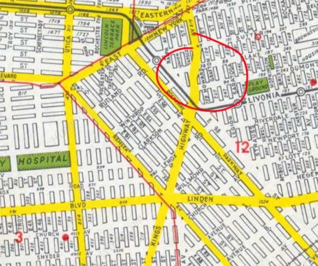
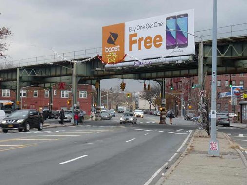
Today I’m here to talk about Kings Highway’s east end, which I always found a bit curious. Years passed between when I first saw it on maps in the 1960s and when I actually saw it from a vehicle in the 1970s. Kings Highway’s official end comes at East 98th Street, shown in the photo above. But a road continues northeast of that. When i first saw this map in the 1960s I assumed Kings Highway continued north to the intersection of Sutter and Howard Avenues. A road does continue there: but it’s not Kings Highway. (In fact the Geographia “Little Red Book” street guide — I have multiple editions — calls it Kings Highway…erroneously).
Instead, in a very curious situation, the road continuing north is a wide section of Tapscott Street between East 98th Street and Blake Avenue. North of that, the Kings Highway “path” is a wide section of Howard Avenue. Why traffic engineers set it up like this is a mystery to me.

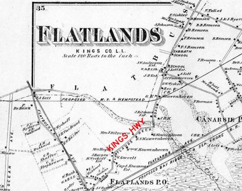
What is now known as Kings Highway northeast of Flatbush Avenue was never a part of the colonial-era Kings Highway, whose route I mentioned previously. Instead, it overlays on an old road called Flatland Neck Road, which ran from Flatbush Road (now Flatbush Avenue) northeast to a country road in New Lots that has utterly disappeared, Hunterfly Road.I have marked Kings Highway’s route on this 1873 map of the area. As you can see, area homesteaders had familiar Dutch names, Remsen, Bergen, Kouwenhoven, Wyckoff. Some of these houses are still in place, lost now amid tract housing. You have to know where to look for them.
Flatlands Neck Road was a quiet country lane after it was renamed Kings Highway. But then in the 1920s, everything changed as pre-Robert Moses traffic engineers gave it multiple lanes as the auto age was born. Kings Highway’s pre-widening appearance
Have I mentioned that the west end of Kings Highway used to be Denyse’s Ferry in the shadow of what is now the Verrazzano-Narrows Bridge? I just did, but that’s a story for another day.
As always, “comment…as you see fit.” I earn a small payment when you click on any ad on the site. Take a look at the new JOBS link in the red toolbar at the top of the page on the desktop version, as I also get a small payment when you view a job via that link.
10/10/23
