As I recounted on FNY’s Avenue A, Manhattan page recently… Southern Brooklyn uses the Flatbush Town Plan, which was also employed in parts of Flatlands and Gravesend, with east-west lettered avenues and north-south numbered streets called East and West, as they were laid out east and west of McDonald Avenue. The Brooklyn street map evolved confusingly, though; developers such as Dean Alvord, when building areas such as Prospect Park South, preferred to give Avenues A through G British or historic names: Albemarle, Beverl(e)y, Farragut and so on. Thus, as neighborhoods developed independently you have a situation in which Avenues A and B, in East Flatbush where it meets Brownsville, are 5 miles away from Avenue C, in Kensington.
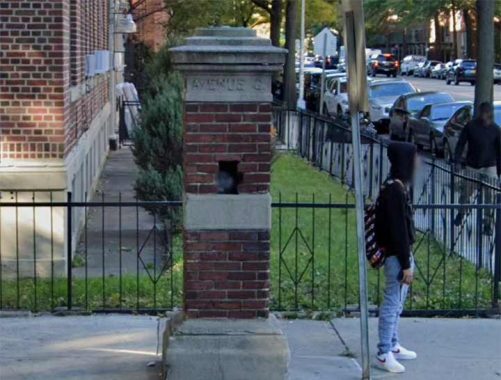
Every now and then, evidence can be seen that Flatbush’s “named” streets were indeed once known by letters alone. There are a pair of brick and concrete gateposts at Ocean Avenue and Glenwood Road that, instead of the latter name, call it “Avenue G” instead. I always thought Glenwood Road was sort of an outlier in the naming scheme, since the A through D avenues employ British-sounding names: Albemarle, Beverl(e)y, Clarendon, Dorchester; Foster Avenue, took over Avenue E. Farragut is likely named for the Civil War admiral, David Farragut. Glenwood, though, sounds somewhat generic.
The gateposts stand on the dividing line between the old Midwood Park and Fiske Terrace real estate developments overseen by T.B. Ackerson. All have been subsumed into the larger Prospect Park South and Flatbush neighborhoods.
As always, “comment…as you see fit.” I earn a small payment when you click on any ad on the site. Take a look at the new JOBS link in the red toolbar at the top of the page on the desktop version, as I also get a small payment when you view a job via that link.
1/13/25
