Rattlesnakes? In New York City? Not anymore. The last rattlesnakes in the Bronx, their last stronghold, died off around the turn of the last century because of encroaching civilization as streets were laid out and housing was built. People and rattlesnakes aren’t a good mix; snakes have fangs and people have pitchforks. (Smaller snakes like garter, ribbon and brown snakes can still be found in parks.)
Probably the last haunt of rattlesnakes in New York City was in what is now Seton Falls Park in the Eastchester section in the Bronx.
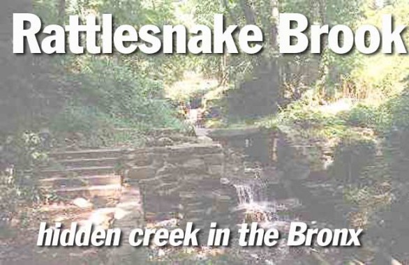
Rattlesnake Brook trickles through Seton Falls Park. When early settlers of what is now the Eastchester section of the Bronx first strived there, they found all manner of wildlife, including some dangerous animals such as rattlesnakes, bears, wolves and wildcats.
According to Bronx historian John McNamara, the original families of Eastchester signed a pact devoted to the destruction of the rattlesnake, and hit upon an unusual method to carry this out. They would set their pigs on them.
Pigs find snakes of all types a delicacy, and their thick hide and layers of fat make them largely immune to snakebite.
By 1900 most if not all rattlesnakes were absent from the area, but it wouldn’t be long before the pigs would be too. The stream that meandered through the area is still called Rattlesnake Brook.
Rattlesnake Brook at storm sewer.
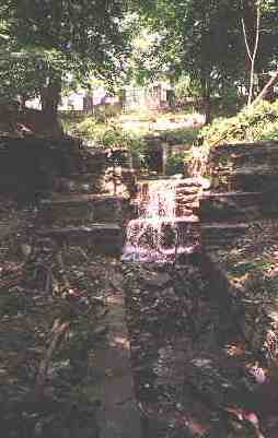
Bronx resident Donald Gilligan, whose photographs of Rattlesnake Brook appear on this page, has this information on the ancient stream:
All that remains of Rattlesnake Brook lies, encased in a masonry trough, within the bounds of Seton Falls Park. The trough is not always visible because it is choked with sediment and overgrown by water-tolerant vegetation such as phragmites. The last vestige of the stream is a slough in the southeast corner of the park, near the intersection of Pratt Avenue and Marolla Place.
There was once a culvert which conducted the brook under Pratt Avenue. In the undeveloped property on the other side of Pratt Avenue, the brook, still in its trough, ran parallel to Marolla Place (then Eden Terrace) as far as Boston Post Road. At that point, it entered another culvert that conducted the brook beneath Boston Post Road at the point where the Dyre Avenue Subway tracks pass over Boston Post Road. On the other side of Boston Post Road, the brook emerged, sans trough, and flowed a short distance into Holler’s Pond.
On this map, I have drawn the approximate route of the old Rattlesnake Brook in the northeast Bronx. The blue blotch is the old Hollers Pond, which was replaced by the Boston-Secor Housing project.
Map © Hagstrom Co.
Donald Gilligan’s Rattlesnake reminiscences continued:
Hollers Pond was an affair of about (I would guess) four acres, shaped like a rather blocky “T”. Picture a shape constructed of four equal sized squares arranged in the shape of the letter “T”. The pond was located where the Boston-Secor Houses now stand. The crossarm of the “T” ran east-west and the vertical bar projected from the south side of the crossarm at the midpoint.
At the southeast corner of the crossarm, there was a dam with a wooden sluice gate which, along with the generally leaky dam itself, leaked enough water to sustain the flow of the stream. Below the dam, the brook flowed in a natural state, through its valley, roughly parallel to the old Reeds Mill Lane, to a point beneath I-95 at approximately where Givan Avenue intersects with the I-95 service road. At that point, the brook turned due eastward and flowed into the salt marsh now covered by Co-op City. Eventually, after meandering through the salt marsh, the stream became tributary to The Hutchinson River.
Sources:
McNamara’s Old Bronx, John McNamara, 1989 Bronx County Historical Society
Reminiscences and photographs by Donald Gilligan


