As Beatle Paul would often say, we’d like to carry on now with five more stations of Staten Island Rapid Transit, or Staten Island railway, as it’s called now, as it dawned on the MTA after all these years that it isn’t really all that rapid. Your webmaster has been fascinated with the line since I first started riding it sporadically in the late 1970s; for some inexplicable reason, there were a few years there where I made an annual pilgrimage on New Year’s Eve or new Year’s Day. (I lived in Bay Ridge then, the line was nearby and there were some years I had naught better to do.) I was heartened when the line’s stations were mostly reconstructed beginning in the late 1980s, but I do regret having not photographed them at their nadir. Dave Pirmann and the gang at nycsubway.org, however, were on the case then and have hundreds of pictures showing the changes the line has undergone over the years, from its Baltimore and Ohio days till now.
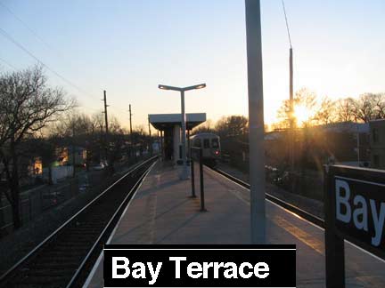
Bay Terrace is one of two stations on the SIRT named for a local street (Jefferson Avenue is the other), one of five with center platform(s), and one of two that doesn’t boast a central business district in the streets surrounding the station.
Formerly known as Whitlock, the community’s main thoroughfare was originally named Bay Terrace Avenue; however, by the late 1940s the word “Avenue” had been dropped and the street’s name became simply Bay Terrace. The vicinity around the street was largely undeveloped until the late 1950s, when single-family home construction began there; the area itself then acquired the name of Bay Terrace, which may refer to its flat, ramplike terrain, which gradually slopes downward to the east until reaching the Lower New York Bay in Great Kills Park.
In the 1970s many Jewish families from Brooklyn and Queens settled in Bay Terrace, providing a significant demographic contrast with the surrounding communities, whose populations are largely Italian-American. In recent years, many new commercial establishments — most notably a large shopping center built on the site of a former swim club — have sprung up to serve the area’s growing population. Part of Oceanview Cemetery, originally established by the Lutheran Church but open to those of all faiths, is considered to be in Bay Terrace, which is regarded by many Staten Island geographers as the southernmost neighborhood of the East Shore, the South Shore beginning with Great Kills, which lies immediately to the south. wikipedia

S. Railroad Avenue, from platform and street level
Bay Terrace probably has a center platform because it serves two distinct halves of its neighborhood; on the south, a thin strip of homes about 6-7 blocks reaching south to Hylan Boulevard and the massive Great Kills Gateway National Recreation Area, and on the north, an exit to Amboy Road and a thicket of shopping centers, new housing developments, and Oceanview Cemetery.
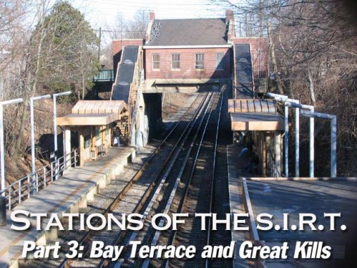
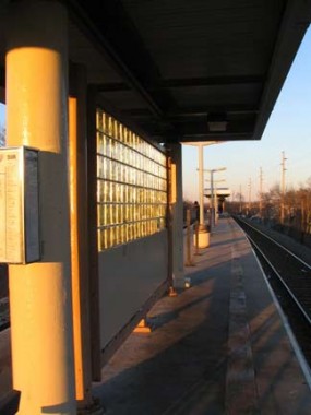
The center platform provides the SIRT with a rare pedestrian crossunder. Access to the center platform is through the opening you see midway through on the right.
As we progress we’ll see more and more light, because I shot the images for this page walking northeast from Huguenot so I wouldn’t have to deal with sun glare.
The SIRT pretty much parallels Amboy Road from here until we reach Tottenville. Amboy Road is one of the longest and oldest roads in Staten Island, branching from Richmond Road in New Dorp on southwest to the Arthur Kill opposite the city of Perth Amboy in Middlesex County in New Jersey. A ferry likely ran from Amboy Road across the Arthur Kill at one time. The walk along Amboy Road to out next station at first appears to be fairly mundane, but there are some Easter eggs along the way…
A narrow path called Adrienne Place trails off southeeast from Amboy Road, meeting a tangle of other small roads (Ramble Road, Clovis Road) lined with handsome frame houses…
Jack’s Pond
For your webmaster, though, the real discovery was Jack’s Pond, named, the story goes, in 1878 when Jack’s Ice House opened for business in Great Kills. Ice, of course, was delivered to houses before the age of widespread refrigeration and Staten Island, with its numerous small ponds, also had several ice houses.
When winters were colder than now,Jack’s must have been a natural for ice skating and hockey.
I’m something of an ‘innocent abroad’ in Staten Island, since its natural attributes are pretty much unknown to me while locals, of course, are quite used to seeing small ponds and streams. The reason for this lies in mapmaking techniques. It’s always been assumed, by the big mapmakers like Rand Mcnally and Hagstrom, that local streams and lakes’ days were numbered until they were filled in and built over, so they weren’t bothered with; in fact, roadways were shown in their place, as developers speculated building on them. In the 2000s though, many of these dreams of paving over Staten Island didn’t pan out — and there the old creeks stay, just as they always have, in some cases run through pipes and sewers. Hagstrom, till recently, showed a Clinton Road running though Jack’s Pond. Google still won’t admit its existence.
Returning to Amboy Road, we pass the Richmond County Savings Bank in a passable 1960s or 1970s-style brick building, and a gift shop complete with what looks like the late great “Grandpa” Al Lewis, who used to do this very thing outside his Greenwich Village restaurant in the 1980s.
Approaching Great Kills
Apartment building, Amboy Road and Brown Avenue opposite Giffords Lane
Post offices are often found along the tracks…many passenger lines doubled as feight delivery and often carried mail…but you will also inevitably find dancing schools clustered next to RR stations, for some reason.
Older mansard-roof building at Giffords Lane and Brower Court, with unfortunate street level addition.
Retro-style Type G T-Pole masts have been installed along Amboy Road in downtown Great Kills, complete with Bell-style replica luminaires.
“Kill” is an archaic Dutch word with various popular translations, including “creek” and “channel;” indeed, many small streams dot the neighborhood, and the name can be interpreted as meaning that a great number of such streams can be found there.
The eastern half of what is today known as Great Kills was originally named Cairedon, while the western half was referred to as Newtown. Later, both came to be known by the single name of Giffords, after Daniel Gifford, a local commissioner and road surveyor — this name surviving in Giffords Lane, the main north-south thoroughfare in what was formerly called Newtown; the Great Kills station on the Staten Island Railway is at the southern end of this street, in the heart of the community’s business district. The present name of Great Kills was informally adopted in 1865. Another former place name associated with the area is Honeywood; its precise origin is uncertain, but it was the name of the telephone exchange that served Great Kills and many other upper South Shore communities from the 1920s through the late 1950s.
At the southeastern corner of the neighborhood is the Staten Island Unit of the Gateway National Recreation Area, which was formerly known as Great Kills Park, and is often still referred to as such by Staten Islanders today. Immediately to the west of this is a harbor and marina, home of the Great Kills Yacht Club. wikipedia
Prior to the grade crossing elimination of the early 1930s Great Kills boasted a handome Queen Anne-style stationhouse, as did New Dorp.
The 1933 brick stationhouse on Giffords Lane contains now-closed ticket windows. Great Kills is a semi-terminal: in rush hours, some SIRT trains begin and end their runs here (and some originate at Huguenot). Photo right taken 9/8/01.
Heading west toward the next SIRT stop we find some interesting sights and anomalies along Amboy Road…
At Amboy and Lindenwood Roads the Coptic Church of Sts. Michael and Mena occupies a newer and older building. 90% of Egypt’s Christians belong to the Coptic Orthodox Church, which originated in Egypt within a couple of decades after Christ’s death.
Older house, Colon Ave. and Amboy Road; “Forest View,” Amboy Road near Acacia Avenue. The back of the house faces Wood Duck Pond.
Welcome to Sherwood. Sherwood Place, on Amboy just west of Colon, has a pair of brick gateposts of indeterminate age complete with stenciled street names. These are likely at least a few decades old.
The Road to Eltingville
Along Amboy Road we go…
At Armstrong Avenue we find a former staple of Brooklyn, Queens and Staten Island roadsides: the art of the billboard. As more and more property is built upon billboards are more and more rare.
Old maps show that Amboy Road made considerably more twists and turns in this area than it does now. Old Amboy Road, the former route, still makes an S curve at Amboy and Armstrong, crossing its straightened modern-day compatriot twice.
–Why do so many major routes in Staten Island begin with A? On this page we have Amboy Road, Armstrong Avenue, Annadale Road, Arden Avenue, Albee Avenue, Alvine Avenue, Arbutus Avenue…


