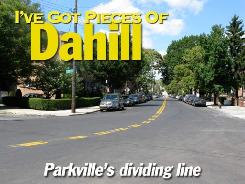
Dahill Road runs in four separate sections in the heart of Brooklyn, in Kensington, Borough Park, Parkville and Mapleton, and serves as the dividing line between two separate street grid systems as well as being McDonald Avenue’s running buddy, accepting some of its traffic and lessening the load on the el-shrouded McDonald. If you look at a map of the area you will notice the streets changing orientation, from the NE-SW of the Borough Park-Bay Ridge-Bensonhurst-Park Slope, where the streets carry unadorned numbers for avenues and streets, to the more or less east-west-north-south orientation of mid-Brooklyn, where streets are prefixed East and West and the avenues carry letter names.
Prior to the 1920s, Dahill Road was called West Street (probably because it formed part of the western end of the town of Flatbush).
Histories of Brooklyn are silent on how Dahill Road acquired its name. “Dahill” is an Irish name (rhyming with the similar Cahill) and derives from the Gaelic O Dathaill; the family originated in County Roscommon. Some Dahills arrived in New York in 1866, but again, the Brooklyn street did not get its name until the 1920s.
I recently explored the shortest section of Dahill Road in Parkville…after getting off the F train at Avenue I, I thought I spied someone I knew at a fruit stand on McDonald Avenue…
Nah…it couldn’t be her…or could it?
Two separate theories of design for living…attached houses on the east side of Dahill Road south of Avenue J, and a mansarded McMansion, more architecturally ambitious than usual in the genre, on 52nd Street just west of Dahill.
At 21st Avenue, Dahill Road is interrupted for Washington Cemetery, a 100-acre, amorphous expanse straddling the neighborhoods of Borough Park/Mapleton and Parkville and located roughly between 19th Avenue, Ocean Parkway, 54th Street, 57th Street and north of Avenues L and M. The cemetery first appears on maps of the town of Gravesend about 1850.
The cemetery is especially impressive from a passing train on the F line — it’s jam-packed, with gravesites just a couple of inches apart. Questions: why are Jewish cemeteries packed this way, and when did Washington Cemetery become a Jewish cemetery? With a name like “Washington” it wasn’t always thus, or was it?
For as long as I remember — back to the Super 70s — the bend in the road that marks the change from 21st Avenue to Dahill Road has been guarded by a single, amber-blinking Cyclops stoplight.
The BMT Culver Line (known these days as the F train) and the shopping center parking lot on Avenue I between Dahill Road have something in common. But what can that be?
Both mark the long-ago days of at-grade (surface) railroading in Kings County. As this picture on rapidtransit.net shows, this was the former site of the Parkville station on the Bay Ridge branch of the Long Island Rail Road, and the LIRR and the Culver intersected at this point. When the LIRR was placed in a cut (that still exists today) a ramp was built that connected the LIRR to the Culver, but when the Culver was finally elevated between 1917 and 1920, the connection was severed. Its right-of-way still exists in the parking lot.
Get Shorty. This incredibly short section of Dahill Road runs for just a few feet, connecting 19th Avenue and 47th Street immediately before 19th changes its name to Parkville Avenue.
Amazingly the short stretch has not one but two separate addresses on it.
Photographed August 2008; page completed September 22, 2008


