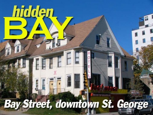
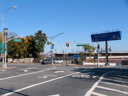
Bay Street, one of the few main streets in Staten Island not named Richmond (Hylan Boulevard is another) takes its name from the route it runs on the eastern shore of the island, facing the water, though only the stretch of Bay Street in the vicinity of the ferry is actually in sight of Upper New York Bay. The remainder is closer to the Narrows, a strait between Upper and Lower New York Bays, separating Staten Island from Bay Ridge, Brooklyn. Bay Street is the main street of Tompkinsville (along with Victory Blvd.), Stapleton, Clifton and Rosebank, and along its length you can find vibrant hotbeds, silent towns, historic churches and abandoned theatres. On Bay Street’s stretch nearest the ferry you’ll find Staten Island’s closest approach to resembling the rest of New York City…
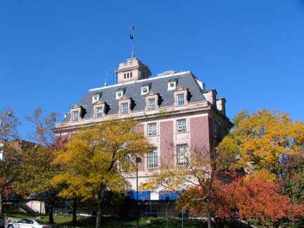
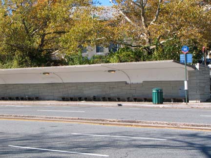
Staten Island’s Borough Hall, where Richmond Terrace meets Bay Street, is the large building that comes up fast when you are riding the front of the ferry from Manhattan, looming behind the ferry terminal. It was designed by Carrere and Hastings and completed in 1906. Its main hall displays 12 murals depicting early Staten Island life painted by F.C. Stahr — check them out if ever are inside. RIGHT: Long before NYC began installing glass bus shelters that are incessantly attacked by vandals, there was the largest bus shelter in NYC, this stone and concrete number on Bay Street and Borough Place. Smash this!
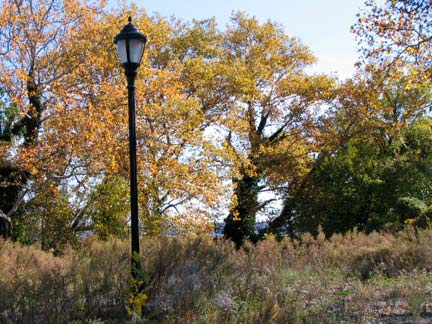
Adjoining the elaborate auto ramps to the ferry (that serve only buses dropping off passengers, since 2001 no cars have been allowed on the ferry) you will find an aged brick wall studded with star anchors that protects … a weed and tree covered yard and the occasional lamppost. This used to be the site of the Chief Physician’s Residence, US Coast Guard, a structure built in 1815. Fill me in on what happened to it — it’s obviously no longer there, but the AIA Guide mentioned it in 1988. A walk down Borough Place will produce some very old buildings, though, in what is billed as the future site of the US Lighthouse Museum, though the ‘future’ designation has been there for quite awhile. TheNantucket lightship that was supposedly a main attraction has been sold and is moving to Boston.
ForgottenFan Etta-Lee Heiman: The Chief Physician’s Residence of the Coast Guard/Lighthouse Station was burned down mysteriously and then demolished in mid to late eighties. There had not been any concerted effort to save and preserve this building. The area was still “Federal Government Property” until it was officially de-commissioned. Also this all happened way before the St. George area was declared an Historic Area in the 90’s. The Coast Guard had moved out in 1966-67 and moved to Governor’s Island after the Army had moved out. The house was beautiful, more like a country estate rather than a farm house. It was painted white with dormers and a open front porch. The gardens were always kept pruned.
Between Hyatt Street and Slosson Terrace we find several “high rise” office buildings on Bay Street, mostly dating to the Roaring Twenties and Dirty Thirties. I imagine the floors are taken up by local offices and concerns these days. Staten Island’s largest post office, the St. George branch (mid-left) and the former Title Guarantee & Trust Company.
Etta-Lee: The building with the white truck in front of it had originally been Richmond College. Before The College of Staten Island located now on Victory Boulevard in the old Willowbrook Mental Hospital campus [known in its day as just Willowbrook], there was Staten Island Community College [known as Community] located near Clove Road and the SI Expressway. That was a 2 year school with just Freshmen and Sophomores. If you wanted to complete your college and get the full-fledged BA, you attended Richmond College on Bay Street. This was also 2years with just Juniors and Seniors. The picture to the left of the one of “Richmond College” showing a multi-storied office building with a large arched doorway was originally the Corn Exchange Bank at the turn of the 20th century.
The St. George Branch post office building is so large because it was originally the Main Post Office on Staten Island. It’s chief drawback in later years was the lack of parking due to the increase of traffic. [There was a marked increase of traffic due to the opening of The Veranazzo Narrows Bridge, i.e., The Bridge.] So the main post office was moved to a ‘new smaller but more modern building with parking’ built in mid-sixties on Manor Road near Victory Boulevard.
Staten Island Railway (formerly Staten Island Rapid Transit) runs from St. George to Tottenville. Here, Bay Street is at the summit of a high cliff, and a lengthy wall has been built along its length. The SIR runs in a tunnel for a few hundred feet but emerges here.
There would be an excellent view of the Narrows, Bay Ridge, and downtown Manhattan from here, but freight terminals, converted to condos in the 1990s, block the view.
Hotel Slosson and Cargo Cafe, Bay Street and Slosson Terrace. (The RSO hotel is unnamed; I just dubbed it Hotel Slosson). The Cargo has a new look every time I pass by. It was opened in 1990 and has quite a loose vibe — too loose, according to some yelp reviewers — though my meals there have been decent ones. For best service, better to go in the off hours.
There are some striking examples of premier architecture at Pershing Circle, where Bay Street, Central Avenue and Victory Boulevard all intersect. The Staten Islander was a newspaper. The beautiful brick buildings lining Victory Blvd. west of Bay Street (bottom) called the Baltimore Flats, date to 1885. For many years the corner building was sheathed in ugly metal cladding — it looked like a prison!
Photographed October 25, 2009; page completed October 27
