

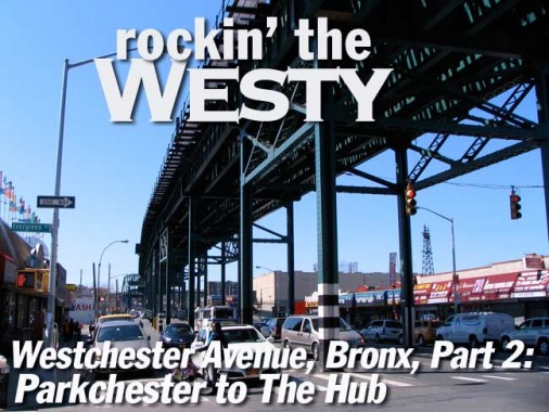
It’s about time I finished my Westchester Avenue walk, which I began in the summer of 2009 from Parkchester, the 1942 apartment complex created by the Metropolitan Life Insurance Company on the grounds of the former Catholic Protectory, an orphanage and “home for troubled boys” run by the Brothers of Christian Schools, which moved to Lincolndale in Westchester County, east to Pelham Bay Park. This time I again began from Parkchester, where the Q44 from Flushing, Queens, stops, and walked west this time, to Westchester Avenue’s source at the Hub in Melrose. Westchester Avenue’s name reflects its former locale in Westchester County: the Bronx annexed portions of Westchester County beginning in 1874. The avenue was formerly a toll road known as the Southern Westchester Turnpike when it was first opened in the 1860s.


The neighborhood just west of Hugh Grant Circle and Parkechester is hard to define — it’s not quite Castle Hill, not quite West Farms — not quite sure what to call it. (Some say Versailles Park). Here Westchester Avenue is shadowed by the IRT Lexington Avenue line el, which runs mostly up Lexington Avenue in Manhattan and East 149th and Westchester Avenue. The el opened for business in 1920 and has just enjoyed arecent paint job.
People from outside the Bronx might not know it but Parkchester is one of the Bronx’ chief shopping/entertainmnet hubs, with upscale stores and a multiplex theater. Zaro’s has been on Grant Circle for a few decades.
We will see some vintage light poles along the way — they seem to be encrusted on elevated train lines like barnacles. This is one of the cylindrical shafted posts that were the first to light the Cross Bronx Expressway when it arrived here in 1954. There are just two of these remaining on the circle; there are a few more west of here on the Cross-Bronx.


Neighborhood joints, Montera Funeral Home and Willie’s Steak House (also a local place to hear salsa — the painted sign used to say “Home of Latin Jazz”). The painted sign definitely uses Clarendon Condensed as a guide font though it’s not quite the same.
This part of the Bronx — and most of the Bronx east of the Bronx River — does not use the Manhattan street numbering system (Bronx and Manhattan use the same numbering system, since both Manhattan and the Bronx were in New York County until 1914, and until 1874, east of the Bronx River was in Westchester County) and the streets are named, with some unusual ones at that. The streets here are named for former landholders through which they run. The street sign misspells the name of 1890s landowner Albert Theriot (the Department of Transportation, using the new upper-lowercase signs mandated by the Feds in 2009, misspells it). The proper pronunciation is likely “terry-oh” if the pronunciation of St. Louis Cardinal [2011] Ryan Theriot is any guide, though I don’t know how they do it in the Bronx. The name is French by derivation.


At 1836 and 1802, near the St. Lawrence Avenue station, some remnants from earlier times (I am always looking for relics of the past wherever FNY goes). The doorway, in particular, looks unchanged from the Truman era except for the recycling sign.


Murals, Harrod Avenue, either side of Westchester. Art on right is by Per 1.


Plenty of dummies in the window at Fashion Hilight near Ward Avenue. Hold that thought. Right: terra cotta exterior at Ward Avenue hints at former grandeur.

10¢ a dance. More dummies modeling shapewear on Ward Avenue.


Reminds me of a classic music video by the late great Robert Palmer. Or maybe this one.

I spotted several classic theater buildings on this walk, such as 1546 Westchester Avenue, the former Ward Theater. It opened iin 1927 (many, many theatres opened around town in the late 1920s) and had 1,865 seats. Now home to the Rainbow Shops chain of women’s fashions.
Chase-ing a mystery


This Chase branch at Westchester and Boynton has a sloped, Spanish-tiled roof, terra cotta detailing just under the eave and a TCM monogram. Or is it TMC or CMT? Can anyone identify the monogram and let me know what bank this was when first constructed? Looks like a circa 1905-1910 construct. Across the street, the La Moderna barber’s plastic (or vinyl) lettered sign has the mark of the Fab Fifties on it.
[Manufacturer’s Trust Company as it turns out.]


Wheeler Avenue was the scene of one of the most infamous incidents in the history of the New York Police department, as Guinea, West African immigrant Amadou Diallo was shot and killed 2/4/99 by four plainclothes cops who used 41 rounds of ammunition; they believed he had drawn a weapon. The officers were acquitted at trial, which brought on a firestorm of controversy regarding police practices, especially in ‘minority’ neighborhoods.


At Evergreen and Colgate Avenues, just east of the Bronx River, Westchester Avenue runs through a valley but the el structure stays level, rising high off the street. The avenue does have a connection to the toothpaste folks, as William Colgate (1783-1857) the founder of the starch, soap and candle factory in downtown Manhattan that ultimately became Colgate-Palmolive, once owned property in what became the surrounding neighborhood. He was also a trustee in upstate Colgate University.


Street art on Colgate, left: King Bee
Concrete Plant Park

Bronx River, looking north toward Westchester County. The river is actually the only freshwater river, technically speaking, within the five boroughs. The East River is more a strait than a river, as it connects two bodies of water, and the Hudson River is considered a tidal estuary (and is not contained within the five boroughs anyway). The Bronx River originally rose in the Kensico Reservoir area but after the reservoir was dammed it was cut off from its original source. Beginning in the 1800s, the Bronx River became a man made sewer from the many industrial plants (and Lorillard Snuff Mill) that were built alongside it, but strong efforts have been made in the late 20th and early 21st Centuries to clean it up and reintroduce wildlife.


Concrete Plant Park, built from 2004-2009 for about 10 million dollars, runs on the west side of the Bronx River replacing what used to be a concrete batch mix plant between Westchester Avenue and Bruckner Boulevard. Edgewater Road, which used to lead in and out of the plant, in existence from 1945-1987, has found reuse as a park plant. The solos, hopper and conveyor structures from the plant have been left in place.
Within the park, the silos hold your eye. Painted a matte kidney-bean pink, the silenced concrete works look like sculpture as much as infrastructure. Even the somewhat clunky concrete bases, which were recast by Parks, add to the composition’s abstract quality. They also provide shade while the new trees mature.
[Landscape architect James] Mituzas said that Parks hopes to eventually use the silos as “green machines,” as water cisterns or power generators with attached photovoltaics, but in the meantime the Parks department spent much of the project’s funding removing petroleum-tainted soil from the site, a former brownfield. “Most of the money went to clean the site,” he said. “It’s come a long way.” Archpaper
In general the park’s a good idea, but I can’t help but think that there were once thousands of jobs along the river (but also lots of pollution and disease) that was replaced by idlers, strollers and frisbee catching dogs. Where did the jobs go?
A magnificent ruin


On Westchester Avenue and the Sheridan Expressway stands the decades-old ruin of the New York, Westchester and Boston Line’s Westchester Avenue station. Classical elements were often used in station ornamentation in the 19th and early 20th Centuries, and the NY, NH and H employed the winged staff of Hermes (Mercury) with its two entwined snakes. As railroad historian explains on this FNY page, this station was in service until 1937. It’s likely that the city hasn’t stabilized the ruin because Amtrak owns the property and has determined it poses no danger to trains passing underneath.


Walking west on Westchester, the el train turns south on Whitlock Avenue and enters a tunnel for the remainder of its route to Manhattan. Westchester Avenue then enjoys about a five -block stretch where it is in the open air. Don’t get used to it!
Westchester Avenue here passes both Home Street and Hoe Avenue. I was attracted to the hand lettered “Home antiques” sign and by the freestanding apartment building at the SW corner of Hoe Avenue. This section of the Bronx has, or had, street names connected with the printing trade: Colonel Richard Morris Hoe (1812-1886) was the inventor of the rotary press; when the area was laid out, Hoe Avenue was named him, along with Aldus Street, named for Italian press pioneer Aldus Manutius (1449-1515) and Gutenberg Street, named for the inventor of movable type printing. (Gutenberg Street is now East 165th).


A view of St. John Chrysostrom Church at Hoe Avenue and East 167th; the church was built in 1900.
The Bronx street layout is endlessly interesting: nominally a grid, it is bisected by streets that go off on their own tangents that follow old creek beds, colonial paths or Indian trails. West Farms Road is one of these old tracks and it meets Westchester Avenue and Southern Boulevard at Gladstone Square (right), named for a World War I soldier who later became a state assemblyman.


I said not to get too used to Westchester Avenue being in the open air. The White Plains Road el, one of the longest el routes in the city, travels on White Plains Road, Boston Road, Southern Boulevard and Westchester Avenue before ducking under at the Hub and then running down Lenox Avenue, Broadway and 7th Avenue as the west side IRT, before ending its run in Brooklyn. A #2 train can take you from Brooklyn College all the way to within walking distance of Mount Vernon in Westchester County. This el is much older than the Lexington Avenue line el we just emerged from — it was completed in 1904 in this stretch. Westchester Avenue is the only street in NYC that has el lines from 2 different trunk lines built on top of it.
Life with the Moons. Oddments of former streetlighting systems get ovelooked under els, and one of NYC’s few remaining “crescent moon” fixtures can be found on one of the pillars here.


I detoured on Southern Boulevard to have a look at former banks and theatres. The history of New York National Bank is hard to trace — all the information I have says it converted to Federal Barclays Bank of NY in 1982, but that was a long time ago.
This Banco Popular branch occupies a former Dollar Savings Bank branch, which used the Morgan Silver Dollar as its symbol. As late as 1992 Dollar, after a stint as Dollar Dry Dock, became a part of Emigrant Savings Bank and subsequently liquidated.
Boulevard Theatre, designed by Thomas Lamb, opened 1913 for stage shows and vaudeville, and movies in 1917. Its exterior has recently received a long-awaited touchup.


Simpson Street mural. You can’t show people smoking anymore!
Ancient painted sign for Oriental Gifts –bags, toys, gifts, wigs


One of the nicer trends over the past 20 years is that NYC infrastructure has once again been noticed and appreciated. The stations on the White Plains El have, in the past 5 years, been spruced up with new elevators, paint jobs, and platform lighting, though there is still work to be done. This is the chalet-style el station at Simpson Street. The 1904 trestle and pillars have not been painted in many a moon.

Westchester Avenue forms the border between Longwood and Morrisania. The streets that passed through here, like Kelly Street (left) were destroyed by first neglect and then arson in the late 1970s, an it took nearly 20 years before they could be built up again. As you pass Fox, Tiffany, Kelly Streets adn Intervale Avenue and rogers Place, note tha almost all of the buildings are of recent construction.
There is no better account of the dark days of the streets of the south Bronx, and their revival, than Jill Jonnes’ South Bronx Rising. (Fordham University Press, 2002)
For a (senastionalized) account of south Bronx streets, see Paul Newman’s 1980 film Fort Apache, The Bronx, which was filmed here in 1981 and depicts the former wasteland. The 41st Precinct at 1086 Simpson, depicted in the film, closed in 1993 after a new building was constructed.


The monumental Thessalonia Baptist Church, Rev. James A. Polite Avenue north of Westchester Avenue at East 163rd, is a former synagogue; the menorah on the pediment tells the story. The Thessalonia, named for an epistle by the apostle Paul, moved to this building in 1942.


In 1981 the former Stebbins Avenue was renamed for Rev. James A. Polite, for the longtime pastor (1939-1980) of the Thessalonia. A short stub of Stebbins remains further north near Crotona Park.


Before taking a look at Prospect Avenue, the main north-south route in the east side of Morrisania, here are some more oddments beneath the el at the intersection: a ‘No Left Turn’ sign that might date to the FDR administration, and two antique lampposts from the early 1950s. This is the only instance of a sodium ‘bucket’ luminaire in use on Westchester Avenue.

It might not look like it but the 1918 vintage Prospect Theatre, 851 Prospect Avenue, was open as recently as 2006 and restored as recently as 2000 as the Olympic Concert Theatre. It substituted for the Fillmore East (2nd Avenue in the East Village) in the 2005 film “August Rush.” Most recently it was the Abundant Life Tabernacle.


Can’t vouch for how the magnificent Manhanset apartment building, SE corner Westchester and Prospect, looks on the inside, but it must have had some work doen since the bad old days of the 1970s. The ironwork on those fire escapes is incredible.
This was likely the cream of apartment house architecture in the 1910s..below are some samples from the 2010s…


The Melody fills the east side of Prospect Avenue between Longwood Avenue and Macy Place. I know nothing at all about this newly constructed building but it’s several shades nicer than most new multifamily dwellings.


When I was in Morrisania I found several small enclaves that had been given landmark status, and Macy Place, which runs for a block between Prospect Avenue and Hewitt Place, looks like it should have gotten the same designation. A view to the end of the block reveals the United Church, constructed in 1906 as yet one more synagogue.


809 Westchester Avenue (once a music hall called the Burland Casino) is on an odd shaped lot between Westchester and Union Avenues and East 160th Street. The building has had official capacities before, judging by the insignia, but is presently home to the Osborne Association, which according to its website, offers opportunities for individuals who have been in conflict with the law to transform their lives through innovative, effective, and replicable programs that serve the community by reducing crime and its human and economic costs. We offer opportunities for reform and rehabilitation through public education, advocacy, and alternatives to incarceration that respect the dignity of people.


The street signs on Tinton Avenue were originally misspelled –perhaps with an extra “I.” As on many other plots on Westchester Avenue, the corner remains empty and ready for development. Has it been empty since the arson of the 1970s?
Tinton was named for the Tintern village in Wales where the Bronx’ first colonial-era family, the Morrises, were from. Its famed abbey contains ruins dating to 1136. A street parallel to Tinton that does not reach Westchester Avenue is called Wales Avenue.


Just past Tinton Avenue the skyline of the Hub, the southern Bronx’ office building and shopping district at 3rd Avenue and East 149th, comes into view, along with a curved-mast lamppost that was among the first generation of modern posts placed on NYC streets in the early 1950s. Westchester Avenue here runs through the St. Mary’s Park Houses and John Adams Houses.


This building at 600 Westchester at Eagle Avenue is a mystery –it is presently a Seventh Day Adventist church. A knoll across Eagle Avenue is gated but with a Parks department sign,


The Department of Transportation marks Hegney Place between St. Ann’s and Brook Avenues, even though it exists only as a parking lot on the north side of the avenue. It ran alongside his abandoned railroad cut, which runs under St. Mary’s Park and connected the Port Morris freight station with the main NY Central/Metro North line running in the middle of Park Avenue.


The 1904 el structure turns off Westchester Avenue at Brook Avenue and dives underground to complete its run to the Brooklyn Bridge station.


Westchester Avenue’s western end, or its beginning, is at Third Avenue and East 150th Street; until 1973, Third Avenue also was shrouded by a clattering el train. The McCrorey Building apparently used to be home to the department store chain of the same name.
This is the Bronx’ downtown shopping area, known as The Hub because the Third Avenue El (replaced by buses) and the IRT #2/5 train came together here. Just to the northwest is the Bronx’ courthouse district, the Grand Concourse, and Yankee Stadium.
4/4/11