In the colonial era, mile markers were often placed along the main road to inform the traveler of how many miles there were to go to the nearest big town, or how far away you were from it. In NYC, the now-defunct Post Road in Manhattan, Kingsbridge Road in upper Manhattan (now a part of Broadway), Kings Highway in the town of New Utrecht (now Bensonhurst, Brooklyn), Northern Boulevard in Jackson Heights, and Ocean Parkway, built in the 1850s, all had such mile markers. Ocean Parkway, in fact, had half-mile markers, only one of which, the 3rd mile marker, is still in place.
Railroads, too, have mile markers. I have been riding the Port Washington Branch of the Long Island Rail Road regularly since 1992 and have noticed the occasional mile marker along the route. Recently, though, I nailed down where most of them were, though most are in spots to inaccessible to photograph without getting killed by a train or risking arrest.

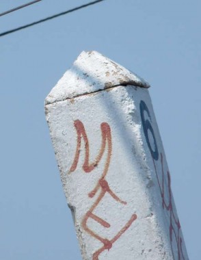
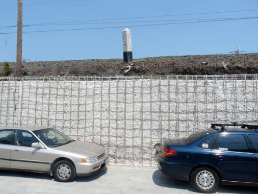
This one is the 6th mile marker and can be found facing 44th Avenue along the tracks, which are on a raised embankment, just west of 111th Street. Along the route, I have now identified the locations of the 4th through 12th mile markers, which are along the line from Woodside east to Douglaston.
Recently, by keen observation out the train window, I found mile markers 2 and 3.
I do not know if these markers measure distance from Penn Station or from the East River waterfront, though since the 4th mile marker is just east of Woodside, I imagine the latter.
If there are any LIRR historians who know a) when these markers were placed — the 4th and 5th mile markers have been replaced with new ones recently; and b) if other LIRR branches have them, let me know in Comments.
Readers have come through:
Distance is measured from the LIC station in Hunters Point
Photos of mile markers elsewhere in the LIRR
12/14/12
