After a bracing walk in the “new” Coney Island boardwalk area in March 2013, my fears that the Brooklyn Riviera would be starbucked, mcdonaldsed and condo’d into a comatose state were somewhat allayed. Stalwarts like Cha Cha’s and Shoot The Freak were gone but longtime mainstays like Ruby’s Bar, Lola Star and Paul’s Daughter had been rebuilt, the boardwalk Nathan’s was relocated and the dogs and fries were what I always remembered them to be. The new Luna Park was aburst with happy kids. There was still a possibility that Surf Avenue and the side streets would be corporatized and Bloomberged, but I’m not as fearful that will happen now. The museum and sideshow building was still being cleaned after the superstorm. I do wish the Surf Avenue strip could be restored with rides and carny games.
My purpose besides lunch at Nathan’s and a look at the cleaned-up boardwalk area was also to walk north up Stillwell Avenue and contrast the Land of Dreams from the Road of Dreams that leads to it. Many roads lead to Coney Island: Ocean Parkway was built as its grand boulevard, Coney Island Avenue once carried trolley lines to it, Shell Road was once paved with gastropod coverings. Cropsey Avenue (except for this FNY page) and Stillwell are unsung and unchronicled.

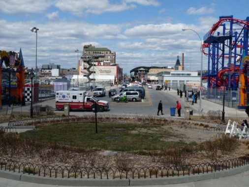
Stillwell Avenue from the Riegelmann Boardwalk
Stillwell Avenue is a four lane road that runs perfectly straight, with no angles at all, from Bay Parkway and Bay Ridge Parkway south to the boardwalk. North of Bath Avenue, it is the barrier between two separate Brooklyn grid schemes: on its west, the numbered avenue and street grid, with no East or West prefixes, of Park Slope, Bensonhurst, Sunset Park and Bay Ridge; and on its east, the vast plains of southern Brooklyn featuring lettered east-west Avenues and longitudinal numbered East and West streets. On the west, streets approach it at angles, while on the east, the avenues meet it perpendicularly.
Stillwell Avenue stands where logically, West 14th Street would be. The Stillwell family, from England, fled the Cromwell regime and settled in New Netherland in the late 1600s, finding kindred people with the Dutch already here. Stillwells lived in Gravesend for over two hundred years.
The avenue’s most famous appearance is likely in the French Connection as Gene Hackman’s Popeye Doyle pursues a bad guy on an el train in his car on Stillwell and New Utrecht Avenues under the el.

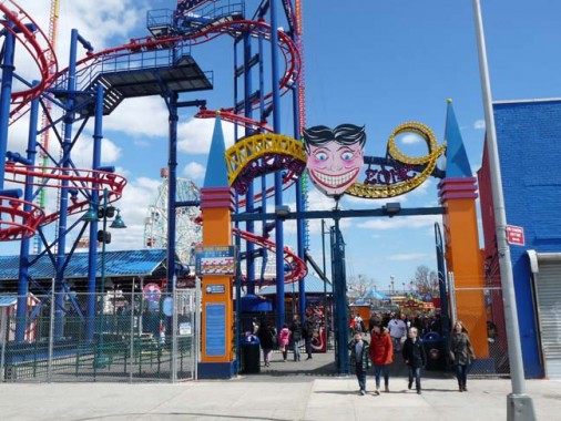
The Soarin’ Eagle Luna Park Scream Zone ride is a mini-roller coaster that replaced the old batting cages (used by Billy Crystal and Bruno Kirby in When Harry Met Sally). Luna Park is a revival of the older amusement park from Coney’s salad era; it burned down in 1944. The new Luna uses the old Steeplechase Funny Face as a mascot. The Funny One has 44 teeth, 12 more than the normal complement.
Stillwell Avenue, looking toward Luna Park rides and the Wonder Wheel, Coney Island’s oldest ride. It opened in 1920. By the mid-20-teens, it will be supplanted as NYC’s tallest Ferris Wheel by a 625-foot-tall wheel on Staten Island.
Probably the most famed building on Stillwell Avenue is the original location of Nathan’s famous, which opened here in 1916. Its best sellers are the franks and fries, but a full complement of seafood, including clams and frog legs, can also be purchased here. The building suffered extensive damage on October 29, 2012 during Hurricane Sandy, but Nathan’s owners hope to have it rebuilt for the summer season. Its boardwalk entry opened for business as usual in March.
Since 1920 the BMT subway terminal at Stillwell and Surf Avenues, serving the West End, Culver, Brighton and Sea Beach lines (or more prosaically, the D, F, Q and N trains) may have had character, but it was decrepit, outmoded and stank of piss. It was given a complete overhaul from top to bottom from 2001 to 2005, with a slatted roof through which sunlight pours on nice days.
Here’s a view of the terminal from the air. Click on the Gallery for a full size view.
The further we get from the Land of Dreams, the more aseptic and pedestrian the landscape. Still, there are colorful reminders of the past. This is the old Terminal Hotel at Stillwell and Mermaid Avenue, which degenerated into a flophouse late in the 20th Century, and now serves as a billboard holder.
Not the most inviting Alcoholics Anonymous office, on Stillwell south of Neptune.
As far back as my memory bank will process, there has always been this humungous behemoth, Riviera Caterers, on Stillwell and Neptune. Its parking garage across the street is almost as large.
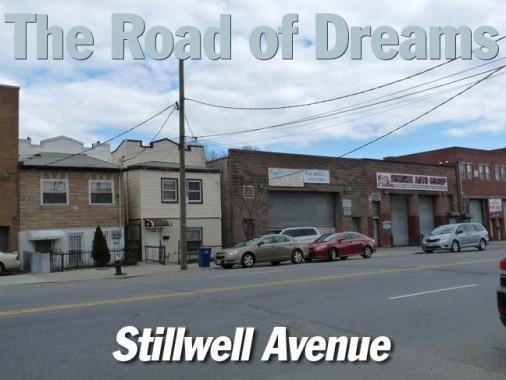
Between Neptune Avenue and Coney Island Creek, Stillwell Avenue, like its brother, Cropsey Avenue, is lined with collision, auto repair shops and tire dealers. Interspersed between them are diminutive dwellings with insulation siding masking their true age, which is likely near to a century.
Brooklyn contains many inlets and waterways, such as the noxious Newtown Creek, the gooey Gowanus Canal, and the contaminated Coney Island Creek, which Stillwell Avenue crosses on a rather ordinary steel and concrete fixed span.
This is a good time to mention that while Coney Island isn’t actually an island any more, it used to be. It was the westernmost of the barrier islands off the southern coast of Long Island, separated from Long Island by Coney Island Creek, which ran from Gravesend bay on the west to Sheepshead Bay on the east. Part of it was little more than tidal flats. Officials at one time considered dredging and straightening it for a ship canal, as was done on the Harlem River, but instead it was filled in between Shell Road and East 15th St. in the 1930’s as the Belt Parkway was being constructed. But the name Coney Island remained, as Coney Peninsula doesn’t have that same ring. Long Distance Voyager
The creek is also famed for its Yellow Submarine.
Until the late 1970s (or early 1980s?) Stillwell Avenue crossed the creek on a rickety two-lane truss bridge, built in 1929. Here, it easily handled the B31 trolley, which ran from the Bush Terminal area in Sunset Park to the Stillwell Avenue subway terminal mostly along 5th Avenue, 86th Street and Bath Avenue. The brand-new Belt Parkway looms in the background of the picture which is probably from 1940 or so. photo: subwaywebnews.com
In a more recent photo a GM “fishbowl” bus negotiates the span. photo: Bernard Ente collection
In about 1940, the Belt Parkway was constructed crossing Stillwell Avenue just north of the creek. It was originally known as the Circumferential Parkway before this stretch was officially named Shore Parkway.
A pair of tiny and aged houses tenaciously cling to the east side of Stillwell just north of the highway. The one on the right is so narrow that it can fit only the front door and a second story window.
A concrete plant, Stillwell Ready Mix, occupies the east side of Stillwell Avenue, along with a retail hardware store, between the Belt Parkway and Harway Avenue. A pair of its colorfully painted trucks were standing on the avenue. Schwing America, a manufacturer of concrete pumps, must get a few jokes about the name.
“Dirty, disgusting, filthy, lice-ridden birds.” Stillwell Avenue and Avenue Z.
Well, probably not.
If there were a commissioner for pigeon racing in the five boroughs of New York, in recent years that title would have gone to Frank Viola. Mr. Viola, a slight, white-haired man from Bath Beach, Brooklyn, founded his namesake club in the early 1990s and ran the Frank Viola Invitational for the last 16 years [in 2007]. With 1,500 birds, the race became one of the largest in the city, the Kentucky Derby of the pigeon season. New York Times
I’ve encountered the Viola Homing Pigeon Club before, at the west end of Avenue Z at Cropsey Avenue.
A rather desultory stretch of the Road of Dreams, between Z and Harway. Once again, small homes huddle against heavy industry.
The BMT elevated West End line has traveled over Stillwell Avenue since 1917. Here it makes a bend into Coney Island Yards before rejoining Stillwell Avenue again at its terminal on Surf Avenue. Prior to the el, ther West End ran as a surface steam train for a few decades.
There’s a map mystery–around 1930, Cropsey and Harway Avenues mysteriously switched identities. After that year, Cropsey became Harway where the two roads meet at 24th Avenue, and Harway became Cropsey.
In 2013, times remain tough and money remains tight. Therefore, a proper bus stop sign and schedule couldn’t be produced, and chalk and spray paint were substituted.
Further north, a 1960s route map has stubbornly remained in place. Ater a couple of years’ absence, the #64 was re-extended to Coney Island in 2012.
On Harway Avenue, I spotted a hand painted awning sign.
The triangular plots at Bay 49th and Bay 47th at Stillwell are empty, and they appear to have been for some time. I don’t know if anything has ever been built there. The Bay 47th plot has a conifer tree, an unusual street tree in Brooklyn.
One last pair of derelict houses opposite Bay 47th.
On the west side of Stillwell you’ll find a rather large lawn care and gardening store. Since I was questioned about taking a photo of the establishment, I’ll forgo the free publicity they would have gotten by my placing a photo of it in this space.
4/1/13
