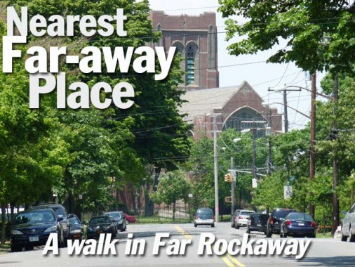
It was the hottest day of the year so far, and I spent it in Far Rockaway.
The plan was simple. The day after the Hurricane Sandy-ravaged A train trestle was restored to service across Jamaica Bay, I would take it to its further reaches at the very end of Queens, the eastern end of the Rockaway peninsula, where the city has stashed housing projects and old folks’ homes for decades. I’d walk the longest boardwalk on the east coast and perhaps, the USA, from Beach 9th all the way to the end in the Beach 120s. But as the master of the Newtown Pentacle often phrases it, the ‘thermonuclear eye of God’ was burning with an end-of-July intensity. So I altered the plan into a brief walk around Far Rockaway instead.
Needless to say, this portion of New York City has been Ultima Thule as far as I’ve been concerned as long as I’ve been exploring. When I was a teenager in the mid-1970s, I would gird my loins and brave the Marine Parkway Bridge, which has perilously low railings and prompted a fear of gusting winds, and cross Jamaica Bay on my bicycle. One day the weather was sufficiently crisp and I followed the concrete el all the way to the end, and I had attained Far Rock on my bike. I felt like Captain Cook. Then, I turned around and pedaled 15 miles back to Bay Ridge. This was years before the Willyburg hipsters were pedaling to Rockaway Beach for the fish tacos.
Years passed, and I visited again a few times when researching and photographing Forgotten NY the website and the book. Gradually, I’ve gotten something of a handle on the town (it’s more like an isolated town than a neighborhood). Here, the general grid system that dictates the street layouts of most NYC neighborhoods falls away, and like downtown Boston, the layout is more like a hub, with the spokes circulating around the intersection of Mott and Cornaga Avenues, and though you do have regulation, 4-cornered intersections, but even that disappears in Wavecrest, originally a private development built around 1900.
On this walk, I covered some of the ground that I had on a Far Rock walk in 2003. 10 years! It all went by so quickly. Even on these two walks, I was unable to comprehensively cover places like Wavecrest and Bayswater, though I have touched on them. Other pages cover neighboring Edgemere and part of Arverne.


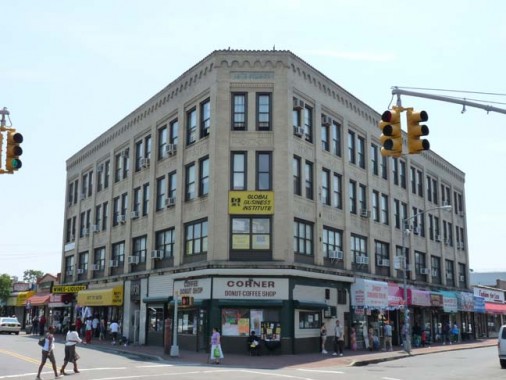
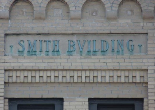
The Smith Bvilding occupies the NE corner of Mott and Central Avenues, the two most prominent avenues in the neighborhood. The building dates to 1931 and replaced an earlier Smith Building that went up in 1911; it had contained offices of the Far Rockaway Bank, whose president was named Samuel R. Smith. There is also a dead end Smith Court in the back of the building facing Mott Avenue.
This key intersection is well covered in Rockaway Memories.
Central Avenue is one of the few Far Rockaway thoroughfares that is vouchsafed by Nassau County to keep its name once entering the county. It extends for a mile or so, ending in Woodmere.
The Far Rockaway Bank was organized in 1880 and was merged into the National Bank of Long Island, becoming the National Bank of Far Rockaway, in 1903. Its marble Greek Revival building went up in 1912. The building is wedge-shaped to accommodate the former route of the Long Island Rail Road, which adjoined its left side until the mid-1950s.
Cuban-born gynecologist Perla Tate has occupied offices in the building for several years.
Engine 264/328, Ladder 134, known as “The Big House,” Central Avenue opposite the Tate Building. Anyone have any stories about the firehouse?
The Rockaway News, Central Avenue. Since the Rockaways became a resort area in the late 1800s, there have been a series of newspapers published serving the community. The first of these was The Rockaway Rattler, later the Rockaway Journal, first published in 1883. It was followed by Rockaway Life, Far Rockaway Journal, The Argus, and The Rockaway News. The sole survivor is The Wave, founded in 1893. Tragically The Wave lost much of its physical archives to Hurricane Sandy.
This arch-windowed, pedimented one-time beauty along Central Avenue was a Masonic temple at one time. All over town, Masonic temples display eclecticism and beauty in their architecture.
Far Rockaway has always had its share of multi-unit apartment buildings like The Balfour at Central Avenue and Nameoke Street. The commuter railroad to New York is nearby.
Speaking of Nameoke Street, I’m stumped about its pronunciation and derivation. It doesn’t appear on area maps until the 1920s or so; it was formerly named Roanoke Street and Carlton Avenue and I suppose its name is Native American in origin. Looking at it, I’d guess it’s pronounced na -MEE -o-kee, but I’ve been wrong about these things before, and it might well be NAMMY-oak. It’s one of those place names found exclusively in Far Rockaway, like Cornaga or Watjean.
In Copenhagen some of the street signs were outfitted with speakers that talk their pronunciations at you. (In NYC, experienced vandals would have these disconnected forthwith.)
A selection of houses along Nameoke Street. I always look for houses with older features that mark their great age. The big one with the slight gambrel, the dormers and the white fence looks like it could have been a Dutch farmhouse.
Intermediate School 53 on Nameoke Street has been called the Brian Piccolo School since 1972. Piccolo was a fullback for the Chicago Bears for four years before his death from cancer at age 26. He was played by James Caan in the acclaimed television film Brian’s Song in 1971.
Turning up Mott Avenue, named for landowner Benjamin Mott, who donated property for the original Long Island Rail Road terminal (which stood where the shopping mall across the street from the A train terminal on Mott Avenue is now).
The US Post Office on Mott Avenue and Beach 18th St was finished in 1936 and designed by architect Eric Kebbon. It was built in a Colonial Revival style and its dome was inspired by Thomas Jefferson’s Monticello.
The oldest church in Far Rockaway, now the Beth-El Temple, can be found across Beach 18th from the post office. It was built in 1858 to a design by famed ecclesiastical architect Richard Upjohn of Trinity Church fame. It was a chapel of the Trinity parish before it became the independent St. John’s Episcopal Church in 1881. It became the Beth-El Temple in 1975. The roof is apparently under repair, with a blue tarp stretched across it.
Two handsome churches of a certain age are next door from each other on the south side of Mott Avenue, the Doric-columned Refuge Church of Christ and God’s Pentacostal Church, which caters to a Latino congregation.
So many police precincts in NYC built in the 1920s have the Italian Renaissance Style, such as the 101st Precinct on Mott Avenue just west of Cornaga.
Though New York Newsday stopped publishing several years ago (there’s still a Long Island edition) this convenience store on Mott and Cornaga still has the old sign.
One of southern Far Rockaway’s premier homes, complete with dormers, gables, a porch and topiary, at Caffrey and New Haven Avenues. James Caffrey founded Far Rockway’s seashore Transatlantic Hotel in 1843.
Around the corner, on Caffrey, is probably Far Rockaway’s oldest artifact, the Cornell Family Burial Ground, one of Queen’s many vest pocket family cemeteries. The first formal settlement by an Englishman in what is now Far Rockaway was Richard Cornell’s homestead, built in 1690, located on what would now be Beach 19th Street. Cornell’s descendants lived in the area until 1833. This cemetery was established in the early 18th Century. Family members include Ezra Cornell, who founded Cornell University, and Alonzo Cornell, a NYS Governor from 1879-1882 (Alonzo Road, elsewhere in Far Rockaway, is likely named for him.) The actual tombstones fell and were carted away decades ago. Till recently the cemetery was hidden behind hedges and overgrowth, but the Parks Department has cleared them away.
Richard Cornell not only owned much of Far Rockaway at one time, but much of eastern Queens along what is now the Queens-Nassau County Line, all the way north to Little Neck.
A 1946 account has a photo of the cemetery, overgrown even then, with gravestones intact.
Far Rockaway is full, and I mean full, of odd alleys and dead-ends, many of which don’t make the maps or are even granted street signs. Grandview Court (top) and William Court, both on Caffrey Avenue, are two of these.
Beach 9th Street, called Jarvis Lane and Oak Street before 1916, when Far Rockaway acquired its Beach street numbering system, is a main north-south thoroughfare in the eastern part of the town. Between Cornaga and Central Avenues, it features a phantasmagorical collection of freestanding houses built from 1890-1920 that can rival anything in Richmond Hill or Prospect Park South. “You’d Never Believe You’re in Far Rockaway” eh?
Despite all that, we’re still in Far Rockaway — so there’s an empty lot filled with “Collyer trucks” (stuffed with unusable things.)
Another beauty at Sage Street and Alonzo Road, named for Governor Alonzo Cornell. What’s that unusual conifer in the left background?
Some of the utility poles in Far Rockaway are equipped with these things. Can anyone identify their purpose in Comments?
Alonzo Road runs into Doughty Boulevard. The strange thing is that the houses along the road are all in Far Rockaway, while the boulevard itself is in Lawrence, one of the Nassau County Five Towns. The city line runs on the sidewalk, apparently.
Also: notice that the hyphen, the trademark for most Queens County house numbers, does not appear in Far Rockaway.
NYS 878 at Central Avenue. this surface arterial highway, which runs from Rockaway Turnpike in Cedarhurst to the Atlantic Beach Bridge, is relatively new: it was completed in 1990. Another section of the 878 parallels the Belt Parkway along Kennedy Airport; that section is signed as Interstate 878.
Handsome Tudor-esque apartment building at Virginia Stret and Central Avenue.
I live in Little Neck, also along the Queens-Nassau line, and there aren’t any “Welcome to Queens” signs there, though there are some “welcome to Nassau County” signs.
The doyenne of Far Rockaway churches is the Russell Sage Memorial First Presbyterian Church, on Central Avenue facing the north end of Beach 9th.
Financier and philanthropist Russell Sage (1815-1906) left a considerable fortune to his widow Margaret Olivia Slocum Sage (1828-1918), who established Russell Sage College for Women in his hometown, Troy, NY, established bird sanctuaries in Louisiana, and founded NYC’s Russell Sage Foundation, dedicated to research in social welfare, public health, education, government, and law. Mrs. Sage also funded this magnificent building, the magnificent First Presbyterian Church, a.k.a. The Sage Memorial Church, with its stained glass windows designed by Louis Comfort Tiffany. It was built in 1909 by Cram, Goodhue and Ferguson.
Feeling the heat, it was time to head for home. Making my way toward the tracks, this early 20th Century leftover on Augustina Avenue and Nameoke Street boasts a conifer in the front yard.
We’re edging toward the tough part of town. This Nameoke Street house has seen better times. When those times were, I don’t know.
I’ve seen a number of Long Island Rail Road terminals (Penn Station, Flatbush Avenue, Port Washington, even Long Island City) and by far the Far Rock terminal is the most perfunctory. Heavy metal screens protect the windows. This became the terminal when the LIRR severed the connection to what became the A train after 1956. All trace of such a connection has vanished.
I think that only the lack of a turnaround at Inwood has prevented that from being the terminal. Heading back to town, I noticed that the 5 Towns stations were anchors of busy, prosperous neighborhoods, with plenty of shops and restaurants. Here, you’re faced with an auto repairs shop across Nameoke Street when you get off.
I’ll be back to the Far Rock when it’s cooler.
6/2/13
