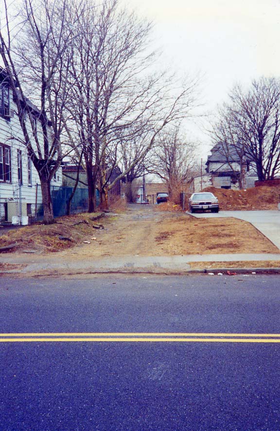
In 1999 I investigated and photographed a Canarsie dead end called Savage Lane, which I have found on only one map: the Colorprint NYC atlas produced by the American Map Co. This map was discontinued about 3 decades ago, and I zealously hold onto my dogeared copy.
I got my 1999 shot from East 98th Street looking west, just south of Foster Avenue.
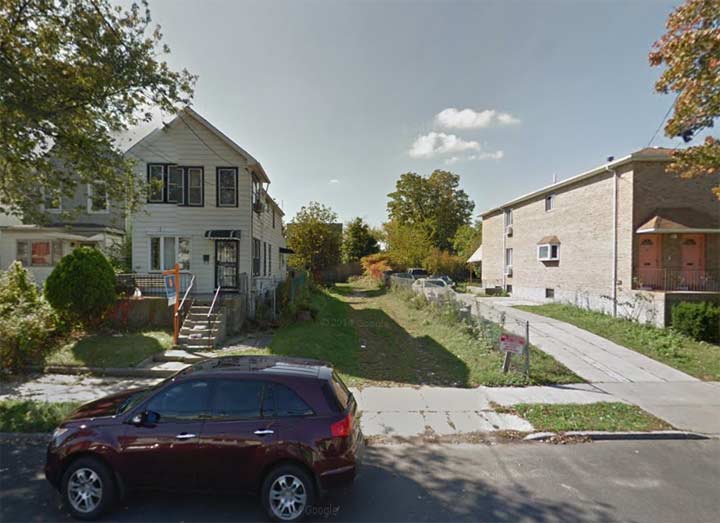
In 2014 (Google Street View) Savage Lane is still there. Long ago it became the driveway of the dwelling seen just to its left. Since 1999, it’s become grassed over, but with some imagination, you could tell it was once a thoroughfare.
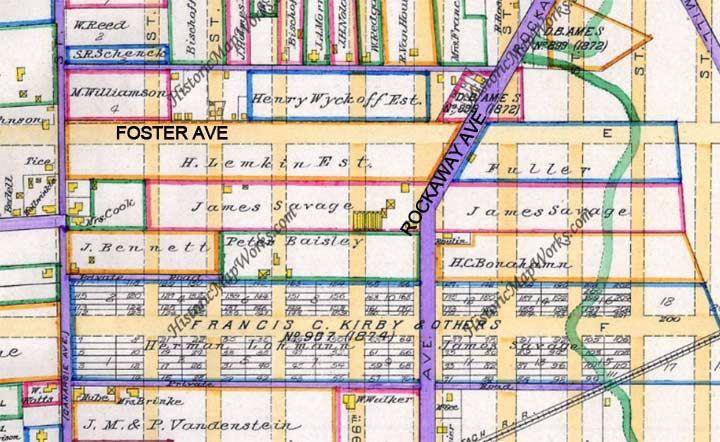
Here’s a Kings County map from 1890 showing the area. The purple lines show paved roads. A James Savage owned property on either side of Rockaway Parkway between Foster Avenue and Farragut Road.
I can guarantee you that no one who lives on East 98th Street these days could tell you about Savage Lane. But that’s why there’s…Forgotten New York.