

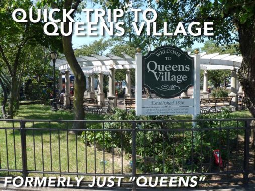


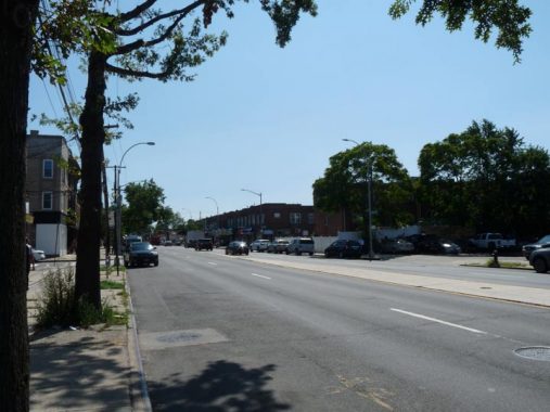
The buses were free in the summer of 2020, in this Year of Covid. I took somewhat advantage, traveling on the Q36 on Little Neck Parkway and Jamaica Avenue to locales I’ve only been a few times such as Queens Village and Floral Park. The party was over in August, when the MTA revived the $2.75 bus fare; and unless the agency gets plenty of relief aid from the Feds, 2021 will be a sorry year as subway and bus lines will be severely cut or eliminated. However, let’s live in the here and now…

The land where Queens Village sits today is actually on the western end of the vast, flat Hempstead Plains that dominate southern Nassau County. The area around Jamaica Avenue and Springfield Boulevard was settled early on, in the 1820s, by entrepreneur Thomas Brush; an early name for the settlement was Brushville but by the late 1800s, it was called simply Queens. The “Village” was added later to differentiate it from the county and borough.
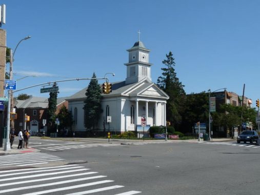
The intersection is punctuated by the wedding-cake white Queens Reformed Church (Eglise de Bethesda) which dominates the NE corner of Jamaica Avenue and Springfield Boulevard. The “old white church” opened in 1859 as the Reformed Protestant Dutch Church. The columned portico was added in 1947. The coat of arms, which can be seen in the sanctuary, features two foreign-language phrases: Nisi Dominus Frusta (Latin, ‘Without the Lord all is in vain”) and Eendracht, Maakt, Macht (Dutch, “Union Makes Strength”).

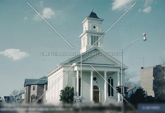
Here’s a look at the church in 1960, from the Greater Astoria Historical Society collection. The church looks practically the same!
However, you can also see state-of-the-art street lighting, with an octagonal post with a Westinghouse “cuplight” incandescent. The fire-alarm indicator globe is mounted atop the Westy, as was the practice then. In addition, stoplights were then painted black. By 1965, though, all had been repainted in bright yellow, now standard in NYC.

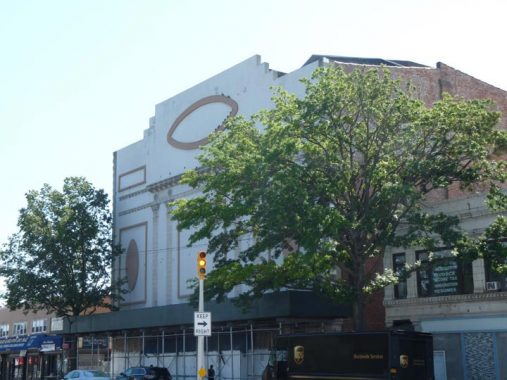
At the southeast corner of Springfield and Jamaica is shown the long-shuttered Queens Theater. The theatre, designed by architect Thomas Rau, opened December 29, 1927 and while it was originally a vaudeville theater featuring stage shows, it converted to films early on. Almost to the end of its run, though, the Queens was unable to show first-run pictures, which were available in Jamaica, anyway, and switched to porn before it closed. In 1938, two of the projectionists, Nathan Klein and Solomon Schulman, got into a fight; Klein was killed, and Schulman was convicted of manslaughter and received a 15-year sentence. The theatre eventually became the New York Deliverance Gospel Church, but it’s now shuttered and awaiting the next chapter.


The Long Island Rail Road has had a station at Jamaica Avenue and Springfield Boulevard since 1834, the first year the railroad penetrated this far east. The square formed by the two roads and Amboy Lane is the Queens Village and Bellerose World War II Veterans Memorial Plaza. The plaza contains a memorial to area Queens Villagers killed in WWII, Korea and Vietnam.


The area now known as Queens Village, centered at Springfield Blvd. and Jamaica Avenue, was known originally as Little Plains, then Brushville, for Thomas Brush, until about 1920. The present elevated station was constructed in 1924.
In 1856, residents voted to change the name of the town to simply “Queens” and that name persisted until at least the 1920s, when the Long Island Rail Road added the word “Village” to the station name. Before the 1898 consolidation the village of Queens was located in the county of Queens, which may have led to some confusion. However, people have seemingly adjusted to saying “New York, New York” for over two centuries.

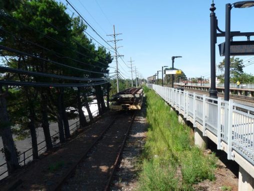
Interestingly the Queens Village station has the remnants of a layup track to the rear of the eastbound platform.

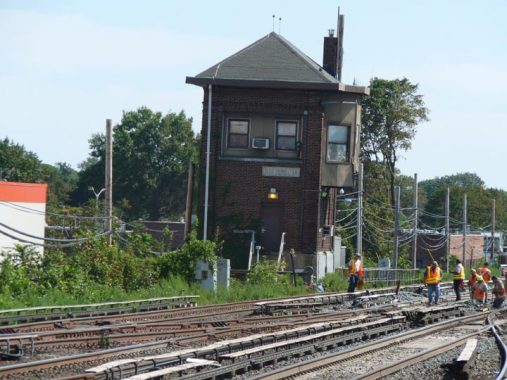
If you look closely at the control tower (which recently closed, ceding control to the Jamaica station) you can see the station’s old name, simply “Queens.”

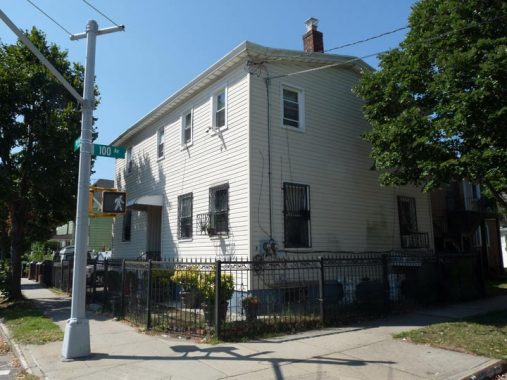
Here’s a relatively unadorned private house at the corner of Springfield Blvd. and 100th Avenue…

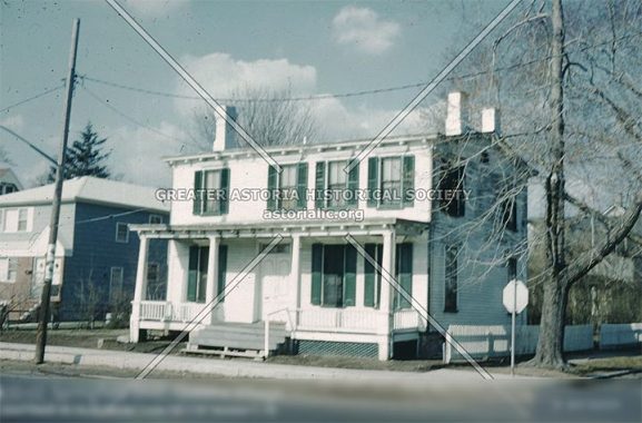
…and how 100-02 Springfield looked around 1960, from the GAHS archives linked above.

Hempstead Avenue, NY State Route 24, begins at Jamaica Avenue and 213th Street. It quickly escapes into Nassau County and forms the southern end of Belmont Park Racetrack, retaining the name Hempstead Turnpike as far east as Farmingdale. It’s the quickest non-expressway route to the Nassau Coliseum and Hofstra University. Route 24 extends out to NYS Route 110 in East Farmingdale.


A sampler of storefront signs along Hempstead Avenue between Springfield and the city line at Cross Island Parkway. I doubt John P. Bianca is still there.

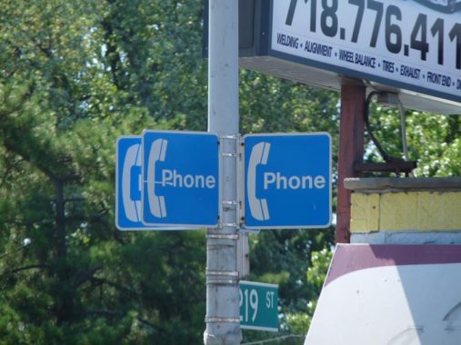
Signs for a nonexistent pay phone at Hempstead and 219th Street.
Check out the ForgottenBook, take a look at the gift shop, and as always, “comment…as you see fit.”
11/23/20