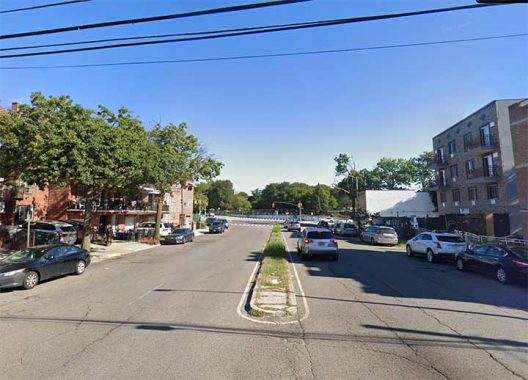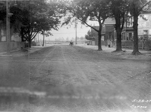
TODAY’S view in older Queens takes us back to 1937 and this view of Saultell Avenue looking north toward Corona Avenue/111th Street, with the still undeveloped Flushing Meadows-Corona Park in the background, which would host NYC’s first World’s Fair in a couple of years. This is in an odd pocket of Corona in which the streets run athwart the overall grid and have kept their names instead of receiving numbers, with street names like Van Cleef, Van Doren, Waldron, Penrod, Granger and Queens’ only “X” street, Xenia. 108th cuts through the odd grid the way 7th Avenue South does in the Village, and was likely a late addition. The region was laid out relatively early as can be seen on this 1909 map excerpt; street names have been changed since then.

On the 1909 map, Saultell Avenue is labeled as “Broad Street,” and is indeed broad in 2023 as it has a center median. Traffic planners probably made it wide as it connects 108th and 111th Streets. However, in 1937 it was no wider than its fellow Corona streets.
Nothing in the 1937 photo remains in the present.
As always, “comment…as you see fit.” I earn a small payment when you click on any ad on the site. Take a look at the new JOBS link in the red toolbar at the top of the page on the desktop version, as I also get a small payment when you view a job via that link.
9/9/23
