I have to admit, this one caught me by surprise after almost 25 years doing Forgotten New York. I was doing some Google Maps reconnaissance of Edgewater Park, a private enclave in the northeast end of Throg(g)s Neck in the Bronx. (I spell Throg(g)s Neck with the parentheses because while the Department of Transportation insists on one “g” in signage, the locals are just as adamant about two. The situation is different from the Verrazzano-Narrows Bridge, where overnight it seems in the 2010s the decision was made to add a “z” based on old accounts.
I often joke about the “undefended border” of Queens and Nassau, but there are in fact borders in NYC that are indeed defended, such as Sea Gate at the west end of Coney Island. There’s only one way in and out, at Surf Avenue and West 37th Street, and a Checkpoint Charlie. Maybe they even have guns. I have entered only once and to this day, I don’t remember how I got in. It was on a very early ForgottenTour in 1999. Similarly, I’ve only been in Edgewater Park once, in 2000; like Sea Gate, there’s only one way in, on Meagher Avenue (locals: how is that pronounced, “meager” or “mar”?) I suspect that today if I was spotted skulking around with a camera in Edgewater Park, I’d be hustled out, pronto. Locals, what say you? Can I prowl around up there?

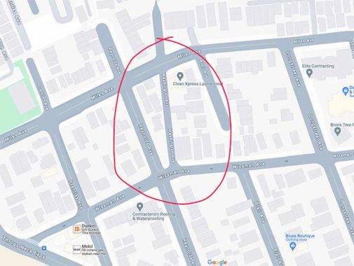
Anyway, while looking at the Google map, I spotted something I hadn’t seen before, an extra alley east of Reynolds Avenue between Miles and Wissman, marked “Washington Avenue.” I am unsure Google Maps had marked it before, and it’s completely absent from the paper Hagstroms and Geographias. Open Street Map has it, too.

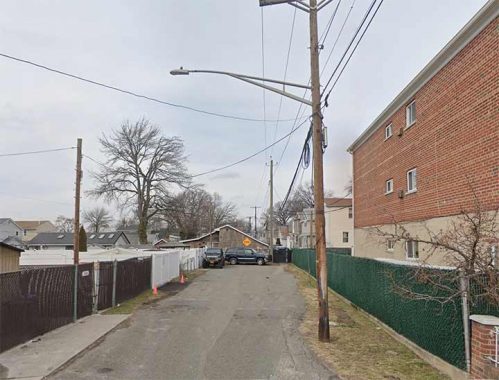
This section of Washington Place dead ends at the border of Edgewater Park north of Miles Avenue and is the only section of the alley that has a proper pavement. The DOT has provided it with a street light, double-mast no less.

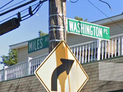
This is the sole street sign. While Google and OSM refer to it was “Washington Avenue” the DOT has it as Washington Place. This is likely because there’s a lengthy Washington Avenue in the western Bronx, running from Morrisania north to Bronx Park in Belmont.
Washington Place, between Miles and Wissman. There is one streetlamp and gravel pavement.
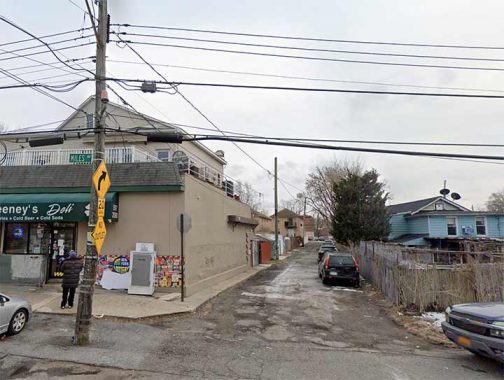
Washington Place, running north from Wissman. Here the lack of real pavement is especially obvious.
In History in Asphalt, the late Bronx historian John McNamara mentions that Washington Avenue is the former name of Reynolds, but doesn’t mention the alley.
Is there a clue in old maps of the area? Indeed. Here’s a map of the Edgewater Park/Throg(g)s Neck area in 1909 when the area was being deveoped from the George T. Adee (1804-1884) and Francis D. Wissman estates. Adee’s mansion was called Edgewater, as it was at the edge of Eastchester Bay. Smack in the center is Washington Avenue, which remains to this day though none of the other roads do, at least under their present names. Morgan Avenue became Wissman while Green became Miles.
This forgotten alley is forgotten no more. At least by me.
As always, “comment…as you see fit.” I earn a small payment when you click on any ad on the site. Take a look at the new JOBS link in the red toolbar at the top of the page on the desktop version, as I also get a small payment when you view a job via that link.
12/14/23
