


DURING the administration of Gov. Andrew Cuomo, state-operated bridges and tunnels received giant medallions with the state’s emblem in a display of civic pride for some travelers, or perhaps an extravagant waste of taxpayer money. While researching the history of Conduit Boulevard on the eastern edge of Brooklyn, I noticed an earlier example of an official emblem on a transportation route.
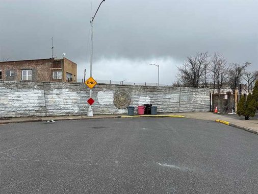
In the City Line neighborhood, one block shy of the border with Queens, Drew Street is bisected by the portal that brings the A subway train out of the tunnel onto the remnant of the Fulton Street El as it runs above Liberty Avenue from Ozone Park to Richmond Hill. “Board of Transportation City of New York” indicates the agency that built this wall, a precursor of the MTA. The city initially had plans to extend this subway line into Queens along Pitkin Avenue but by 1947 a less expensive plan was approved: connect it to the Queens portion of the elevated line, as its Brooklyn portion was demolished. This connection was completed in 1956, severing Drew Street to make way for the ramp.

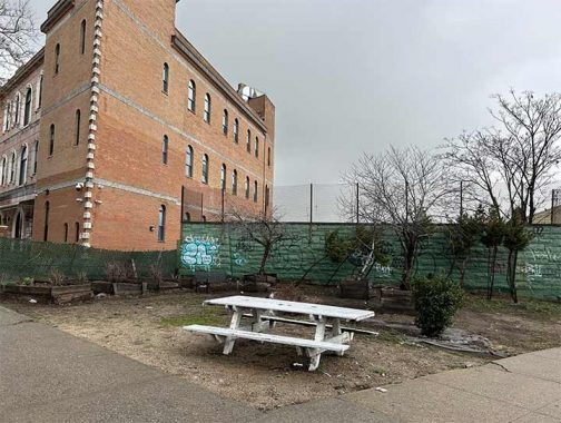
At Glenmore Avenue and Forbell Street, a triangular property above the portal was assigned to the Parks Department as designated as a community garden maintained by members of the neighboring Masjid Al-Aman. Historically Jewish and Italian, City Line underwent white flight in the 1960s, with Blacks and Puerto Ricans settling in. After the turn of the millennium, Bangladeshis arrived in City Line, building mosques, madrassas, and halal food establishments. This little garden also has the transit agency logo on its wall. It appears on maps as the BACDYS Garden, which stands for Bangladeshi American Development and Youth Services, a leading organization in this newcomer community.

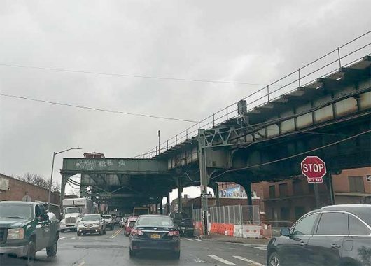
At 76th Street, one block inside Queens, the ramp lands on the old elevated trestle. Stub tracks stick out to indicate where trains rain prior from 1915 to 1956. When this elevated line opened, travelers could take the train from the Park Row terminal on the Manhattan side of Brooklyn Bridge, riding atop Fulton Street, Pitkin Avenue, and then Liberty Avenue to the eastern terminal at Lefferts Boulevard. The 1956 subway project also added another element to this line, an extension to the Rockaways using a repurposed Long Island Rail Road line. [if only such conversions could be done inexpensively today. –Ed.]
Sergey Kadinsky is the author of Hidden Waters of New York City: A History and Guide to 101 Forgotten Lakes, Ponds, Creeks, and Streams in the Five Boroughs (2016, Countryman Press), adjunct history professor at Touro University and the webmaster of Hidden Waters Blog.
Check out the ForgottenBook, take a look at the gift shop. As always, “comment…as you see fit.” I earn a small payment when you click on any ad on the site.
3/23/25