In early April 2012 I walked the route of the New York, Westchester and Boston Railway, or the closest possible approximation along the tracks, from the Bronx Park East station all the way northeast to Dyre Avenue. It gave me a chance to traverse the Pelham Gardens and Eastchester sections of the Bronx, which I’m in just a few times per year, and to approach both the subway route and the neighborhoods it travels through with a fresh perspective.
For an explanation of what the NYW&B was, and remains today, check the link to Part 1 at the top of the page.
TOUR ROUTE
Gun Hill Road
One of the Bronx’ more colorfully-named routes, Gun Hill Road, seen here at Wilson Avenue, begins at Mosholu Parkway at Van Cortlandt Park and runs generally east to the confluence of the Hutchinson River Parkway, New England Thruway and Bruckner Expressway. Most of it is actually “East” Gun Hill Road, with a short “West” Gun Hill Road between Mosholu and Jerome Avenue, the divider between East and West Bronx streets. As is the case with Throg(g)s Neck, there’s a dispute whether the proper spelling is Gun Hill or one word, Gunhill.
The western section of the road near Van Cortlandt Park is the oldest part, with the eastern section gradually built out in the early 20th Century. The actual Gun Hill, from which a group of Americans fired on British troops on January 25, 1777, is located within Woodlawn Cemetery.
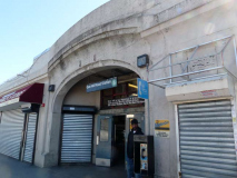
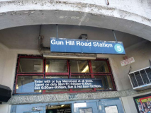
The Gun Hill road station is located on the south side of the road between Seymour and Fenton Avenues. The NYW&B is in an open cut at this point. It’s rather difficult to get good photos of NY&B stations because they tend to face north and the sun is shining directly over them at midday. Nevertheless I got a representative sample.
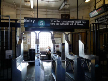
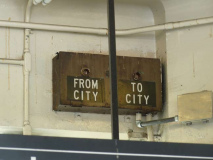
The exterior resembles Pelham Parkway (see Part 1) with a concrete exterior with an arch over the entrance. There’s a bench just past the entrance turnstile, and an indicator notifying patrons when a Manhattan or Dyre Avenue train is inbound (“From City” or “To City.”) Since this station now has the timers that show how long the wait is till the next train (most IRT stations had them by 2012) I’m not sure if the old indicator is working at all.
A street sign or two indicate Betty Brady Square, at East Gun Hill Road, Fenton Avenue, Knapp Street, DeWitt Place and Morgan Avenue. (The NYW&B, its attendant streets that run alongside and the overlying street grid make this a complicated intersection.) Betty Brady was a community volunteer and organizer associated with Holy Rosary Church. As it happens, the paperwork associated with the naming of the square in 1991 is all online. Everything was still done with typewriters then.
The Eastchester branch of the New York Public Library, which adjoins the railroad, arrived in 1985 — the building looks rather older than that, as it resembles the no-nonsense structures built by Works Progress Administration during the Depression.
Click on the photo for a bigger view. A Bromley atlas plate shows Ward 24, or Eastchester, in northeast Bronx. In 1906 this was still mainly farmland, with the just-formed NYW&B Railway plotted out in a straight line running SW to NE — I highlighted it in red. The waterway in the center of the map is Stony Brook, a tributary of Westchester Creek now buried in the sewer system. Though today’s street grid is mapped it would still be several years before any of the streets were actually built.
Only three roads were actually open, shown in pink: Boston (Post) Road on the left, Eastchester Road on the right, and the vanished Saw Mill Lane at the bottom.
A curve at Fenton and Hammersley Avenues reveals the New York, Westchester & Boston in an open cut. Topography and street levels change quickly in the northeast Bronx and the NYW&B finds itself in tunnels, open cuts, embankments and elevated structures. A fellow named J. Hooker Hammersley owned a lot of Bronx acreage in the 1860s.
This large house at the corner of Hammersley and Eastchester Road boasts a huge lawn abutting the railroad. Now used as day care and a nursery school, it may have been a farmhouse at one time.
Eastchester Road, which connects Westchester Square with the NE Bronx Eastchester neighborhood, predates European settlement as it was once a trail used by the Siwanoy Indians.
Eastchester Road is bridged over the NYW&B tracks. The railroad used to have 4 tracks, but when the City purchased it and converted it to subway use, the inner two were removed in most stretches.
A look northeast on Hammersley Avenue toward Co-Op City, built in 1968 on land formerly used as a historical amusement park, Freedomland (1960-1964), which in turn was formerly swampland. In the early 1900s, roads were plotted to run through there, but were never built, but that is why the Bronx has Hunter, Boller, Palmer and DeReimer Avenues that have 50-block gaps between one piece of them, and another.
I’m attracted to alleys and dead-ends, the obscurer the better, and just north of the NYW&B bridge, there’s one called Fox Terrace, lined with one-family houses, trailing west on Eastchester Road. It’s 200 feet long and there are 13 houses facing it.
As I mentioned in Part One, the builders of the NYW&B were generous about planning for traffic below Pelham Parkway, with a minimum of interruptions — the railroad was elevated above the cross streets. When the NYW&B was being plotted out, the land was occupied by farms and the Morris Park Race Course south of Pelham Parkway (as you can see on this 1906 atlas plate — zoom in for a clearer view). North of Pelham Parkway, though, the railroad runs in an open cut below grade and when streets were built, they tended to be routed around it.
Here, I’m walking against auto traffic as Burke Avenue curves into Mickle Avenue. The ROW is guarded by a yellow concrete barrier with directional arrows. In this part of town, north-south streets are named for 19th Century mayors; Mayor Andrew Mickle served from 1846-1847. Other area avenues honor NYS Governors.
A look at Kingsland Avenue from both sides of Givan Avenue. There are some handsome peaked frame buildings — likely once part of a real estate development. The NYW&B ends Kingsland’s run here temporarily.
A couple of northern Brooklyn avenues and northern Bronx avenues share names. Both Greenpoint’s and Eastchester’s Kingsland Avenues are named for Ambrose Cornelius Kingsland (1804-1878) NYC Mayor from 1851-1853. The sperm whale oil merchant resided in Greenpoint, where he had a lot of acreage, and there is a short Newtown Creek inlet called Whale Creek Canal. Kingsland appropriated funds for the creation of Central Park.
Throop Avenue, in Pelham Gardens, and Throop Avenue, in Bedford-Stuyvesant, Brooklyn, are also named for the same person, Enos Throop (pronounced ‘Troop’), NYS Governor from 1829-1833.
Robert Givan
Scotsman Robert Givan arrived in the USA in 1795, establishing a mill in Westchester County; he and his family established a large estate north of what is now Pelham Parkway and east of Eastchester Road through which most of the neighborhood of Eastchester was established in the early 20th Century.
One of the former Givan mansions, hidden behind modern siding, can still be found at 2910 Mickle Avenue near Givan Square, at Gun Hill and Eastchester Roads. When you see a house facing athwart the street on which it is standing it’s a good bet that the house predated the street grid.
In 1906 the NYW&B railway builders anticipated the construction of Givan Avenue that would run through here, and constructed an overpass at what would be Wickham Avenue. At the time, though, the overpass stood in pretty much open country. Courtesy Robert A. Bang Collection, John Tolley Archive.
Today the rail bridge is exactly the same, while the modern #5 train uses the overpass. The road has been newly constructed under the railroad.
Turning north on Wickham, the next avenue encountered is Tillotson. I was surprised to find a brand new shiny park has been built on what was the former roadway between Wickham and East 222nd Street. It’s so new, signs haven’t yet been posted that identify it.
Both of these photos show the NYW&B railroad bridge crossing East 222nd Street, east of Ely Avenue. In 1906 when the RR was ran through, East 222nd was a dirt road. Courtesy Robert A. Bang Collection, John Tolley Archive.
This far north in the Bronx, especially in Eastchester in the shadow of Co-Op City, there are still a few reminders of a rural or suburban past. For one block between Ely and Grace, Tillotson Avenue has no sidewalks.
There is some older housing stock in northern Bronx. I think the small porch on the second floor of this Grace Avenue house is a newer addition; the concrete lawn and brick fence certainly is.
PS 169 (Baychester Academy) at Boston Road and Edson (not Edison) Avenue is actually brand-new, having opened in 2009. It was named the Willie Ella Paschal Bowman Campus after a local community activist and buinesswoman. The school replaced what had been the Baychester Diner.
The Baychester Avenue station, east of Boston Road, is directly under the RR overpass and architecturally, isn’t much to write home to Mother about. It’s the penultimate station on the Dyre Avenue line, which is uncharacteristic for what is nominally an IRT line with lengthy distances between stations, a sign of the line’s railroad pedigree.
I encountered Tillotson again and turned north on Boller Avenue, where there are a couple of interesting structures.
You could probably shave your beard with the peaks on this stucco-exterior house on Boller between Tillotson and Boston Road.
I’d like to know the story behind this group of stone buildings at 3434, identified as Belvidere XLIV (44) which has been divided into apartments.
1906 view of the railroad bridge carrying the NYW&B over Boller Avenue. It looks as if the builders anticipated a wider road would be built through, but Boller is one lane only. Courtesy Robert A. Bang Collection, John Tolley Archive.
A couple of 2012 views of the Boller Avenue railroad bridge. Strictly speaking it’s a pair of railroad brudges connected by lengthwise girders.
Exposed rock outcroppings, the product of a glacier’s passage at the end of the Ice Age, are a frequent sight in northern Manhattan and much of the Bronx.
Till it roars past the city line and into Westchester County, Boston Road is pretty much lined with gas stations, auto repair palaces and tire replacement shops. But this one has a nifty painted sign.
Though no street signs identify it this is actually the intersection of Boston Road and Needham Avenue, a directional arrow is painted on one of the rock croppings and traffic signs are mounted on what could be an old trolley pole.
When NYW&B builders ran through the railroad on a straight line in 1906, it had to cross Boston Road at an angle as it curves a bit to the northeast here. The road was just two lanes at the time, but later in the 20th Century two more lanes were added. The road is part of US 1 at this point. Courtesy Robert A. Bang Collection, John Tolley Archive.
2012. The city has added Twin versions of Corvington posts to illuminate the busy roadway here. I’m skeptical about this esthetically, since Corvs were never twinned during their first great run between 1900 and 1950. When Boston Road was widened, anew bridge replaced the older one.
Turning north on Harper Avenue, where you can occasionally see a train running in your backyard.
At Light Street and Harper Avenue we are almost in Mount Vernon and it’s getting to look fairly suburban. There are three streets in the neighborhood called Light, Dark and Lustre; Dark Street was named first, for a Charles Darke who owned the property through which the street was laid out. The other two were named whimsically in imitation.
Dyre Avenue
Dyre Avenue is a main traffic and shopping drag from Boston Road north into Mount Vernon, and the NYW&B built a station here that has become the end of the line for the IRT when it took over in 1940. It ia named for William Dyre, an early NYC mayor from 1680-1681. It was still a dirt road in 1906 when the railroad arrived. Note the gas lamp: though electric lamps were beginning to take over in 1906 there were still quite a few gaslights, and there would be until the 1920s. Courtesy Robert A. Bang Collection, John Tolley Archive.
The Dyre Avenue trestle is today much the same except for the superstructure with station offices, added sometime during the 20th Century. One of the interesting aspects of the railroad bridge for me is a pair of nonfunctioning “crescent moon lamps” that illuminated the road underneath the bridge. These were installed about 1940 and might have worked into the 1980s or 1990s.
Some views from the station exterior, just inside the station, on the platform, and from the window of an idling #5 train. It appears that in the 1960s the station got the same species bricked tiles that IRT station extensions were getting then.
As I’ve said, the old NYW&B extended well into Westchester County (plans called for an extension into Connecticut but the road went bankrupt before that happened). There are indeed several station traces in Westchester, but I’ll let the NYW&B website handle those.
Are there other NYC subways that descend from railroads? At least 4 in southern Brooklyn do: the D train (West End steam railroad); B/Q (Brooklyn, Flatbush and Coney Island); F (Culver) and N (Sea Beach).
However, the NYW&B differs from them all because it is of more recent vintage and never used steam engines. It was designed to take electric power from overhead wires from the start. When the city bought it, it installed a third rail on the surface.
Sources:
History in Asphalt, John McNamara. Where it all begins.
The New York, Westchester & Boston Railway Company, Robert A. Bang. The NYW&B is surprisingly well-documented in print.
4/22/12
