I found myself in Bay Ridge a great deal in 2013, mainly because of extensive dental work, but the neighborhood, in which I lived from 1957-2003, is one I always enjoy visiting. It hasn’t been gentrified, yuppified or “Brooklynified” yet. It’s less Irish, Italian, Scandinavian and Syrian than it used to be, and more East Asian and Eastern European. Yet the basic DNA is the same, a mix of row houses, detached houses, and massive apartment buildings that date from the Golden Age of NYC Apartment Houses, about 1923-1935.
I live in Little Neck now, but the eastern Queens neighborhood has become increasingly anodyne. Its primary meeting place, the Scobee Diner, is gone, closed in November 2010 and razed in October 2013. Shops and bars have closed along Northern Boulevard. Even the OTB closed. Shaffer Funeral Home is still around, but funerary is a business that will never have hard times. Other neighborhoods attract, such as Astoria and Bay Ridge. But you can’t go home again. Except when you go to the dentist.
I haven’t paid much attention to Ridge Boulevard in the past, other than this ForgottenSlice in 2010. I decided to concentrate here on those blocks where Ridge Boulevard evolves from the almost suburban-like Bay Ridge to the gritty urbanity of Sunset Park. Even the name of the street changes, from Ridge Boulevard to 2nd Avenue. In Bay ridge, the numbered avenues begin at 3rd. There are three more north-south avenues west of 3rd, but they’re called Ridge Boulevard, Colonial Road, and Narrows Avenue, before the original shoreline at Shore Road is reached. Old maps — very old ones — show Ridge Boulevard and Colonial Road as 2nd and 1st Avenues, respectively, but I have a Kings County map showing 1st and 2nd Avenues in 1890 and Ridge and Colonial in 1910, so the change was made sometime in between.
I don’t know why the change was made. Bay Ridge was very much an outlying suburb until the 1920s, with rich nabobs’ mansions lining the shoreline, and scattered farms further inland. It wasn’t until the BMT Subway pushed south to 86th Street in 1915 did any massive real estate development happen, with side streets built up and ‘affordable’ houses lining them. I think we can be fairly assured, though, that RE development was the reason for the change.
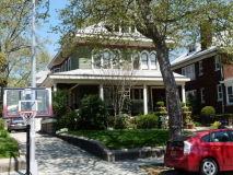
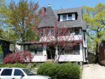
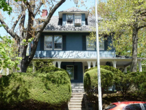
Side streets of Bay Ridge are full of eclectic and handsome architecture like this group on 77th Street near Ridge Boulevard.

Bay Ridge doesn’t enjoy protection from the Landmarks Preservation Commission, so developers are free to tear down any building in the area. Whatever rises here won’t have nearly the personality of the three houses just shown.
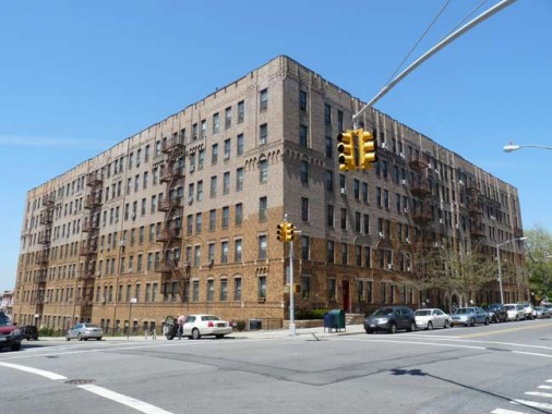
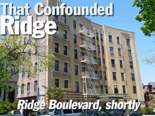
Many people in Bay Ridge call their neighborhood “The Ridge,” but this massive multifamily on Ridge Boulevard and 75th Street (they don’t call it Bay Ridge Parkway) has claimed the title. It’s so big, it has two addresses.
75th descends on a slope toward the Narrows. On its brother streets, 74th and 76th, the slope is too sharp an angle for vehicles, so steps streets were built.
Skipping over Flagg Court, constructed by early 20th Century architect Ernest Flagg (it’s on this Ridge Boulevard page) you find an example from the golden age of public school architecture (in my opinion, 1900-1930) on 72nd Street, PS 102, known as the Bayview School. School architecture from the 1950s onward has made them look like prisons.
This Queen Anne-style house, just past Senator Street (Bay Ridge Avenue; over a dozen Bay Ridge Streets have “Bay,” “Ridge” or both in them) is the parish house for the St. Andrew the Apostle Catholic Church (founded in 1971; obviously a private residence was purchased for it). The church itself consists of a brick ground floor constructed around a pre-existing corner house in 1981. The parish was formed when the Bay Ridge Towers on 65th Street between 3rd and 4th Avenues was completed in 1971, overwhelming the pre-existing Our Lady of Angels (4th Avenue and 73rd Street) parish.
In the New Testament, Andrew was the brother of Simon Peter and shared his profession, fishing. According to tradition he shared the fate of Jesus Christ and Peter, that of crucifixion. Not considering himself worthy to be crucified on the T-shaped cross used for the Christ, he requested an X-shaped cross, today known as “St. Andrews’ Cross.” Such X-shaped crosses were included in the architecture of Manhattan’s st. Andrew’s Church at Foley Square.
Art Deco apartment building at Ridge Boulevard and 67th Street. Notice the angle the building takes. It’s following a bend in Ridge Boulevard, the same bend that all north-south Bay Ridge Avenues take at 67th. In the late 1800s, 7th Avenue was laid out at a diagonal against the overall Brooklyn street grid south of 65th Street, and its brother avenues take an angle to remain parallel with it. I have an intriguing (OK, to me, at least) Beers Atlas of the town of New Utrecht from 1873, and it shows just a few streets traversing through what would be Bay Ridge. 3rd and 4th Avenues are already established, but 86th Street and 7th Avenue are just ghost lines.
As for the building itself, it features intricate brickwork and plenty of right angles in the facade.
This multifamily at 6623 Ridge Boulevard was apparently inspired by medieval fortresses. If you have time on your hands for several months… count the bricks.
From 1938-1940 the Circumferential Parkway was constructed in western Brooklyn along the shoreline into Queens, joining a network of roads such as the Cross Island Parkway and Southern State Parkway. When that name proved to be too much of a mouthful, it was changed to the Belt Parkway, though highway and street signs call it Shore Parkway.
This overpass, dating to 1940 with several improvements since, originally connected the Belt Parkway to the Gowanus Parkway on 3rd Avenue, which was originally built between 38th and 65th streets in an ingenious manner: it used the pillars and supports of the old 5th Avenue Elevated train, which had switched to 3rd Avenue in Sunset Park. (New stanchions were built north of 38th Street.)
20th Century road czar Robert Moses was history’s greatest traffic mover, but he’s also remembered as a neighborhood destroyer. The uninterrupted shadows caused by the Gowanus Parkway over 3rd Avenue brought crime and economic depression, some say (especially Moses biographer Robert Caro) and brought on Sunset Park’s reputation as a place where, as my parents used to tell me as a kid, “the bad boys are.”
At the Belt Parkway overpass, as mentioned earlier, Ridge Boulevard becomes 2nd Avenue. I considered these street signs unusual — instead of the usual Highway Gothic or Clearview, the DOT street signs were made in Helvetica Bold.
Ridge Boulevard is bridged over by the Belt Parkway, but itself is on a bridge that lasses over Shore Road Drive and the west end of the Bay Ridge branch of the Long Island Railroad, here officially the NY & Atlantic — and has been in place since the mid-1800s. The line ends at the Brooklyn Army Terminal and in the dim past was actually a passenger line. In 1958, by then an all-freight line, it nonetheless had a Very Important Passenger — more anon.
I once had a private trip on the entire Bay Ridge Branch, which ends at Fresh Pond Yards in Glendale, Queens.
This monolithic behemoth at the corner of 2nd and 64th Street looks like it could survive a couple of Hurricane Sandys. I wonder what its original purposes was. It is now home to Extra Space storage. The exterior is fenced off pretty securely. I stuck the camera through the bars for some photos.
The Brooklyn Army Terminal (officially, BKLYN Army Terminal) complex is a massive grouping, filling the area between the waterfront and 2nd Avenue between the railroad and 58th Street.
The complex was also known as the U.S. Army Military Ocean Terminal and the Brooklyn Army Base, as part of the New York Port of Embarkation. It was designed by Cass Gilbert and completed in September 1919. It was the largest military supply base in the United States through World War II. By the time the base was closed in the 1970s, over 3 million soldiers and 37 million tons of military supplies had passed through the terminal.The 95 acre complex had its own railroad line, police and fire departments. wikipedia
The Feds sold the complex to NYC in 1981, and since then it’s been home to light manufacturing, back offices and warehousing. Its interior open space is phantasmagorical. Unused train tracks connecting to the LIRR Bay Ridge branch can be found within. This was a major embarkation point for US troops heading to Europe and elsewhere in the draft days, and the draftees were often brought in from the mainland along the tracks. In 1958, one of the draftees was Elvis Presley, in probably his only Brooklyn appearance. A poster in the BAT foyer commemorates this occasion.
Yet another huge brick behemoth can be found occupying the entire block between 2nd and 3rd Avenue and 58th and 59th streets, and again occupied by a plethora of small businesses. What was its purpose? A clue can be found on some stone tablets by the roofline.
The Brooklyn City Railroad, incorporated in 1853, ran horsecar and later trolley lines in western Brooklyn for decades. This complex for repair and storage of the cars was built in 1892 at what was then the city of Brooklyn’s southern limit. The company continued to run Brooklyn’s trolleys until 1929, when the BMT (Brooklyn-Manhattan Transit) reformulated it into Brooklyn-Queens Transit. The boroughs’ trolley lines had disappeared by the mid-1950s.
“Directed Accident Response Program” and “Rotation Towing.” Where you collect your car when it’s been towed. 2nd Avenue and 62nd Street.
Pizzeria Cafe 58, serving breakfast and lunch, serves workers in the BKLYN Army Terminal complex.
Following the signs to the ferry. For the past couple of decades there has been a ferry from “Bay ridge” (though this is Sunset Park) to Wall Street off and on (it keeps getting cancelled and reactivated from time to time, but it’s currently in service until at least January 2014, when full service is restored on the R train between Brooklyn and Manhattan.
It’s the successor to another ferry that ran prior to the opening of the Verrazano-Narrows Bridge in 1964. Services using smaller boats ran from the 69th Street Pier periodically from the 1960s through the 90s, but the service swithced to a larger pier at 58th Street.
The ferry is walkable from the 4th Avenue BMT 59th Street subway, but it’s easier to take a bus. The B11 bus serves the terminal and also the nearby Lutheran Hospital. It transfers to the BMT at the 53rd Street station.
The rail tracks along 1st Avenue leading into the BAT serve Brooklyn’s only railroad still running on a street open to traffic.
The Bush Terminal Railroad was built to provide service to Bush Terminal tenants and was a key element of the integration of the facility. Sidings into all buildings from rail arteries running down the avenues allowed materials to be be directly transferred to and from rail cars, eliminating the difficulty and expense of transporting products to and from rail depots by truck at a time when rail transport was the primary mode of conveyance for all but the shortest distances. The railroad was linked to the rest of the country either by float bridges at 51st Street or the LIRR Bay Ridge Line at 65th Street. In its early years, the Bush Terminal took responsibility for rail freight transfer on the rail line, with the tenants only responsibility being to get their items to/from the transfer lobby via the freight elevators in all buildings.
The railyard was located just to the east of the terminal warehouses and occupies the six blocks between 44th and 50th streets. At its peak, the railyard could handle 1,000 cars.
The rail system also included smaller team track yards at 29th, 37th, 39th, 48th and 54th Streets. Such yards are so named because in an era before trucks, teamsters with wagons and teams of horses would come to such yards to load and unload railroad cars.
The New York Cross-Harbor Railroad was formed in 1983 to take over the underused facilities of the Brooklyn Terminal Railroad, Brooklyn Eastern District Terminal and the New York Dock. The facilities later came under the perview of the New York New Jersey Rail, providing rail carfloat connection between Greenville Yard in Jersey City, NJ and the Bush Terminal in Brooklyn. Michael Minn, who has additional photos of this unusual railroad.
The road to the ferry passes some semi-abandoned warehouses and smokestacks belonging to the BAT power plant.
At first I thought this referred to a party boat. You’ll have to help me with this, as the internet is silent about what the phrase means, other than the obvious.
The first boats launch from the Army Terminal dock weekday mornings at 6:20 am. Another boat departs at 7:10 am, followed by ships at 8:20, 8:50, and 10:05 am. They dock first at Wall Street, then head upriver to East 34th Street. Fare is $2 one-way, and commuters can skip the train altogether by paying $2 to ride the shuttle van that picks up passengers above every Bay Ridge R stop starting in time to make the 7:10 ferry. The shuttle stops at 95th Street and Fourth Avenue 40 minutes before each departure, at 86th and Fourth 35 minutes beforehand, at 77th and Fourth 30 minutes early, and at 69th Street and Fourth 25 minutes prior to launch. The Brooklyn Paper
It’s one of NYC’s least-known ferry terminals. Views across Upper NY Bay and the Narrows can be had, providing views as far as the Statue of Liberty and Jersey City.
The waterfront end of the BKLYN Army terminal. The most surprising thing here, to me …
… was the pedestrian bridge between complexes. I hate to be ambiguous, but when I took these, I was reminded of a bridge in Italy (I have never been, but have seen photos). Now I can’t remember which one I was thinking of. Once again, give me a boost.
I can say it’s one of the more impressive pedestrian bridges in NYC no one knows about.
Lutheran Medical Center, 2nd Avenue and 56th Street. Lutheran was founded in 1883 by a Norwegian Lutheran Deaconess-Nurse, Sister Elizabeth Fedde, to serve the Norwegian immigrant community. The institution has provided care for the southwest Brooklyn communities for more than 80 years. My father was treated here for his final illness in 2002-2003.
Ascending the hill on 58th Street going southeast. The housing units here have survived fairly intact, without a lot of alterations, from the early 20th Century.
Sunset Park is mostly Hispanic these days, but Irish Haven, 4th Avenue and 58th, may be a relic from the days when the Irish held firm.
And with that, time to get home before the peak fares kicked in at 4PM.
10/26/13
