

I’m lucky to reside in an area that still has retained some aspects of its rural past amid its current suburb-ity. A walk through the neighborhoods of the northern part of Queens…College Point, Whitestone, even Bayside…will reward the urban enthusiast with glimpses of the small Long Island North Shore towns they used to be, as there are town centers at 14th Avenue and 150th Street in Whitestone, along College Point Boulevard between 14th and 18th Avenue, and Bell Boulevard between Northern Boulevard and 35th Avenue. The spaces between these town centers, once meadows or farmland, have been filled with block after block of one and two-family homes and seem to have been thoroughly “folded” into a bland Queens fabric: definitely not the dense, urban feel of a Soho or a Park Slope, but not the thoroughly suburban atmosphere of a Levittown or Hicksville.
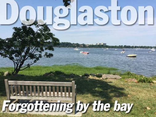
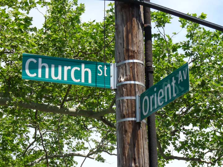
The two “northeasternmost” of Queens’ neighborhoods, Douglaston and Little Neck, however, have a different tone: they somehow seem carved out of the rather exclusive, definitely monied precincts of the Nassau County towns immediately to the east, Great Neck and Manhasset. Part of it is their compactness: both neighborhoods are served by a short shopping strip along Northern Boulevard, and the area’s hilly topography doesn’t lend itself to block upon block of similar-looking ranch houses.
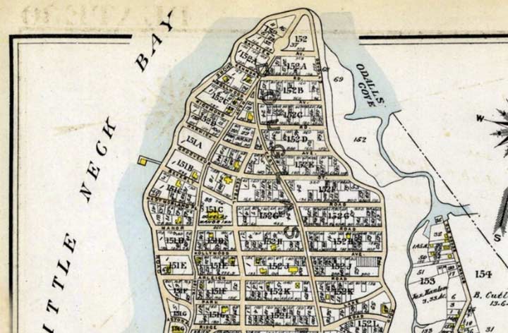
Scotsman George Douglas purchased the peninsula from Wyant Van Zandt in 1835. The region was later developed as a suburban resort and exclusive enclave, and enjoys pleasant views of Little Neck Bay and Long Island Sound. Streets were laid out in 1906 by the Rickert-Finlay realty company, who had purchased the property from William Douglas, George’s son, and eclectic, individualistic homes were built in the area, which has always been among Queens’ most affluent.
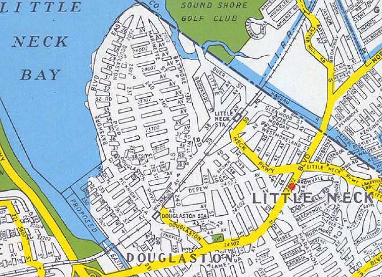

The streets have retained their original names and have ignored the Queens mania for giving every street a number; however, Hagstrom numbered Douglaston streets in maps made from the 1940s (above map 1949) into the 1970s. Can area residents confirm for me whether the numbered avenues were there during that time?
The Douglaston name was appended to the area in 1876, after William Douglas had donated a Long Island Rail Road stop. Today, mansions in Douglas Manor can sell for $4 million or more.
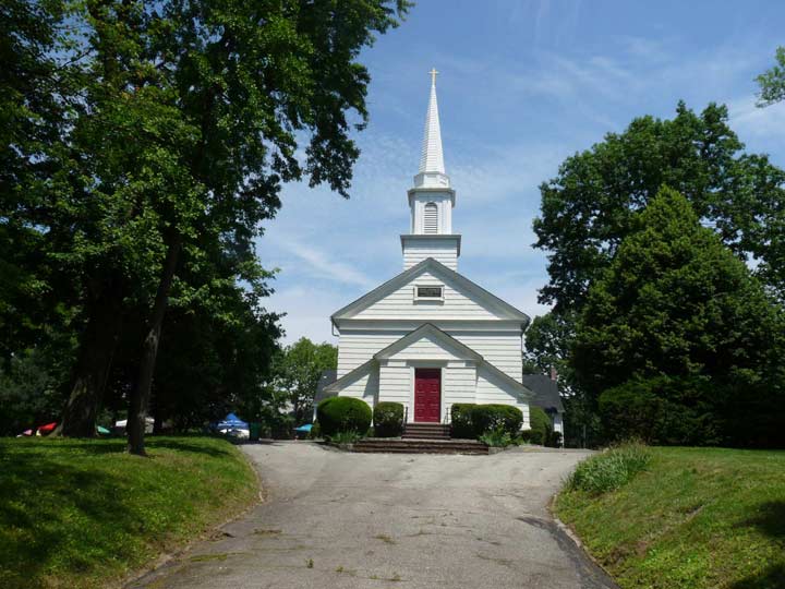


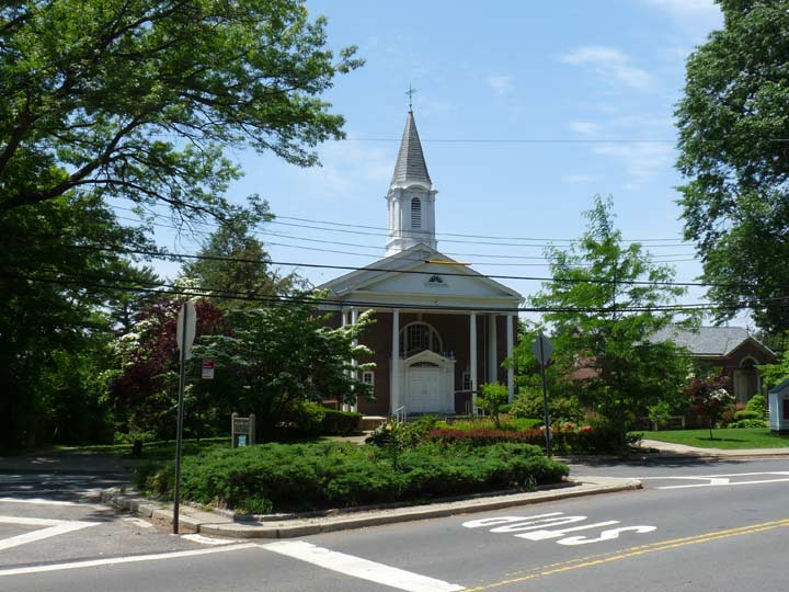
For me, Douglaston begins at Zion Church and its graveyard, on Northern Boulevard just east of Douglaston Parkway. Zion Church was completed in 1830 on plans from Trinity Church architect Richard Upjohn. The original church burned down in the 1920s, but was reconstructed as a faithful copy of the original. Colonial-era Douglaston landowner Wynant Van Zandt is interred in the family vault beneath the cemetery; Van Zandt had held local services in his home before the church was built. Bloodgood Cutter, who once owned large areas of property in Douglaston and Little Neck and fancied himself a poet of note (though he was actually a master of doggerel, parodied in Mark Twain’s Innocents Abroad as a’Poet Lariat”) is interred here.
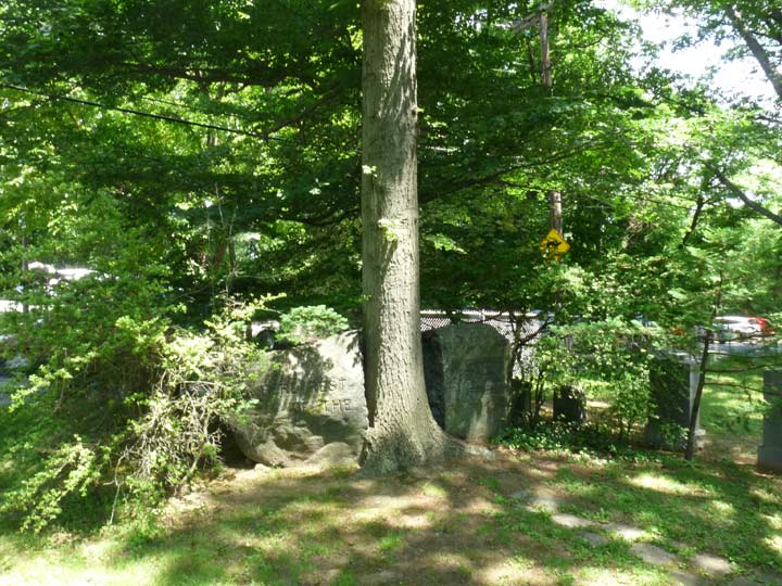
The Matinecock Indians, a branch of the Algonquin group, had occupied the lands of eastern Queens for centuries before Europeans arrived. While the Matinecock tribes gradually sold off their holdings to the Dutch and British in other parts of Long Island, giving the lands a peaceful transfer, Thomas Hicks (of the Hicks family that settled Hicksville) forcibly evicted many remaining Matinecocks from Little Neck.
Much later, when the Flushing and Hempstead Turnpike, also known as Broadway and presently, Northern Boulevard was being graded and widened, the graves of the Matinecocks were located in a roadside cemetery. They were reinterred in the Zion Episcopal Church cemetery in 1931. A stone marker, designed in two pieces on either side of a tree, is marked “Here Rest the Last of the Matinecoc.”
Descendants of the Matinecocks, notably the Waters family, still reside in Little Neck, and the intersection of Northern Boulevard and Marathon Parkway was recently sub-named “Matinecock Way.”


The area south of the Long Island Rail Road, east of Douglaston Parkway, and north of Northern Boulevard was developed as Douglaston Hill beginning in the mid-1850s on the former Jeremiah Lambertson farm. While not as exclusive as Douglas Manor to the north, it features dozens of architectural styles from the Victorian up to the modern eras. Some streets feature unusual brick gutters.
I can verify that the streets in Douglaston Hill were numbered until a decade ago, when they resumed their original names by local ordinance. Most of the house numbers are “regular” and don’t conform to Queens’ hyphenated house numbering scheme.


On Cherry Street we have what I believe are an original hitching post and curb stepping stone. The post’s manufacturer name is indistinct, but the town, Chelmsford, MA, is plainly visible. These artifacts date back to the days of horse-drawn wagons. Curb stepping stones date back to when streets were not regularly paved. On rainy or muddy days, wagons would pull up to the block and people could step out onto it without getting shoes muddy.
The Community Church of Douglaston (associated with the Reformed Church) was organized in 1919 and services were first held at the Douglaston Club. The current church building at Douglaston Parkway and 40th Avenue was dedicated in 1925.
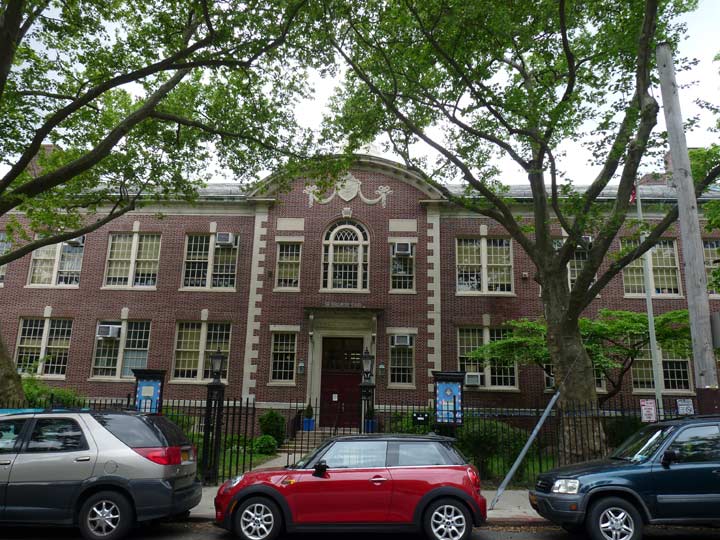
Just south of the church is PS 98 (the Douglaston School) a handsome early 20th Century building. It’s hard to find architectural details on NYC public schools, so any would be appreciated.
It used to be simple for school buses to approach the school when Douglaston Parkway crossed the Long Island Rail Road tracks via a simple grade controlled by crossing gates, but the parkway was elevated and bridged over the RR in the 1930s. The stub ends were renamed 235th Street; buses now have to U-turn at 40th Avenue.


The Douglaston LIRR station was established as early as the 1870s but the station house itself is relatively new (1962). As stated, traffic used to cross the tracks on a gate crossing that was eliminated several decades ago when the parkway was placed on a bridge and high-level platforms were installed at the station.


The station is also the site of a cutting of Flushing’s famed Weeping Beech Tree and Douglaston’s World War I memorial. The bronze plaque on the memorial lists the names of 60 men who died in the so-called Great War.
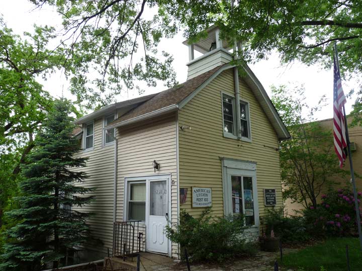
South of the railroad on 235th Street, a volunteer firehouse, still with its original bell used to call neighborhood firefighters, has become American Legion Post 103. The building was in use by the Douglaston Hose Company between 1906 and 1929, when the current FDNY firehouse was constructed on 244th Street.


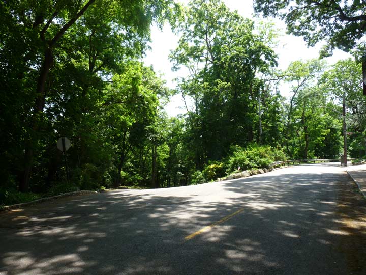
235th Street and Douglaston Parkway features some of Douglaston’s last tracts of natural forest. In 2012 the Parks Department built a couple of trails through the tract, west of Douglaston Parkway between the railroad and Northern Boulevard, and cleared out the overlook which sits atop a rather steep hill for these parts and added new benches. It was named for the late Joseph Hellmann (1940-2010) an area writer and preservation activist, who successfully fought against a high rise building that would have been plunked into the tract.
Deep into the woods here is a natural kettle pond, Old Oak Pond, chronicled here by FNY correspondent Sergey Kadinsky.
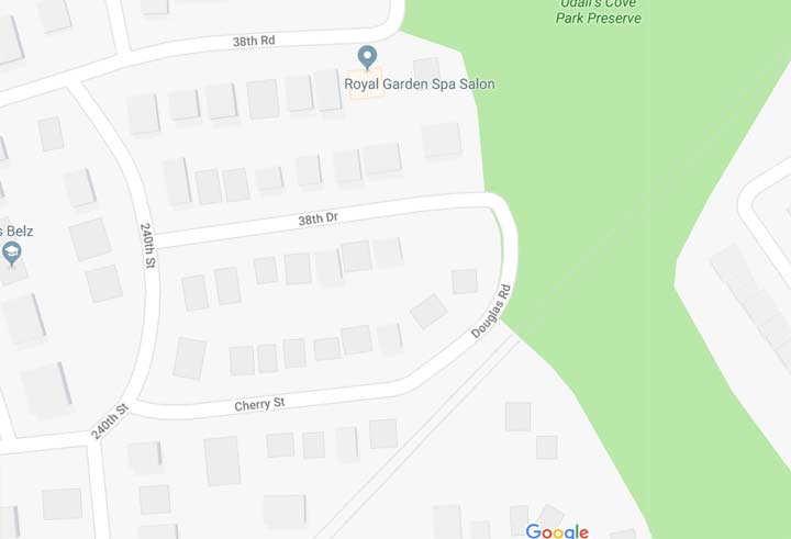


Douglaston streets can be hard to figure out. I’ve seen this loop countless times from the railroad, as Cherry Street does a U turn to become Little Neck Road (called 38th Drive by Google, which hasn’t caught up). But the end of the loop is actually a small piece of Douglas Road, which begins its northern stretch for good at Hillside Avenue (38th Road). This small bit of Douglas Road has just one house on it.


A little further south, there’s a similar situation. if you follow 40th Avenue east from Douglaston Parkway it narrows considerably and loses its sidewalks. Finally it turns north and becomes 240th Street before it can end at the LIRR open cut.
However, the bend in the road…and only the bend in the road… is called Willow Street. There must be only one or two homes with a Willow Street address.
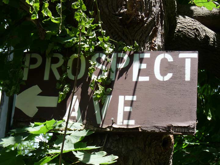
Even nuttier, a handmade sign indicates that Prospect Avenue can be found around the bend. But it can’t. The street it becomes is actually 240th Street.
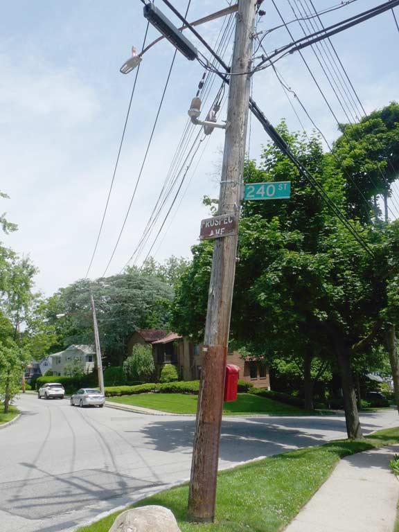

The error is promulgated once again at the corner of 240th and Hillside. Another hand-stenciled sign says this is Prospect Avenue. However, the actual Prospect Avenue is a block west, and runs for one block between Hillside Avenue and Cherry Street.
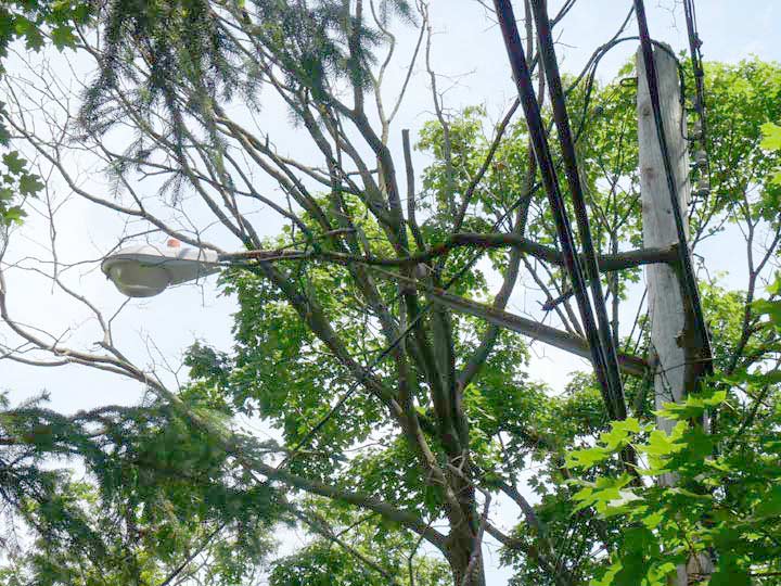
The Department of Transportation has overlooked this 1970s-era GE lamp on 40th Avenue, likely because it’s thickly wooded. Most other posts in Douglaston have now been changed out for bright white LED lamps; this sodium vapor lamp burns yellow. It missed the purge in 2009 that saw Crouse Hinds lamps installed on nearly every NYC lamppost except the historic models that use Bell fixtures.


At the north end of the Douglaston peninsula, Shore Road, Douglas Road, and West Drive all come together. While bicycling I noticed an anomaly in the street configuration at West Drive and Bayview Avenue. On each side the sidewalks and tree line form a semicircle and even the homes are constructed on an angle, conforming to the semicircles. However West Drive continues along with no traffic circle in evidence.

The 1909 map answers the question. Note the circle at the very top of the map, where West Drive meets Bayview Avenue. There had indeed been a circle here and it was there even as homes were constructed on lots surrounding it. In subsequent years, the circle was eliminated and West Drive was straightened. However, the sidewalks accompanying the old circle have remained.


Ridge Road, one of many of Douglaston’s east-west routes, has kept its brick gutters. It more resembles locales in Westchester County with its suburban architecture. Douglaston architecture is protected by the Landmarks Preservation Commission, and the eclectic styles here range from old-fashioned Tudor to streamlined, Wright-esque buildings that nonetheless fit right in.
A road branches off on the left at Douglas Road between Oak Lane and ridge Road. As it turns out this is the only road north of Northern Boulevard that connects the communities of Douglaston and Little Neck.


The road snakes southeast through Udalls Cove Park and it actually carries three names, four if you call it “the back road” as locals do. The city has a street sign on Douglas Road calling the western section Bayshore Boulevard but apparently no one uses the name. There is only one address on the western section of the road which is called Sandhill Road west of Aurora Pond.


Aurora Pond is a small kettle pond in Udalls Cove Park.
Udalls Cove, accessible from the northern end of Little Neck Parkway at 255th Street north of the Long Island rail Road, is a 30-acre park dedicated solely to wildlife and nature preservation. Udalls contains salt marshes, a forest, meadow and a freshwater pond. The remains of Little Neck’s clamming past can be evidenced by the wood pilings at Virginia Point, the end of the parkway formerly known as Old House Landing Road. The cove is named for 19th Century settler Richard Udall, who owned a mill in the region; his family owned the property until 1950 when the Nassau County portion of the property was sold to the Nassau County Historical Society. The Udall’s Cove Preservation Committee, which takes charge of the park’s upkeep, was formed in 1969 and the cove was opened to the public in 1972.
The pond, meanwhile, was named for the co-founder of New York State Northeast Queens Nature and Historic Preserve Commission, Aurora Gareiss. A waterfront area at the north end of Little Neck Parkway is named Virginia Point for the other co-founder, Virginia Dent.


After passing Aurora Pond, Sandhill Road straightens out, narrows and runs along the Long Island Rail Road. It passes a few homes. This section of the “back road” is named 39th Avenue and the homes have hyphenated Queens addresses on that avenue. However the department of Transportation has not officially mapped it and does not provide a street sign, and the potholed road has not been repaved for some time. There are 2 or 3 lamps mounted on telephone poles.
The road ends at Little Neck Parkway, which runs across the tracks on one of NYC’s handful of grade crossings.
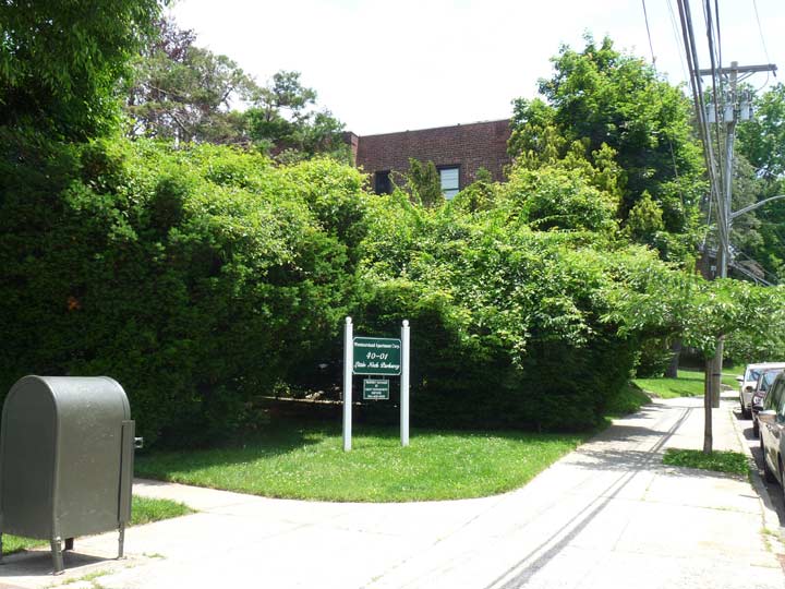
After a pleasant day in Douglaston it was home again to FNY headquarters at Westmoreland Gardens.
Please help contribute to a new Forgotten NY website.
Check out the ForgottenBook, take a look at the gift shop, and as always, “comment…as you see fit.”
7/29/18