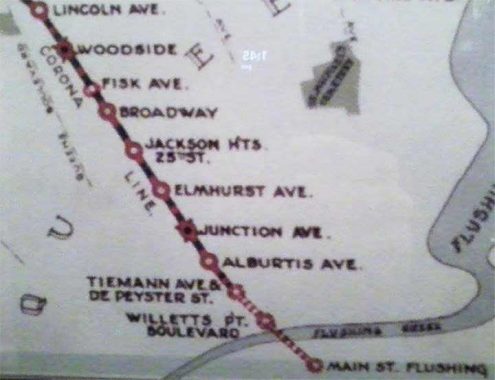
On Facebook, William Padron supplies this map displayed map inside a vintage-1917 IRT Lo-V type trailer subway car #4902 at the New York Transit Museum. Lincoln (52nd), Fisk (69th), Junction Avenue (Junction Boulevard) are still on station signage on the #7 Flushing Line, though it’s been almost a century since numbers replaced the names. Or in some cases, new numbers replaced old numbers; 82nd Street was originally numbered 25. Alburtis Avenue has long been known as 103rd Street.
A curiosity I have encountered here is a station corresponding to 111th called ‘DePeyster-Tiemann.” Let’s take a look at these names, because I presume their spots on old NYC maps refer to the same persons. Abraham DePeyster (1657-1728) was a Dutch Colonial 17th-Century New Amsterdam mayor born in the Dutch colony of New Amsterdam. He became a colonial merchant, chief justice, colonial governor, treasurer, and mayor from 1691-1694. His seated statue has moved around quite a bit in lower Manhattan.
Tiemann Avenue likely refers to the namesake of the Grant’s Tomb-area Tiemann Place in Manhattan, Mayor Daniel Tiemann (1805-1899), a paint manufacturer who was elected in 1858, who according to Henry Moscow’s The Street Book, was the first mayor to prescribe mounting street signs on lampposts and telephone poles. I think I may have gotten along with the guy. The Pelham Bay area in the Bronx also has a Tiemann Avenue, as numerous early NYC mayors are name checked in Bronx streets.

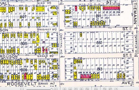
This 1915 Belcher Hyde map shows Roosevelt and Tiemann Avenues, but DePeyster is nowhere to be found. That’s not a surprise, as street names were in a great deal of flux in the early 20th Century before the overall numbering system took hold. In 1915 you can see how sparsely populated the area was, but the elevated Flushing Line was on the way; they built it, they came.
As always, “comment…as you see fit.” I earn a small payment when you click on any ad on the site.
5/28/22
